|
|


|
|
|
Pink Line:
Cermak (Douglas) branch
 |
|||||||||||||||
|
Legend:
Click on a station name to see that station's profile (where available) |
|
|
|
|
|
Pink Line:
Cermak (Douglas) branch
|
|
|||||||||||||||
|
Legend:
Click on a station name to see that station's profile (where available) |
Service Notes:
History:
The Douglas branch of the Pink Line began as one of four branches of the Metropolitan West Side Elevated (aka the "Met"), the original private operator of most of the city's elevated on the West Side of Chicago. The Met's main line, a four track elevated railroad, was to start at Fifth Avenue (Wells Street today) on the southwest edge of downtown and extend west to a point of the company's choosing, which turned out to be Marshfield Avenue (a minor side street one block west of Ashland Avenue). At this point it was to split into three branches extending due west (the Garfield Park branch), northwest (the Logan Square and Humboldt Park branches), and southwest (the Douglas Park branch).
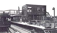
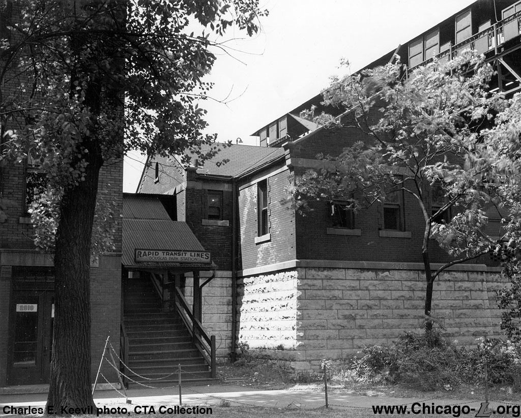
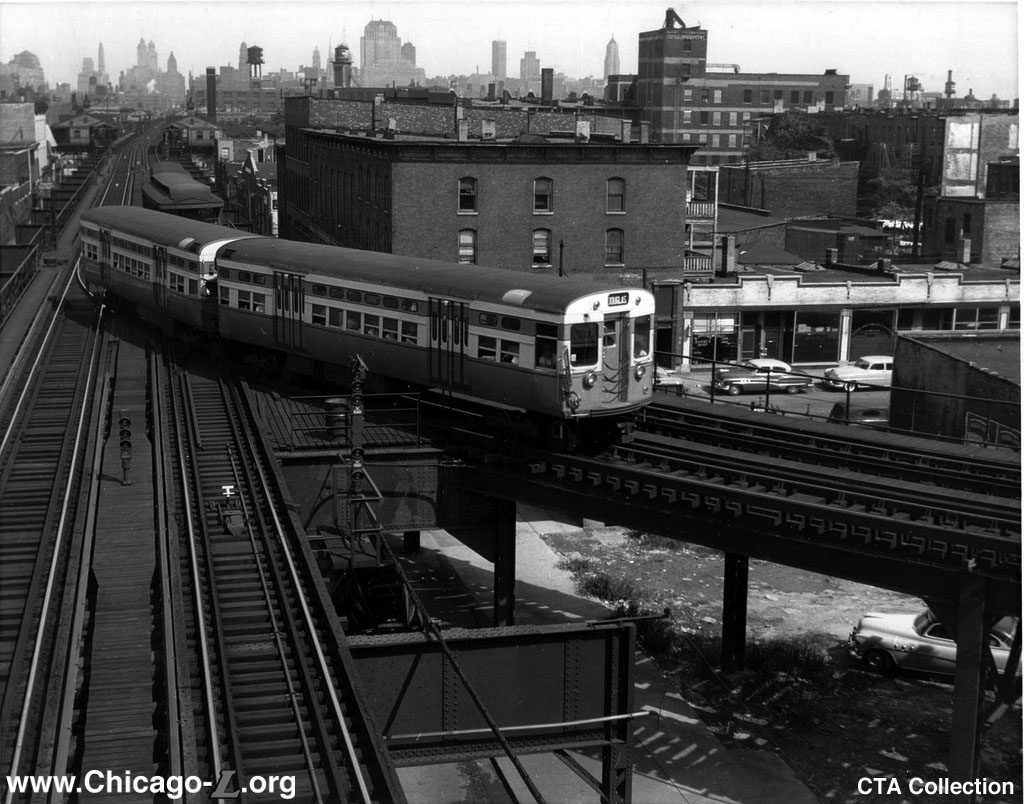
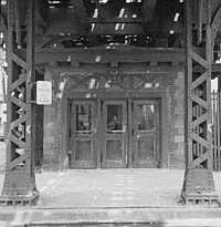 A view of the original Polk Street station, built in around 1895, looking south on March 8, 1971. Many of the Met's early stations, like Wood (also on the Douglas Park Line) used this design. The original Polk was demolished in 1983. For a larger view, click here. (Photo from the Chicago Transit Authority Collection) |
Construction, inaugurated in mid-1893, progressed rapidly on most of the branches... except the Douglas Park. Service commenced between Canal Street on the main line and Robey Street (Damen) on the Northwest branch on May 6, 1895, with a further extension to Logan Square on May 25th. Service was extended toward downtown to Franklin Avenue terminal on May 17th (the planned Fifth Avenue Terminal would not be obtained until 1904). The Garfield Park branch went into operation on June 19th and Humboldt Park followed on July 29th. But the opening of the Douglas Park branch was still nearly a year away.
Finally, on April 28, 1896, the Douglas Park branch opened as far as 18th Street. This four station branch was shorter than any other branch of the Met, but seemingly took longer to build than any other. Work on extending it was already well underway, however. The branch was extended to Western Avenue on August 7, 1896 to what was at the time the southwest side of the city. Western remained the terminal of the branch for six years, until the next extension opened in 1902, though the station was not designed in any appreciable way to serve as a terminal. In fact, it was designed in the same configuration was most other "through" stations, with two side platforms. It was for this time, in essence, what is called a "stub terminal".
The stations on this initial section -- located at Polk, 12th Street (Roosevelt), 14th Place, 18th Street, Wood, Hoyne, and Western -- were all essentially of the same design. A typical station was a largely rectangular building with a bay extending approximately five feet in front of the building and another only about two feet from the rear leading to the platform stairs. The one-story headhouse situated beneath the elevated tracks employed an unusual vernacular form with influences from the Craftsman and even Prairie School styles. The exterior walls were clad in dark red/brown bricks while a rusticated stone base lined the bottom of the wall at ground level while the corners had stone quoins. The Craftsman influences came through in the wide overhanging eaves with exposed rafters and the battered half-timbered treatment over the front entrance, while the Prairie School style can be seen in the low pitched roof, extended eaves (one of several qualities shared with the Craftsman) and tall, thin, banded windows on the side elevations.
The side platforms were each nearly identical to each other and to other Met station platforms. The flooring was treated timber planks. The railing structure was somewhat decorative, using metal posts with small designs cast in them and simple wooden railings. In between, a series of square cast iron square plates with a stylized diamond design cast into them. Each platform had a short canopy in the center of the platform, covering he stairs and a small waiting area about two cars long. The canopy frame was iron, with latticed supports and bracketed rafters. The long canopies had hipped roofs of corrugated metal. Strung beneath the canopy roof were incandescent lights for nighttime illumination. The platforms were additionally lit by gooseneck lamps that were well integrated into the railing design. Certain railing posts were replaced with lampposts of a similar design. They extended up beyond the railing to about seven feet high, terminating in a decorative capital and topped with a hooked shepherd's crook and saucer-shaped shade with two or three incandescent light bulbs.
Just a couple years after the Douglas Park branch entered operation, a common downtown terminal for all of the city's elevated lines opened in the form of the Loop, a bi-directional two-track elevated over Lake, Wabash, and Van Buren Streets and Fifth Avenue. A short extension was built as part of the Loop west from Fifth Avenue over Van Buren to Market Street, then north a half block to connect to the Metropolitan main line. On October 11, 1897, the Met closed its Franklin Avenue terminal and all Metropolitan trains -- including the Douglas Park service -- were routed into the Loop.
By 1899, the Metropolitan had extensive extension plans for many of its lines, the Douglas Park included. In 1900, the Met made an application to the Chicago City Council for extension of both its Garfield Park and Douglas Park branches to 52nd and 40th Avenues, respectively. Although the city's far west side was still sparsely populated at this time, it held tremendous potential for real estate developers and was surely not far away from spreading development. The council approved the extensions on June 29th with little comment or fanfare.
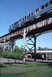
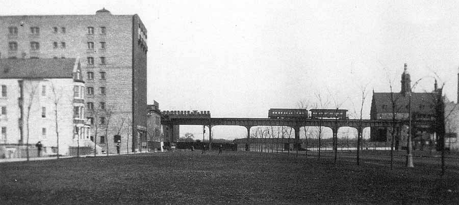
 Above: A Douglas Park train crosses the ornamental bridge over the park-like Marshall Boulevard around 1910. The Douglas Park station platform can be seen on the left. For a larger view, click here. (Photo by Fred Borchert, from the Robert Gibson Collection) Below: Architecturally, the Douglas Park station was unlike any other on the "L" system. The stop was one of several on the "L" system built in one of the city's park boulevards. For a larger view, click here. (Photo from the Charles E. Keevil/Chicago Transit Authority Collection)  |
The stations on this section of the line were similar to those of the earlier portion of the Douglas Park, but were more similar to the stations on other Met branches. Rather than flat Craftsman fronts, these stations featured dual doors with transoms set in a brick bay outcropping. The exterior featured decorative brick- and stonework, including dentals and egg-and-dart decorations along the top of the bay, as well as a decorative wooden pilaster between the two double-hung windows in the bay facing forward between the angled doors. The interiors had tongue-in-groove chair-rail paneling and a fare collection booth integrated into one of the side walls. The platforms were generally the same as the previous section, which was basically a Met standard. The 40th Avenue terminal, however, a very different track-level arrangement. This station at the end of the line also featured an elevated yard and shop for car storage and repair. It was also desired to have a convenient way to turn trains back for return trips quickly and with little interference of traffic. So, a large elevated turning loop was constructed here, with storage tracks inside the loop. A two-story shop was built on the north half of these tracks inside the loop, hugging the turning loop. Arriving trains unloaded their passengers on a side platform on the north half of the loop, adjacent to the shop, then circled around the Loop and picked up passengers at a second loading platform on the south half of the loop. Both platform fed into a station house at grade below the tracks, apparently of the same design as the rest of the extension's headhouses. The only headhouse that was not standard was that at Douglas Park. This station had an unusual rusticated stone station and was against an embankment (the elevated crossed the Burlington & Quincy here). It is uncertain what the interior looked like and this seems to be the only station of this design on the system.
As the City of Chicago continued to expand westward, the Met responded with a number of extension plans. One of the only ones to make it through to the franchise and construction process was their plan for the Douglas Park branch. The Met wished to extend the line west into the growing suburbs of Cicero and Berwyn, with their residential populations as well as commercial and industrial centers. This extension, however, was built in a very piecemeal fashion over a very long period of time. The first segment to be built extended the line from the 40th Avenue terminal to 46th Avenue (Kenton) at the city limits, with an intermediate stop at 43rd Avenue (Kildare). The new trackage, which extended a distance of less than one mile and opened for service on May 22, 1907, brought the Douglas Park branch to its original intended terminal, according to the Met's original franchise agreement with the City of Chicago. It also placed the line very near the massive Hawthorne Works of the Western Electric Company (which would provide a major source of passenger traffic for the branch) and brought it to an intersection with the Belt Railway of Chicago, which would be helpful later. The 40th Avenue station needed some modification to function as a through-station rather than a terminal. Although 40th Avenue would remain the Douglas Park branch's main yard, shop, and crew reporting location for another 40 years or so, and some trains would continue to terminate here on the loop track until CTA service revisions in the 1950s, an island platform was added to two of the yard tracks, which became through tracks, intersecting with the loop track and connecting to the extension.
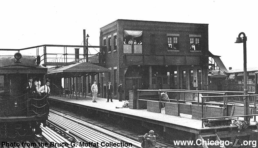
 The island platform was installed when 40th Avenue became a through station, as seen in this post-World War II view. For a larger view, click here. (Photo from the Bruce G. Moffat Collection) |
The rest of the line's extensions were built in small pieces over a period of several years. It would be another three years until the next segment opened to 52nd Avenue (Laramie), with an intermediate stop at 50th Avenue, on August 20, 1910. That same year, the Met built a coal and materials yard at 46th Avenue, taking advantage of its proximity to the Belt Railway for a freight rail connection, to replace an older facility on the Garfield Park branch. Stations at 54th and 56th (Central) Avenues were put in operation on August 1, 1912 and to 62nd (Lombard) Avenue, with stops at 58th and 60th (Austin) Avenues, on August 1, 1915. The final stretch to Oak Park Avenue, with a stop along the way at Ridgeland Avenue, opened nine years later on March 16, 1924. All of the stations on these extensions were more or less the same as the other grade-level wooden station houses, with variation only in window and door spacing, exact dimensions, and interior arrangement. Property was also purchased to extend the line another half mile to Harlem Avenue, but was never built on. The Cicero trustees also authorized an extension into the southwestern portion of the township following Ogden Avenue, but this was also never realized.
After the Douglas Park branch reached its full extent in 1924, it had a rather uneventful life until the CTA took over in the late 1940s. In spite of declining revenues as a result of the Depression and poor performance that would eventually put the Chicago Rapid Transit Company (which took over ownership of the elevateds in 1924) in bankruptcy and receivership, some improvements were still made to the Douglas Park branch. By the end of 1930, all platforms on the Douglas Park, as well as the Garfield Park, Humboldt Park, and Logan Square branches of the Metropolitan Division, were extended to handle 8-car trains (though it is likely that they were still not long enough to open end doors on these trains).
About the same time, Western Avenue, the longest street in Chicago and an important North-South thoroughfare, was widened for its entire length. The Metropolitan Elevated had four stations along Western on various branches and used an unusual solution to the encroachment on their property. Instead of demolishing the station houses wholesale and erecting a new buildings further back on their property, the Met retained their station buildings, cropped off their fronts, removed several feet from the footprint of the structure, and added a new front facade at the new property line. Rather than try to design a new front to mesh with the style of the original building, the new fronts used a radically different, decidedly modern style. The Art Moderne facade of tan and olive green glazed brick and tile is a stark contrast to the brick Craftsman side elevations. The central portion of the street elevation is clad in tan glazed bricks and is framed by a set of tan glazed tile piers with olive green "piping", topped with a band containing the words "L • RAPID TRANSIT • L" in green Art Deco lettering. The use of the Art Moderne style for the facade was fashionable at the time, but made for a very unusual and unique combination with the original Craftsman sides and rear.
Developments in the CTA Era
 |
|
|
The next series of changes occurred after the CTA took over operation of the rapid transit system in 1947 and they came fast and furious!
When the CTA took over, the "L" was running a complex network of schedules of locals and expresses mostly on two-track lines that were not designed for such operations. Stations were closely spaced, cars were old and slow, any change to the schedule would cascade through the system and cause numerous problems, and the whole thing was quite a tangled mess. In 1948, the CTA tested out a new type of operation, A/B skip-stop service, that would allow some form of express/local operation on the two track lines. Trains were designated "A" trains, "B" trains, or "All-Stop" trains and stations were coded "A" stations, "B" stations, and "AB" or "All-Stop" stations. "A" trains stopped at "A" and "AB" stations, "B" trains at "B" and "AB" stations and so on. Combined with closure of extremely-poorly patronized stations, the scheme did much to speed up rapid transit operations.
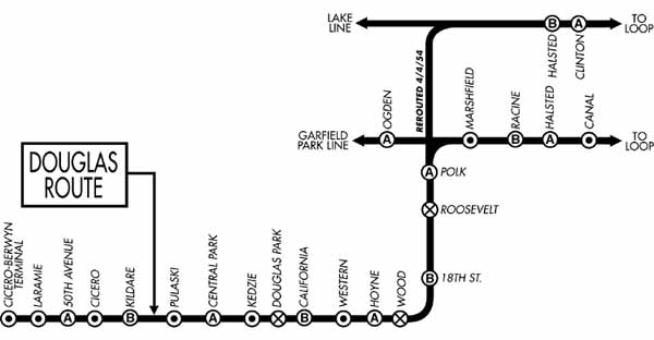
The skip-stop system was tested with great success first on the Lake Street Line in 1948, then was implemented on the North-South and Ravenswood Routes in 1949. In 1951, the CTA set out to rationalize the Garfield Park and Douglas Park services. The Douglas Park had the least amount of change, with five stations closing -- 14th Place, Homan, Drake, Lawndale, and Kenton -- and one new one opening -- Central Park, only one block west of the former Drake stop -- effective December 9, 1951. The west end of the line was to be cut back to 54th Avenue at the same time and replaced by a shuttle bus, but this action was halted by an injunction obtained by the Village of Berwyn. Polk, Hoyne, the new Central Park, and 50th Avenue were made "A" stations and 18th, California, and Kildare were made "B" stations, while the rest (including the Central-through-Oak Park stops that had received a brief reprieve) were made All-Stops.
An odd variation was also made in skip-stop service on the Douglas branch (CTA dropped the "Park" from this and the Garfield Line in the service revision to streamline the line names) in the form of three "partial service" stations. Despite poor ridership, the Roosevelt, Wood, and Douglas Park stations were retained involuntarily because of political pressure. So, CTA made these unmanned stations with entrance only through a full-fare token turnstiles, with no children's or reduced fares accepted and no agent to assist passengers. Trains, designated by signs hung from the front chains, stopped about every half hour in the off-peak at the special service stations and every fourth train (approximately every 15 minutes) during rush hours. Trains that stopped at these stations did not call at Polk, 18th, or California (these being the next stop east/north of each of the special service stations).
Changes continued to affect the Douglas branch for several more years. Two months later, on February 3, 1952, the CTA completed its original rationalization plan and suspended service between 54th Avenue and Oak Park Avenue, replacing this section with an extension bus route. Three months later, on May 3rd, the Douglas Park and Roosevelt stations were closed, leaving only Wood as a special service station. Hence forth, Wood was simply served by certain "B" trains that made all other "B" stops (but which were still designated by signs hung on the front of the train). On May 25th, the CTA created a formal terminal at 54th for the Douglas branch. The old through-station on the east side of the street was closed and a new station, referred to as "Cicero-Berwyn Terminal", was opened on the west side. The new station was of a novel design: it featured both an island platform and a side platform, but only two tracks. The side platform, on the south side of the eastbound track, was also a platform for connecting buses, providing what may have been the first and only cross-platform "L"-bus transfer on the CTA system (though you have to pass through fare controls for each to access the other). Cicero-Berwyn Terminal was also the site of the system's first Park'n'Ride lot, now at many suburban "L" terminals and stations, also built in 1952. In December 1953, the CTA completed the rearrangement when the crew reporting location was moved from Pulaski Yard to 54th.
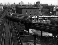 For just over four years while the new Congress Line was being constructed, Douglas trains were diverted via the Lake Street Line to gain access to the Loop. They used a portion of the Metropolitan's old Northwest branch, previously used by Logan Square services, and a new connection to the Lake Line built at Paulina east of Lake Street Transfer station. In this 1954 view, a Douglas train of 6000s turns south from Lake Street at Paulina Junction on their way out to Cicero-Berwyn Terminal. For a larger view, click here. (Photo from the Chicago Transit Authority Collection) |
In May, the CTA began automatic operation of Paulina Junction, with trains using a device called a Train Identification Coil. This was an electronic device carried by the lead car of each Douglas train. The motorman obtained the coil before the beginning of his run from the Station Clerk when going on duty and returned it when going off-duty (unless directly relieved by a Motorman requiring use of the coil). The Motorman inserted the coil in a bracket mounted on the right front of the train. As a train approached the junction, an electronic device (e.g. the coil) passed in front of a trackside electronic device which automatically set the proper switches for the train. Since only Douglas trains carried the coils, the presence of a coil set the switch for the Paulina Connector. Otherwise, the switch was aligned for the Lake Route by default. If the correct route fails to be automatically set by the transmitter, the Motorman could manually set the route by operating levers on the wayside route selector. This system was later used at Loomis Junction, where the Douglas would connect to the Congress Line when the later was completed.
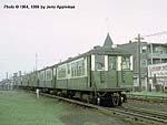
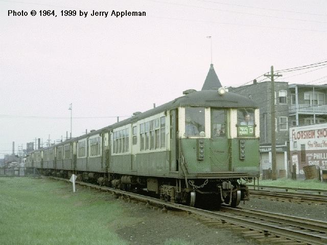
In early 1955, the CTA assigned a sufficient number of 4000-series cars to remove all wood-bodied units from service on the Douglas Line. By September, the last of the woods were reassigned or retired and the few new 6000s that were also assigned were moved to other lines. The car shuffle continued through the mid-1950s: In February 1957, sufficient 6000-series cars were assigned to Douglas to provide all non-rush service, with the 4000s relegated to supplement the rush hours. By December, a sufficient number of 6000s had been received and assigned to Douglas to cover all service, allowing the removal of the last of the 4000s from regular service. Several "baldie" 4000s continued to be assigned to the West-Northwest, however, as late as 1964, when the last of the 2000-series cars arrived and replaced them. The remaining 4000s were needed during rush hours (when needed at all), and were generally relegated to Douglas-Milwaukee trains. In May, Wood station, the last "special service" or "partial service" station, was closed, completing the CTA's rationalization of the Douglas service. A ground-level walkway was opened between Damen Street and Hoyne station to serve some of the riders who's previously used Wood, as well as to serve riders of the #50 Damen bus. The next summer, the Douglas would received its last major service change for the next half-century...
Douglas Gains a Through-Route, Loses Riders
 |
|
|
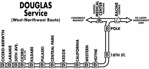
By the summer of 1958, construction of the new Congress Line was largely complete. As part of the project, a new ramp was designed and built in the vicinity of Paulina Street that connected the Douglas elevated with the median-level Congress Line. On June 22, 1958, the Congress Line officially opened and the old Garfield elevated closed. Henceforth, Douglas trains would be rerouted via this ramp to the Congress Line at Loomis Junction. East of Halsted Street, the Congress Line descended into a short section of new subway that connected to the Milwaukee-Dearborn tube at LaSalle/Congress. The Milwaukee, Congress, and Douglas Lines were combined into the West-Northwest Route, a horseshoe-shaped through-route know today as the Blue Line, and Douglas trains would reach downtown by way of the Congress Line and Milwaukee-Dearborn Subway, continuing to a terminal at Logan Square on the Northwest Side.
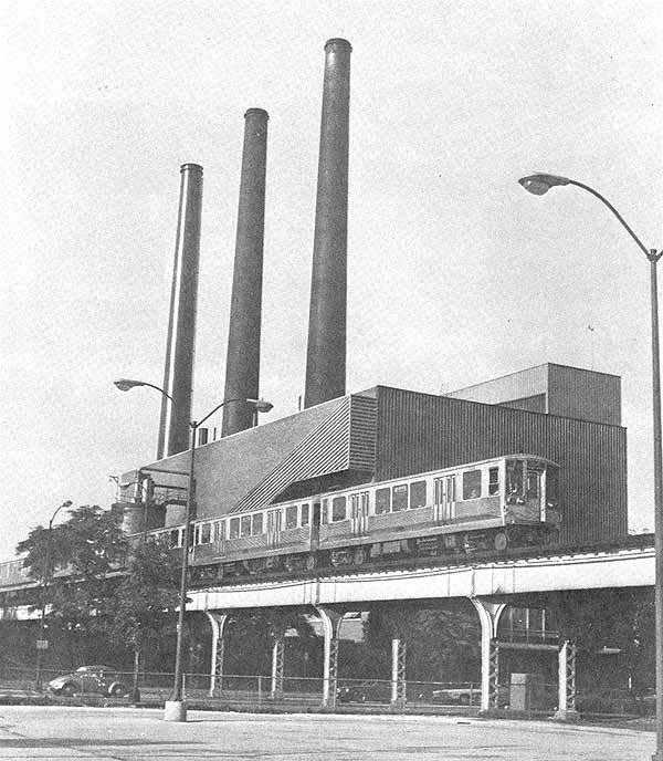
 The corrugated sides of the Budd 2200-series cars, led by 2333, provides a nice compliment to the corrugated sheathing of the heating plant for the University of Illinois Medical Center campus in this view looking southwest at Taylor Street on July 22, 1975. For a larger view, click here. (Photo by Roy G. Benedict) |
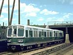
Douglas service remained largely unchanged after this through-routing arrangement went into effect. In the early 1960s, Pulaski Yard was taken out of service and 54th Yard became the Douglas branch's only yard facility. The year 1973 would bring some hardship to the line, with a fire at Pulaski destroying most of that station in August and an accident at Kildare in November demolished that station house entirely. As part of massive service cuts imposed throughout '73, 50th Avenue station was closed, as was the 47th Court auxiliary entrance to Cicero. 50th Avenue got a reprieve in January 1974 and reopened, but was finally closed for good in 1978, when a new Cicero station opened on the west side of that street with an auxiliary entrance at 49th Avenue. 50th Avenue station was preserved and moved to the Illinois Railway Museum, while the 49th Entrance to Cicero lasted only three years before being closed and converted to an exit only.
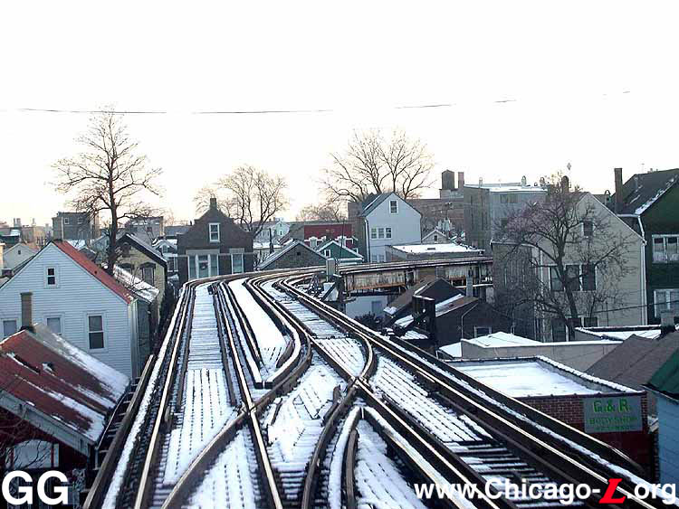
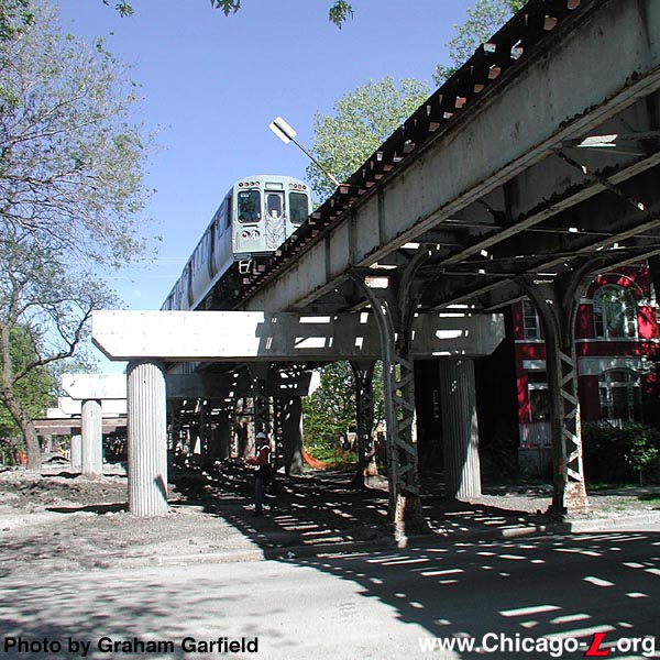
 The ornamental Marshall Boulevard crossing with a train of rehabbed 2600s, looking northwest in May 2001. For a larger view, click here. (Photo by John Smatlak) |
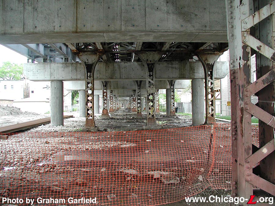
In 1975, installation of the CTA 's new cab signal system was completed on the Douglas branch all the way from Polk to 54th Avenue. In 1978, an automatic interlocking plant with an alternating sequence for southbound trains was installed at Loomis Junction, eliminating the need for Identra coils on trains. In 1983, Polk station was rebuilt as well, making Cicero and Polk the only accessible stations on the branch. Beyond these improvements, the mid-1970s marked the beginning of a long period of deferred maintenance on the Douglas branch, as well as much of the rest of the system. Operating costs were rising as ridership and market share were dropping and the CTA began hemorrhaging money. Whereas planners in the immediate postwar period had concentrated on bringing the system up to a good state of repair and service, the agency's planners now concentrated only on keeping the existing physical plant going and often struggled just to do that. Ridership on the line deteriorated as many of the neighborhoods around it declined in income and density. This decreased level of patronage because the Douglas branch and its maintenance to become a lower priority for the authority, allowing deterioration through age and deferred maintenance to continue.
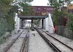
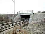
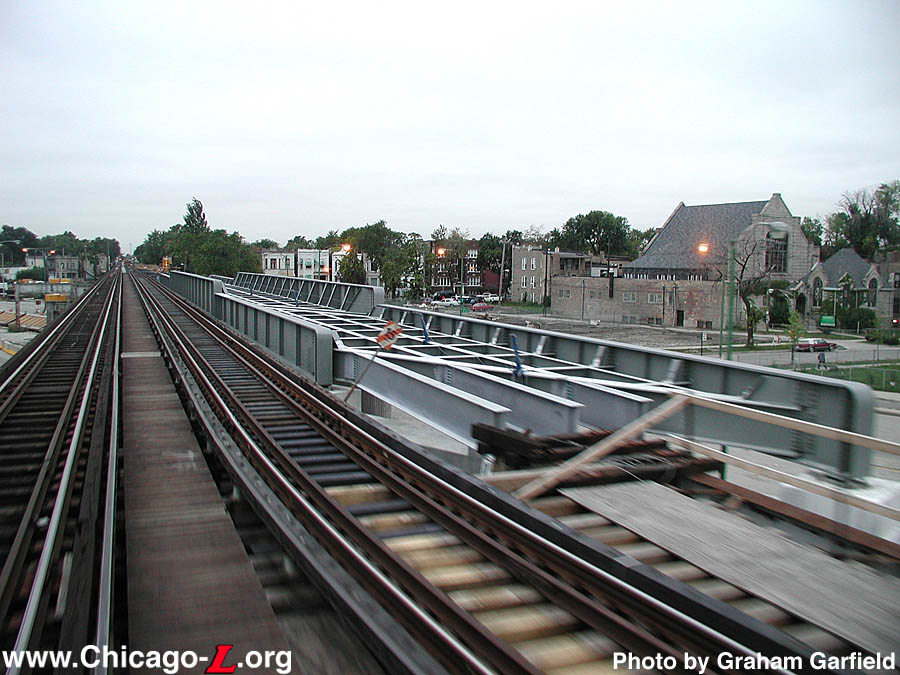
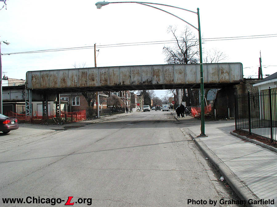
Some improvements continued to be made to the Douglas branch, however, to try to keep the line viable. In 1979, construction work was undertaken to replace the 76-year-old bridges over the railroad tracks at 15th and 16th streets. A 925-foot temporary "L" structure was built around the work site for uninterrupted service for CTA riders. The $3.2 million bridge replacement project was under contract with the E. J. Albrecht Company, of Chicago. The 15th street bridge spanned the Chessie System railroad tracks and the 16th street bridge was over the tracks of the Chicago and North Western Railroad and the Burlington Northern Railroad. Between the two bridges, there were 150 feet of "L" tracks which also were replaced. The work was completed in 1980.
In 1991, the authority undertook a track reconstruction program on the line to rehabilitate some of the track infrastructure. The next year, Laramie station was closed due to low patronage and to speed up service (Cicero-Berwyn terminal was only two blocks west). In 1993, 18th Street station was rebuilt, making three modern, accessible stations on the line. That same year, the rapid transit lines were given color-coded names. The West-Northwest Route became the Blue Line. (Circa 1996, some of the branches also received name changes, with the Douglas branch formally becoming known as the Cermak branch. However, these new branch names have met with limited adoption, even within the Chicago Transit Authority, and the branch is still usually referred to as the Douglas branch.) And in 1995, A/B skip-stop service was suspended, although it has little effect on the Douglas branch since all trains made all stops on that line.
In 1998, the Douglas branch saw its service level drastically cut under the Booz-Allen Hamilton Service Plan adopted a year earlier. The Purple, Green, and Douglas branch of the Blue Line all had their owl (late night) service eliminated, but the Douglas branch also saw its weekend service suspended. This made the Douglas branch and the Skokie Swift (Yellow Line) the only "L" lines not to run seven days a week.
Douglas Rehabilitation
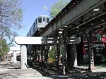
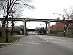
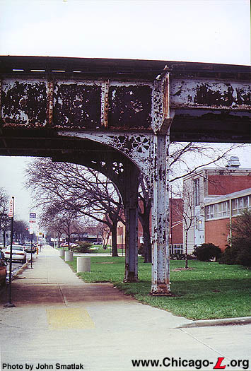
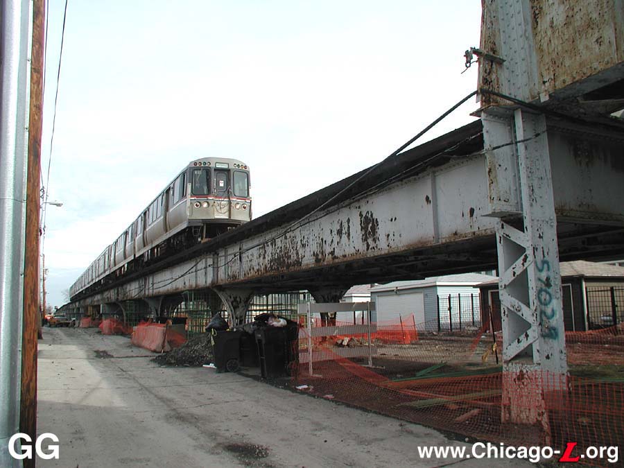
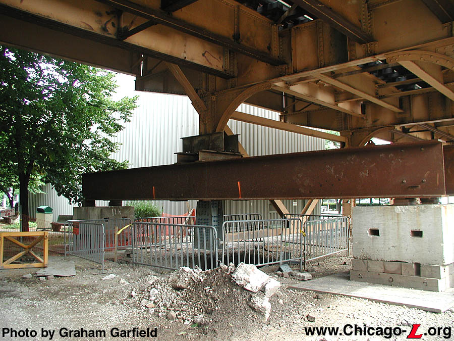
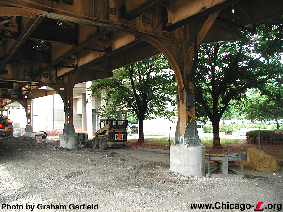
 The rust and wear on the steel of the trestle carrying the Douglas branch over the Burlington North Santa Fe tracks -- the former location of the Douglas Park station -- provides ample explanation for the Douglas Renovation Project. For a larger view, click here. (Photo by Graham Garfield) |
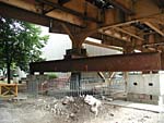
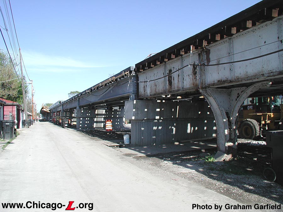
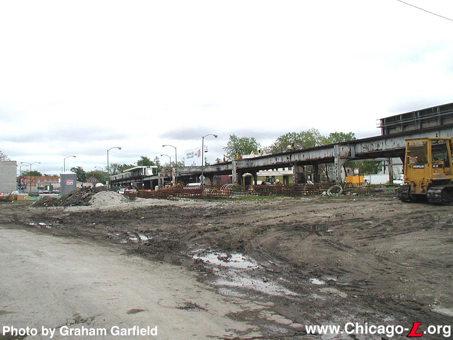
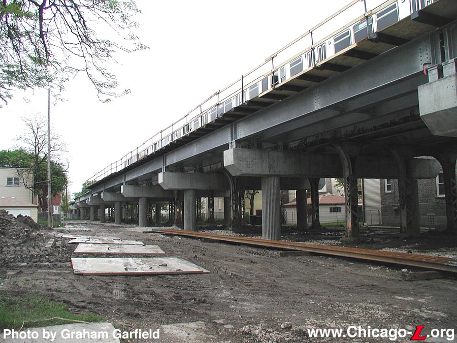
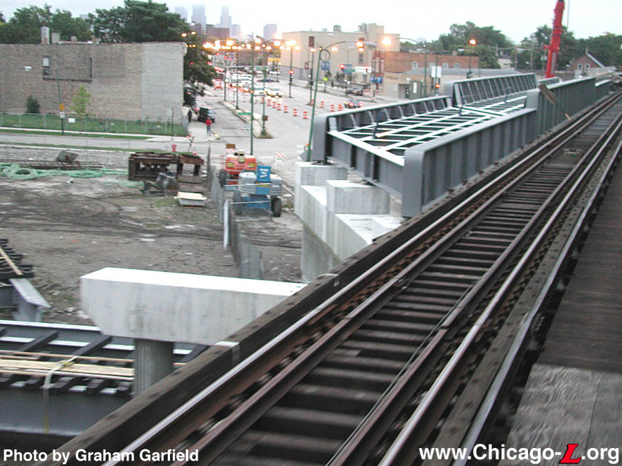
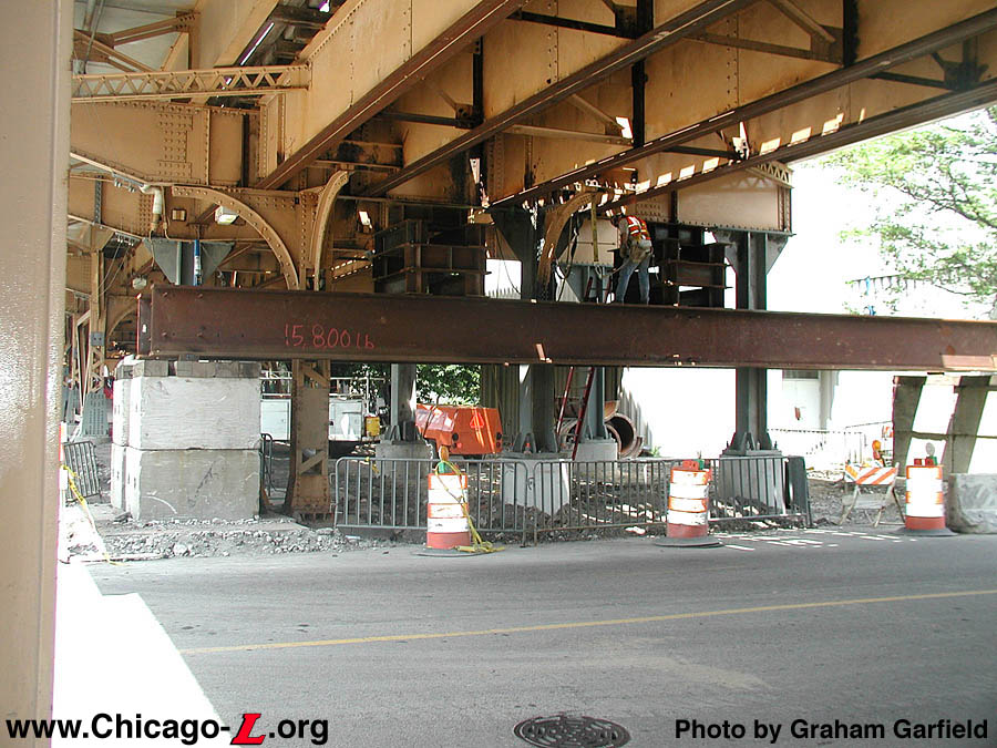
So, after a long battle to secure funding from both the state and federal governments, the CTA decided it was time to embark upon a complete rehabilitation of the entire Douglas branch. The Douglas Rehabilitation Project is perhaps the largest single capital improvement project the authority has even embarked upon. The federal government approved a full-funding grant agreement in January to pay for the rebuilding of the Cermak (Douglas) branch. The agreement is the federal government's commitment to share the $482 million cost of reconstructing the 105-year-old rapid transit line. Under the agreement, the federal government will pay $384 million, with $80.9 million coming from Governor George Ryan's Illinois FIRST program and the balance coming from regional funding. The $317 million construction contract to rehabilitate the Cermak (Douglas) branch went to Kiewit/Delgado, AJV (A Joint Venture). Under the proposed agreement, the firm will oversee a comprehensive construction project to restore the branch so that it is 100 percent ADA compliant and allows for faster travel times from one end of the line to the other.
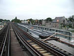
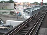
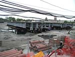
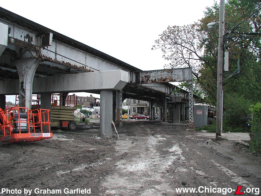
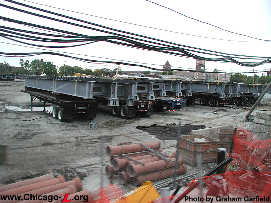
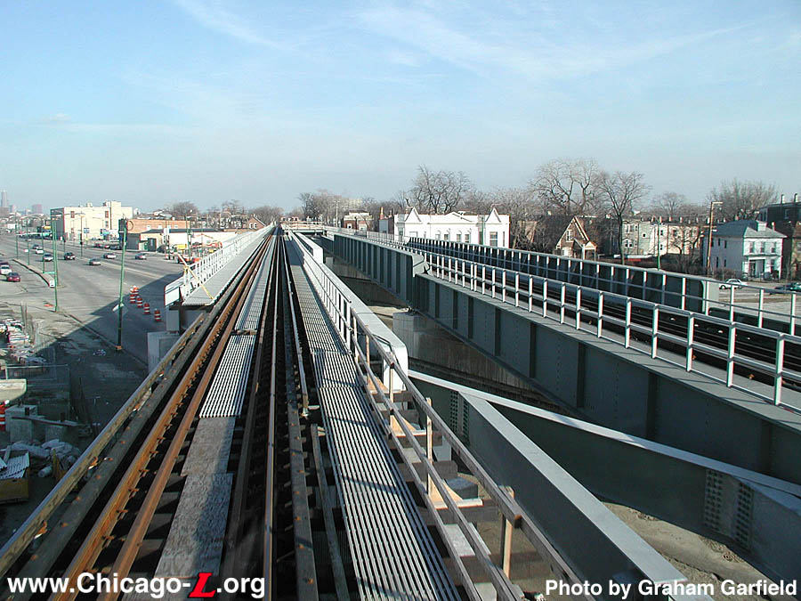
During the rehabilitation project, the Douglas branch remained open for service. Kiewit/Delgado, AJV conducted the majority of the track and structure work on weekends when the branch was not in service. Work that was not at track level -- such as station house construction, electrical substation construction, foundations, bents and utility relocations -- was performed on weekdays, with the CTA creating temporary stations to avoid the inconvenience to its customers of closing stations entirely. The rehabilitation project involved extensive work on eight CTA rail stations (six elevated and two at-grade), five miles of track, signal and communications equipment, traction power system and infrastructure rehabilitation.
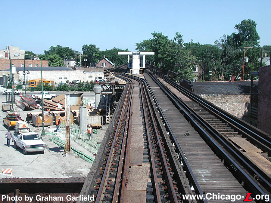
The official groundbreaking for the Douglas Rehabilitation Project took place at Pulaski station on September 10, 2001, with actual construction work beginning shortly thereafter at 54th/Cermak and Pulaski. As work progressed, all eight stations to be rebuilt -- 54th/Cermak, Kildare, Pulaski, Central Park, Kedzie, California, Western, and Hoyne -- each closed one by one between February 23 (54th) and November 30, 2002 (Western and Hoyne), replaced by temporary stations within two blocks. Track, signal, communications, and traction power work progressed as the elevated structure and stations were rebuilt.
![]() For
more information on the Douglas
Rehabilitation Project, click on the link to go to our Douglas
Rehabilitation Project pages.
For
more information on the Douglas
Rehabilitation Project, click on the link to go to our Douglas
Rehabilitation Project pages.
Structural work was completed in June 2003, comprising the replacement of 713 stringer pairs, 716 caissons, 702 new columns, and 175 new foundations. The first rebuilt Douglas station to open was Kostner (replacing Kildare) on July 17, 2003 and the last was Damen (replacing Hoyne) on July 22, 2004. Work continued through the rest of 2004 on other areas, like track, signal, communications, and traction power. All renovation work was scheduled to be completed by the end of January 2005.
On Saturday, January 8, 2005, the Chicago Transit Authority celebrated the completion of the $482.6 million renovation of the Cermak branch of the Blue Line. Mayor Richard M. Daley and Joel Ettinger, Regional Administrator, Federal Transit Administration, joined Alderman Michael Chandler (24th Ward), Chicago Transit Board Chairman Carole Brown and CTA President Frank Kruesi at a press conference at the historic Kedzie station to celebrate the completion, which has given CTA customers eight newly renovated, fully accessible stations, and a faster, smoother ride.
Mayor Richard M. Daley said, "The expansion we are inaugurating today, and the recent weather challenges, help to underscore the vital importance of reliable, accessible public transportation for all Chicagoans." The Mayor added, "No matter what season or time of day it is, Chicagoans depend on public transportation for their daily and weekend commutes to and from work or school, as well as access to shopping and health care - the CTA remains the primary mode of transportation for many."
The official completion of renovation work was not scheduled until January 31, 2005, but the work had progressed far enough by the 8th that "substantial completion" -- generally defined as progress in construction to a stage where the structure can be inhabited or project brought into service -- could be issued and a press conference held to celebrate completion. Only a few punchlist items remained for Kiewit to finish afterward.
Weekend Service Returns
During the duration of the project West Side residents continuously lobbied CTA officials to reinstate the weekend and owl service that was suspended as part of the 1998 Booz-Allen Hamilton service cuts. Although CTA could not reinstate weekend service while rehabilitation work was going on -- the entire project timetable and budget was based on the ability to turn the branch over to the contractor for intensive work each weekend -- the Authority was contemplative on the issue of restoring service after work was completed. At the monthly meeting of the Chicago Transit Board on October 14, 2004, CTA announced that weekend service on the Douglas branch would resume in January 2005. Service was to be restored by diverting half of the trains from the Forest Park branch to the Douglas branch, a reversal of how the weekend Douglas service was "cut" in 1998 (in point of fact the runs were not eliminated, they were simply diverted to the Forest Park branch, doubling that line's service level regardless of demand). As of October 2004, CTA said no decision has been made about resuming late-night "owl" service on the Douglas branch.
With the completion of major construction, the CTA resumed weekend service on the branch beginning Saturday, January 1, 2005. Although weekend service was added before Kiewit was completely finished with their work, there were few enough punchlist items left that 7-day-a-week service could resume while they finished these tasks. Service runs every 15 minutes on Saturdays from 4am until 1am, and every 20 minutes on Sunday from 4am until 1am. On weekdays, service hours are 4am until 1am.
A Reroute to Downtown
In Summer 2004, the Chicago Tribune reported that the CTA was studying the concept of rerouting some or all Cermak (Douglas) branch trains to the Loop Elevated rather than via the Dearborn Subway to the Northwest Side and O'Hare. Rerouted trains from 54th/Cermak would leave the Cermak branch at Harrison and reach the Loop via the renovated Paulina Connector and the Lake Street branch of the Green Line.
The concept of rerouting Cermak trains via the Connector, Green Line, and Loop were one part of the highly-conceptual Circle Line plan the CTA publicized in 2002, although the two concepts are not dependent on one another or inextricably linked as some members of the public have claimed. (Note: It must also be recognized that the Circle Line concept publicized in 2002 was merely conceptual and is not a finished plan. It is required to undergo the federally-mandated Alternatives Analysis process.) The main drive behind rerouting Cermak trains via the Loop and disconnecting the branch from the rest of the Blue Line lies with the ability to schedule trains independently based on demand and travel patterns. Presently, by acting as a branch of the Blue Line, service levels are constrained to be half the number of Blue Line trains run north of Loomis Junction.
Ironically, the proposed reroute would resume a pattern of service used between 1954 and 1958 when Douglas trains accessed downtown via the Paulina line and Lake branch while the Congress branch and Eisenhower Expressway were under construction, the last time the Paulina Connector was used in scheduled passenger service.
The concept as publicized in 2004 elicited protests from residents of the Lawndale, Little Village, and Pilsen neighborhoods, some of whom did not want to lose a one-seat ride to those areas served by the Blue Line, and many of whom were convinced that the reroute would somehow guarantee less service on the branch. CTA and Daley administration officials, on the other hand, argued that the reroute would provide better transit options to communities undergoing revitalization by providing a faster ride downtown via the Paulina Connector and Green Line, and by allowing the CTA to add service to the branch, something not feasible without completely disrupting the rest of the Blue Line's schedule and requiring a number of railcars that simply are not on hand.
Ultimately, amid a budget crisis and calls to instead concentrate on restoring weekend service to the Cermak branch (which the CTA did effective January 1, 2005), the CTA dropped the 54th-Loop route concept for a time. But the idea was not abandoned.
The CTA conducted a West Side Corridor Study with nine interactive workshops in July and August 2004 that brought CTA and West Side residents together to discuss how to enhance service. The study evaluated West Side and west suburban rail and bus service to develop a comprehensive picture of the service needs of the communities.
On November 9, 2005, the Chicago Transit Board directed staff to begin community meetings on the enhancements developed in the workshops. In January 2006, the CTA held three community meetings to discuss the findings of its West Side Corridor Study and obtain public comment.
The proposal to reroute Cermak branch trains to the Loop via the Green Line and Connector generated dozens of comments at the community meetings, more than about any of the 10 proposals to improve CTA bus and rail service on the West Side and western suburbs. Community activists still feared the proposal would adversely impact Cermak branch riders because, although the new route could shorten the trip to Clark/Lake by 8 to 10 minutes and enhance connections to the Orange, Brown, Green and Purple lines, the route would bypass several stops in the West and South Loop areas and eliminate the one-seat ride to the Northwest Side.
CTA officials say the proposal would increase service on the Forest Park and Cermak branches, because trains would no longer be split between the two routes. With more trains running, waiting times would be reduced, making the Forest Park line a more attractive alternative to the Eisenhower Expressway, the study stated. On the Cermak branch, trains would run every 10 minutes versus the current 15-minute intervals, CTA staffers said.
On February 15, 2006, the Chicago Transit Board approved recommendations for both bus and rail service enhancements for the West Side and West Suburbs based on the results of CTA's West Side Corridor Study. The plan includes changes to 14 bus routes and the Cermak (Douglas) branch. As part of a 180-day experiment to begin in Summer 2006, trains from 54th/Cermak will be rerouted to travel to and from the Loop via the Paulina Connector and Lake Street branch of the Green Line at all times of operation. To address community concerns, service to the O'Hare branch from 54th/Cermak via the Dearborn Subway will be maintained during morning and afternoon rush hours. In addition, bus service on the #7 Harrison will provide connections between UIC's east campus and the Illinois Medical District. Enhanced service to O'Hare will still be possible at other times through a free transfer at Clark/Lake.
The frequency of service on the Forest Park branch of the Blue Line will increase, especially during weekday off-peak hours and weekends. Customers who board trains on the Forest Park branch between Medical Center and Forest Park will benefit from increased frequency of service at all times, including weekends, and improved access to CTA and Pace buses along the route. During rush hour commutes, Loop-bound customers on the Cermak branch will have the choice of the current Blue Line routing via the Dearborn Subway and or elevated service via the Paulina Connector.
Although the 54th-Loop service had at many times over the years been referred to colloquially as the "Silver Line", this name was never the route's officially-adopted moniker. In February 2006, the Chicago Transit Board announced a contest in which Chicagoland students would be allowed to submit nominations for the line's color-coded name. The "Name the Line" contest was open to students in kindergarten through eighth grades and students were asked to submit an essay of 200 words or less explaining why their nominated color is best for the new rail line. Over 500 students participated in the contest and entries were submitted from throughout the CTA service area. The winning student received a $1,000 U.S. Savings EE Bond, received public recognition through car cards on CTA trains and buses, and had the opportunity to be one of the first to ride on the new line. The Chicago Transit Board evaluated the essays and selected the winning entry, which was announced on March 30, 2006: the Pink Line.
Pink Line service began Sunday, June 25, 2006.
Following several surveys and data analysis, CTA reported in early October 2006 that ridership on the Pink Line and Forest Park branch of the Blue Line steadily increased since service enhancements were introduced to customers at the end of June.
One month following the introduction of the service enhancements, CTA surveyed a representative sample of customers using quantitative metrics such as travel time, walking distance and overall satisfaction to gauge the quality of service. From July 24 through August 5, CTA's Market Research Department conducted onboard surveys in English and Spanish of 2,267 West Side corridor rail customers on three rail lines to determine the initial reaction to the service improvements. Of those surveyed, 81 percent of Pink Line customers said they were satisfied with the service and slightly more than half (56 percent) of Pink Line customers perceived their current trips to be faster than before the service was reconfigured. Meanwhile, 87 percent of Forest Park branch customers were satisfied with the service and nearly half (49 percent) perceived their trips to be faster since the frequency of service was increased in June. CTA continued to monitor the performance of the routes throughout the six-month experimental period as well as soliciting customer feedback on the service.
On December 12, 2006, the Chicago Transit Board approved a six-month extension of the experimental service enhancements for the West Side and near western suburbs, including the Pink Line service. A preliminary evaluation of the service enhancements by CTA during the initial experimental period showed a 7.1 percent increase in ridership on the Cermak [Douglas] branch. In addition, CTA has conducted two customer surveys and the most recent survey indicates that 82 percent of customers are satisfied with the route enhancements. More than 7,800 customers participated in the surveys.
As the experimental period continued, the CTA revised service on the Cermak branch to eliminate the rush period Blue Line trains, leaving the Pink Line to provide all service to 54th/Cermak. Although ridership had risen overall since the introduction of the Pink Line, Blue Line trains had consistently low ridership on a person-per-railcar-basis. The last day of Blue Line Cermak service was Friday, April 25, 2008.
 |
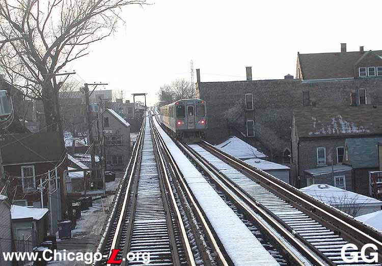
cta4175.jpg
(47k) |
 |
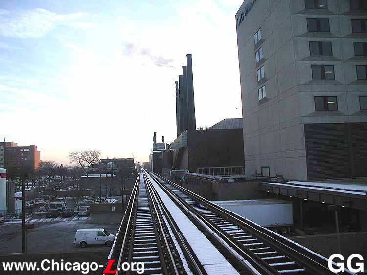
cta2175-76.jpg
(49k) |
 |
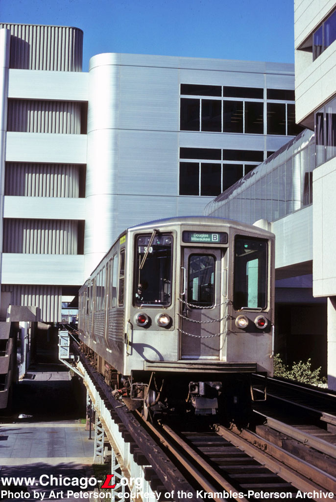
cta2334.jpg (194k) CTA's modern, streamlined stainless steel 2200-series railcars complements the new, sleek, modern buildings of the Illinois Medical District, seen looking south from Harrison Junction on September 24, 1977. Car 2334 leads Run 130, a Milwaukee-Douglas "B" train, as it heads north, about to descend the ramp down to the Congress Line on its way to the Northwest Side via the Dearborn Subway. A lime and forest green "Air conditioned" decal has been added above the motorman's window, promoting the passengers that it is one of CTA's air-cooled cars. (Photo by Art Peterson, courtesy of the Krambles-Peterson Archive) |
 |
ROW@Roosevelt01.jpg
(72k) |
 |
ROW@CullertonSB01.jpg
(128k) |
 |
ROW@LeavittWB01.jpg
(125k) |
 |
ROW@TaylorSB01.jpg
(88k) |
 |
ROW@Karlov01.jpg
(126k) |
 |
ROW@Karlov02.jpg
(113k) |
 |
ROW@Keeler02.jpg
(105k) |
 |
ROW@Karlov03.jpg
(135k) |
 |
ROW@Kedzie01.jpg
(234k) |
 |
ROW@LawndaleSB01t.jpg
(191k) |
 |
ROW@LawndaleNB01.jpg
(130k) |
 |
ROW@HardingNB02.jpg
(172k) |
 |
ROW@HardingNB01.jpg
(226k) |
 |
ROW@SpauldingNB01.jpg
(125k) |
 |
ROW@Flournoy01.jpg
(201k) |
 |
ROW@Flournoy02.jpg
(209k) |
 |
ROW@OgdenNB.jpg
(188k) |
 |
ROW@OgdenSB01.jpg
(142k) |
 |
ROW@OgdenNB02.jpg
(144k) |
 |
KentonYard.jpg
(167k) |
 |
ROW@BeltRwy01.jpg
(155k) |
 |
ROW@BeltRwy02.jpg
(221k) |
 |
ROW@OgdenNB03.jpg
(172k) |
|
ROW@KeelerBridge01.jpg
(146k) |
 |
ROW@Polk01.jpg
(181k) |
 |
ROW@BeltRwy03.jpg
(155k) |
|
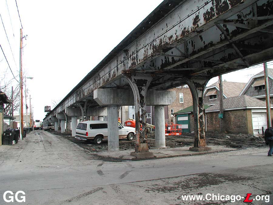
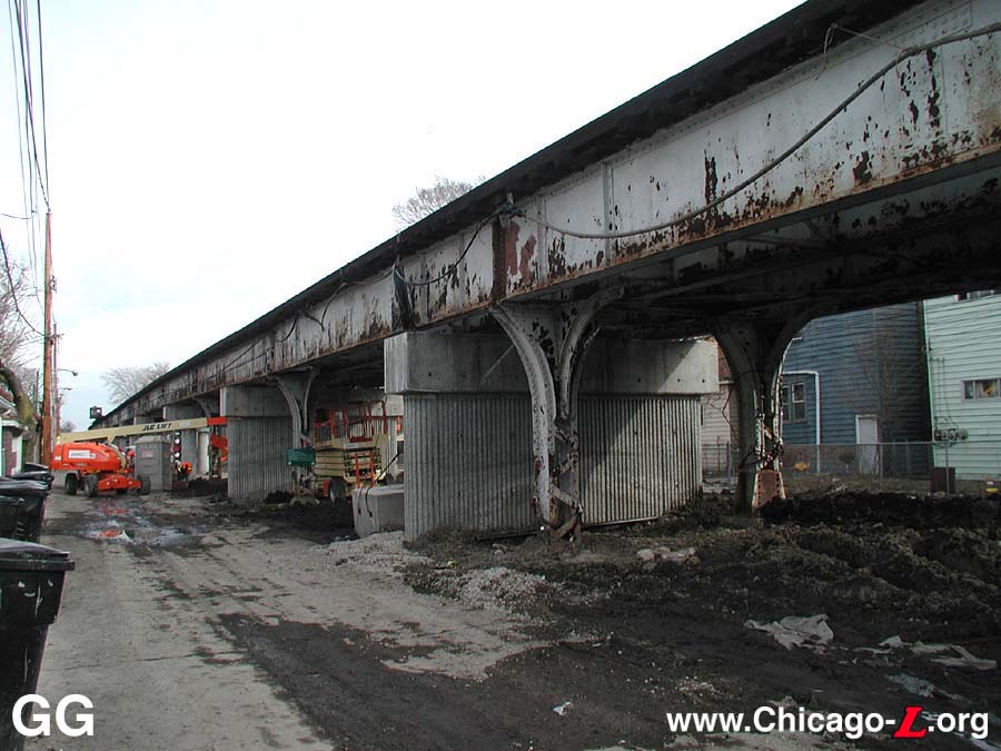
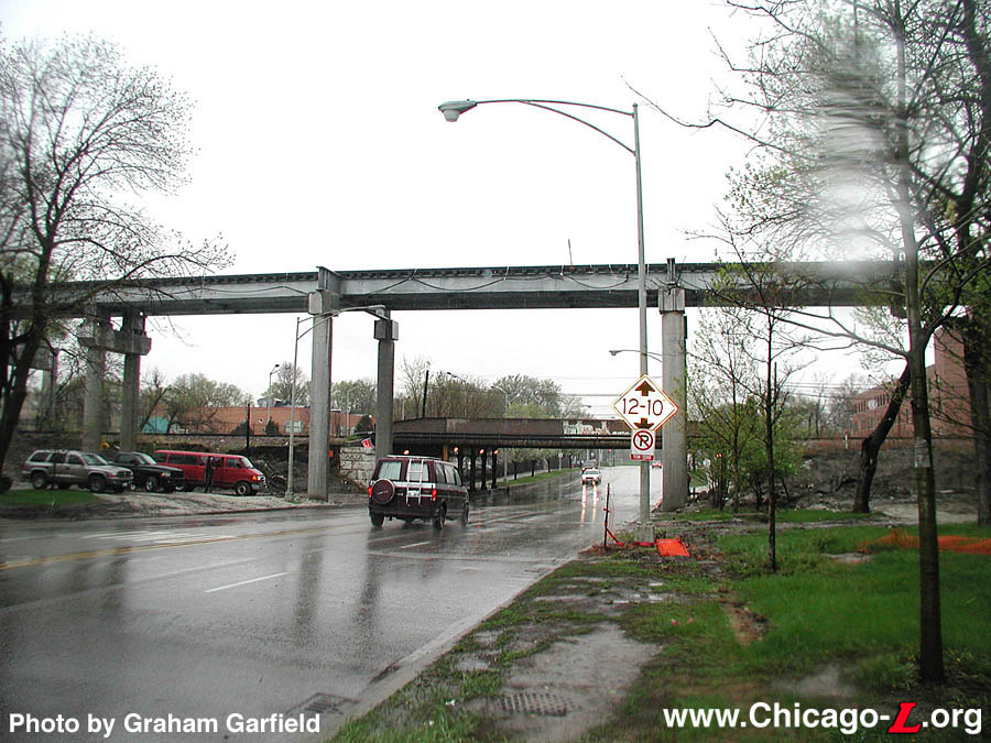
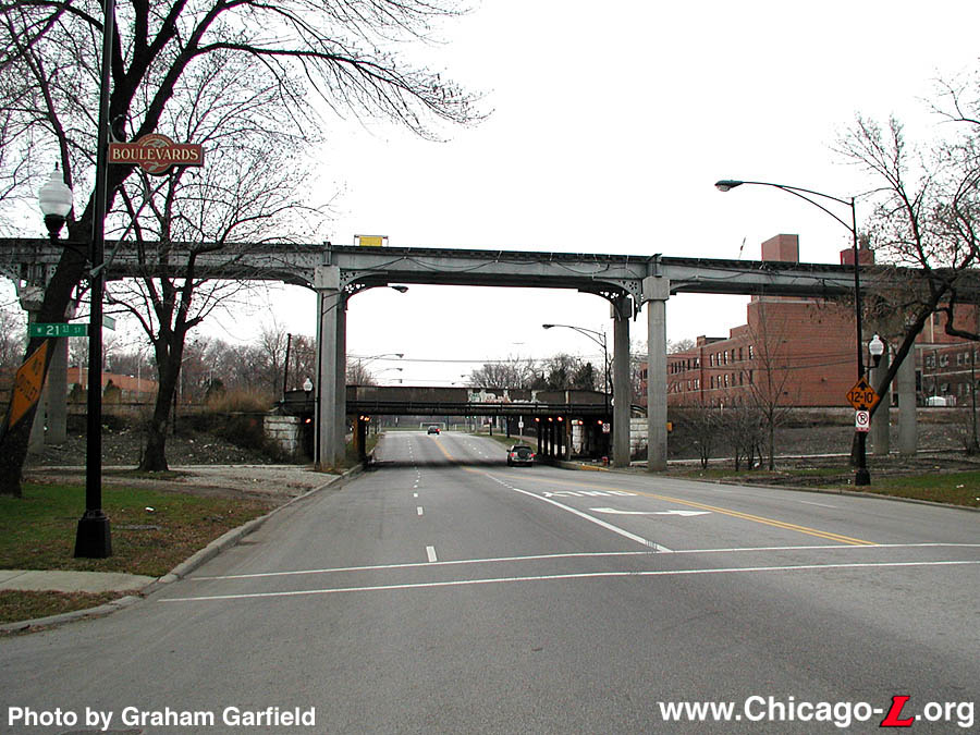
ROW@MarshallBlvd03.jpg
(176k) At the top left, the new columns and spans are in place over Marshall in this view looking north on a rainy May 1, 2003, but additional work is still to be done on the structure. At the bottom left, t he new crossing is complete in this view looking north from 21st Street on December 8, 2003. The decorative brackets from the original 1902 structure have been attached to the new spans, but note that they do not actually attach to the new concrete columns and thus just sort of hang off the new steel trackway. (Photos by Graham Garfield) |
 |
HardingSubstation01.jpg
(148k) |
|
|
|