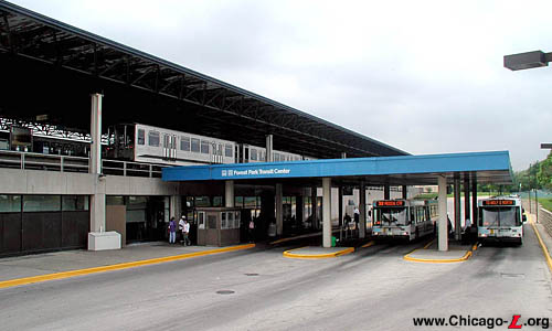
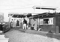
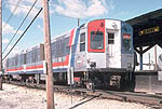
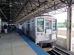
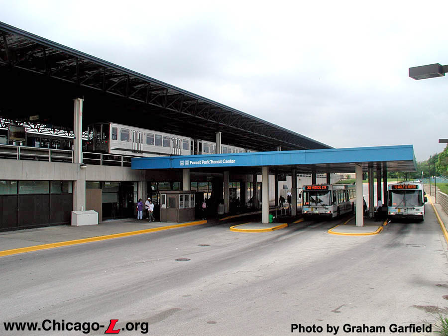
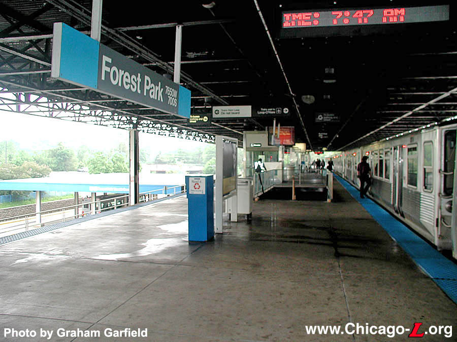
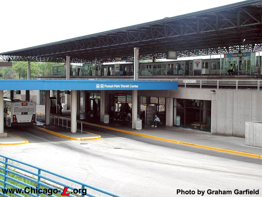
The Forest Park terminal,
looking west at the north bus bay, on May 20, 2004. A train
of 2200-series
(visible above the bus canopy) and 2600-series
(obscured behind the canopy) cars unloads passengers on the
elevated platform above as two Pace suburban buses prepare
to depart below. For a larger view, click here.
(Photo by Graham
Garfield)
|
Forest Park
(7650W/700S)
Desplaines Avenue and
Eisenhower Expressway, Village of Forest Park
Service
Notes:

|
Blue Line:
Forest Park
|

|
Accessible
Station
|

|
Park'n'Ride:
1,051 spaces
|

|
Owl
Service
|
Quick Facts:
Address: 711 S. Desplaines
Avenue
Established: |
August 25, 1902 (AE&C interurban service
inaugurated) |
March 11, 1905 ("L" service
inaugurated) |
Original Line: |
Aurora, Elgin & Chicago Railway (interurban service) |
Metropolitan West Side Elevated,
Garfield
Park branch ("L" service) |
Previous Names: Desplaines Avenue
|
Skip-Stop Type:
|

|
Station
(1953-1958)
|

|
Station
(1958-1995)
|
Rebuilt: 1953, 1959 (new
platform), 1981-82
Status: In Use
History:
The Aurora
Elgin & Chicago (AE&C) interurban began service from Aurora and
Wheaton to a connection with the "L" at 52nd
Avenue (Laramie) on August 25, 1902. On opening day, not every station was ready; in the Maywood and Oak Park areas, the stations in service on the first day were Maywood (5th Avenue), Harlem (referring to the Village of Harlem, not the Avenue, so this was Desplaines Avenue), Oak Park (Avenue), Austin Avenue, and 52nd Avenue. However, early photos and records indicate that other stations were soon added.1
The Metropolitan
"L" assumed local service between 52nd
Avenue and Desplaines Avenue on
March 11, 1905, relieving the AE&C of this unwanted chore. The
extension of Garfield
Park service to Desplaines and the
Met's servicing of the local stations between was part of the
reciprocal trackage agreement that allowed the AE&C to extend to
downtown Chicago and the Fifth Avenue
Terminal over the Metropolitan Elevated.
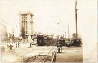
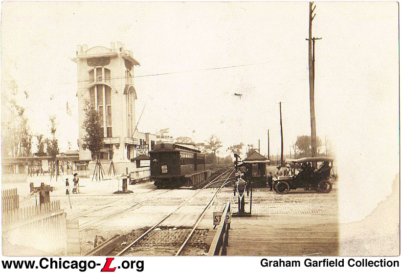
This postcard view at Desplaines Avenue looks west circa 1910. A two-car Met "L" train is approaching the grade crossing, while entrance to the Met's high level platform is just visible to the left of the cars. The tall structure and facility on the left is part of the Forest Park amusement center, located next to the station and operated from 1907 to 1922. For
a larger view, click here. (Graham Garfield
Collection) |
The Met served the existing Desplaines Avenue station, as they did with the other AE&C stations between 52nd and Desplaines, following their 1905 assumption of local service. Initially, only shuttle trains ran between Desplaines
and 52nd Avenue; passengers had
to transfer at 52nd to a train
to the city, but didn't have to pay a second fare. Through shuttles
to the city began in 1906 during rush hours. Eventually, a local
through train was added.
The AE&C continued to stop at Desplaines Avenue as well. The interurban loaded passengers on the east side of Desplaines
Avenue, but separate facilities for the Met "L" were built on the
west side of the street, also in 1906. A new track was added in each
direction that branched off immediately west of the street, creating
a four track line here with the AE&C using the inner two tracks
and "L" trains switching onto the outside tracks. High-level
platforms were built on these outside tracks to serve "L" passengers.
West of the platforms, the interurban veered southwest while the "L"
terminated in a loop (crossing the AE&C tracks at-grade). The
creation of these sidings and the loop minimized switching conflicts
between "L" trains, which terminated here, and the interurban
trains.
In 1925, the Chicago Westchester & Western Railroad was
organized by the CA&E (formerly the AE&C, reorganized) to
build a western bypass around western Chicago suburbs, similar to the
North Shore Line's Skokie Valley bypass. The only tracks built
extended from Bellwood to Roosevelt
Road and operation of this branch was made the responsibility of
the Chicago Rapid Transit Company, which began regular revenue
service past Desplaines without fanfare at 12:34am, October 1, 1926.
Desplaines remained an important transfer station, as CA&E
interurbans and through "L" locals and expresses stopped there, as
well as certain "L" runs which terminated at the station.
At a later date, possibly coinciding with the extension of "L"
service to Westchester, a new station was built at Desplaines. The
short four-track portion of the line on the west side of Desplaines
Avenue was kept in place, as was the southwesterly direction of the
tracks originally used by the AE&C, now used by Westchester "L"
trains as well. But the turning loop was reconfigured so that it no
longer crossed the through-tracks and the high-level platforms were
moved to the east side of Desplaines Avenue, where the line was only
two tracks. A more elaborate station house may have been added at the
same, possibly resembling those at Gunderson
east on the Garfield Park and 50th Avenue,
Laramie and Oak
Park on the Douglas Park: a small wood frame structure with a
clapboard siding exterior and a peaked roof with eaves that extended
out about a foot.
Desplaines Becomes a Terminal
Operation of Desplaines station remained the same until the
CTA era. On December 9, 1951,
the CTA revised the Garfield
Park service, terminating all service west of Desplaines on the
Westchester branch, replacing it with buses. Trains terminated at
Desplaines Monday through Saturday; trains ended their runs at Laramie on Sundays. A/B
skip-stop service was put in place at the same time, but only lasted
until June 1953, when the Garfield Park branch began to be demolished
to make way for the Eisenhower Expressway and the new Congress "L"
Line therein.
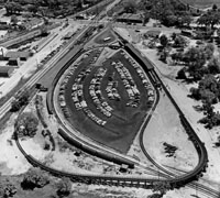
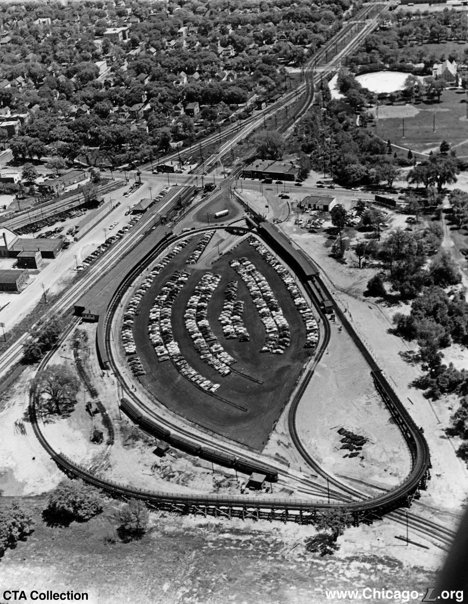
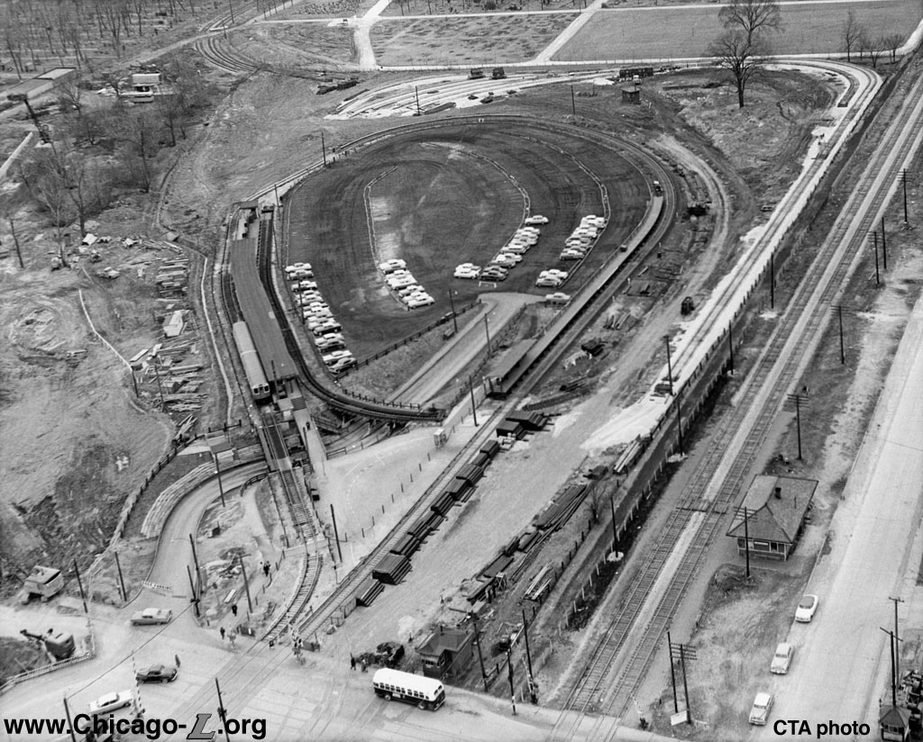
An aerial view looking northeast in 1953 shows the "loop-in-loop" arrangement at Desplaines, with the "L" approaching from the east (top), the CA&E approaching from the southwest (bottom right) and the station's early park'n'ride lot in the middle of the loops. For
a larger view, click here. (Photo from CTA Collection) |
On September 20, 1953, a handful of operational changes were made to Garfield Line service. First, westbound trains began operating via
temporary surface track in a vacated portion of Van Buren Street from
Aberdeen to Sacramento to allow demolition of the elevated to begin
for the new Congress Superhighway (Eisenhower Expressway) and
Congress "L" line. (Eastbound trains did the same a week later.)
Second, the Chicago Aurora & Elgin discontinued service east of
Desplaines Avenue into Chicago on account of declining revenues and
the hardship of operating in the temporary Van Buren
right-of-way.
This dovetailed with the third change, a new "loop-in-loop"
station that entered service at Desplaines on the west side of the
street and the closure of the old station on the east side of the
street. This station served as a terminal for both
CTA and CA&E trains and
included an interchange with the CA&E. The CA&E tracks
approached from the southwest and terminated in a large loop track
west of Desplaines Avenue. The "L" approached from the east and
terminated around a second, larger loop outside of the CA&E's
loop. The "L" outer loop crossed above the CA&E approach tracks
via a wooden trestle at the southwest corner of the property. There
were two island platforms, each offering cross-platform transfers
between the CTA and the
CA&E: one on the south side of the loop for eastbound trains
(CA&E alighting and CTA boarding) and another on the north side
(CTA alighting and CA&E
boarding). A fare collection barrier extended the length of the
eastbound platform, thus ending the ability of CA&E riders to
gain free transfers to the "L". The north platform had no such
barrier since CA&E fares could be collected on-train by
conductors. The new terminal also had an auto parking lot in the
center of the loops, connected to Desplaines Avenue by an access road
that passed underneath both loop tracks by way of underpasses. As
part of the new terminal coming into use, the crew reporting location
moved from Laramie to
Desplaines. Lastly, Sunday service between Laramie
and Desplaines resumed as of this date, with all trains operating
from the Loop to Desplaines at all times.
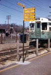
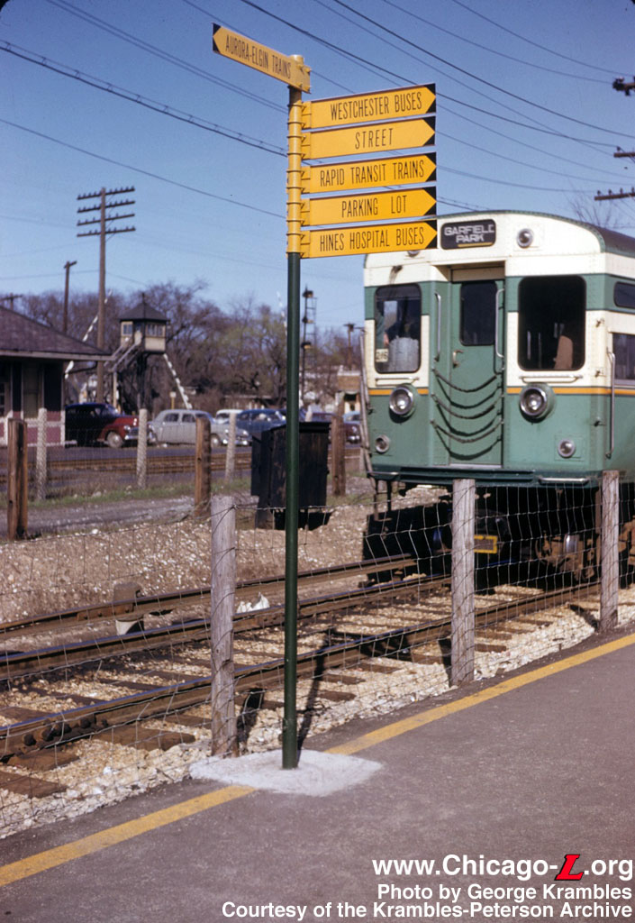
A Garfield Park train of 6000-series cars is about to pass a directional sign of arrow graphics on the walkway to the Desplaines station, seen on April 11, 1954. For
a larger view, click here. (Photo by George Krambles, courtesy of the Krambles-Peterson Archive)) |
In 1954, a new type directional sign was installed at the Desplaines terminal, which informed passengers where they may board vehicles of connecting CTA bus routes, rapid transit trains and trains of the Chicago Aurora and Elgin Railway serving western suburbs. These long, narrow black-on-yellow directional signs were a recognizable feature of the terminal in this era.
On July 3,
1957, the CA&E suspended all service at 12:15 pm, stranding about
6,000 commuters trying to get home in the evening without warning.
The construction of the Congress expressway and rapid transit line
continued to affect Desplaines station for several years. In fall 1957, the laying of tracks for a temporary loop installation largely in the area occupied by the park'n'ride lot for CTA patrons marked the first stage in the construction of new terminal facilities at Desplaines. The temporary loop was installed to permit the existing station area to be cleared for the construction of permanent facilities which was planned to include a permanent car storage yard, a shop building for maintenance and light overhaul work, a transportation building, and parking facilities for patrons, if sufficient area were available. The planned facilities had an estimated over-all cost of $2,500,000. Cost of this work was borne in part by the City of Chicago as part of the cost of constructing the West Side Subway (Congress Line), and in part by the CTA, with the latter installing the tracks and other terminal facilities.
The need to begin work on these facilities was urgent so that the section of the Congress Expressway between Laramie and Central avenues could be completed (which required vacating the old Laramie Yard farther east on the line), and so that new yard facilities, replacing those at Laramie, could be ready for use in advance of the start of operation in the new "L" line then under construction Congress Expressway median strip.
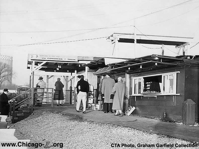
Looking west at the first
Desplaines station on the Congress Line on November 19, 1959
during the morning rush hour. As this view suggests, the
Desplaines station was rather temporary and piecemeal in
nature. Passengers paid their fare here, then crossed the
eastbound Congress track to access the island platform. For
a larger view, click here. (CTA Photo, Graham Garfield
Collection) |
On
Thursday, October 17, 1957, a second temporary westbound platform and new turning
loop were placed in service at Desplaines, and the former CA&E inner turning
loop and the trestle over it were removed.
The Congress Line officially opened on June 22, 1958, but the permanent right-of-way
and stations were only in service between Halsted and Lotus. Between
there and Desplaines, work continued for a couple years to bring
additional permanent infrastructure on-line.
The Desplaines station was one of the few Congress Line stations
not located in the Eisenhower's median, instead located about 1,000
feet north of the expressway. In 1959, one year after the new line
opened, a new station was built. It consisted of one island platform, 375 feet long by 12 feet wide, flanked by two tracks, a wooden canopy and a small open air station
house with fare controls at the extreme east end. Passengers paid
their fare, then crossed the eastbound track at grade to access the
island platform. During this time it was still hoped that the
CA&E might resume service to this station, so an additional
platform, which would have been accessed by then crossing the
westbound track at grade, and stub track were constructed immediately
to the north of the north "L" track for this use.
Hopes were so high
for a resumption of CA&E service, in fact, that a new track
connection was even laid between the old CA&E right-of-way on the
west side of the Desplaines River (immediately west of the station)
and the interurban's new platform. The bridge that had carried the
interurban over the river was relocated a few feet north (necessary
for expressway construction) and a new double-track line laid. Since
the discontinuance of CA&E service, the
CTA had developed the land
around the station rather intensively for its own purposes, including
the installation of a large yard that took up most of the site. So,
as the CA&E's line approached the yard from the southwest, it
narrowed from a double-track line to a single track running north
along the westernmost edge of the property. This way, the interurban
track reached the northwest corner of the property, turned east, and
entered its one-track, one-platform terminal. But the interurban
never did return to service, construction never started on a CA&E
ticket office, waiting room or joint ticketing arrangement with
CTA , and the track connection
was never used. It is rather questionable whether such an arrangement
for the CA&E would have worked operationally anyway -- whereas the
1953 loop-in-loop station had separate platforms for loading and
unloading, room on the loop for up to three short trains to stand,
and five cars of storage, this layout for the CA&E could have
accommodated only one train at a time and had no car storage,
certainly a less-than-ideal situation for the terminal of a busy
interurban. Of course, with the new expressway and improved service
from the paralleling C&NW commuter railroad, one wonders just
how frequently the CA&E would have run had it resumed service.
(It is interesting to note that while CTA stated ahead of time that the new platform was the first step toward providing interchange facilities required to permit resumption of Chicago, Aurora and Elgin Railroad operation on a 90-day trial basis, the platform would be a part of the permanent arrangement of the terminal regardless whether or not the CA&E remained in operation after the 90-day trial period.) Once it was clear that the CA&E was not to return, the interurban
lead track along the western edge of the property was removed and the
double-track throat to the
CTA's yard was restored. This
severed the CA&E station track from the rest of the system
completely. Before this was done, a group of old wooden "L" cars were moved onto the track to be used as a trainroom, clerk's office, and other terminal
functions (since no permanent terminal facility had been constructed).
The additional island platform stuck
around for several decades in this function.
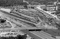
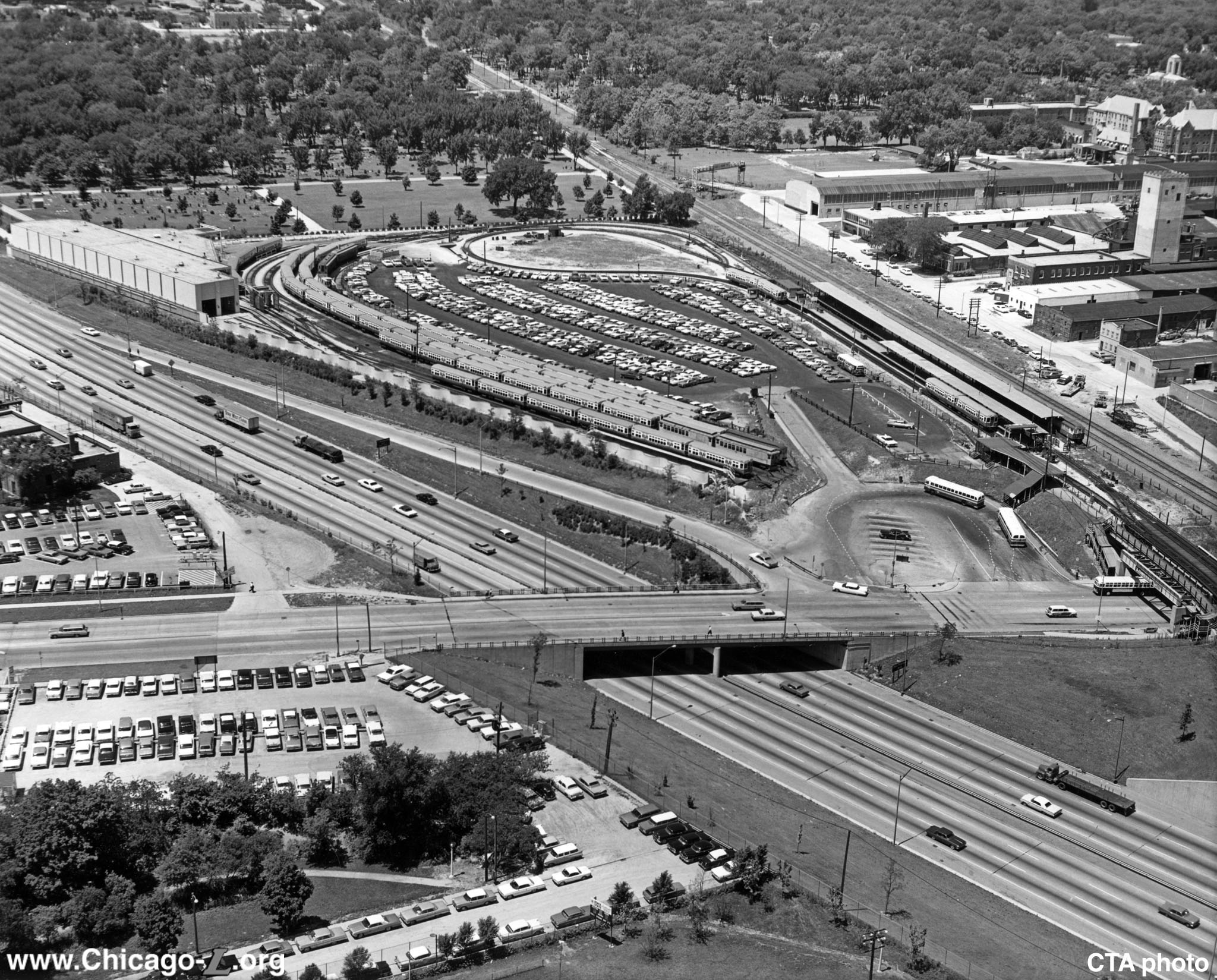
The final arrangement at Desplaines, with the overpass over Desplaines Avenue, platform design for cross-platform transfers with the CA&E (never used as such), U-shaped yard lead and storage yard, and park'n'ride lot and bus terminal between the yard and station is seen in this northwest aerial view on June 25, 1964. For
a larger view, click here. (CTA photo) |
Work to construct the above-described facilities began February 3, 1959. The new island platform facility came into use on July 26, 1959. The new facilities were built by CTA at a cost of approximately $90,000. The station also featured a low level bus loop for convenient transfer between west suburban buses and CTA Westchester extension buses, and rapid transit trains. Plans for subsequent improvements at the Desplaines terminal included permanent fare collection facilities with a direct below track connection to the rapid transit platform for the convenience and safety of patrons; however, these improvements never came to fruition.
In 1960, the grade crossing at Lathrop Avenue was closed, replaced
by an overpass at Desplaines Avenue a block west. The overpass is
somewhat interesting in that it consisted of two spans, one wide
enough to accommodate two tracks (which were used by the "L") and a
second wide enough for one track. This span was not used by a third
track, however, but rather was used as a pedestrian
bridge from the east side of Desplaines Avenue. This allowed
passengers to access the station on the west side of the street from
the east side without having to cross wide, busy Desplaines Avenue.
This made intermodal transfers from buses on Desplaines Avenue
especially convenient. A set of stairs on the west side of the street
connected to this elevated walkway as well.
A storage yard was also constructed along with the temporary
terminal. A repair shop followed shortly after, opening in the early
1960s. Other improvements continued to be periodically made as well.
Early Park 'n' Ride Lot
Desplaines terminal had one of the earliest park 'n' ride (commuter parking) facilities on the "L" system. While it wasn't the first -- that distinction belongs to Cicero-Berwyn terminal (now 54th/Cermak) at the end of the Douglas branch, opened in spring 1952 -- the parking facilities at Desplaines were larger and in some ways more developed. The parking facility's prominence, at least after 1958, was also likely due to it being at the west end of the new Congress line, the CTA's modern, showpiece new rapid transit line, with high speeds and fast travel times from the west suburbs to downtown Chicago. As such, Desplaines terminal and the fast, new Congress line probably represented the best scenario for CTA to entice suburban commuters to drive to a CTA station, park, and use the "L" for the balance of their trip to downtown.
The first parking lot at the Desplaines terminal, then at the end of the Garfield Park line, opened December 15, 1953. When it first opened, the Desplaines park 'n' ride accommodated about 300 automobiles; plans were ultimately for space for over 400 cars. The original lot was a somewhat basic affair, with a cinder base for a driving surface and parking berths delineated by railroad ties set in the ground. Lights were placed around the entire perimeter of the lot and draining facilities were provided to keep the unpaved lot from becoming waterlogged. Access to the lot was by means of a paved driveway, located on the west side of Desplaines Avenue, which crossed underneath the "L" right-of-way. A large, illuminated sign, indicating "free parking," was located over the entrance to the lot. The lot was constructed by employees of the CTA Way and Structures Department and Electrical Department.
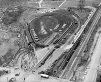
This aerial view looking west at Desplaines on March 17, 1958 shows an intermediate stage of the construction of the final terminal arrangement. The CA&E loop has been partially removed and the "L" is on a temporary loop while installation of the final tracks has begun on the right. The capacity of the park'n'ride lot in the middle of the loop is temporary reduced at this point due to construction. For
a larger view, click here. (CTA photo) |
By August 1956, the free parking lots at Desplaines had a capacity of 420 automobiles.
In fall 1957, construction of new terminal facilities at Desplaines was underway. The first stage was the laying of track for a temporary loop largely in the area that was occupied by the parking lot. The temporary loop installation was made to permit the present station area to be cleared for the construction of permanent facilities. The parking lot continued in use during the terminal construction, although its capacity was reduced to 300 automobiles. The automobile parking lot planned for the terminal was to accommodate approximately 600 automobiles, about 200 more than the capacity of the previous lot. The entrance and exit facilities of the proposed new lot were to be conveniently accessible so that motorists from the western suburbs could park at the terminal and transfer easily to and from rapid transit service.
In summer 1958, parking space for an additional 156 automobiles was made available in two locations -- one site accommodating 97 cars was west of Desplaines Avenue, adjacent to the westbound track in the terminal, in an area formerly used by CTA for the storage of materials; the other area, located east of Desplaines Avenue between Harrison Street and the CTA tracks, part of which was formerly used as a turnaround for Westchester buses and the rest has been leased by CTA, provided parking for an additional 59 cars. The addition of these two new areas increased the capacity of parking facilities at the Desplaines terminal to 456 automobiles.
Work to construct Desplaines's permanent terminal facilities began February 3, 1959. With the start of construction work, it was necessary to eliminate auto parking facilities in the recently established supplemental parking lot on the west side of Desplaines Avenue between the CTA and Chicago Great Western tracks, north of the main parking lot. This reduced the parking space for cars by about 90 vehicles.
Additional parking space for about 80 automobiles near the Desplaines terminal became available April 13, 1959 through the cooperation of state, county and local public agencies. The agreement between the State of Illinois, Division of Highways; the Cook County Highway Department and the Village of Forest Park made it possible for CTA patrons to utilize the paved portion of the Desplaines Avenue roadway between Harrison Street and the CTA tracks for parking. The parking spaces were 18 feet long for end stalls and 22 feet long for inner stalls; all were about six and a half feet wide. This arrangement was for a temporary period of about one year or until the north portion of Desplaines Avenue over the Congress Expressway is completed and opened to through traffic. This additional parking area brought the total number of parking spaces at the Desplaines terminal to about 445.
|
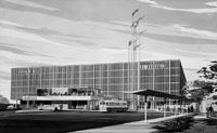
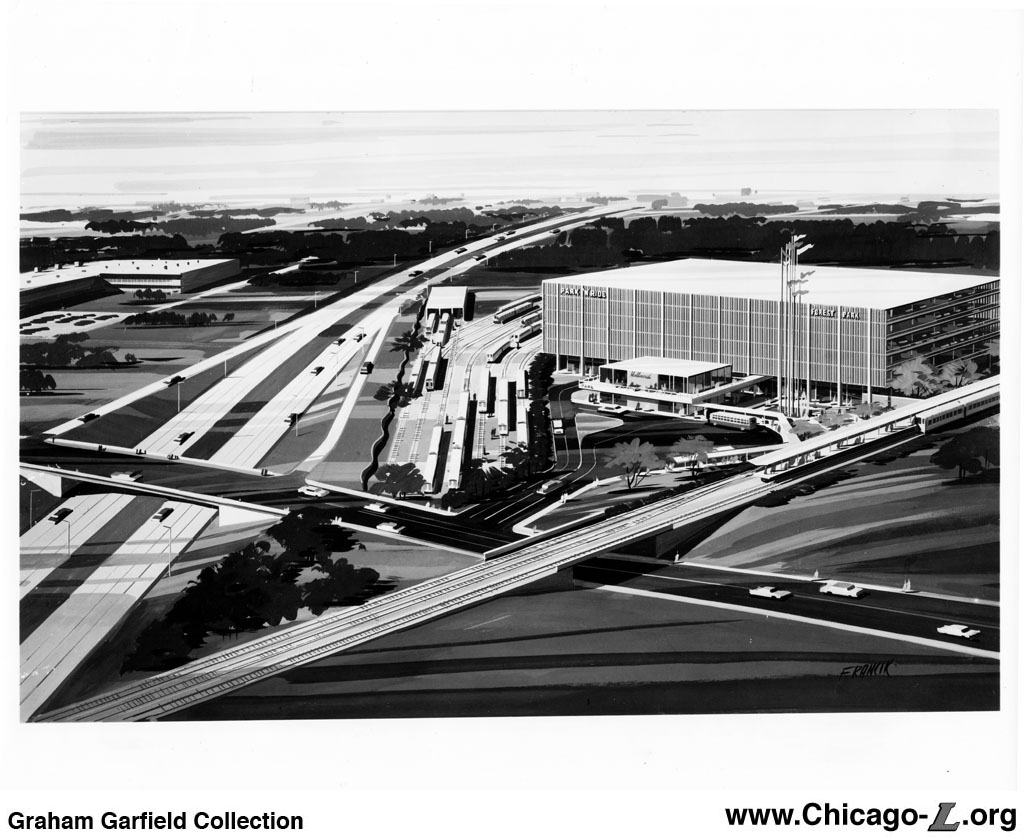
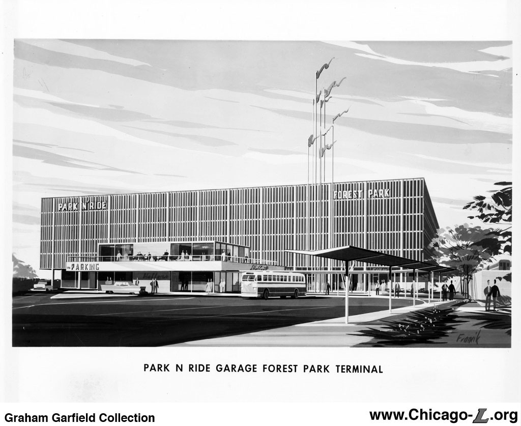
Renderings from the New Horizons for Chicago's Metropolitan Area capital improvement plan show the proposed multi-story parking garage envisioned for Desplaines. The arrangement of the station tracks and yard that were actually built in 1957-60 left space in the middle for this structure to be built. For
a larger view, click here (top) and here (bottom). (Images from Graham Garfield Collection) |
The CTA's $315 million, 20-year master plan for rapid transit improvement and
expansion published in 1958, New Horizons for Chicago's Metropolitan Area, included a new terminal at Desplaines at an estimated cost of $4 million. Besides a new, expanded station (with covered bus-train transfer facilities) and transportation office and a train maintenance shop, the plan included a large multi-story parking garage "for thousands of automobiles". The parking garage would have been easily accessible from the adjacent Eisenhower Expressway to facilitate commuters driving to and from the west accessing the garage with minimal hassle. Some presentations of the New Horizons plan presented the Desplaines garage as being part of a larger Park 'n' Ride Garage Program not included in the $315 million program but rather being a separate effort alongside it. This presented the proposed garages as having a capacity of 6,000 autos, with construction to be financed "by public transportation funds."
The CTA continued to press for a program of outlying park 'n' ride garages throughout the metropolitan area into the early 1960s, packages with various other improvement proposals. A new railcar maintenance shop was completed in 1962, though construction of an enlarged, permanent passenger station with cover rail-bus transfers facilities would not occur until 1980 (see below). As late as 1965, it was noted that the terminal (including the yard and shop) had been designed so that a combined multi-story garage and shopping center could be constructed in the future, if funds to finance the project could be obtained. At that time, preliminary planning for this project contemplated a garage to accommodate 2,000 automobiles, with retail shops located at first-floor level in the garage plaza and direct, under-shelter connections with the train platforms. None of these projects ever came to pass, however, and to date the terminal's parking facilities remain a series of surface lots surrounding the station.
Improvements continued to be made to the surface lots, however, with the main park 'n' ride lot undergoing a refurbishment in mid-1966. The lot was reconstructed and paving, lighting, and marked parking stalls provided. Blacktopping of the surface was performed a private contractor. Striping of parking areas was undertaken by CTA employees. The work was said to have been completed over a single weekend to minimize inconvenience to CTA patrons. On Monday, September 19, 1966, the paving work was complete and a 25 cent parking fee
began to be charged for use of the lot.
A Permanent Facility for Desplaines
In the late 1970s, after the "temporary" station had been in
service for approximately 20 years, a new, permanent terminal
facility was planned for Desplaines. The new terminal was to be built
in approximately the same location as the existing station, so a
temporary station had to be built adjacent to the north so the land
could be vacated. To access the temporary station -- an
island platform flanked by two tracks -- westbound trains used the
former Chicago Great Western Railroad bridge immediately to the north
to cross Desplaines Avenue. Use of the temporary station and Great
Western bridge began effective July 1977.
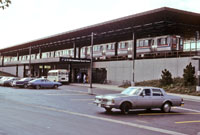
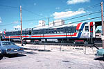
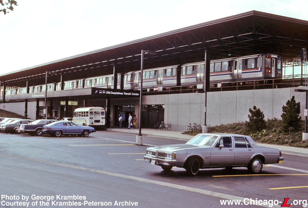
A view of the bus stop at
the "Desplaines Transit Center", looking northwest on July 8, 1981, as work on the new station was being completed. Designed as an intermodal facility, a train of
2400-series
train is loading passengers bound for Jefferson Park, while a bus makes connections below and park & ride spaces are in the foreground. For a
larger view, click here.
(Photo by George Krambles, courtesy of the Krambles-Peterson Archive) |
Once the temporary station was in use and the old station was
vacated, construction began on the new terminal. The two-level
station has the tracks and a platform on the elevated level, while
the ground level building underneath the tracks contains the fare
controls, auxiliary rooms, and concessions. The station was designed by Louis Rocah, who was the supervising architect with the City of Chicago's now-defunct Bureau of Architecture. The
CTA 1980 Historical Calendar
describes the new station like this:
Featuring an open-plan design concept,
the CTA is rebuilding five major rapid transit stations which will
have escalators and elevators for the convenience particularly of
the elderly and handicapped. The design provides maximum
visibility, easy movement of people through fare control areas,
and a high level of illumination. Under construction are a new
terminal at Desplaines Avenue, Forest Park, for service in the
Eisenhower Expressway, an enlarged station at 79th
Street on the Dan Ryan expressway
route, elevated stations at Loyola
and Granville
on the North (Howard) route, and an elevated station at
Western
Avenue on the Ravenswood route.
The island platform is 425 feet long and 28 feet wide, a generous
dimension. Perhaps the station's signature and most recognizable
element is the platform canopy. The enormous floating roof system is
dramatic and is not entirely dissimilar from the canopy roof design
executed by Helmut Jahn for the second (and current) McCormick Place
exhibition hall, completed less than a decade earlier. The canopy is
432 feet long and 80 feet wide -- completely covering the island
platform as well as both tracks -- and supported by columns on the
outside of the tracks. The structure of the roof is comprised of a
framework of steel Warren trusses, a structure of repeating
triangles, arranged in a grid. With the roof and trusses painted dark
brown, the entire structure has a dense, modern feeling. The platform
was also outfitted with three 16-foot long windbreaks and infrared
heaters.
The station house underneath the tracks and platform were
connected to the upper level by way of two sets of stairs and
treadle-activated escalators, as well as an elevator for
accessibility. Most of the lower level, some of which contained the
trainroom and auxiliary rooms and some of which was actually just
filled space supporting the elevated tracks, was enclosed by solid
concrete walls. However, the section that contained the station house
was enclosed by a transparent steel and glass curtain wall on either
side. Inside were a two-position agent's booth, turnstiles and other
fare controls, and concession spaces. There was also a Greyhound
ticket office, as the intercity bus service used the Desplaines
terminal as a station. Outside, large canopies projecting out from
the station entrances on the north and south sides protect passengers
transferring to and from buses. The facility was also built with
park'n'ride lots and a kiss'n'ride.
The facility was built in the late 1970s in sections. The elevated
tracks, platform, and canopy, and the station house underneath were
all built at the same time, as were the entrance, 300-space parking
lot, and bus lanes on the south side of the facility. Meanwhile, the
land on the north side of the facility could not be excavated until
the new station entered service because the temporary station sat
atop the land there. Over the weekend of June 27-30, 1980, about 100
CTA personnel worked
feverishly for about 2,000 man hours to make the transition from the
temporary station to the new facility. About 300 feet of track,
signals, and traction power that led to the temporary terminal was
dismantled and another 300 feet was installed to make the permanent
track connection to the new terminal. In addition to moving the
track, building and grounds crews relocated office facilities,
including the offices of the terminal superintendent, clerk,
trainroom, and ticket agents' work area, to the new station. Come
Monday morning, June 30, 1980, trains and passengers used the new
station. Following this conversion, the north temporary platform was
removed and track and structure demolished so that the land could be
excavated and the new north bus turnaround could be constructed.
When the station opened, the south bus terminal served RTA West
Towns buses and the north terminal served
CTA buses. Over time, the
agencies' use of the two bus bays was less segregated. The station
was completed in December 1982 when the station's elevator was placed
in service. The transit center project cost over $5 million and was
funded jointly by the Urban Mass Transportation Administration and
the Illinois Department of Transportation.
A New Name and Other Recent Developments
The station's name was changed to Forest Park (for the city it is
in) in 1994, when the CTA adopted color-coded names for the "L" routes and the West-Northwest
Route became the Blue Line. At the same time, the Congress branch became the "Forest Park branch" of the Blue Line. The station name and
column signs on the platform were replaced around at that time to
reflect the new station name.
The bus canopy was originally painted brown, like the train canopy,
and lettered "cta
Desplaines Transit Center" with train, bus, and Greyhound
logos. In the early 2000's, the canopy was repainted blue to denote
the Blue Line and re-lettered "Forest
Park Transit Center", minus the Greyhound logo.
During Autumn 2004 and Spring 2005, several "L" stations got new
station name signs. As part of a multi-station program, twelve
facilities in all on the Blue, Purple, Red, Orange, and Green lines
received new, Green Line
Graphic Standard station name signs, replacing older KDR-type
signs that used an outdated graphic scheme that was inconsistent with
the colored line names. The new signs not only replaced old ones in
existing locations at these island platform stations, but were added
at additional locations outside the tracks, facing to the platform,
for ADA compliance. The additional station name signs are suspended
from above using long vertical tubular steel supports attached to the
truss roof structure. Installation at all stations was complete by
the end of November 2004. Fabrication and installation of the signs
was performed by contractor Western Remac.
On August 18, 2005, the Chicago Transit Board approved two
intergovernmental agreements (IGAs) making way for the construction
of a pedestrian bridge and pathway over the Des Plaines River and
onto CTA property near the
Forest Park terminal on the Blue Line. The bridge and pathway will
provide a direct connection for pedestrians and bicyclists traveling
between the Forest Park Blue Line station and Maywood, and the
Maywood Circuit Court complex located on the west side of the Des
Plaines River.
The agreements with the Villages of Forest Park and Maywood are
related to construction and maintenance of the bridge and pathway.
The first grants the two villages a right of entry to permit access
to build the structure onto
CTA property and lasts only
during the construction period. The second agreement relates to
maintenance of the bridge and pathway, and allows Maywood and Forest
Park onto CTA property for the
purpose of maintaining the bridge and pathway. It will last for a
term not to exceed 40 years or until the bridge is no longer in
use.
There was to be no cost to the
CTA related to the
construction or maintenance of the pathway. The Illinois Department
of Transportation and Operation Green Light provided funding for
the project which will be coordinated through the Villages of Maywood
and Forest Park.
In 2006, the park'n'ride lot at Forest Park station converted to a
new payment system. Called "Pay & Display", it differed from the
usual method of CTA lots, in
which after driving your car into a numbered spot, one slides the
correct amount of cash into the corresponding slot on a metal box
mounted in the station or the lot. In "Pay & Display", an
electronic meter at the parking lot entrance accepts the parking fee
paid with cash or credit card. The machine spits out a receipt, which
is displayed on the dashboard of the parked car. This eliminates the
need to carry the necessary coins or exact bills. As of 2006, the
Forest Park stop is the only one on the
CTA , so far, that uses the
system. The Forest Park lot is managed by the Village of Forest Park
-- as with most suburban CTA lots, which are managed by their respective municipalities -- whereas
lots in the City of Chicago are managed under contract, at that time by Standard
Parking.
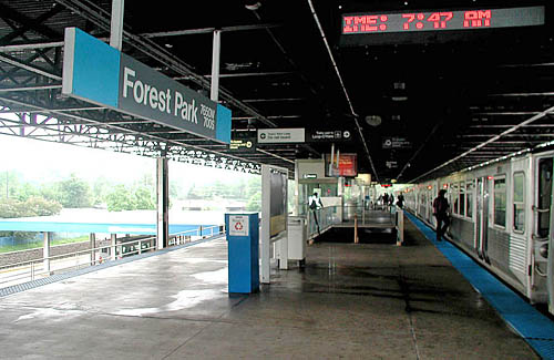
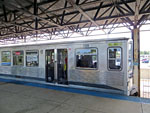
The island platform is
covered by a wide canopy structure of steel trusses and
supporting a flat roof. Looking east on May 20, 2004, the
Blue Line train on the right has turned around on the
turning loop and is loading passengers on the south track
for the trip downtown and to O'Hare. The north bus terminal
is visible below on the left. For a larger view, click
here.
(Photo by Graham
Garfield)
|

|
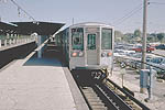
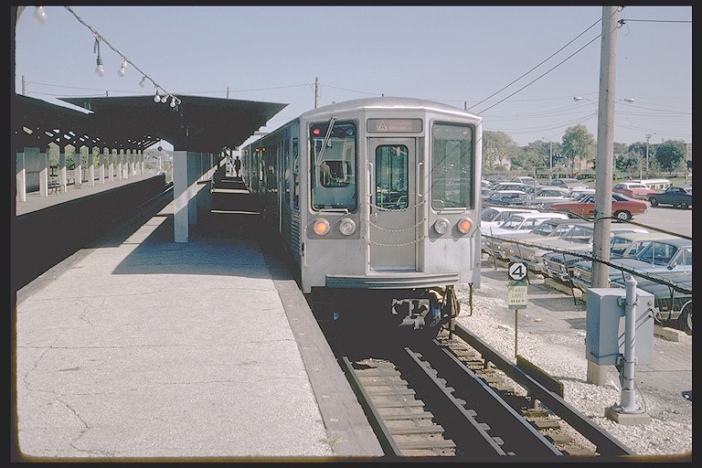
cta2227.jpg
(127k)
A 2200-series
Congress-Milwaukee "A" train is trailed by car 2227,
boarding passengers at Desplaines Terminal on October 4,
1972. The strings of lights give the platform, approximately
20 years old by the time of the photo, an unfinished look.
(Photo by Steve Zabel, Collection of Joe
Testagrose)
|
|
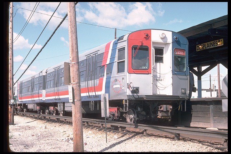
cta6663.jpg
(145k)
The "Francisco de Miranda", led by 6663, loads passengers at
Desplaines terminal before beginning its Congress-Milwaukee
"A" run on September 21, 1976. The car had been released in
its Bicentennial livery only six months and two days
earlier. Note the 1950s station sign under the canopy on the
right. (Photo by Doug Grotjahn, Collection
of Joe Testagrose)
|
|
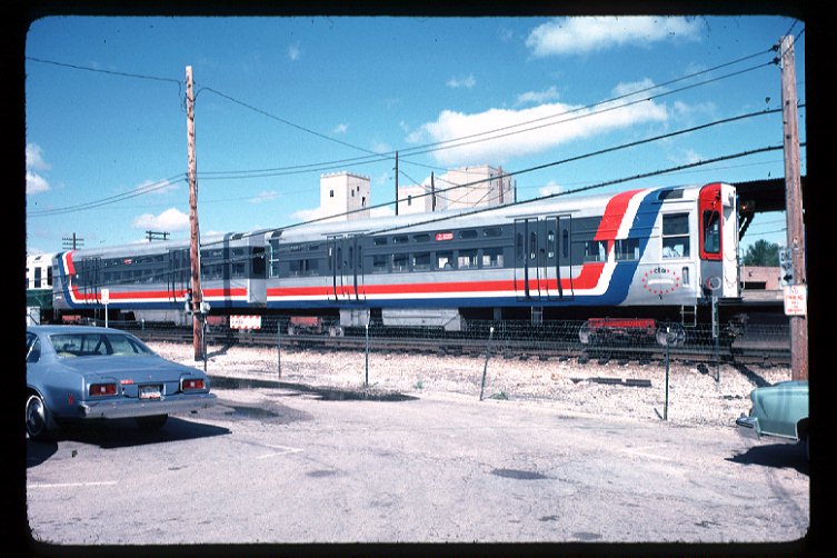
cta6663b.jpg
(95k)
A full view of the "Francisco de Miranda" - 6000-series
cars 6663 (right) and 6664 - at Desplaines terminal on
September 21, 1976. (Photo by Doug Grotjahn,
Collection of Joe Testagrose)
|
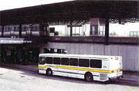 |
desplaines02.jpg (145k)
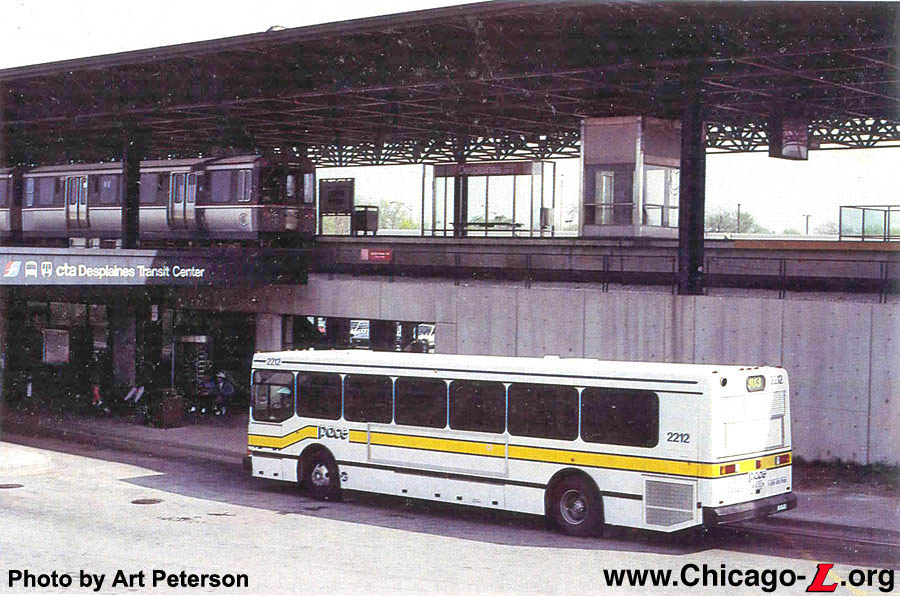
A view of the bus stop at the "Desplaines Transit Center", looking southeast on May 5, 1992. Coordination of regional transit services allows Pace and CTA to run an integrated service here. A 2600-series train is loading passengers bound for O'Hare. An annunciator sign on the station wall alerts bus operators to approaching trains they might not otherwise see. (Photo by Art Peterson) |
|
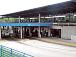
desplaines05.jpg
(154k)
The station house is essentially a hollowed-out section of
the embankment that supports the elevated tracks, platform,
and canopy, as seen looking southeast from the station's
north park'n'ride lot on May 20, 2004. The North Terminal
bus interchange is see in front of the station entrance.
(Photo by Graham Garfield)
|
 |
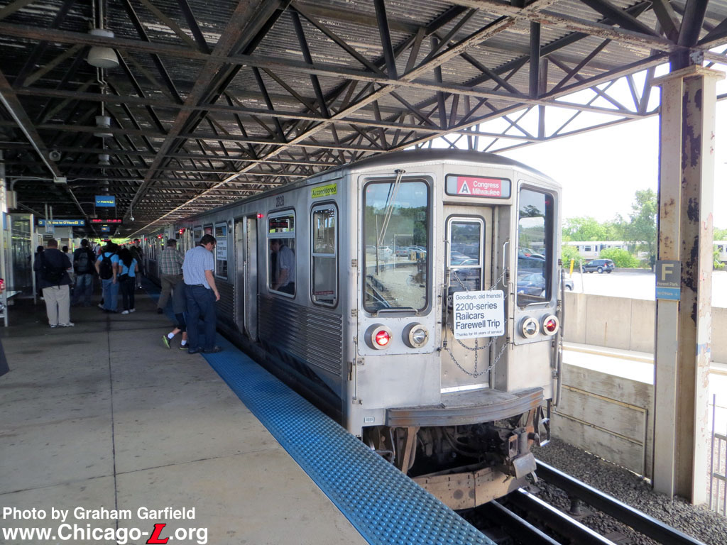
cta2328b.jpg (238k)
The all-2200-series train running for the series' ceremonial last trip on the CTA is berthed in the platform at Forest Park on August 8, 2013. awaiting its departure to O'Hare -- the last in-service trip the cars would take on the "L". For the last trip, car 2328 trailed the eight-car consist. Customers and railfans, seen taking photos and boarding the train, were invited to join in on the CTA tradition of saying "Goodbye, Old Friends" -- that sentiment has been used on the onboard signage for the last trips of the 4000-series (in 1973) and 6000-series (in 1992) cars as well. (Photo by Graham Garfield) |
 |
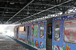
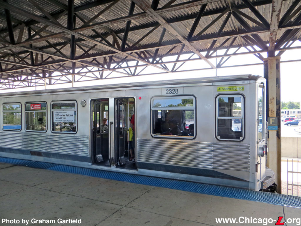
cta2328c.jpg (240k)
Car 2328 is on one end -- the rear end, for the trip that's about to depart Forest Park for O'Hare -- of the solid eight-car train of 2200-series cars that is running for the series' ceremonial final trip in passenger service on August 8, 2013. For the occasion, the cars' exteriors were "restored" to an appearance closer to their early years. Although changes like the hopper windows added during mid-life overhaul were not undone, decals that were added to the cars later in their service lives were removed, the "Air conditioned" decal (added a few years after the cars entered service) and ACI stripe on the side doors for automatically setting certain interlocking lineups (not visible because the doors are open) were added back, as were period destination sign graphics (applied as decals rather than actual roller curtains). (Photo by Graham Garfield) |
 |
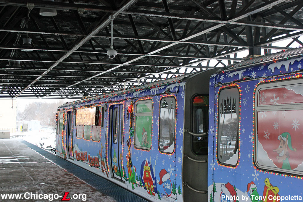
cta2894-HolidayTrain2013b.jpg (292k)
The Holiday Train has reached the end of one of its trips on the Blue Line, and is laying over in the north pocket at Forest Park station on December 14, 2013. Car 2894 is at the far end of the train. (Photo by
Tony Coppoletta) |
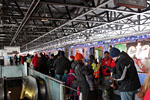 |
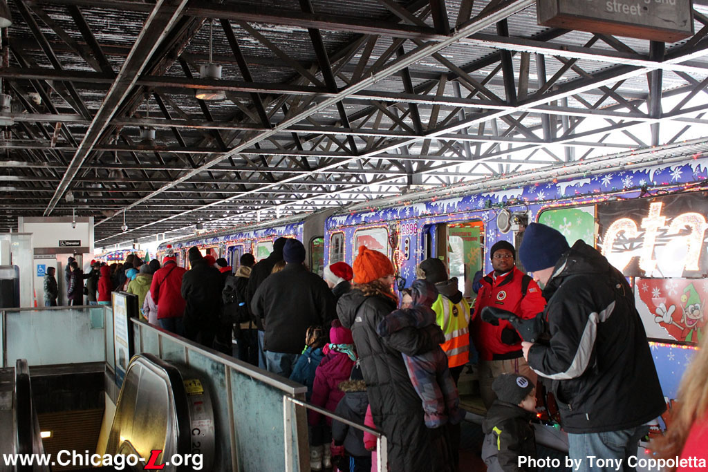
cta2896-HolidayTrain2013a.jpg (276k)
While the Holiday Train lays over at Forest Park on the Blue Line on December 14, 2013, a long line of parents and kids wait to have their photo taken with Santa. (Photo by
Tony Coppoletta) |

|

|
Notes:
1. Plachno, Larry. Sunset Lines: The Story of the Chicago Aurora and Elgin Railroad - 2: History. Transportation Trails, 1990.


