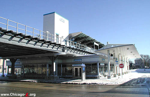
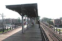
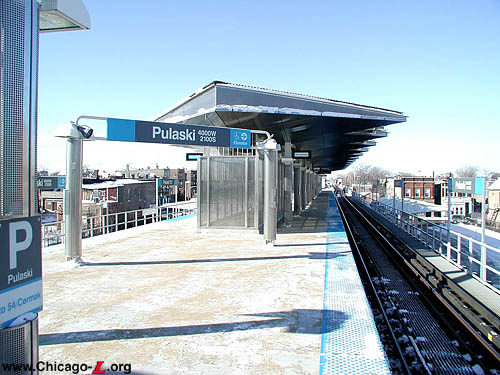
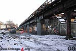
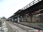
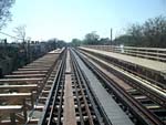
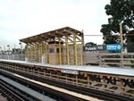
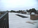
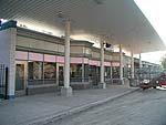
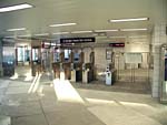
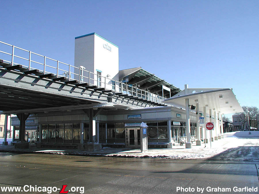
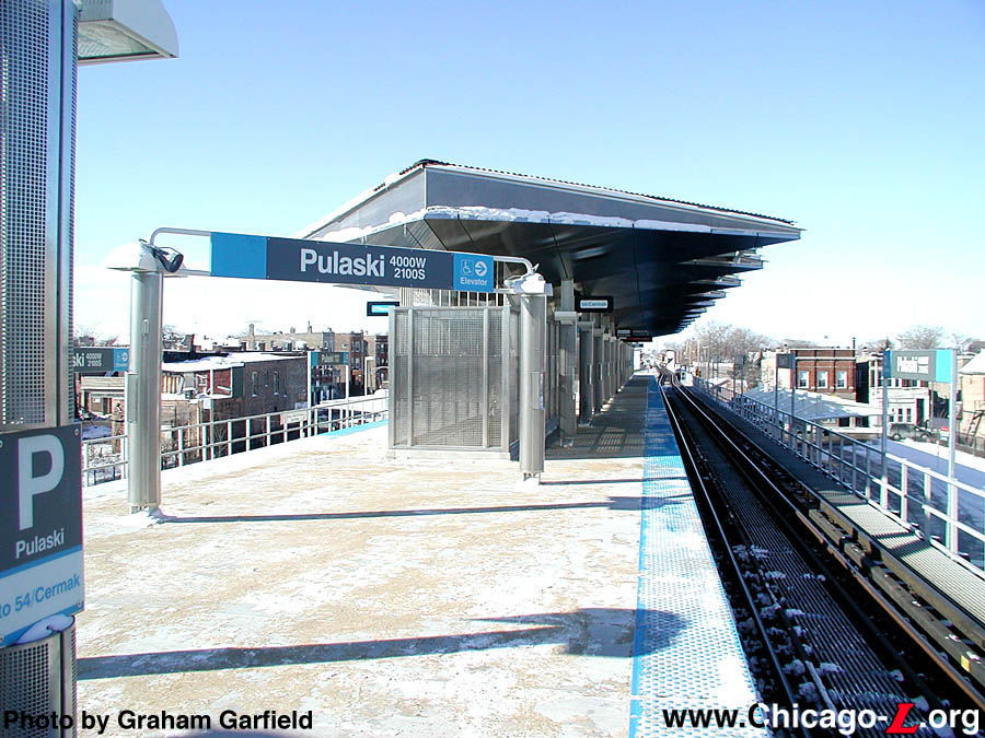
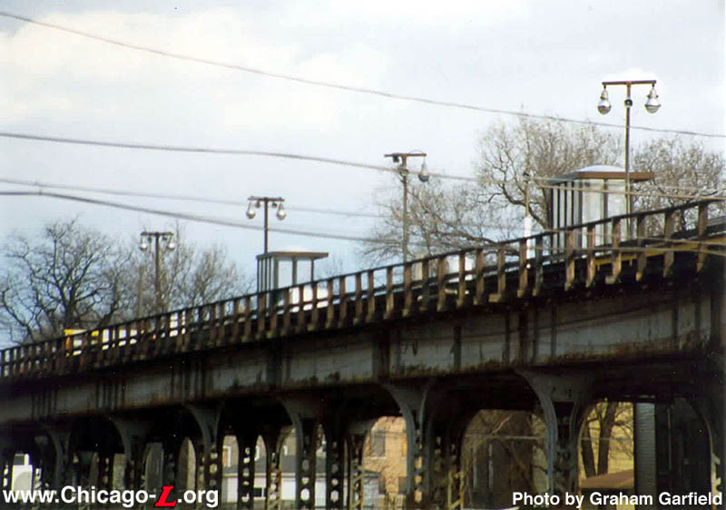
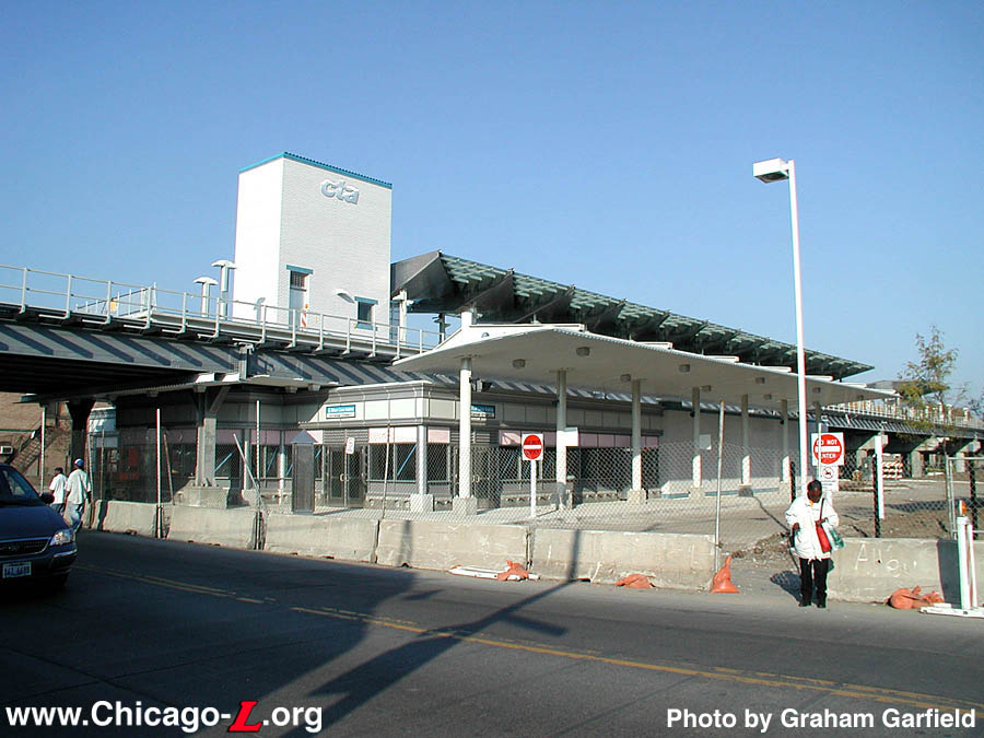
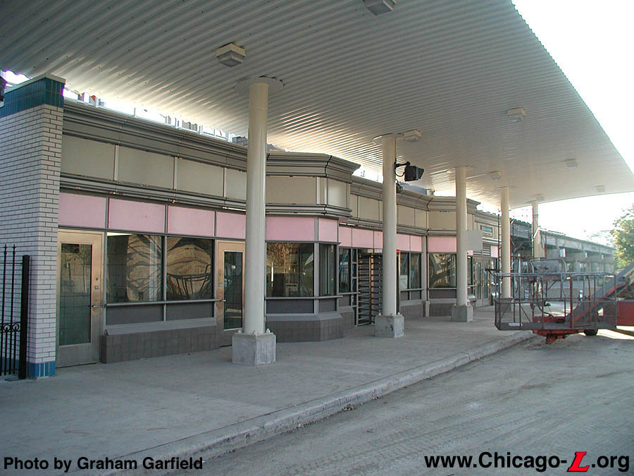
The Pulaski station house
and island platform canopy, looking east on January 30,
2004. The station features a large, spacious station house,
wider accessible island platform, and off-street bus
terminal, all executed in a postmodern design.
For a larger view, click
here.
(Photo by Graham Garfield)
|
Pulaski
(4000W/2100S)
Pulaski Road and 21st
Street, North Lawndale
Service
Notes:

|
Pink Line:
Cermak (Douglas)
|

|
Accessible
Station
|
Quick Facts:
|
Address:
|
2021 S. Pulaski Road
(Pulaski
entrance)
|
|
2020 S. Harding Avenue
(Harding
auxiliary exit)
|
Established: June 16, 1902
Original Line: Metropolitan West Side Elevated, Douglas
Park branch
Previous Names: 40th Avenue Terminal, Crawford Avenue
|
Skip-Stop Type:
|

|
Station
(1951-1958)
|

|
Station
(1958-1995)
|
Rebuilt: 2002-04
Status:
In Use
History:
The Douglas branch of the Metropolitan West Side Elevated Railroad
was originally planned to extend to 46th (Kenton) Avenue in its
original stretch. However, the branch was only open as far as 18th Street by April 28, 1896 (long after the
other Met branches were in service) and Western
was activated August 7. In June 1900, the Chicago City Council
authorized extensions in the Garfield Park and Douglas Park branches
of the Metropolitan Elevated Railroad to 52nd and 40th Avenues,
respectively. Douglas Park service was extended to 40th Avenue on June 16, 1902,
following an earlier, intermediate extension of service to Lawndale (3700W) on March 10.
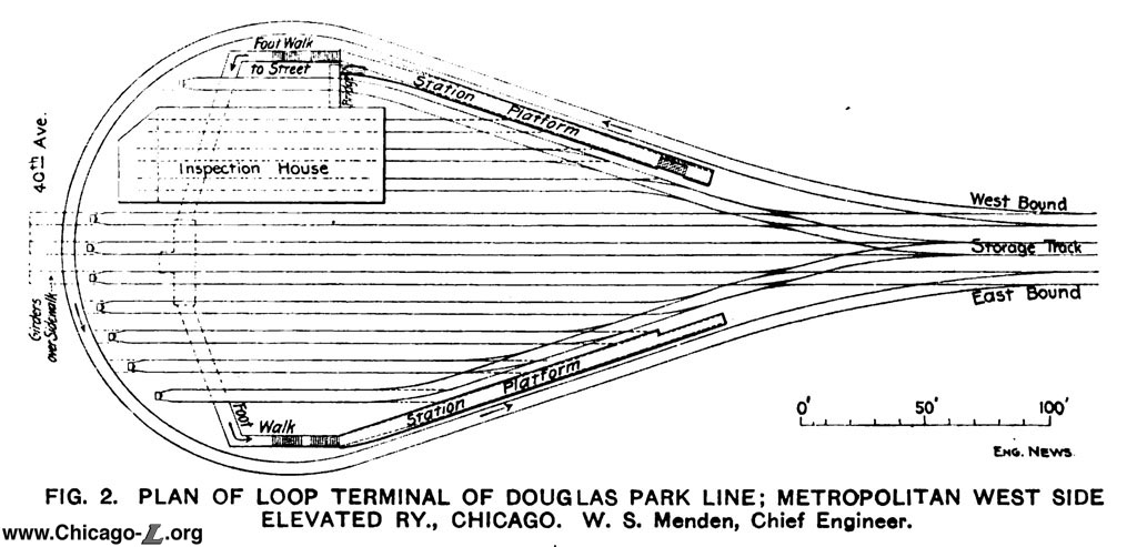
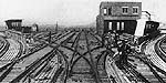
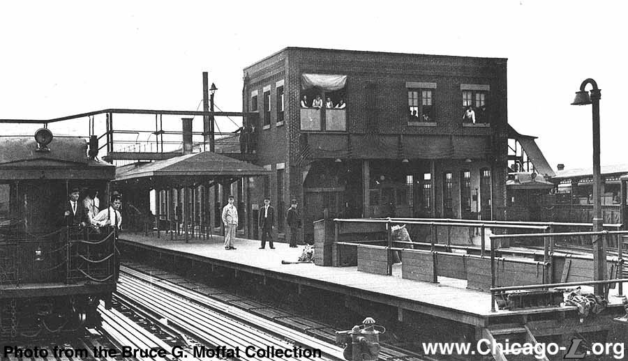
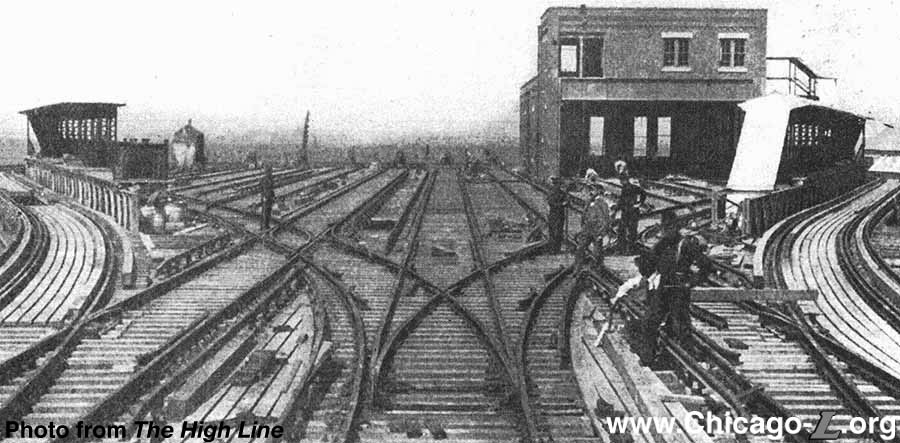
Track diagram and site layout of 40th Avenue Yard, as it appeared when it opened in 1902. For a larger
view, click here. (Image from Engineering News) |
The 40th Avenue terminal included an elevated storage yard and railcar maintenance shop at
track level, with a loop track for turning trains. The terminal was described in a 1902 Engineering News article:
The advantages of loop terminals over dead-terminals for elevated railways, with their traffic, have several times been pointed out, but the first road to adopt this system is the Metropolitan West Side Elevated R.R. of Chicago, which has recently completed a loop terminal at the of its Douglas Park line and is now building similar terminal at the end of its Garfield line... With the loop system there need be no holding of trains outside the during the busy hours, caused by a slight delay of a train at the unloading platform, which delay in the case of a dead end terminal necessitates holding all incoming trains until the offending train has backed out in the face of these trains... The great advantage of the loop lies in the fact that it eliminates all switching and reverse movements, the trains moving ahead all the time and following each other closely...
The loop at the [40th] Ave. terminal station of the Douglas Park line... is on the elevated structure, as is the car yard at this point. There are three tracks approaching the terminal... which diverge and are connected by a curve of 90 ft. radius, forming a kite-shaped loop...
The station building on 40th Ave. and the car inspection house are both of red pressed brick... From the waiting room of the station there is a short stairway to elevated walks leading under the structure to the platforms, which are reached by other stairways...1
The 40th Avenue terminal's headhouse design was typical of the
architecture for most of the Metropolitan Elevated's 1902 Douglas
extension. The building, executed in brown brick and tan rusticated
stone with wooden doors and window frames, had an eclectic mix of
influences and styles, many of which were purely vernacular. The use
of dark brick masonry, heavy, rough-cut stone in the sills and
quoins, and the decorative brickwork and terra cotta along the
cornice all suggest some influence of the Romanesque Revival style.
The station was generally square except for a bay in front and was
one story tall.
The loop track that encircled the yard had two side platforms.
Trains terminating at 40th Avenue operated around the loop in a
counterclockwise direction, dropping off alighting passengers at a
platform in the north half of the yard, circling behind the shop, and
then picking up inbound passengers at the platform on the south half
of the loop.
The island platform was
installed when 40th Avenue became a through station, as seen
in this pre-World War II view. The old alighting platform on
the former loop track can be seen on the right. For a larger
view, click here. (Photo from the Bruce G. Moffat
Collection) |
This arrangement worked fairly well for the station as a terminal,
with the quick turnaround times and separate platforms for boarding
and alighting. It would not work as well as a through-station,
however, and it wasn't long before the Met had to address this
situation, not surprising given their original plans to terminate the
branch at least as far west as the city limits about six blocks west. In 1907, the line was extended to 46th Avenue at the city limits. (Later extensions brought the Douglas Park branch to 48th [Cicero Ave., 1907], 52nd [1910], 56th [Central Ave., 1912], Lombard [1915] and finally Oak
Park Ave. [1924].) When 40th Avenue became through station in 1907, the loop track was
broken in half as two of the yard tracks were extended west through
the yard and beyond the station. Between them a new island platform
was added for trains continuing west. While a new stairway was built
from the island platform down to the street-level station house, an
elevated walkway was also built to connect the new island platform
with the two side platforms on the old loop. It is unclear how much
use these original platforms got after 1907, though some trains still
terminated here and may have used them, though with the loop no
longer going all the way around they would have functioned only as
stub tracks.
By the summer of 1912, the loop track and its side platforms were removed,
though the shop building and the rest of the yard remained. The yard continued in service for many years, even after the
CTA shortened the line to 54th Avenue in 1952 and built a small
yard and shop there. The yard was closed circa 1962. Remnants of the yard in the form of sections
of structural steel remained as late as the 1970s and to this day
there is an unusually large area of cleared land around the station,
demarcating the size of the former yard.
40th
Avenue was renamed Crawford Avenue in 1913, and finally changed to
Pulaski Road in 1933. The station changed names each time with the street.
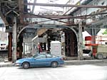
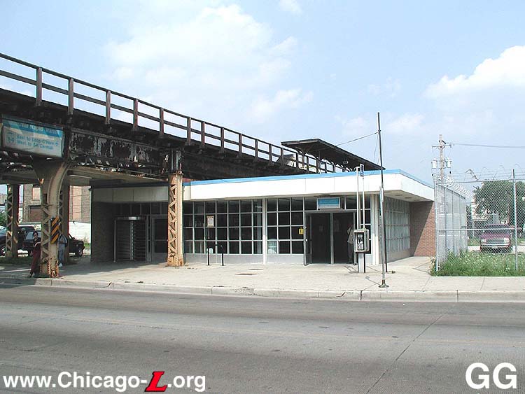
The Pulaski station house
and island platform canopy, looking east in August 2001.
Several generations of construction are evident here: the
structure and canopy date from circa 1907, while the station
house is from circa 1990. Boxy and utilitarian, the station
house is typical of its period of construction. For a larger
view, click here. (Photo by Graham Garfield) |
In mid-1973, fire struck the Pulaski station and gutted the
station house. (This was not a good year for the
CTA : in addition to budget issues causing numerous
station and entrance closings, the Kildare
station house one stop west on the Douglas branch was also destroyed
in an accident.) The platform was largely undamaged, so a new
stairway was built from the platform to the ground, behind where the
station house was, and temporary fare controls were built there at
the top of the stairs on the platform. The portion of the platform
west of the stairs was abandoned and an extension was built to the
east so that 8-car trains could still berth. The canopy on the island
platform was also refurbished at this time. Finally, lights were
strung on wooden poles and some signage was replaced, completing the
temporary facility that would serve until a new, permanent
replacement station could be built. While the burned out station
house was demolished, this "temporary" station ended up lasting for
well over a decade.
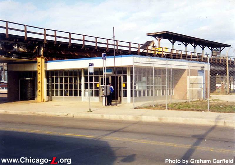
Finally, construction of a new station got underway circa 1989. An
entire new station facility was designed, but only the station house
was actually built. Coming into use in 1990, the headhouse had a
utilitarian design tan brick walls on both the interior and exterior
and a glass and steel front facade. It featured an open and spacious
interior and glass front facade that allowed riders waiting for the
northbound #53 Pulaski bus to wait inside while still keeping a good
view of the street. The agent's booth and fare controls were
stainless steel. The north end of the front facade had a rotogate on
the front and a door that allowed for the station to be closed and
through access to be provided when no agent was on duty and "pay on
train" was in effect, but was otherwise locked. Interestingly, the
station's fare controls included a wheelchair access gate, required
by the Americans with Disabilities Act even though the station lacked
an elevator or other ADA-compliant means to access the elevated
platform.
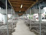
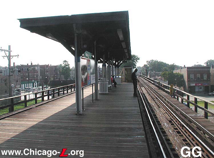
A very short canopy stood at
the west end of the Pulaski platform, looking west in August
2001. The section of canopy is many decades old and shows
its age too well. It is also where the only station name
signs in the entire station -- two in all, one in each
direction -- were posted. For a larger view, click
here.
(Photo by Graham Garfield)
|
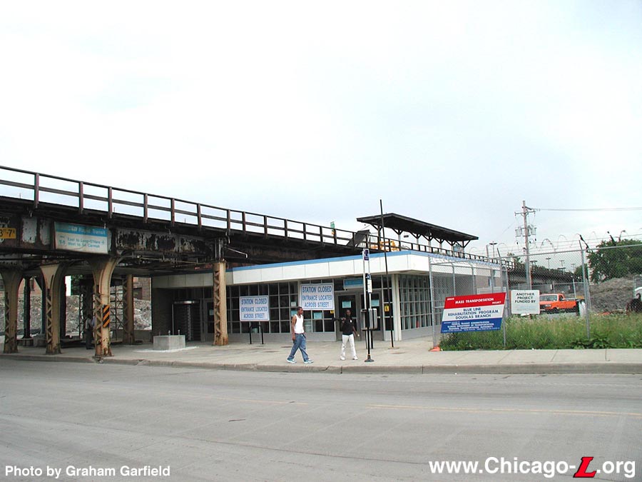
The rest of the station faired less well. The other components of
the plan were not executed and despite the presence of a relatively
new station house, the rest of the station continued to be in poor
condition. The old island platform from the 1907 extension (which had
last received significant work back in 1973) remained, with its short
canopy, covering only the extreme west end from the stairs to about
one car length down the platform, and modest amenities. From the back
of the station house -- where a new stairway and possibly an elevator
would have been built to a new platform -- customers were deposited
into a fenced in passageway that led to a narrow set of stairs to the
platform (the same ones "temporarily" installed after the 1973 fire).
The north exterior wall in the paid area had three door-shaped
outlines in the brick wall. This, combined with the large amount of
empty space around the station, would seem to suggest that the
CTA's plans for this station
may have included a bus turnaround, never built.
Douglas
Renovation Project
By the time of new millennium, the platform was in poor condition.
There was only one set of station name signs, one for each direction,
and they were found under the tiny canopy; otherwise, the platform
was devoid of any signage identifying the station to passengers.
There was a single windbreak, under the canopy; all other shelter on
the platform is was provided by makeshift windbreaks using bus
shelters installed on the platform. The platform lights were of a
decidedly jury-rigged and temporary appearance (a lot less temporary
than they were probably intended to be), using utilitarian,
industrial fixtures (not found anywhere else on the system) attached
to wooden poles. Some had detached wires hanging down. The
incongruous progression, from a clean, solid station house to a
ragged platform via a makeshift passageway only accentuated the
aborted plan for the station.
Over the years, the condition of the Douglas branch deteriorated
to a point that permanent "slow zones" were present throughout more
than 47% of track and many of the stations were in poor condition.
After a long battle to secure funding from both the state and federal
governments, the CTA decided
it was time to embark upon a complete rehabilitation of the entire
branch. The Douglas
Rehabilitation Project was the largest single capital improvement
project the authority had embarked upon up to that time. The project
was to restore the branch so that it would be 100 percent ADA
compliant with eight of the branch's 11 stations (six elevated and
two at-grade) completely rebuilt and to allow for faster travel times
from one end of the line to the other.
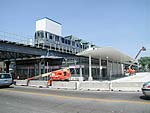
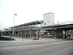
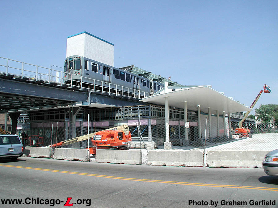
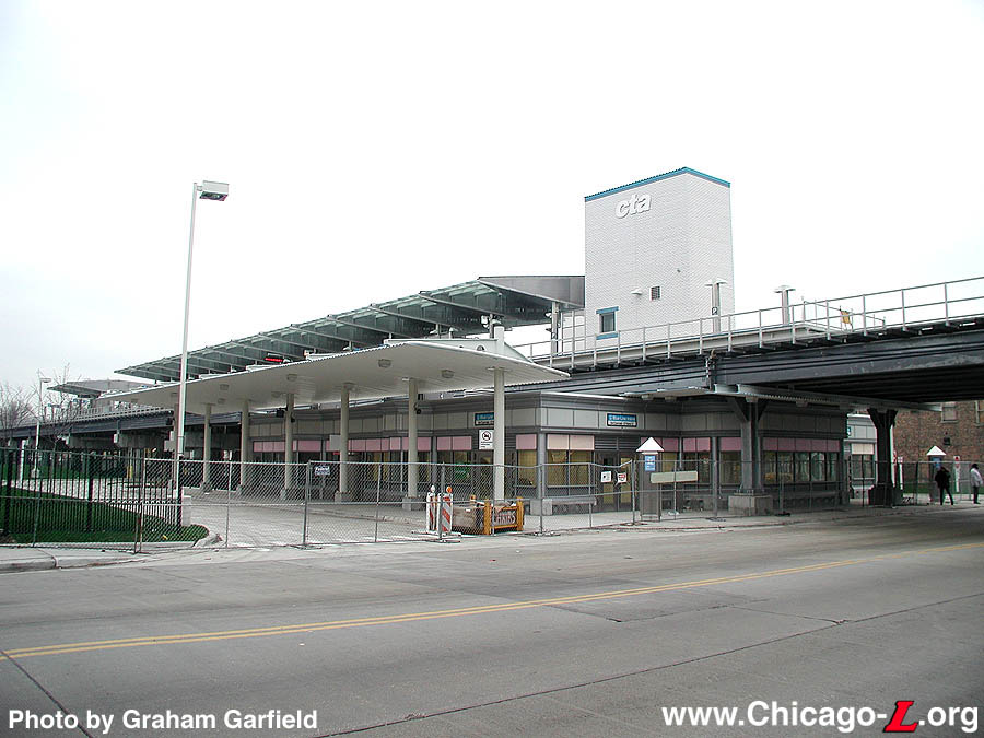
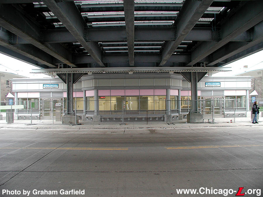
As part of the renovation project, Pulaski was replaced with an
entirely new station facility. The new headhouse is a modern glass
and steel facility centered below the elevated tracks. The building
exterior features quarry tile at the base, a metal-frame storefront
on the front and side facades with large picture windows, glass walls
and a band of art glass along the top, and capped by a large metal
cornice divided into boxes. The interior is simple and functional,
featuring white ceramic glazed tile walls, a spacious waiting area
and seats for waiting bus riders, fare controls, fare vending
machines, a customer assistant booth and bus supervisor's booth, more
room in the paid area for waiting train and bus passengers, and
various auxiliary equipment rooms.
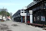
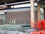
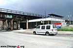
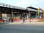
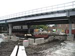
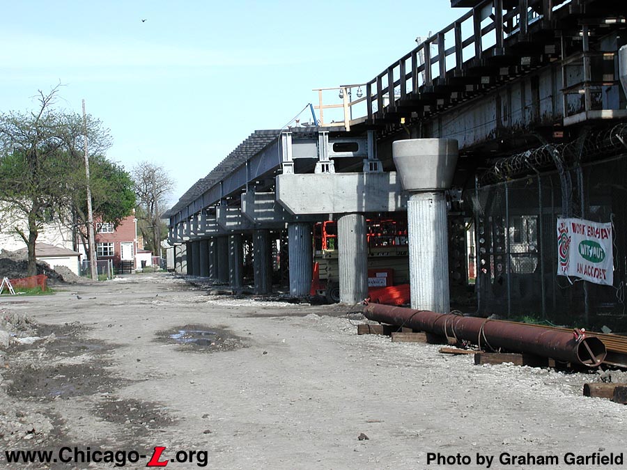
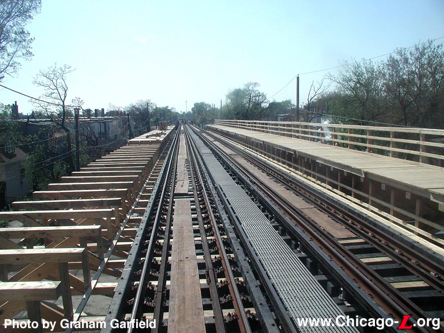
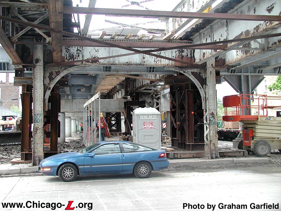
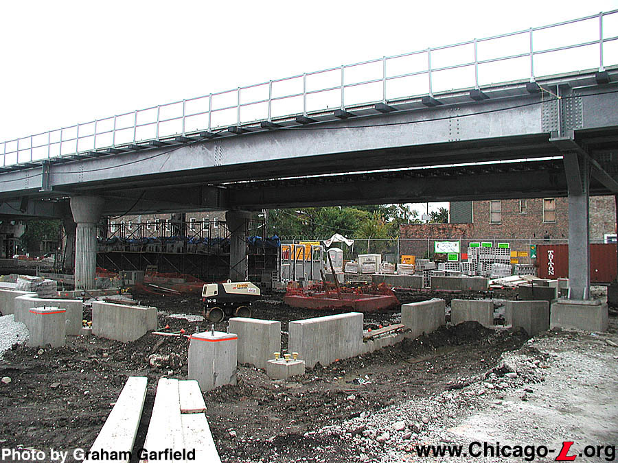
Construction of new
caissons, caisson caps, and concrete piers are complete at
Pulaski and steel cross spans have begun to be installed in
this May 9, 2002 view. For a larger view, click
here.
(Photo by Graham Garfield)
|
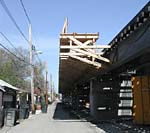
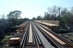
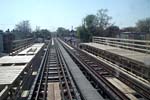
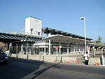
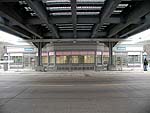
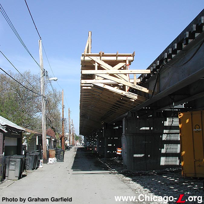
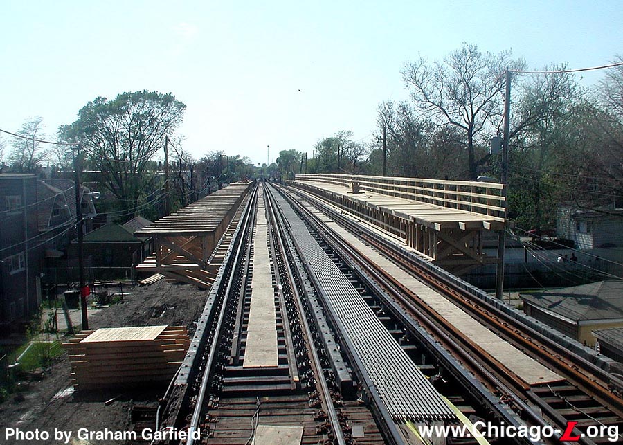
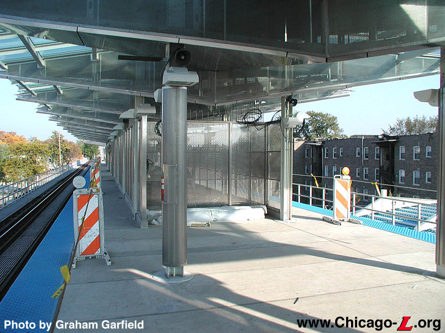
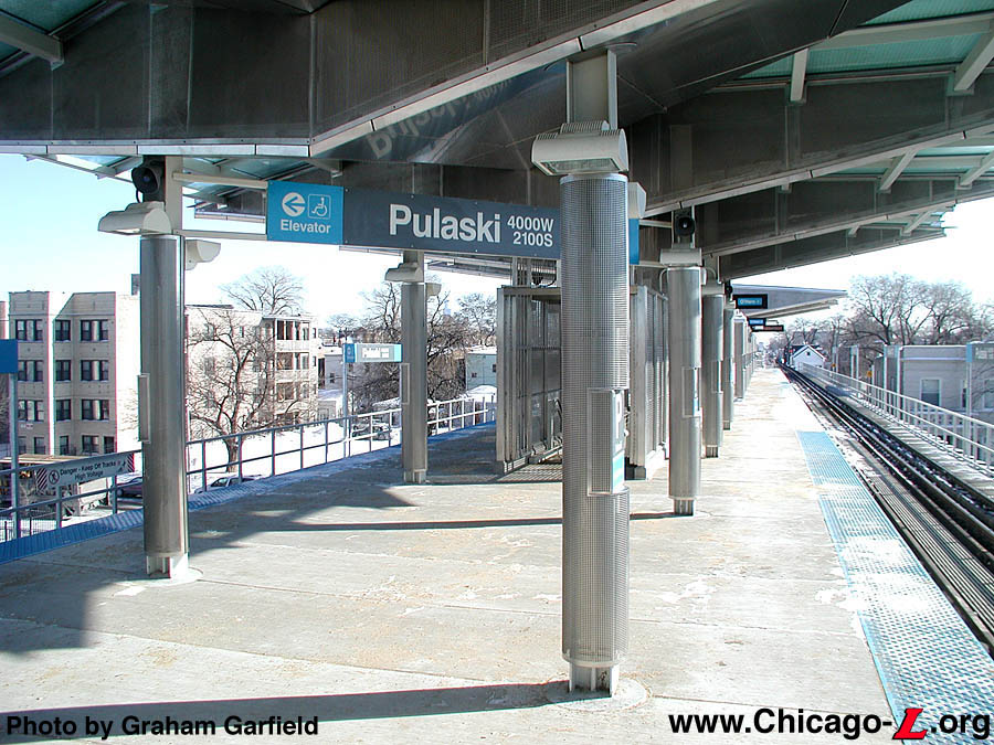
The old island platform was replaced with a new, wide island
platform. The new canopies were designed as "showpiece" structures,
with clear glazed roof sections that allow natural light on the
platform alternating with triangular solid, three-dimensional metal
wedges and clear triangular panels that led the canopies to be dubbed
by some as the "flying triangles". "Honeycomb" paneling adorns the
platform canopy fascia, as well as being around the various columns
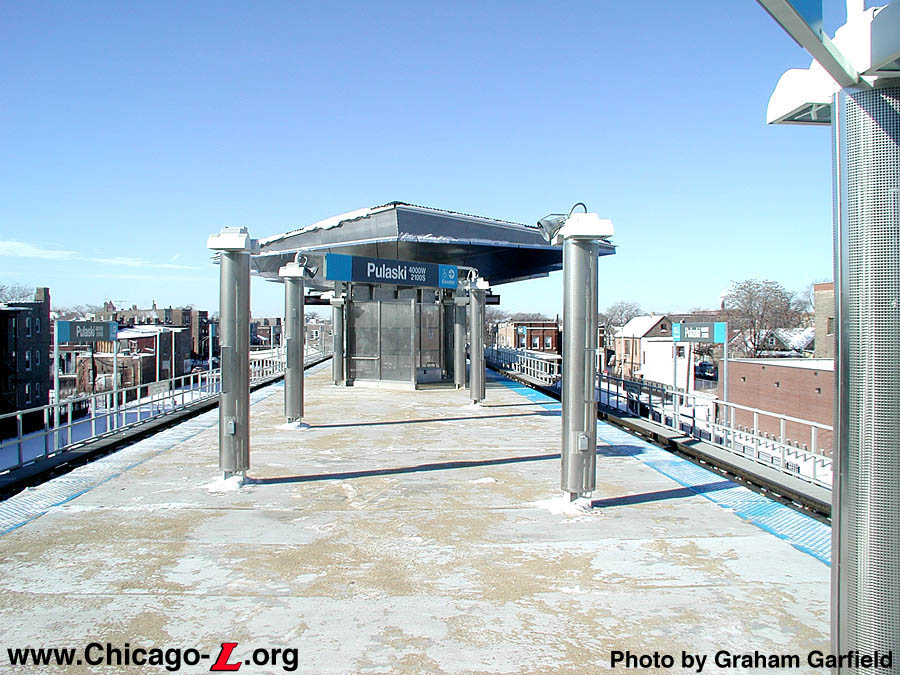
and poles at platform level. A new elevator provides ADA access, with
the tall elevator tower cladded in white tiles with a blue band
around the top and a steel "cta"
on the north and south sides dominating the street elevation the
facility. The platform amenities carry through the angled motif of
the canopy, with benches, lights, windbreaks, and some signage angled
off-axis from being parallel or perpendicular to the tracks. For
customer comfort, the platform features benches, overhead heaters and
enhanced lighting. In addition to the elevator, a
wheelchair-accessible gate in the fare controls, TTY telephones,
tactile edging and Braille signs offer accessibility for customers
with disabilities. Audiovisual station signs and a public address
system help customers navigate the station and receive travel
information. There is an auxiliary exit at the east end of the
platform at Harding Avenue, one block east of Pulaski Road, allowing
residents of the nearby community direct egress from the station.
A new bus turnaround encircles the station, providing convenient
drop-off and pickup points under a canopy that protects customers
from the elements. There are side entrances to the unpaid area of the
station house as well as rotogate exits from the paid area directly
to the bus stops, allowing passengers transferring to #53 Pulaski
buses a more convenient transferring option. Other work at the
station included landscaping around the facility -- the land around
the station is unusually extensive because of the large elevated yard
that was once around the station -- and renovation and upgrading of
the adjacent Harding Substation.
The official groundbreaking for the Douglas
Rehabilitation Project -- also known as "Renew the Blue" -- took
place at Pulaski station on September 10, 2001, with actual
construction work beginning shortly thereafter at both 54/Cermak
and Pulaski. For several months, work was underway around Pulaski
while the station remained open, as equipment drilled massive holes
for the cement caissons that would surround the new metal support
columns. The placement of caissons, caisson caps and piers continued
though Spring 2002, followed by the replacement of the steel
cross-spans along the elevated structure with new steel and concrete
ones. After that, the CTA could then create the new, wider elevated structure to accommodate
the new, wider island platform.
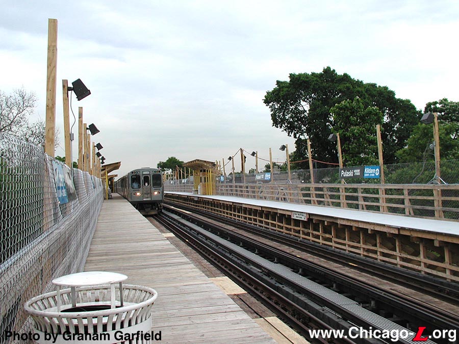
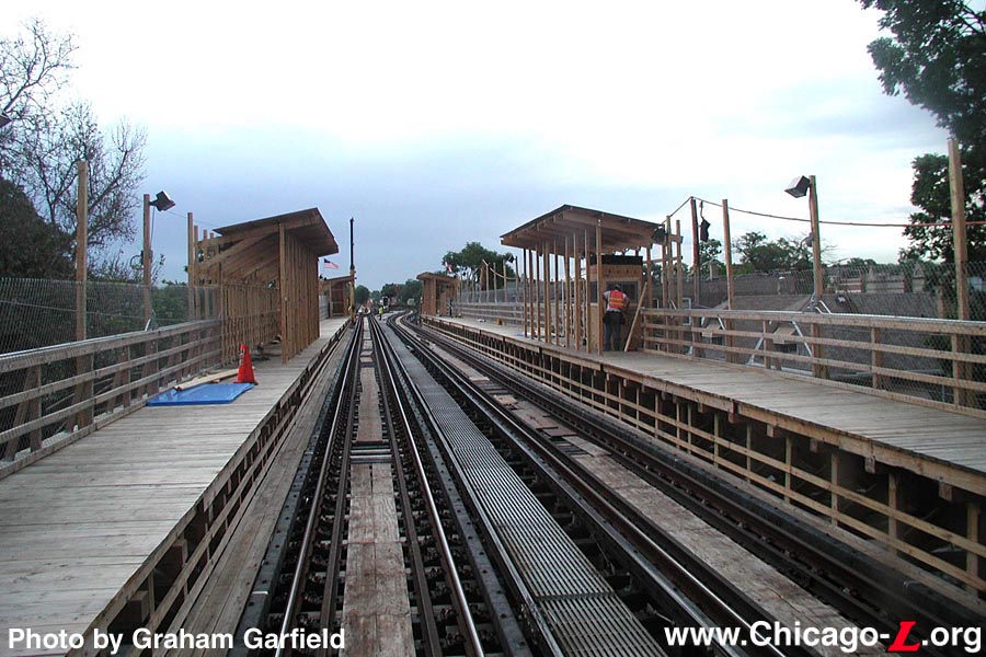
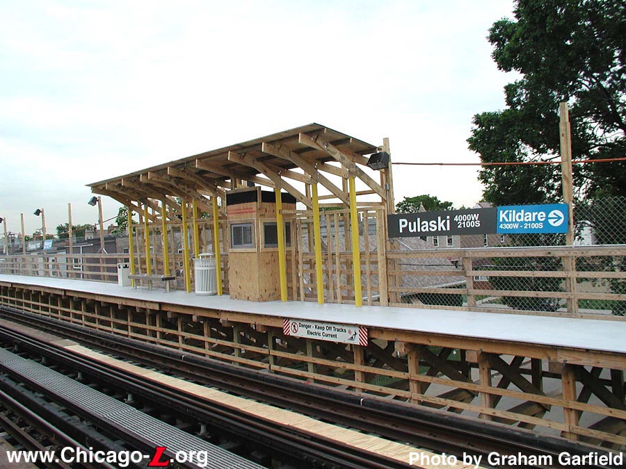
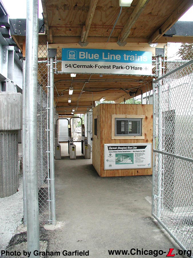
Pulaski-Kildare
Temporary station
The new Pulaski-Kildare
station on opening day, looking east on June 17, 2002 as an
outbound Cermak branch train pulls in. For a larger view,
click here.
(Photo by Graham Garfield)
|
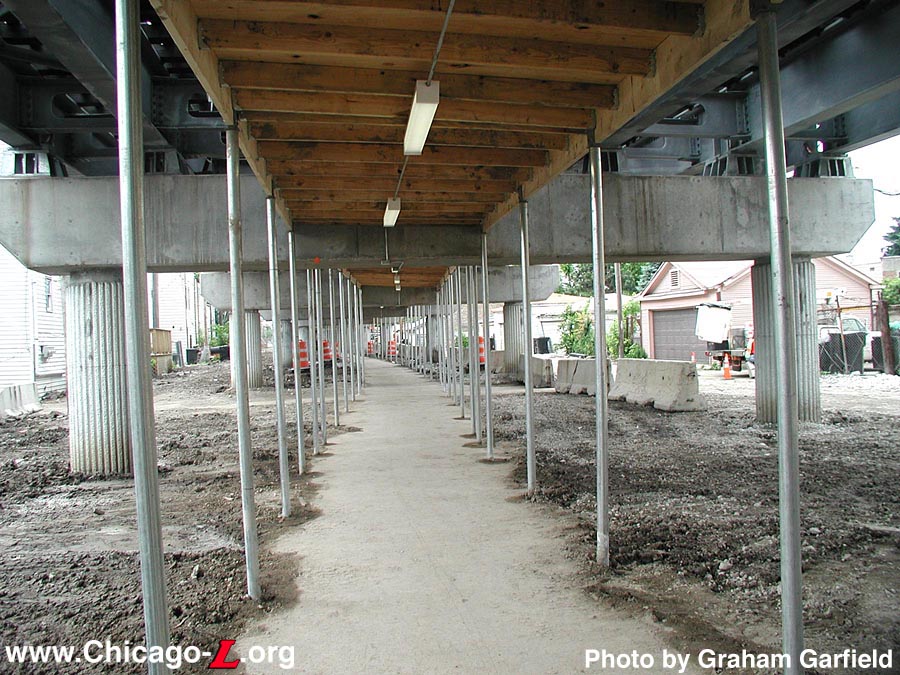
To allow for the removal of the old platform and the construction of
the new, a temporary station was built on the west side of Pulaski
Road. The station featured temporary wooden dual side platforms,
stretching from Pulaski Road to west of Karlov Avenue. These
platforms were feed from dual fare control areas, which were under
the new elevated structure on the west side of Pulaski Road (4000W)
and a half block east of Keeler Avenue (4200W). The fare control
areas consisted of concrete and asphalt floors, chainlink walls, and
wooden agent's booths. The platforms had wooden decking and railings,
wooden canopies, and temporary signage. Station name signage called
the stop "Pulaski", with the west entrance/exit nearest Kildare
(actually at Keeler) acknowledged on a blue tab.
Kiewit/Delgado began construction of the Pulaski-Kildare temporary
platforms over the weekend of May 4-5, 2002. The platforms were
between Keeler and Pulaski, though they were actually over Karlov
rather than their namesake streets. The side platforms were supported
strictly on the structure itself, with one set of beams extending
horizontally underneath the tracks, clamped between the ties and
steel structure decking. The other set of supports consisted of
diagonal bracing between the underside of the outer edge of the
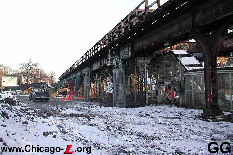
platform and the lower lip of the horizontal decking spans.
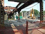
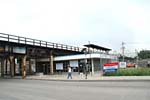
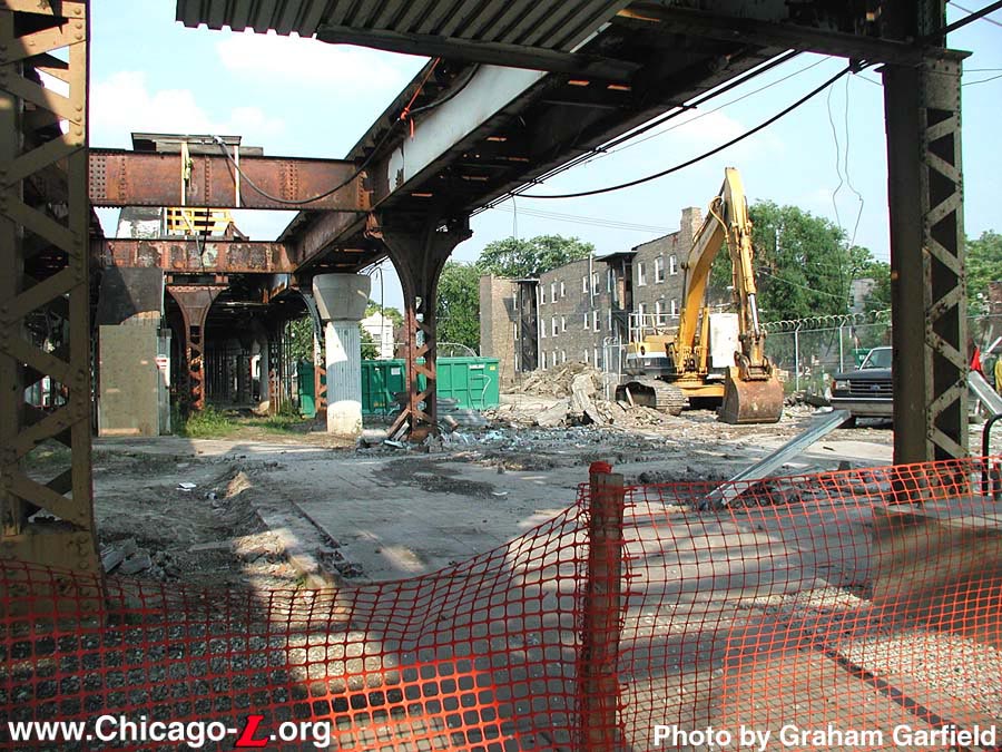
Only some floor tile and a
few pieces of steel remained on June 21, 2002 where the
Pulaski station house had been. Two days later, the platform
above would follow suit. For a larger view, click
here.
(Photo by Graham Garfield)
|
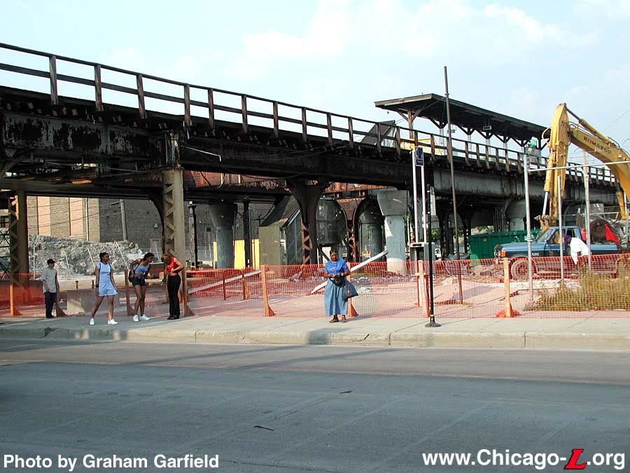
At 0200 hours on Saturday, June 15, 2002, the stations at Pulaski
and Kildare closed for demolition and
replacement with new facilities. Some demolition work on the stations
began immediately, primarily in the form of equipment removal for the
new, temporary facilities. After Pulaski station was closed and
locked, CTA forces removed the
fare controls and AVMs in that station and relocated them to the
Pulaski entrance to the temporary Pulaski-Kildare station (including
the wheelchair gate!). Complete demolition of the station house
occurred on Wednesday, June 19th. By the afternoon of the 20th, there
was little trace of the station house at all, save for the wooden
stairs up to the platform, the flooring that was still embedded in
the ground, and two bent steel beams that had once been part of the
front elevation. Construction of the new station house commenced
thereafter.
On Tuesday, January 13, 2004, Mayor Richard M. Daley joined
Chicago Transit Authority President Frank Kruesi and other officials
for the opening of the newly renovated Pulaski station. Pulaski was
the third of eight stations to reopen after renovation and the first
of six the new Cermak (Douglas) branch elevated stations.
Following the press event, the new Pulaski station opened for
customer use. The new station officially opened for customer use at
1215 hours. Coincident with the new opening was the closure of the
temporary Pulaski station across the street.
After one train in each direction stopped at both the new Pulaski and
temporary Pulaski stations to assure that any
remaining passengers who'd entered the temporary station weren't
stranded, the temporary Pulaski station was
closed and secured, berth markers hooded and signs were placed on
both platforms alerting operators not to stop. The temporary station
was removed at a later date.
At its monthly meeting on February 11, 2004, the Chicago Transit
Board approved the modification to the south terminal of the #37
Sedgwick/Ogden route, so that it will better serve customers. The #37
moved its south terminal from Cermak/Karlov to the newly reopened
Pulaski Cermak (Douglas) branch station.
The Pulaski station also had new original artwork installed as
part of the Douglas branch renovation. Included through a unique
partnership between the Chicago Department of Cultural Affairs'
Public Art Program and the
CTA , the Public Art Program
administered the selection, design, creation and installation of
public art for the project. The Pulaski station includes a series of
Byzantine glass mosaics with quotes by famous African-Americans on
interior walls titled "Pulaski Station" by artist Adam Brooks. The
CTA allocated $1 million for
the Cermak Branch Art Project and retains ownership rights to all of
the artwork created.
Completing punchlist work, Kiewit lifted a new Supervisor's Booth
from street level to the Pulaski station platform by crane, under
flagman protection, on the morning of Tuesday, July 12, 2005.
After conducting a West Side Corridor Study and holding public
meetings during 2004 and 2005, the
CTA began operation of a new
service over the Cermak
branch. Beginning Sunday, June 25, 2006, the new Pink
Line began providing the primary rail service to the branch.
Operating seven days a week during the same service hours as the
Blue Line had operated,
Pink Line trains operated
on the Cermak branch
from 54th/Cermak to Polk,
then terminated around the Loop
via the Paulina
Connector and Lake
branch of the Green
Line. Service levels increased with the introduction of the
Pink Line, with trains
running more frequently including a 7.5-minute interval during
weekday rush periods. To address community concerns, Blue
Line service to the O'Hare
branch from 54th/Cermak via the
Dearborn
Subway was maintained during morning and afternoon rush hours.
The Pink Line and revised
Blue Line services were
instituted as an 180-day experiment, extended for additional 180-day
experimental periods subsequently, while ridership and other effects
were studied. As the experimental period continued, the
CTA revised service on the
Cermak branch to
eliminate the rush period Blue
Line trains, leaving the Pink
Line to provide all service to 54th/Cermak.
Although ridership had risen overall since the introduction of the
Pink Line, Blue
Line trains had consistently low ridership on a
person-per-railcar-basis. The last day of Blue
Line Cermak
service was Friday, April 25, 2008.
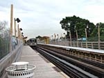
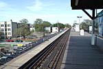
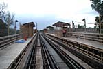
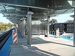
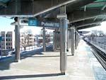
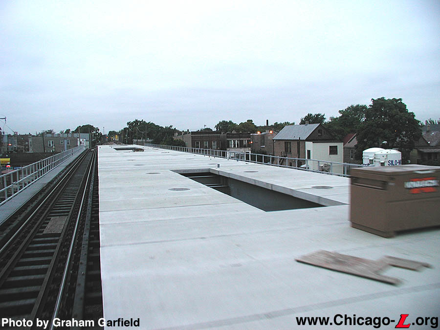
Looking west on the Pulaski
station platform on January 30, 2004, about two weeks after
opening, the source of the canopies' nickname of resembling
"flying triangles" is clearly demonstrated. For a larger
view, click here.
(Photo by Graham Garfield)
|

Old Pulaski
(1902-2002) |
Temporary
Pulaski-Kildare (2002-2003) |
New Pulaski
(2002-present)
|
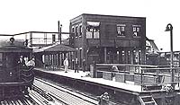
40thTerminal02.jpg
(111k)
The 40th Avenue Terminal was still under construction
in 1902 when this photo was taken. Arriving trains unloaded
passengers at the platform at right, circled around the
station and picked up passengers at the platform at the
left. The center tracks were used for
storage. (Photo from The High
Line)
|
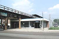
|
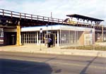
pulaski01.jpg
(103k)
The Pulaski station as seen on March 28, 1998. Note
the utilitarian station in the foreground and the old wooden
platform canopy in the background. (Photos
by Graham Garfield)
|
|
pulaski02.jpg
(95k)
Close up of the Pulaski island platform looking southeast on
March 28, 1998 shows the unusual makeshift lights and the
bus shelters used as windbreaks. (Photo by
Graham Garfield)
|
|
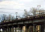
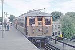
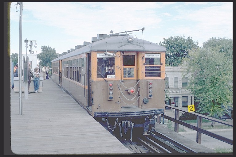
cta4272c.jpg
(117k)
Historic Car 4272 poses at Pulaski station on the Douglas
branch on an August 28, 1982 fan trip.
(Photo by Doug Grotjahn, Collection of Joe
Testagrose)
|
|
|
pulaski04.jpg
(106k)
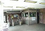
The interior of the Pulaski station house, looking north in
August 2001. The station house is in very good condition
compared to other parts of the station. A wheelchair gates
has been installed, although the station is clearly not ADA
accessible. (Photos by Graham
Garfield)
|
|
pulaski07.jpg
(127k)
The construction staging area and new concrete
caissons at Pulaski, looking east on January 18,
2002. (Photo by Graham Garfield)
|
|
pulaski08.jpg
(162k)
Some of the construction materials are leaned up
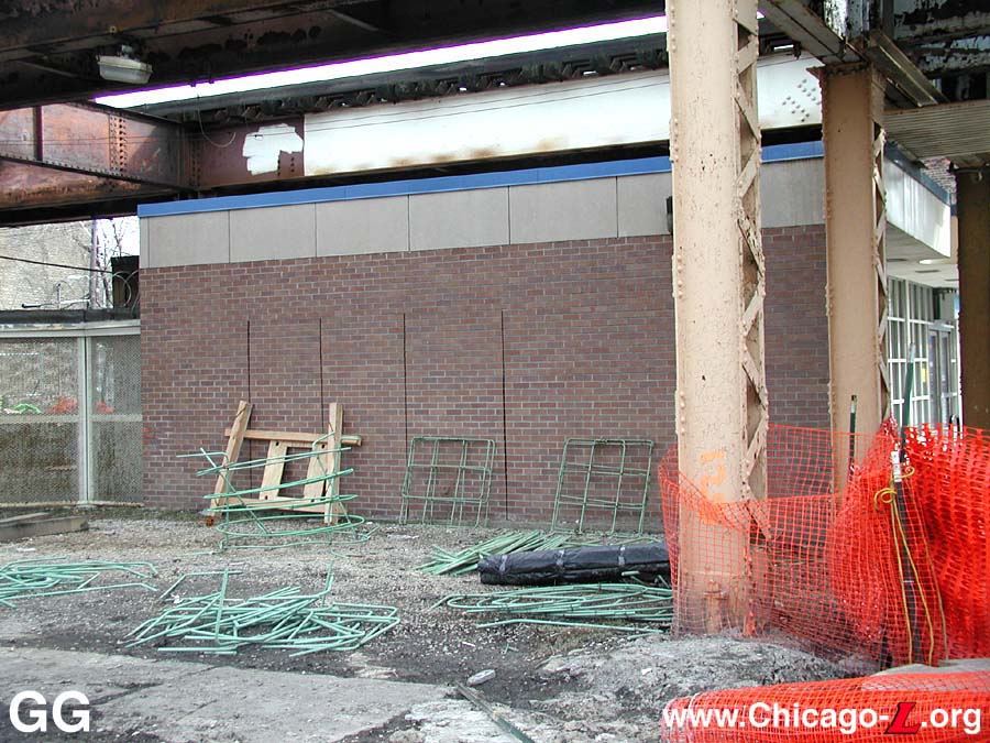
against the 1990 station house at Pulaski in this view
looking south on March 11, 2002. The vertical cuts in the
brick wall of the station house may have been intended to
eventually been punched out to create doorways to a bus
turnaround, planned but never constructed around the
station. (Photo by Graham
Garfield)
|
|
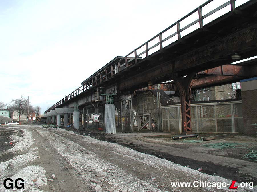
pulaski09.jpg
(121k)
Construction has progressed since the January
2002 image above, with additional caissons added, some
crossbeams installed, and most of the construction materials
and debris cleared away in this view looking east on March
11, 2002. The new structure is being completed so that a
temporary station can be built at Harding and the old
facility can be torn down for replacement.
(Photo by Graham Garfield)
|
|
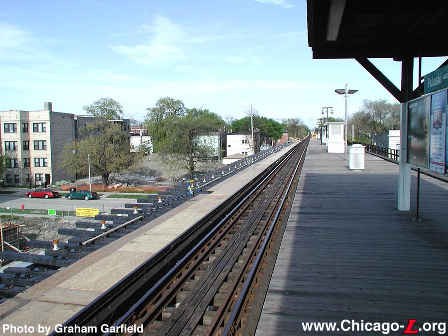
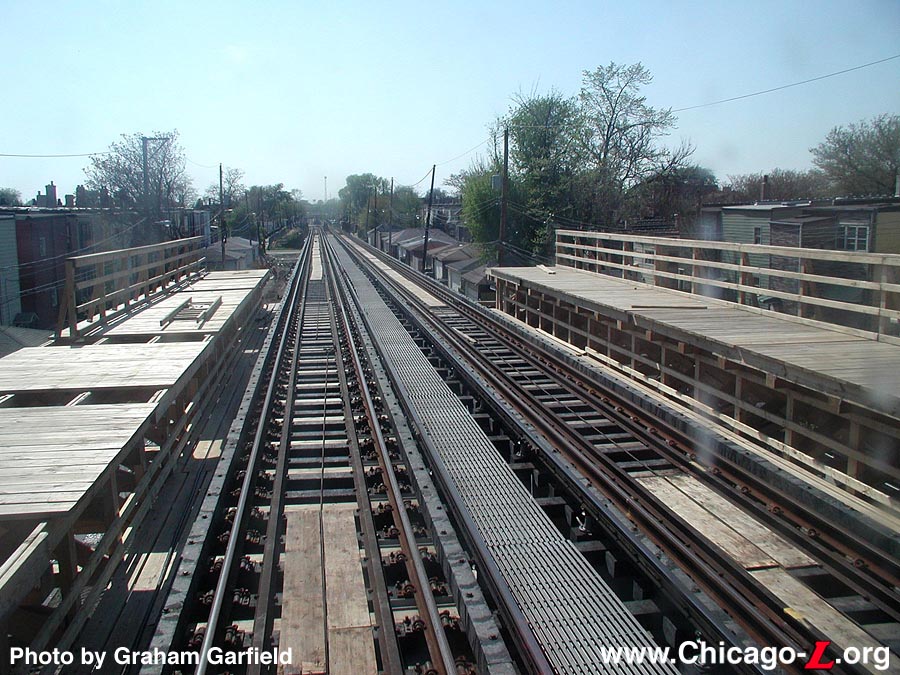
pulaski11.jpg
(149k)
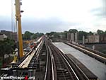
The larger width of the future right-of-way is
clear in this view on the current Pulaski platform on May 9,
2002. Note the use of plastic ties. (Photo
by Graham Garfield)
|
|
pulaski13.jpg
(130k)
Pulaski station on the last full day of service,
June 14, 2002, looking northeast. (Photo by
Graham Garfield)
|
|
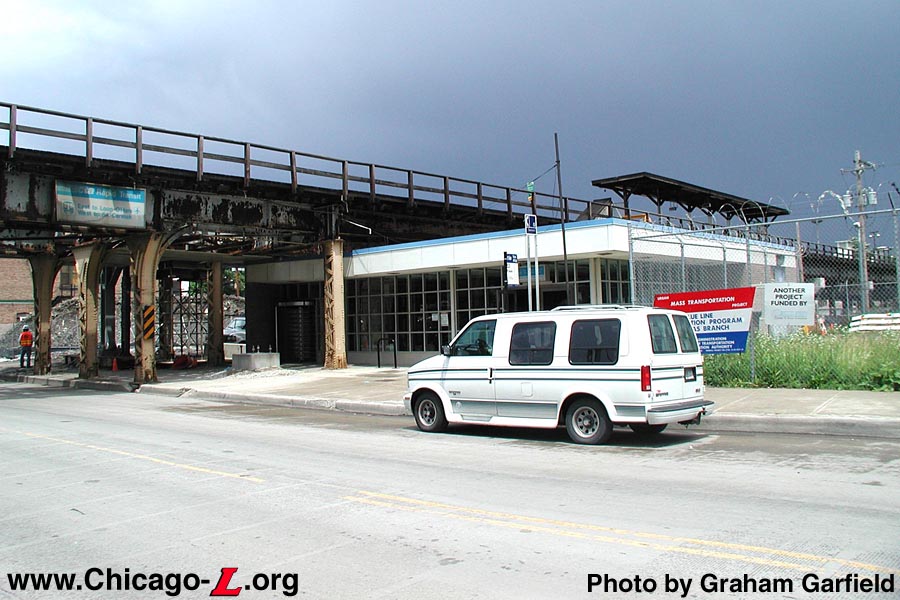
pulaski14.jpg
(103k)
Pulaski station two days after closure, looking
northeast on Monday, June 17, 2002. The signs on the front
windows direct passengers across the street to the Pulaski
entrance of the Pulaski-Kildare temporary station.
(Photo by Graham Garfield)
|
|
pulaski15.jpg
(139k)
By June 21, 2002, only five days after Pulaski
station closed, the station house was demolished, although
the platform still remained. (Photo by
Graham Garfield)
|
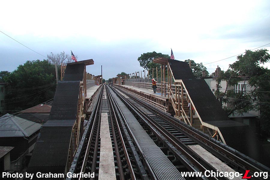
Temporary Pulaski-Kildare
station
|
pulaski-temp01.jpg
(116k)
This May 9, 2002 view of the temporary Pulaski
platform under construction shows its horizontal and
diagonal support structure, looking east in the alley north
of the structure near Karlov. (Photo by
Graham Garfield)
|
|
pulaski-temp02jpg
(196k)
Looking west on May 10, 2002 at the temporary
side platforms for the Pulaski-Kildare station from the
future location of the stairs to the Pulaski entrance.
(Photo by Graham Garfield)
|
|
pulaski-temp03.jpg
(186k)
The temporary side platforms will have simple
wooden decking and railings, some of which has already been
installed in this May 10, 2002 view. (Photo
by Graham Garfield)
|
|
pulaski-temp04jpg
(182k)
The Pulaski-Kildare platforms under construction,
looking west on May 10, 2002. (Photo by
Graham Garfield)
|
|
pulaski-temp05jpg
(148k)
Looking east on the platforms at Pulaski-Kildare,
with its short canopies over Karlov about a third of the way
down from the east end of the station, on June 14, 2002. The
inbound platform (at right) has a supervisor's booth under
the short canopy. (Photo by Graham
Garfield)
|
|
pulaski-temp06jpg
(124k)
The Pulaski-Kildare station has two entrances to
serve the former Pulaski and Kildare stations, which were
about three blocks apart. Each entrance is at the end of the
platforms, such as the Keeler entrance seen here on June 14,
2002. (Photo by Graham Garfield)
|
|
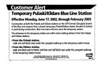
pulaski-temp.CustAlrt.jpg
(60k)
In the days leading up to the switch from the old
Kildare and Pulaski stations to the temporary
Pulaski-Kildare station,
CTA personnel handed
out these flyers to passengers. They were also posted at
many stations, with larger versions inserted into Customer
Alert frames and train ad racks. (Flyer from
the Graham Garfield Collection)
|
|
pulaski-temp08jpg
(165k)
The Pulaski-Kildare station has three short
canopies on each platform: one at each end at the top of the
stairs, and a third over Karlov Avenue, seen here on June
17, 2002. The station name signs are of the Current
Graphic Standard type, with "Pulaski" listed as the
station's name. "Kildare" is added on the blue tab, although
there isn't a matching blue tab on the other side, as there
would be on normal Current
Graphic Standard signs. (Photo by Graham
Garfield)
|
|
pulaski-temp.Pulaski01.jpg
(190k)
Kiewit crews work hard on June 14, 2002 to erect
the walkway from Pulaski Road to the Pulaski entrance of the
temporary station so it would be ready three days later.
(Photo by Graham Garfield)
|
|
pulaski-temp.Pulaski02.jpg
(184k)
Looking west down the walkway from Pulaski Road
to the Pulaski entrance to Pulaski-Kildare on June 17, 2002.
(Photo by Graham Garfield)
|
|
pulaski-temp.Keeler01.jpg
(192k)
The Keeler entrance to Pulaski-Kildare, looking
east on June 17, 2002. The turnstiles, AVM, and display
advertising the new station were relocated from Kildare
station after it closed two days earlier.
(Photo by Graham Garfield)
|
New Pulaski
station
|
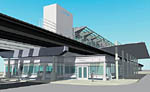
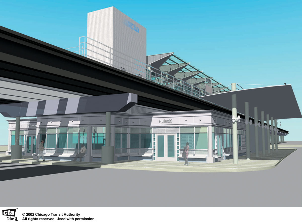
pulaski06.jpg
(148k)
An artist's rendering of the new Pulaski station,
looking northeast. The new Pulaski station includes a new,
enlarged station house, modernized and accessible island
platform, and an off-street bus terminal.
(Drawing provided courtesy of the Chicago
Transit Authority)
|
|
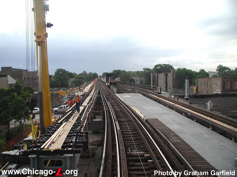
pulaski12.jpg
(147k)
Kiewit crews are installing the new southbound
Track 1, looking east on June 14, 2002, so that it will be
ready for service on Monday, June 17th. The space between
the new track and the existing northbound track on the right
will be the width of the new Pulaski island platform when
it's finished. (Photo by Graham
Garfield)
|
|
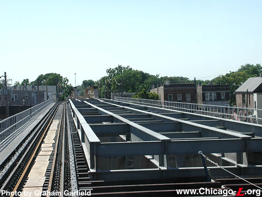
pulaski17.jpg
(135k)
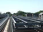
The steel decking supports for the new, wide
island platform is largely in place in this view looking
west on August 8, 2002. (Photo by Graham
Garfield)
|
|
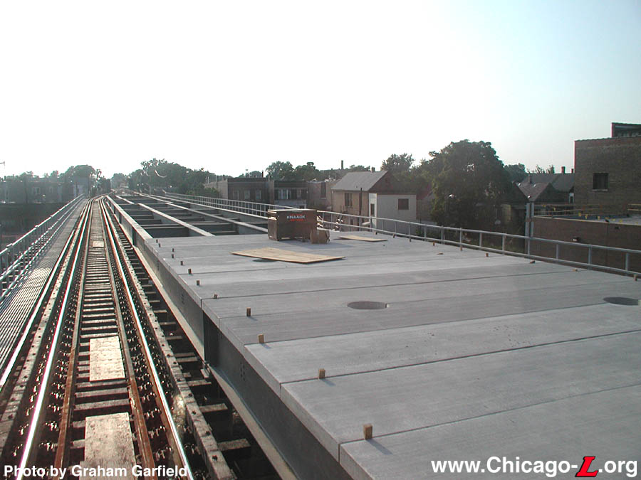
pulaski18.jpg
(115k)
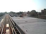
Prefabricated concrete platform decking is in the
process of being installed at Pulaski, looking west on
August 31, 2002. The holes in the decking are for the canopy
support posts. (Photo by Graham
Garfield)
|
|
pulaski19.jpg
(105k)
The prefabricated concrete platform at Pulaski
decking is complete, looking west on October 1, 2002. The
nearest rectangular opening is for the stairs to the Harding
auxiliary exit. (Photo by Graham
Garfield)
|
|
pulaski20.jpg
(205k)
The foundation for the new station house, looking
southeast on October 1, 2002, shows the outline for the new
building. The square in the center under the tracks shows
the location of the future elevator. (Photo
by Graham Garfield)
|
|
pulaski22.jpg
(150k)
As an inbound train passes through the station on
June 24, 2003, crews work on the canopy, with workmen seen
standing on the roof, and applying the storefront finishes.
(Photo by Graham Garfield)
|
|
pulaski24.jpg
(136k)
By the time of this October 11, 2003 view,
Pulaski station is largely complete, with the canopy roofing
and glazing, station house facade, bus turnaround finishes,
and even the stainless steel cta installed on the
elevator tower. (Photo by Graham
Garfield)
|
|
pulaski25.jpg
(139k)
Both sides of the station house, like the north
elevation seen here on October 11, 2003, have access to bus
bays that serve intermodal transfers between the "L" and bus
system. Ultimately, signage and benches will be provided
under the canopy for waiting surface division customers.
(Photo by Graham Garfield)
|
|
pulaski26.jpg
(179k)
The platforms had progressed to a higher degree
of completion by this October 11, 2003 view looking east,
with finishes like the mesh metal column covers installed.
Note the flat panel on the round column cover for a sign to
be mounted. (Photo by Graham
Garfield)
|
|
pulaski27.jpg
(131k)
By the end of the year, Kiewit had largely
completed Pulaski station such that even most of the station
signage had been applied, seen looking southeast on December
8, 2003. (Photo by Graham
Garfield)
|
|
pulaski28.jpg
(171k)
The Pulaski station has a wide street facade,
seen looking east under the elevated structure on December
8, 2003. Benches for passengers waiting for buses and
pickups ring the exterior under the picture windows. The
pink band around the tops of the windows is a protective
covering over decorative art glass, keeping the panels
pristine for opening day. Note the small metal kiosks in
front of each doorway. (Photo by Graham
Garfield)
|
|
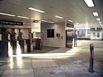
pulaski30.jpg
(138k)
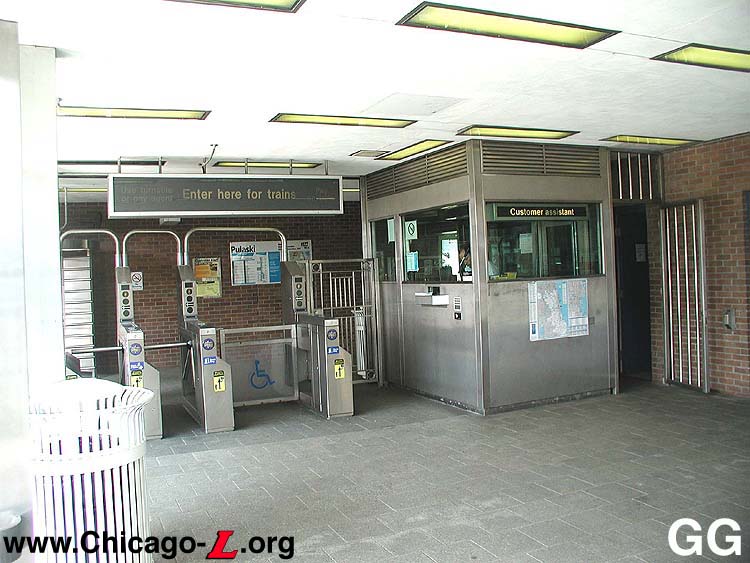
The fare controls of Pulaski station are located
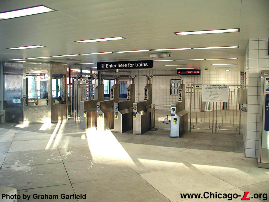
in the north end of the headhouse, seen looking east from
the unpaid area on January 19, 2004. The customer
assistant's booth is located next to the turnstiles, while a
bus supervisor's booth is located behind in the back wall.
(Photo by Graham Garfield)
|
|
pulaski31.jpg
(135k)
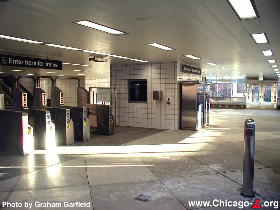
The interior of Pulaski station, seen bathed in
the afternoon sunlight on January 19, 2004, has a large,
open, spacious interior, probably far more space than is
required for the station's current usage level, Looking
south in the unpaid area, the fare controls (on the left)
are in the north half of the station, which is bisected by
the elevator shaft seen in the center. On the other side are
metal barriers and rotogates for additional egress capacity.
(Photo by Graham Garfield)
|
|
pulaski32.jpg
(191k)
The triangular showpiece canopies of the Douglas
stations, seen at Pulaski looking east on January 30, 2004,
are three-dimensional and made up of many components. Parts
are solid, three-dimensional metal wedges with "honeycomb"
paneling on the canopy fascia interspersed with clear
triangular glazed panels. Following the angled motif of the
canopy, some signage like the station name sign seen here
are also off-axis. (Photo by Graham
Garfield)
|
|
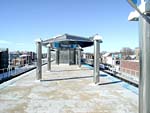
pulaski34.jpg
(176k)
Looking west from the far east end of the Pulaski
platform on January 30, 2004, one of the station's the
triangular canopies is seen in the distance. Between it and
the end of the platform are freestanding light posts covered
in the same "honeycomb" paneling that adorns the fascia of
the canopy wedges. To supplement the off-axis station name
signs on the platform (which are difficult to see from some
seats on a train), signs are also posted on the outside of
the tracks to comply with the Americans with Disabilities
Act. (Photo by Graham Garfield)
|
|
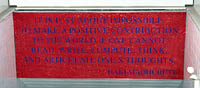
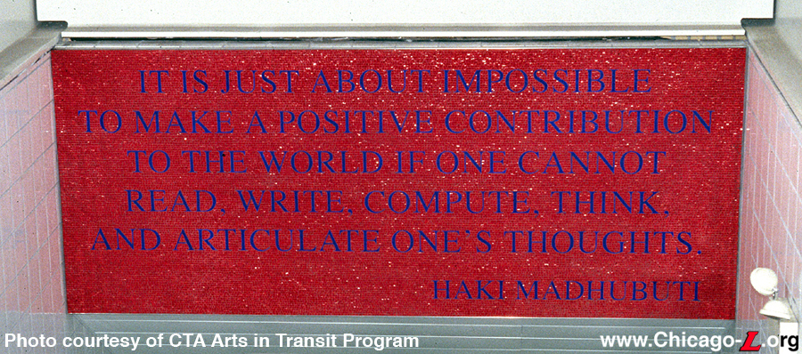
pulaski-douglas_art01.jpg
(621k)
One panel of Adam Brooks' artwork, depicting a
quote from Haki Madhubuti, renowned African-American author,
educator, and poet, is mounted over the stairs from the
platform to the station house. (Photo
courtesy of CTA Arts in Transit Program)
|
|
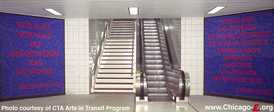
pulaski-douglas_art02.jpg
(109k)
The other two panels of Adam Brooks' artwork,
with quotes from former boxer Muhammad Ali on the left and
African-American Christian theologian James Cone on the
right, are in the station house framing the vertical access
to the platform. (Photo courtesy of CTA Arts
in Transit Program)
|
Notes:
1. "Loop Terminals and Transfer Station Metropolitan Elevated RR Chicago." Engineering News, Vol. XLVIII No. 7 (Aug 14, 1902), p. 115-116.


