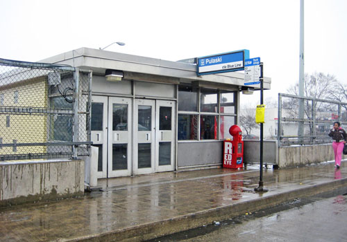
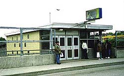
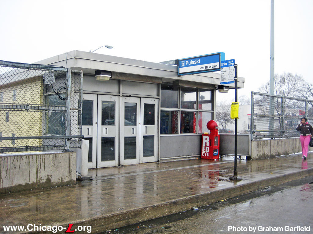
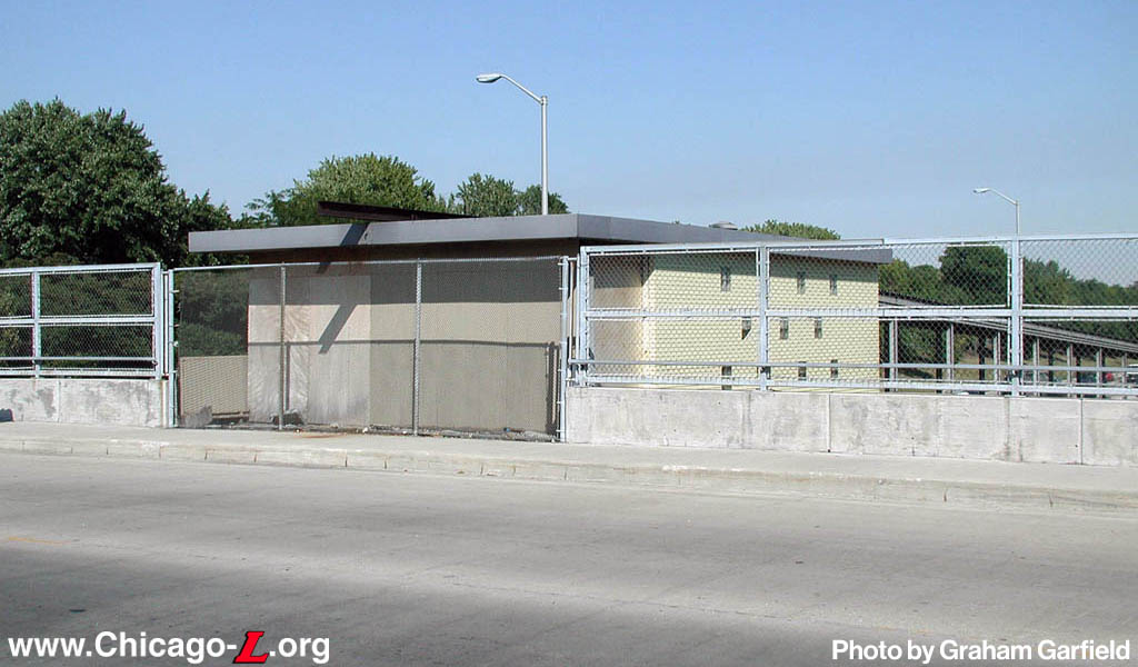
The Pulaski station house at the Pulaski Blue Line station is seen looking northwest on February 2, 2010. Most of the structure remains as originally built, although its front doors have been changed and other small modifications made. For a larger view, click here. (Photo by Graham Garfield) |
Pulaski
(4000W/530S)
Pulaski Road and the
Eisenhower Expressway, West Garfield Park
Service
Notes:

|
Blue Line:
Forest Park
|

|
Owl
Service
|
Quick Facts:
|
Address:
|
530 S. Pulaski Road
(Pulaski
entrance)
|
|
531 S. Keeler Avenue
(Keeler entrance,
closed)
|
Established: June 22, 1958
Original Line: West-Northwest Route, Congress branch
Previous Names: none
|
Skip-Stop Type:
|

|
Station
|
Rebuilt: n/a
Status: In Use
History:
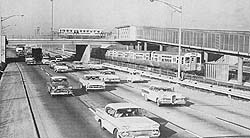
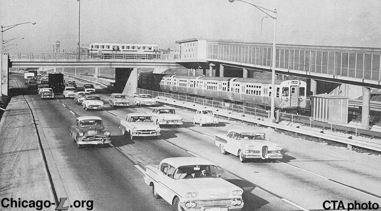
A view of the
Pulaski station house, its ramp to the platform,
and a CTA bus shortly after the Congress Line's
opening in the late 1950s. The Congress
Expressway is relatively new too. Note the
classic '50s autos. For a larger view, click here. (Photo from the Graham Garfield
Collection) |
This station was constructed in the mid-1950s, replacing
the Metropolitan West Side "L" Garfield Park branch Pulaski station, which was located one block to the south at Pulaski Road and Fifth Avenue. Built as part of the Met's Garfield Park branch in 1895, the original station and the rest of the
Garfield Park branch were demolished in 1953
while the Congress Street Expressway was being constructed.
The plan included a novel concept: a rapid transit line in
the median of an expressway, making a sort of transit
corridor. The "new" Congress Line thus provided no net gain
for the "L" system.
Pulaski was nearly identical to every other station built in the Eisenhower Expressway, including an island platform, a small station house on Pulaski's and Keeler Avenue's overpasses containing only a ticket booth and turnstiles and a long, enclosed, sloping passageway/ramp connecting the two. The Congress Line stations were largely devoid of the type of ornamentation seen in the previous 50 years of station design, save perhaps for the illuminated signs and cast door handles on the station buildings, and provided only the most minimal, necessary amenities.
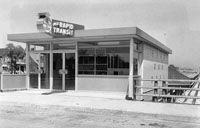
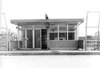
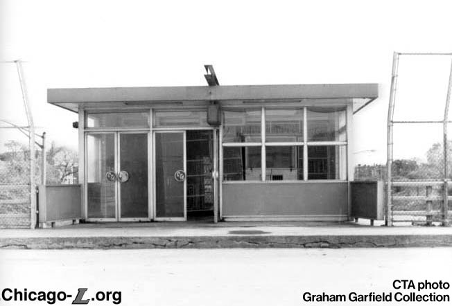
Pulaski station's
Keeler entrance is seen on May 23, 1958, a month before its opening. The station house's design was typical of those built for the Congress Line, including the glazed brick sides and glass and aluminum storefront, and the unique bright red, neon-lit sign over the entrance and cast metal CTA logo door handles. For a larger view,
click here. (CTA photo)
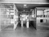
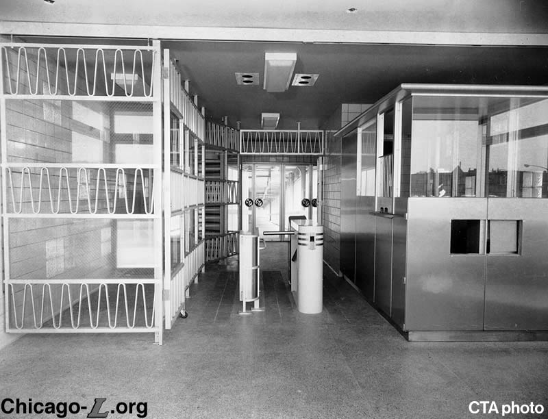
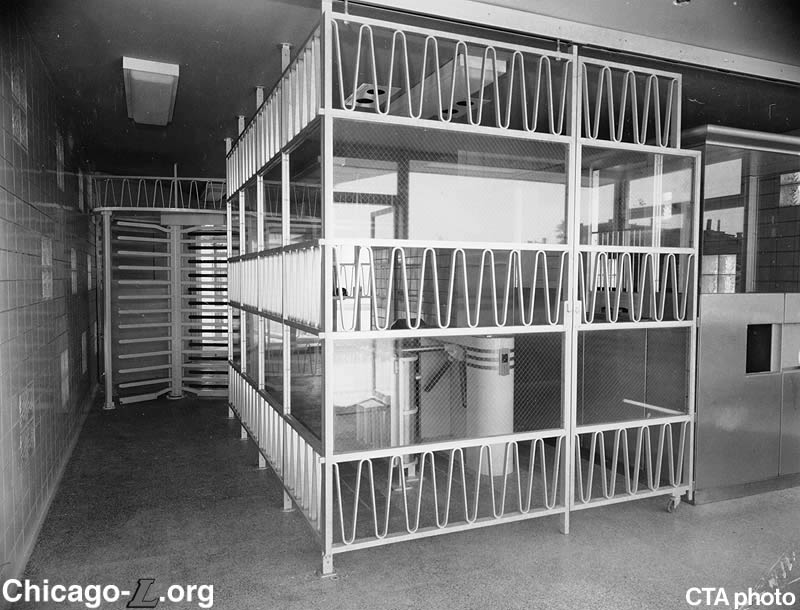
The interiors of the
Pulaski station houses at Pulaski and Keeler avenues were mostly identical -- the Keeler entrance is seen on May 23, 1958 as originally built. They featured canary yellow glazed block walls, light beige terrazzo floors, stainless steel ticket agent's booths, and a system of backlit overhead signs and movable partitions that could be changed for different staffing needs.
Top: The Keeler entrance is shown configured for when a ticket agent is present, with the partitions arranged to channel passengers through the turnstiles or the agent's booth lane. For a larger view, click here.
Above: The Keeler entrance is shown configured for when no agent is on duty and only exiting is allowed through the Keeler house. The partitions are configured to block off access to the agent's booth and turnstiles, allowing passage only through the exit-only rotogate along the side of the interior. For a larger view,
click here. (CTA photos) |
The entrance buildings were small compared to many older stations, about 42 feet long and 21 feet wide, erected on a concrete platform level with the overpass over the expressway, supported by concrete columns rising from the trackbed below. The walls of the buildings were made of glazed brick on the exterior face and glazed tile on the interior. Three pastel-shade colors for the brick and tile -- canary yellow, light blue and light gray -- were used alternately for the Congress stations to avoid monotony and to more easily differentiate the various stops; Pulaski used canary yellow. These color schemes were followed throughout the interior of station buildings for the masonry and on all painted surfaces, except ceilings. Glass blocks, 8" x 8" each in square groups of four, were placed in three rows of alternating patterning on the side walls flush with outer and inner faces of the walls, both to allow more light into the interior and to break up the expanse of brick into a pattern. The roof was constructed of poured, lightweight, reinforced concrete with a perlite insulation topping pitched to roof drain and covered with tar and gravel roofing.
The front elevation of each building had a storefront-type facade, a combination of aluminum panels, polished plate glass windows, and aluminum-framed plate glass doors. The use of a glass front, which provided increased visibility into the station from the street and vice versa was a new concept that would be further explored in the CTA's next generation of median stations in the Kennedy-Dan Ryan project. The rear of the building had four glazed aluminum doors leading into the ramps. The doors on the front and rear were decorated with handles cast in the shape of the CTA logo of the time.

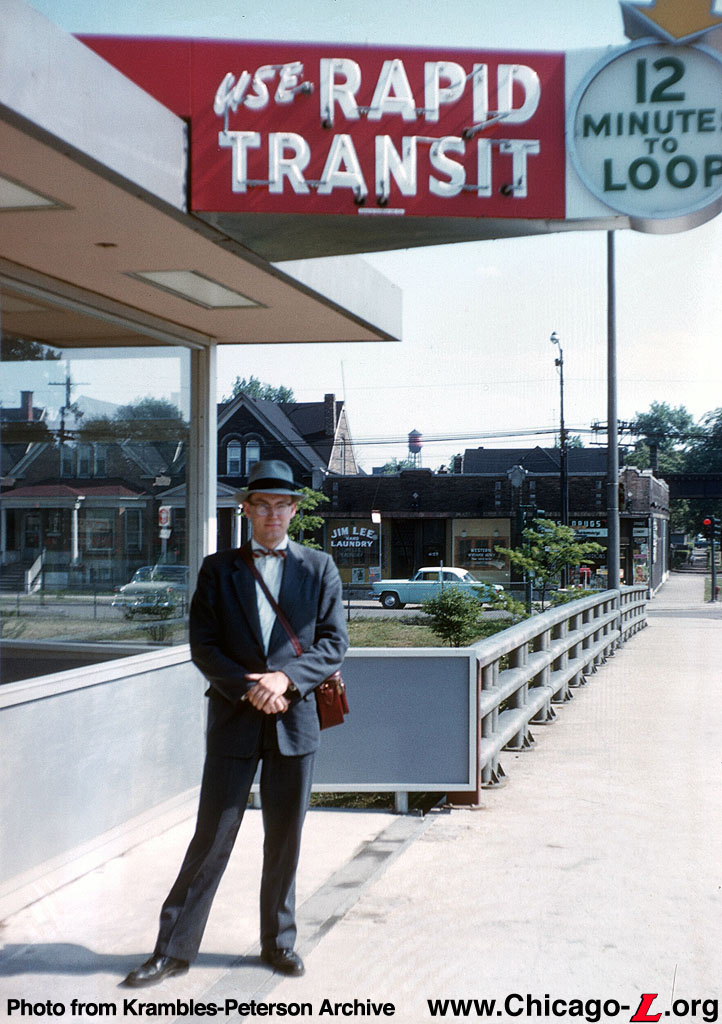
Railfan Bill Vigrass stands under the neon entrance sign at the Keeler entrance to Pulaski station circa 1962. Note the bit of abandoned Garfield "L" structure in the background. For a larger view, click here. (Photo from the Krambles-Peterson Archive) |
Each street-level station entrance was identified by a large, electrically illuminated sign (since removed from all Congress stations). This type of advertising was far more proactive than anything posted in front of most stations previously, although this may have been a requirement, in part, necessitated by the removal of the station entrance from the surrounding neighborhood and its isolation in the middle of the expressway, coupled with the invisibility of the tracks and trains themselves, hidden in the open cut.
Inside each station building, the floors were terrazzo, light beige in color with reddish brown and dark green marble chips and aluminum dividing strips. Special non-slip tile was inserted into the floor finish and fitted into floor pattern along the turnstile lanes, at points where foot traffic will be greatest, in order to reduce wear. Ceilings were painted a light tint of blue-green. The station buildings were equipped with an agent's booth, an agent's toilet room only accessible from inside the agent's booth, a porter's closet, electrical storage rooms, turnstiles, transfer issuing machines, fixed railings and hinged or sliding gates.
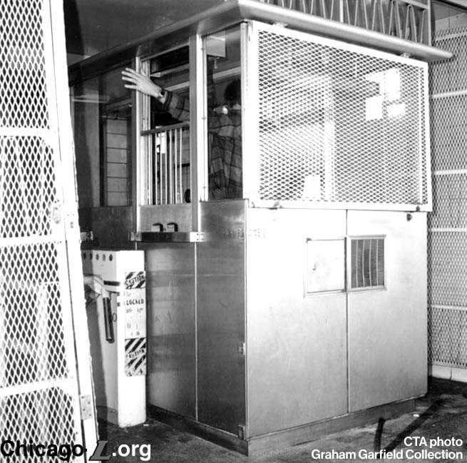
The agent's booths were framed of structural aluminum with patterned stainless steel sheet on exterior faces and plate glass ticket agent windows. The booths were equipped with agent-controlled turnstiles. The entrance turnstiles which were not adjacent to the booths were self-serve, operated with coins or a CTA fare token, and coupled with a transfer issuing machine which issued transfers automatically if sufficient fare was deposited.
Another feature of each station interior was a system of movable partitions made of polished glass and aluminum grills, which could be easily operated by the station agent and used to reconfigure the entrance to either require passengers to pass through the turnstiles, or close off the turnstiles and allow access through the building via a passage along the side. This provided flexibility for staffing the stations, allowing them to be configured for being staffed by an agent (whereby the panels channeled all passengers to either the ticket agent's booth or a self-service turnstile) or unstaffed (allowing access directly to the platform where a train conductor would collect fares, or in certain "secondary" entrances channeling passengers to an exit-only rotogate, making the facility exit-only with no entry -- Keeler was one such station house allowing for the exit-only configuration). Changeable-message signs outside the front doors, hung under the front eave of the roof and operated by switches in the agent's booth, informed the passengers of the configuration of the station house (entry, entry-pay on train, or exit-only) at a given time.
Recalling that the platform is set between two streets a quarter mile apart, there is a rather long distance that needs to be traversed between the station houses and the platforms in between. Thus, connection between the station houses and platform was achieved using long ramps from the back of the station houses to the ends of the platform. The ramps were enclosed with light green corrugated structural glass panels (alternated very 50 feet with vertical panels with fixed aluminum louvers for ventilation) extending from a curb at the floor to continuous horizontal louvers at the ceiling to protect the passengers from the weather, and were brightly illuminated.
All of the original Congress Line platforms were 600 feet long, able to accommodate up to ten-car trains, and between 12 to 15 feet wide. The platforms have a concrete floor, with the edges originally trimmed with a strip of abrasive tiles. There were originally eight windbreaks per platform, each 15 feet long and 6 feet high, with 5-foot wide panels set at right angles at each end of the windbreaks to provide additional shelter in inclement weather. Aluminum windbreak barriers were also spaced at regular intervals. The platforms are covered by a continuous canopy supported on columns and beams, with aluminum roofing sheets and gutters. The welded H-beam columns are split at the web and bent to form a "Y" with curved arms extending outward toward the platform edges. The canopies extend beyond the platform edge and over the roofs of cars.
The contract to build the 15 station buildings on the initial section of the Congress Line was awarded in February 1957 to a joint venture of two companies -- the M.J. McDermott Company of Chicago and the Contracting and Materials Company of Evanston -- who submitted a low bid of $3,678,970. The stations were built quickly, well underway by July and nearing completion by November 1957. This initial section of the Congress Line, as far west as Lotus Avenue (5246 West), opened on June 22, 1958.
Developments in the CTA Era
The Keeler station house at Pulaski station is seen on November 3, 1978. Some of the vandalism damage is evident, such as the glass in the lower three windows on the right being missing. The building has also taken on a generally worn appearance. For a larger view,
click here. (CTA photo, Graham Garfield Collection) |
The Keeler entrance to Pulaski station was closed Saturday, January 13, 1973 (a year in which several waves of CTA service reductions occurred), as a cost-cutting measure, but was retained as exit.
Sometime in October or early November 1978, the Keeler station house appears to have been badly vandalized, including several broken windows and glass panels, some of the movable gate sections being pulled off their track, broken lights, and damaged signs. It is notable that by this time the front window of the agent's booth and the movable partitions had been covered in small-mesh-opening metal panels, suggesting there may have been previous issues with security or vandalism at the Keeler entrance, which had been an unstaffed exit since 1973. In any case, the damage was severe enough that CTA elected not to repair it and instead close the Keeler exit. On Thursday, December 28, 1978, the Keeler station house was officially closed as an exit, although it is unclear (and unlikely) that the exit reopened after the damage occurred earlier that fall.
The CTA's 2002-2006 Capital Improvement Plan included a $3,070,161 project to design replacement
facilities for five rapid transit stations, including
Pulaski on the Congress branch of the Blue Line. These
stations would be accessible when reconstruction is complete.
Initial funding was to provide for station design only; post-FY 2007 funding would be required to reconstruct the
stations. That design project did not proceed, however.
All Stations Accessibility Program (ASAP)
In July 2018, the CTA released its first plan to make the entire system accessible to people with disabilities over the next 20 years. The All Stations Accessibility Program (ASAP) will cost about $2.1 billion, according to CTA, but the program was not funded at the time of the announcement. Rather, CTA formulated and announced the plan to begin the effort to secure funding by building support and increasing awareness of accessibility needs.1
Given the magnitude of this endeavor, project work was proposed to be performed in four phases over the 20-year period. To help prioritize the non-accessible stations, scores were assessed to each location based on needs and the complexity of work to be performed. The criteria used in determining the needs score is similar to what was used in previous CTA accessibility analyses (i.e. the 2012 Infrastructure Accessibility Task Force [IATF] Plan) such as ridership and gaps between accessible stations. In general, stations with higher needs and lower complexity scores were prioritized for near-term plans. Highly complex stations that require more time for planning, design, construction, agency coordination and community input are part of long-term project plans.2
With the passage of the federal Bipartisan Infrastructure Law signed by President Joe Biden in 2021, a new $1.75 billion discretionary grant program was created and announced. This was the first federal funding program specifically for legacy transit agencies, like CTA, to help increase the number of accessible rail stations. The federal program was championed by U.S. Sen. Tammy Duckworth, a Democrat from Illinois, who modeled it after CTA's ASAP and borrowed the CTA’s plan name for the federal program. Duckworth, who lost her legs in a combat helicopter crash in Iraq, said that lack of progress toward transit station accessibility since the signing of the Americans with Disabilities Act in 1990 had been abysmal -- the ADA largely allowed older buildings without accommodations to be grandfathered in if they predated the law. In 2018, Duckworth applauded the CTA for creating a formal plan for getting the rest of the "L" system accessible, but balked at the slow 20-year timeline; CTA President Carter said his hands were tied unless more funding streams opened. So, the then-freshman senator introduced a bill to implement the ASAP initiative on a federal scale. That legislation was folded into the accessibility program in the federal infrastructure bill. "I actually wanted $10 billion over 10 years," she said in an interview. But, "it's a good start."3
In December 2022, the CTA received $118.5 million from the Federal Transit Administration's (FTA) All Stations Accessibility Program grant program. This grant from FTA will be applied toward helping make the Irving Park, Belmont and Pulaski Blue Line stations accessible to those who use mobility devices. The total estimated cost for the three station projects is approximately $148 million, 80 percent of which will be supported with funds received today through federal ASAP grant program. The remaining funds, approximately $29 million, will be a mix of state and/or local funds.4
Rendering of a conceptual design for a rebuilt Pulaski station, from 2017. The image shows the concept for a new Pulaski Road entrance with an elevator and stairs rather than a ramp, and a covered mid-block crosswalk for bus transfers. For a larger view, click here. (Image from the Blue Line Forest Park Vision Study) |
Unlike most other stations where at least a conceptual plan for modifications or complete reconstruction was provided to make the station accessible, the ASAP plan did not include specific concepts or schemes for any of the Forest Park branch stations, including Pulaski. Instead, the ASAP defers to the Blue Line Forest Park Vision Study for direction for these stations. The Blue Line Forest Park Vision Study is a long-term planning study that was initiated in 2013 in collaboration with the Illinois Department of Transportation’s (IDOT) I-290 Phase I Study to improve multimodal mobility along the I-290 corridor; it was completed in 2017. As part of the Vision Study, the CTA evaluated existing conditions, station layout alternatives, and neighborhood connections along the Forest Park branch from the Clinton subway station to the Forest Park terminal. In general, the initial planning-level concepts envision that stations will generally maintain their existing layout and auxiliary entrances will be opened and/or added to improve neighborhood connections.5
The Vision Study organized the 12 stations into six categories based on their recommended future design. Pulaski was classified in the Vision Study as a type identified as "Double-entry, asymmetrical stations", reflecting a station that can be accessed from two streets, but has one primary entrance that is used more heavily. These stations also typically have bus service on only one of the streets between which they are located. For this reason, when these stations are rebuilt, trains will berth close to the primary entrance. People walking and bicycling will be accommodated at both entrances. ADA access will be made available from the primary entrance via an elevator and, from the secondary entrance via a sloped concourse. Bicycle parking is also proposed at both entrances.6
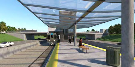
Rendering of a conceptual design for a rebuilt platform at Pulaski, from 2017. For a larger view, click here. (Image from the Blue Line Forest Park Vision Study) |
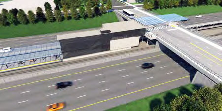
The Blue Line Forest Park Vision Study included two conceptual schemes for Pulaski station, both only developed to the 10% design level. In one, labeled as "Option 1", a new primary station house is built at Pulaski Road on the site of the current one, but with stairs and an elevator down to the platform. The platform is relocated a couple hundred feet eastward, so its east end is near Pulaski Road for the stairs and elevator to connect to. The Keeler entrance is also rebuilt, and connected to the relocated platform via a much longer ramp. The Pulaski Road entrance includes a canopy-covered mid-block crosswalk on the highway overpass in front of the station to facilitate easier, safer transfers to northbound buses (similar to one added at UIC-Halsted in 2016). The other concept relocates the platform even farther east, centered under the Pulaski Road overpass, with new station houses on each side of Pulaski Road to facilitate bus-train transfers in either direction. The west station house is the primary entrance, but both connect to the platforms via stairs and elevators. This concept does not appear to have a entrance at Keeler or any other secondary street.7 Although the Vision Study does not explicitly endorse one concept over the other, the fact that it only includes renderings for the Option 1 design, as well as that the ASAP published a year later states that stations of Pulaski's type would retain entrances on both the primary and secondary streets, suggests this is the concept CTA will likely pursue. It is also notable that the design concept released in late 2022 for Racine farther east on the same line, which is classified in the Vision Study and ASAP as the same type as Pulaski, conforms to the Option 1 schema as well.
Details regarding the scope and timeline of project work for the Pulaski station will be determined following the awarding of contracts, which is expected in late 2023/early 2024.8
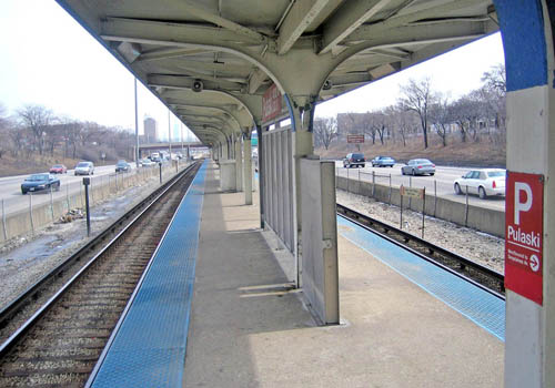
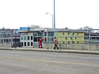
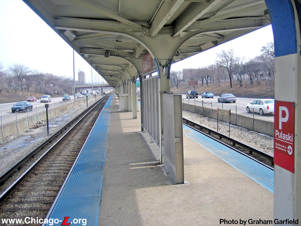
The Pulaski island platform is seen looking east near the closed Keeler exit on March 9, 2007. Except
for the gap filler box, sandbox tactile edge panels, newer windbreaks and KDR standard signage, it is changed little since the day it opened. Today, the platform has Green Line standard signage. For a larger
view, click here. (Photo by Graham Garfield) |

|
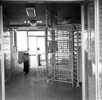
pulaski_19580513_keeler.jpg (71k)
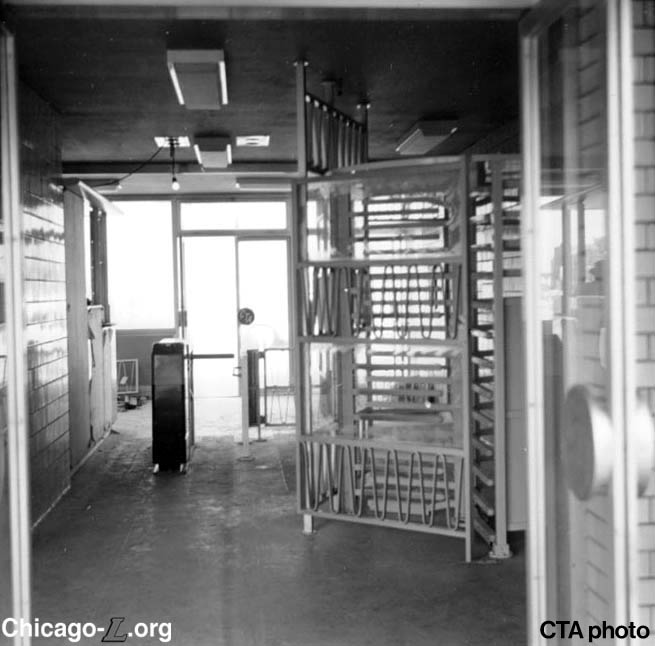
The interior of the station house at Pulaski's
auxiliary entrance on Keeler Avenue is seen looking west from the paid area toward the front doors on May 13, 1958, a little more than a month before opening. While largely complete and ready, some fixtures and equipment are still being installed -- for instance, the agent-controlled turnstile has not yet been installed next to the booth.
(CTA photo)
|

|
pulaski_19580523d_keeler.jpg (32k)
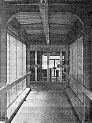
The passenger ramp between the Keeler station house and the island platform is seen on May 23, 1958, a month before the station opened. The
station house is ahead. The door handles are molded in the
shape of the CTA shield logo. (Photo from
the 1957 CTA Annual Report) |
|
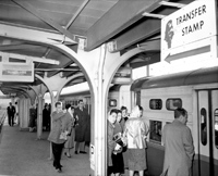
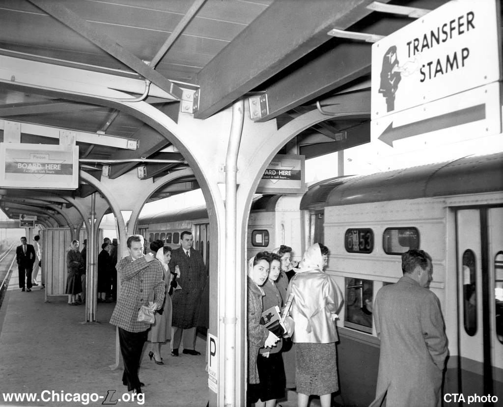
pulaski_19580000.jpg (395k)
In this 1958 view not long after the Congress Line opened, passengers prepare to board a Milwaukee-Congress "A" train of newer 6000-series "L" cars that has just pulled into the station. Note the "Board here" signs over the platform -- these signs are readings on a roller curtain in boxes that can remotely control the reading that is visible, with the message changing depending on the length of trains being operated (i.e. whether you can board at that location along the platform or not) or if it a time when the station is unstaffed and you have to pay your fare to the conductor onboard the train. Signs are also in evidence pointing passengers to the transfer stamp machine -- at that time, if you bought a transfer to connect between trains and buses, you had to validate the transfer before leaving the station, which punched the station name and time on it to allow the bus driver to verify if the connection location and time lapsed was correct for the transfer fare to be valid. (CTA photo) |
|
pulaski_19781103b_keeler.jpg (??k)
The vandalized interior of the Keeler station house is seen on November 3, 1978. The person sticking their hand through the ticket agent's window is demonstrating that the glass has been broken out and is missing. The metal grille partition on the left also seems to be off its track or detached from the floor, at an angle. The fact that the front window of the agent's booth had already been covered with a metal grille suggests this location had already had issues with security or vandalism requiring additional hardening. (CTA photo, Graham Garfield Collection) |
 |
pulaski_19990000_pulaski.jpg (109k)
The Pulaski entrance, looking northwest in 1999. The 1950s electric neon sign is gone, replaced with an advertising box, and the doors have been replaced, but it is otherwise largely unaltered and none the worse for the wear. (CTA photo) |
|
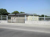
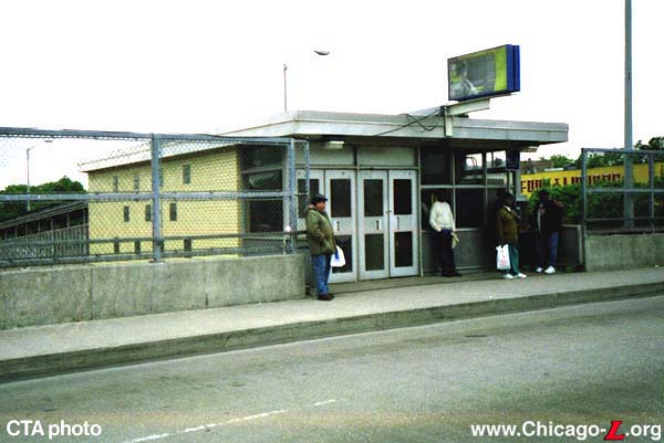
pulaski_20030918_keeler.jpg (117k)
The closed Keeler station house, its whole front elevation boarded up with a chainlink fence further closing it off to secure it from unauthorized access, is seen looking northwest on September 18, 2003. (Photo by Graham Garfield) |
|
pulaski_20070309a_pulaski.jpg (130k)
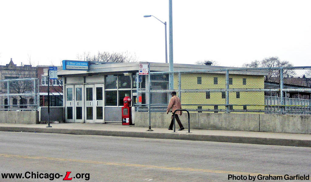
The Pulaski station house is seen looking southwest on March 9, 2007. Except for the removal of its original lit entrance sign and new doors, it is still very much as it was originally built. The advertising sign box from the 1980s is gone, and a current Green Line Standard-style entrance sign has been outfitted over the doors. (Photo by Graham Garfield) |

|
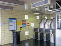
pulaski_20070309b_pulaski.jpg (169k)
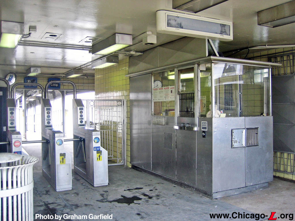
The interior of the Pulaski entrance, seen here on March 9, 2007, still had many of its original features, including the agent's booth, overhead sign and backlit graphic, and the tile and glass block walls. The grillework behind the agent's booth was a remnant of a complex system of movable partitions the station originally had, seen in this 1958 photo above. (Photo by Graham Garfield) |
|
pulaski_20100202b_pulaski.jpg (218k)
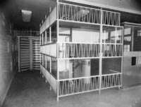
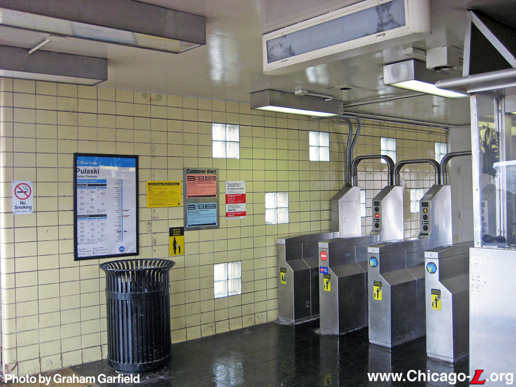
This February 2, 2010 interior view of the Pulaski station house shows the original canary yellow glazed tile walls with square glass block light openings, terrazzo floors and overhead backlit sign box still intact. (Photo by Graham Garfield) |

|

|
Notes:
1. Wisniewski, Mary. "CTA plans for accessible stations, though funds are not available." Chicago Tribune, July 19, 2018.
2. Chicago Transit Authority. "All Stations Accessibility Program (ASAP)" flyer. July 2018.
3. Hinz, Greg. "The CTA just got $118 million for Blue Line elevators. Here's the backstory." Crain's Chicago Business, December 22, 2022.
4.
"CTA Receives $118.5 Million in Federal 'All Stations Accessibility Program' Grant Funds." CTA press release, December 20, 2022.
5. Chicago Transit Authority. All Stations Accessibility Program (ASAP) Strategic Plan, July 2018, pp. 76-78.
6. Ibid, p. 79.
7. Chicago Transit Authority. Blue Line Forest Park Branch Vision Study - Station and Station Access Alternatives, April 2017, pp. 93-94.
8. CTA press release, 2022.


