|
|
|
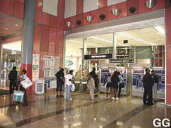
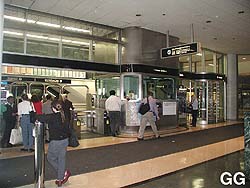
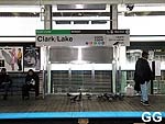
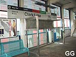
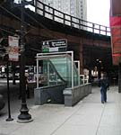
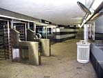
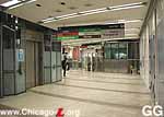
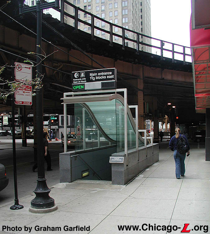
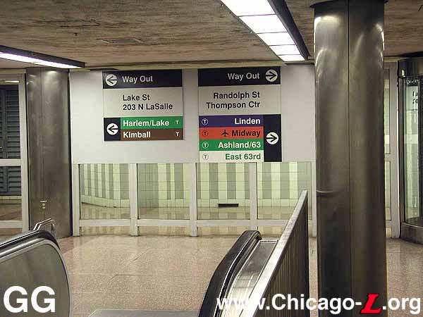
The two entrances to the
Clark/Lake complex: 203 N. LaSalle (right) and the
street-level fare controls in the James. R. Thompson Center
(left) in July 2001. The establishment of these two
buildings allowed for the separate station houses/mezzanines
and fare controls of the Clark/Lake
elevated station and Lake
Transfer subway
station to be eliminated and for the establishment of a
larger, combined tri-level transit facility. For a larger
view of the left photo, click here.
For a larger view of the right photo, click here.
(Photos by Graham
Garfield)
|
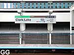
Clark/Lake
(100W/200N)
Clark Street and Lake
Street, Loop
Service
Notes:

|
Blue Line:
Milwaukee-Dearborn Subway
|

|
Green Line:
Lake-Ashland-East 63rd
|

|
Brown Line:
Ravenswood
|

|
Orange Line:
Midway
|

|
Purple Line:
Evanston Express
|

|
Pink Line:
54/Cermak-Loop
|

|
Accessible
Station
|

|
Transfer
Station
|

|
Owl
Service
(Blue Line only)
|
Quick Facts:
|
Address:
|
100 W. Lake Street
(Loop Elevated
station)
|
|
124 W. Lake Street
(subway station,
Thompson Ctr/203 N. LaSalle entrance)
|
|
191 N. Wells Street
(Wells/Lake
entrance)
|
Established: March 23,
1992
(combination of existing facilities, see
below)
|
Original
Lines:
|
Union Elevated Railroad
(elevated
station)
|
|
Milwaukee-Dearborn Subway
(subway
station)
|
Previous Names: Lake
Transfer
(Blue Line only)
|
Skip-Stop Type:
|

|
Station
|
Rebuilt: n/a
Status: In Use
History:
The Clark/Lake tri-level facility is the
CTA's largest, most complex
station and one of its busiest (third busiest as of 1998, behind
Washington/State and 95/Dan
Ryan). It was created in 1992 when the Clark/Lake
elevated station and the Lake Transfer
subway station -- which previously had separate fare controls and
mezzanines -- were renovated and had their passenger access relocated
to the same building. This makes for both a complicated station
and a complicated history. Below are brief histories of the
elevated and subway stations (with links to more in-depth profiles as
well), followed by the history of the current Clark/Lake complex
post-1992, when the current facility was created.
Loop Elevated Station
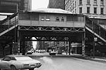
Clark/Lake elevated station,
looking south in 1983. For a larger view, click
here.
(Photo by Dan Clement, from the
Collection of the Library of Congress)
|
The Clark/Lake
elevated station was opened in 1895, constructed before the rest of
the Loop on tracks that, while originally part of the Lake Street
line, were always meant to be the north leg of a downtown loop,
connecting at Wabash. The original Clark
station quite small and incorporated elements from many styles,
including some Classical Revival elements and features reminiscent of
a Chinese pagoda. It had an ornate station house as well as the
decorative railings and platform canopy pillars.
In 1913, many of the Loop stations underwent a number of
renovations and it seems Clark/Lake was one of them. The original
trackside waiting rooms were removed and new open booths were
installed. Left intact, however, were much of the roofs, all platform
canopies, posts, railings and many other features. The station house
enclosure was quite small -- no wider than about 30-40 feet -- but
the roof extended wider, about the width of Clark Street below.
Later, the CTA modified the
building and enclosed the area below the roof with plywood and
fiberglass panels, giving the station house a piecemeal, disorganized
look.
Clark had fallen into a serious state of disrepair when
renovations began in 1988 for the replacement of the old elevated
facility with a new, modern, white steel station, a common design for
new "L" stations referred to as the "open plan concept." Beginning in
January 1992, Clark/Lake was closed weekends for the last of the
reconstruction work, which was largely completed a few months
later.
The new station is actually located west of the old station,
between Clark and LaSalle. The new elevated platform has a canopy
that stretches the entire width of the structure, with a convex
skylight down the center. This elaborate reconstruction was part of a
new tri-level station that connects the elevated with the
ground-level street with the O'Hare-Congress-Douglas subway station
formally known as Lake Transfer.
For additional information
and photos of the Clark/Lake elevated station (1895-1992), click
here
to see the Clark/Lake elevated station
profile.
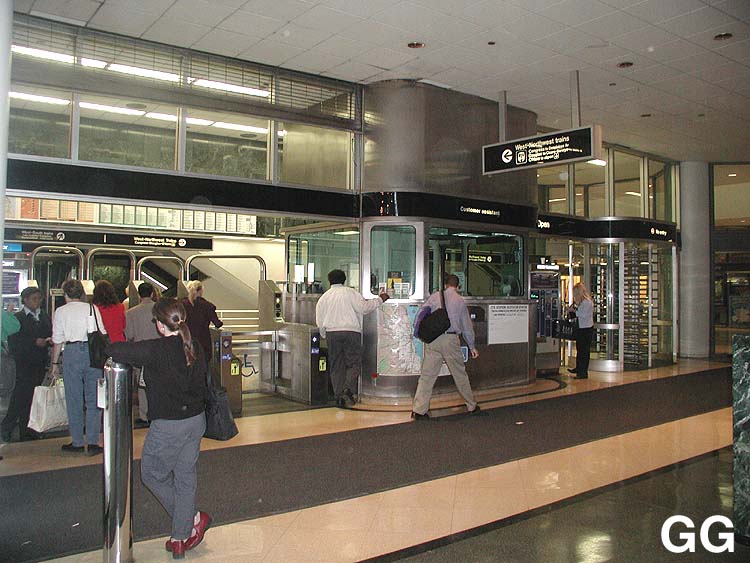
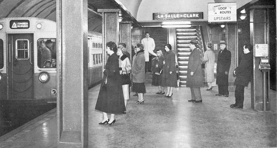
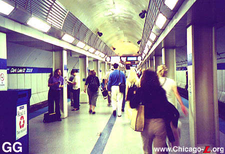
Dearborn Subway Station

Passengers wait to board a
northbound "A" train near the LaSalle-Clark mezzanine at the
east end of Lake Transfer station in late 1958. For a larger
view, click here.
(Photo from the Graham Garfield
Collection)
|
The Lake Transfer
subway station, which opened in February 1951, was typical of all the
Dearborn and State Street subway stations. Described at the time as
of a "modern design", the mezzanine stations -- the main mezzanine
entrance being at LaSalle-Clark/Lake, with an auxiliary mezzanine
entrance at Wells/Lake -- had smooth concrete floors and ceilings and
white glazed tile walls (sometimes referred to as "structural glass")
in an Art Moderne style.
The origins of the combined Clark/Lake "L"/subway complex can be
traced back to 1958, when the West-Northwest through-route was
created between the Milwaukee elevated, Milwaukee-Dearborn Subway,
the Congress and Douglas lines. At that time, "L"/subway transfers
'up' were inaugurated between the Clark/Lake
elevated station and the Lake Transfer
subway station (whose entrances were 1/2 block apart), although
'down' transfers from the Loop to the subway were prohibited here
(these were accomplished between State/Van
Buren and Jackson-Van Buren/Dearborn). In 1969, a new
through-routing once again brought a change to the transfer policy
between the Loop and the Milwaukee-Dearborn Subway. With the
beginning of West-South Route (Lake-Dan Ryan) service, all transfers
-- both 'up' and 'down' -- were changed to between Lake
Transfer and Clark/Lake.
For additional information
and photos of the Clark/Lake subway station (1951-1992), click
here
to see the Lake Transfer subway station
profile.
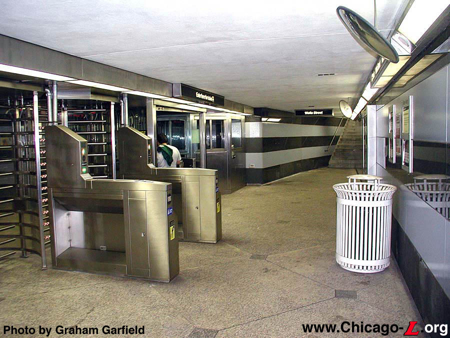
State of Illinois Center Begins
Consolidation
In May 1985, the new $173 million State of Illinois Center (SOIC)
was completed and occupied. Only 17 stories tall (with two additional
levels below grade) but monumentally designed by Helmut Jahn, the
Center stands apart from surrounding office buildings because of its
dome-shape and its multicolored glass exterior. With a low block
design, the glass-enclosed steel structure's curving, sloping facade
faces the corner of Randolph Street and Clark Street.
In 1986, the LaSalle-Clark mezzanine of Lake
Transfer was closed for renovation and integration into the new
SOIC. The mezzanine was already located mid-block between LaSalle and
Clark (where the SOIC is) and at the same level as the first basement
floor. During the duration of construction, the previously part-time
entrance at Wells/Lake was made a full-time entrance. In 1989, the
reconstruction was complete and the east entrance to Lake
Transfer was reopened. The space previously occupied by the
station mezzanine and fare controls at LaSalle-Clark were wiped out
and completely remodeled, now all within the paid area. Likewise, the
mezzanine-to-street stairs were completely removed. The fare controls
were now located in two places: in the basement level of the SOIC
(near the food court) and at street level in the SOIC, connected to
the basement/mezzanine level by two elevators, two escalators, and
stairs. At that time, the Wells/Lake entrance returned to entrance
during the weekday PM rush hours only.
Further renovation came to Lake
Transfer in 1991 when an additional entrance to the former
LaSalle-Clark mezzanine was opened with the construction of the new
203 N. LaSalle Building (aka the Loop Transportation Building,
completed in 1985), across Lake Street from the State of Illinois
Center. Like in the SOIC, passengers could enter the 203 N. LaSalle
Building mid-block on Lake Street, enter through street-level fare
controls, travel down to the basement level by stairs or elevator,
and access the subway mezzanine through a new subterranean
passageway.
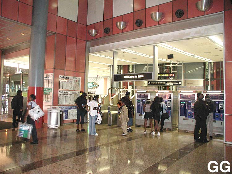
A 'Super-Station' is Created
On March 23, 1992, the Clark/Lake
elevated station's entrances over Clark Street were closed and new
access opened from the newly-constructed elevated platforms to the
State of Illinois Center and 203 N. LaSalle Building. With all access
to both the Loop and subway stations through the same access points
-- also allowing transfers without leaving a paid area -- the subway
and elevated stations were combined into a single facility known as
Clark/Lake, with the subway station thus dropping the Lake
Transfer moniker.
On May 10, 1993 the State of Illinois Center was rededicated as
the James R.
Thompson Center in honor of former Governor James R.
Thompson.
The modernization of the
Clark/Lake station is mostly complete in this July 1, 1996
photo. The central arch is better illuminated by decorative
steel conduit covers and fluorescent lights. Visible on the
outer wall is a prototype for the new CTA station signage,
which was first standardized on the rehabbed Green Line. For
a larger view, click here.
(Photo by Art Peterson)
|
The final phases of the renovation of the Clark/Lake subway station
were initiated in 1995. During the summer, the Wells/Lake auxiliary
entrance was closed for reconstruction. On December 16, 1995, the
CTA operated a special work
train (comprised of work motors 2891-2900 and flat cars S-604 and
S-607) from Forest Park to transport
the new escalator for the Wells/Lake entrance. During the winter of
1995-96, new lighting fixtures, both trackside and on the platform,
were installed. Sound absorbing panels were installed on the tunnel
walls in January 1996 (which, interestingly enough, covered up the
barely-visible sealed-up intersection between the subway and the old
LaSalle Street streetcar tunnel). New Current
Graphic Standard signage and platform furniture were installed
during March and April of 1996.
On May 28, 1996, the Wells/Lake entrance renovation was completed,
reopened as of 1430 hours. Wells/Lake returned to be being a
part-time entrance -- between 1400 and 1800 hours weekdays only --
but a full-time exit. Although an agent's booth was installed, no
agent was regularly assigned: entrance was only with exact change,
tokens, or transfer cards to be deposited in automated turnstiles.
Exit was, of course, through rotogates.
By the summer of 1996, that platform modernization was largely
complete, with better illumination achieved with fluorescent lights
in the central archway covered by steel grating. The columns were
painted blue, denoting the station's place on the Blue Line. (They
were later repainted white.) The outer tunnel walls were covered with
gray sound-absorption panels and new Current
Graphic Standard signage (identical to that pioneered on the
rehabbed Green Line) was applied. The name signs used white letters
on a charcoal background (gray would ultimately be used), with blue
panels on either side containing entrance/exit information. Backlit
above-platform destination signs, mimicking the new destination signs
used on trains, were installed.
In April 1996, the fare controls in the basement of the Thompson
Center (near the food court) were made available for entrance 24
hours a day. No agent was assigned (although there are agent's
booths): entrance was only with exact change, tokens, or transfer
cards as at Wells/Lake. In the Summer 1997, with the institution of
the CTA's electronic
TransitCard fare system, this entrance was modified for unattended
entrance with fare cards. In Fall 1998, the Lake/Wells entrance/exit
received new high barrier gates, allowing it to serve as an entrance
at all hours with use of an electronic TransitCard -- rather than
only during the afternoon rush period -- making it now a full-time,
if unattended, entrance.
At a press conference on Monday, June 5, 2000,
CTA President Frank Kruesi
announced that beginning Saturday, June 10th and Sunday, June 11th,
six downtown area 'L' and subway stations and seven station entrances
that were currently closed late at night or on weekends would be open
at all hours that trains are in service. One of the seven secondary
station entrances was was a Part-Time Entrance -- closed nights and
weekends -- was the 203 N. LaSalle entrance to Clark/Lake station.
Starting at 0600 hours Saturday, June 10th, 203 N. LaSalle entrance
returned to 24-hour operation. Opening these stations and entrances
is just one of the components of a $539,000 service improvement
package that was passed by the Chicago Transit Board in May 2000.
Frankle-Monigle Prototype
Signage
Today, the Clark/Lake tri-level facility is the
CTA's largest, most complex
station and one of its busiest. That complexity is both a great
advantage to passengers -- Clark/Lake provides the easiest, most
convenient transfer between the elevated and the subway -- but can
also be confusing to the uninitiated. Signage is somewhat of a
problem at the station, with some providing unclear transfer
directions and some simply out-of-date and inaccurate (such as the
sign directing passengers to "Jackson
Park trains to Dorchester/63". The
CTA is, however, looking at
addressing Clark/Lake's signage issues as of Fall 2001 with a new
signage initiative to be tested at this station.
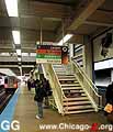
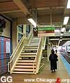
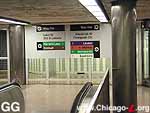
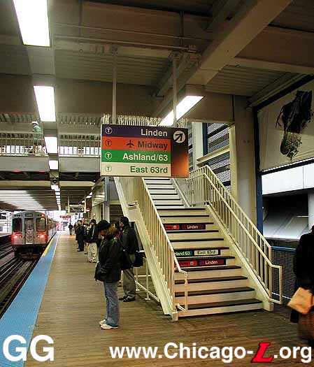
Examples of the Station
Identity Signs, on the Outer Loop platform (left) and on the
Inner Loop platform (right) on October 30, 2001. For a
larger view for the top photo, click here.
For a larger view for the bottom photo, click
here.
(Photos by Graham Garfield)
|
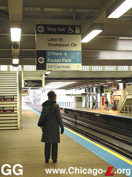
The possible solution to this problem has come in the form of a test
program currently being undertaken at the Clark/Lake elevated
station. The new signage scheme was developed by Frankle Brand
Environments and Monigle Associates and is known as the "Frankle-Monigle
signage". The program is designed to develop signs that better
direct customers to their destinations by displaying the color-coded
train routes that stop at the station and their terminal
destinations; arrows that direct customers toward exits to main
streets, buses, major landmarks and transfer points; and street
numbers that guide customers to points and interest. The Frankle-Monigle
signage system consists of many parts, including:
The extent to which the Frankle-Monigle
signage system is implemented at the Clark/Lake pilot site is
determined by several factors, including time, money, and the scope
of the pilot program. Whether they are implemented systemwide
someday, and to what extent, will depend on their evaluation and
acceptance by the public and by
CTA personnel at the pilot
site.
The deployment of the prototype Frankle-Monigle
signage began in October 2001 with the installation of station
name signs and various "breadcrumbs" (smaller signs, such as "No
Smoking") on the elevated platform and in the Thompson Center station
facility. Installation continued through late January 2002, by which
time most of the elements were in place. Among the later additions to
be installed is the Directional/Transfer Signage, which indicate a
line transfer opportunity for the rider or show the way to different
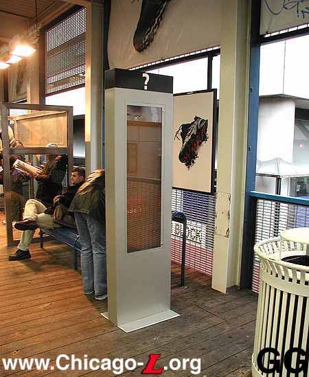
exits, streets, buses, or points of interest. Also installed were
information kiosks that information can be posted in and the large
Station Markers, which are kiosks that draw attention to the location
of "L" stations and provide information about the services provided
at that station from street-level environments, have been installed
on Lake Street outside both the Thompson Center and 203 N. LaSalle
entrances.
The Frankle-Monigle
signage has been installed in the Thompson Center and 203 N. LaSalle
stations at the lower subway-mezzanine level, street level, and
elevated platform levels. They have also been installed on the
elevated Clark/Lake platforms. A set of
Directional/Transfer signs have also been installed on either side of
the elevator in the subway, marking the only Frankle-Monigle sign to
be installed in the Blue Line subway station during the test.
Go Lane Pilot
On June 6, 2005, the CTA launched a pilot program at eight rail stations (as well as on 10 of
its wide-door Nova buses) to help speed boarding for customers by
dedicating one turnstile as an express fare payment lane (called a
"Go Lane") for those paying with either Chicago Card (regular or
Plus) smartcard fare media. The dedicated lanes are identified by
signs over the turnstile and on the floor in front of it. The eight
selected rail stations in addition to both the Thompson Center and
203 N. LaSalle entrances to Clark/Lake were Howard,
Chicago, 79th
and 95th/Dan Ryan on the Red Line; Jefferson
Park on the Blue Line; and the Randolph-Washington mezzanine of
Washington/State, and the
Randolph-Washington mezzanine of Washington/Dearborn
downtown. CTA chose these
stations because they are geographically balanced and serve a high
volume of customers who transfer between bus and rail.
The pilot was conducted to determine if providing a dedicated
turnstile at stations would help to speed boarding and, therefore,
speed service. The pilot also provided an additional incentive for
customers to switch to Chicago Card fare options. The faster and
easier the boarding process, the more the transit experience is
improved for existing customers. Faster boarding also helps to
attract new customers.
CTA monitored the Go Lane
boarding times during morning and evening rush periods to measure
time saved during boarding, as well as the ratio of customers using
electronic fare media compared to cash or transit cards. Customer
reaction and ease of use were also evaluated as part of the pilot to
determine whether use of Go Lanes should expand.
Subway Platform Renewal
While the Jackson/Dearborn project was being completed, the City
and CTA decided to piggyback the replacement of the platform floor at
the Clark/Lake subway station onto the Jackson project. The Clark
floor was improved during the 1996 rehab of the station by
installation of a poured flooring material onto the existing concrete
deck. This material did not age well, however, and by the mid-2000s
was cracking and flaking away. Therefore, it was decided to replace
the flooring entirely with a new granite floor identical to Jackson's
new deck by adding the material order onto the Jackson job to
decrease cost and obtain the material quicker.
Clark/Lake plat renewal started at the east end of the platform in
January 2007. The new platform flooring consists of light gray
granite with dark gray granite panels under the colonnade along the
platform edges. Compass roses are inset in the floor at the bottom of
the stairs from the mezzanine at both ends of the platform. While
work was underway, the south stair and south half of the Lake/Wells
auxiliary entrance was closed off and used for materials access and
storage by CDOT and its contractor.
The new subway floor completed April 2007. Other improvement work
was also performed in May and June 2007, including cleaning of the
acoustical panels on the tunnel walls, repainting the ceiling,
cleaning the light lenses, and replacing damaged signage. To increase
illumination, different lights were tested at the east end of the
center ceiling vault over platform -- none are there now, removed in
1990s rehab -- in Spring 2007. Several are fluorescent tubes, while
two are of the metal halide type tested at Quincy with an angled
shade.
Airport Flight Monitors
On February 14, 2007, the Chicago Transit Board approved an intergovernmental agreement with the City of Chicago that allowed the Department of Aviation to install two Flight Information Display systems at Clark/Lake station.
Two sets of displays were installed installed -- one at the elevated platform level and one in the subway. The monitors at the elevated level were installed inside the Thompson Center on the elevated platform level, next to the doors to the platform. The displays in the subway were installed over the platform, on the same side of the center ceiling vault as the O'Hare-bound tracks. The display in the subway, which is served by Blue Line trains to O'Hare, features information pertaining only to flights departing from O'Hare Airport. The display within the Thompson Center provides only flight departure information for Midway Airport, served by the Orange Line to Midway operating on the Loop Elevated.
The agreement was for one year and automatically renews unless either party terminates. Under the agreement, the City is responsible for the purchase, installation and maintenance of the equipment necessary for the displays with CTA responsible only for the cost of the electricity needed to run the equipment.
Over June 29-July 1, 2018, the two regular turnstiles at the concourse level, which provided access from the basement food court in the Thompson Center, were replaced with high-barrier gate turnstiles. Since this entrance is unstaffed, the HBG turnstiles provided better protection against fare evasion. The HBGs were in service Monday morning, July 2 (the Thompson Center and its food court/atrium are closed on weekends.)
|
|
|
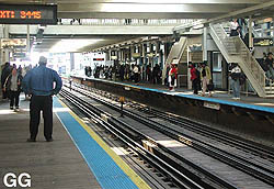
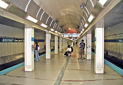
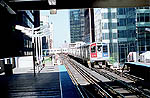
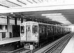
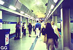
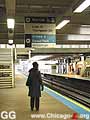
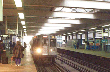
Left: Clark/Lake
elevated platforms, looking west on the Inner Loop platform
in July 2001. The stairs lead to the overhead bridge to
allow transfers between lines. For a larger view, click
here.
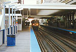
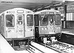
Right: Clark/Lake is
one of the CTA's busiest Loop subway stations, although the
platform is more subdued in this Sunday afternoon view
looking west on the platform on October 30, 2005. For a
larger view, click here.
(Photos by Graham
Garfield)
|
 Clark/Lake
Elevated | Clark/Lake
Subway | Frankle-Monigle
Test Signs
Clark/Lake
Elevated | Clark/Lake
Subway | Frankle-Monigle
Test Signs
|
clark-lake02.jpg
(69k)
A 2400-series Green
Line train has left Clark/Lake bound for Harlem.
|
|
clark-lake03.jpg
(130k)
A 3200-series
Ravenswood train, on the end of its trip around the Loop,
stops at Clark/Lake. (Photo by Jon
Bell)
|

|
clark-lake04.jpg
(71k)
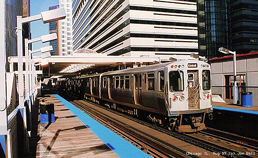
A 3200-series
Midway train stops at Clark/Lake to unload and pick up
passengers.
|
|
clark-lake05.jpg
(68k)
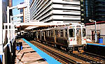
The Clark/Lake platforms looking west as an Orange Line
train pulls into the station.
(Photo by John F. Kuczaj)
|

|
clark-lake06.jpg
(204k)
In October 1993, the majority of the 2000-series
cars were taken out of service. For most, their final
movement was a deadhead trip to the Skokie Shops for
disposition. Car 2021 trails an eight-car train on such a
trip (despite the fact that the destination sign reads
"Englewood-Lake A") through Clark/Lake on October 7, 1993.
(Photo by Art Peterson)
|
|
cta2487.jpg
(68k)
This view shows car 2487 leading an six-car Green Line train
at Clark/Lake station on
February 26, 1999. (Photo by Sean
Gash)
|
|
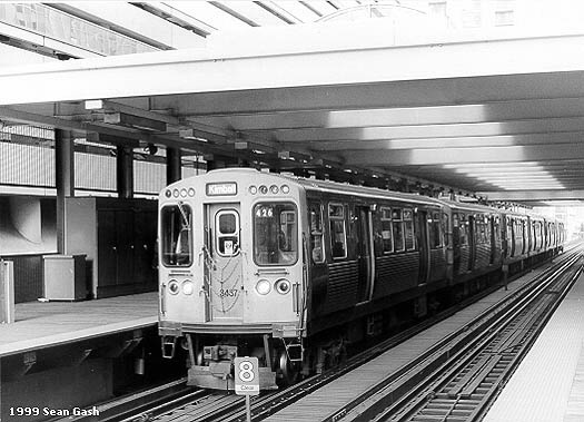
cta3437.jpg
(67k)
A six-car 3200-series
Brown Line train stops at Clark/Lake, led by car 3437, on
February 26, 1999. (Photo by Sean
Gash)
|
|
cta3408.jpg
(71k)
This photo looks east at the Clark/Lake station on March 10,
1999. Car 3408 heads up a six-car Brown Line train headed
for Kimball while 2826 brings up
the rear of a six-car Purple Line Express train beginning
its trip around the Loop before returning to Howard
and Linden. (Photo
by Sean Gash)
|
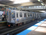 |
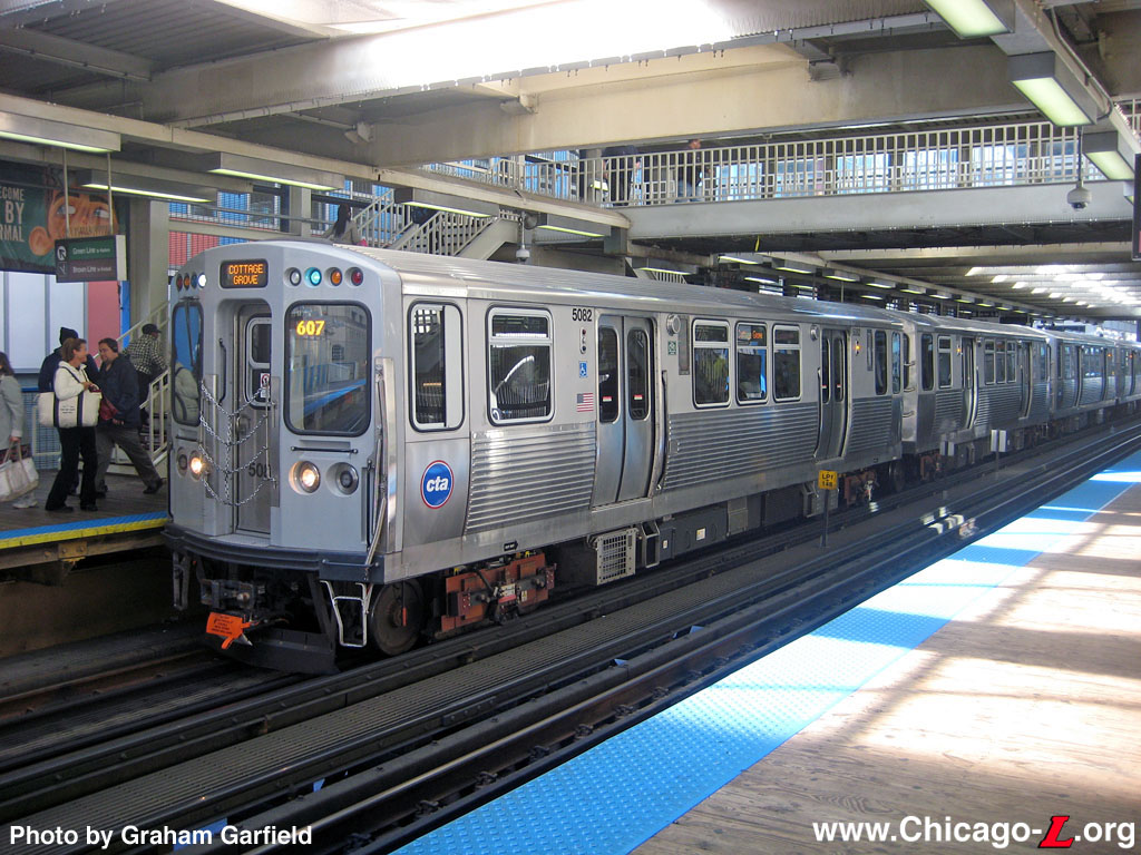
cta5082.jpg (247k)
Car 5082 leads a 4-car Green Line train to Cottage Grove, stopping at Clark/Lake on September 24, 2012. The lead unit has the amber LED destination signs that the first 5000s were delivered with. Note that, on the amber LED signs, "Cottage Grove" is in all-caps and on two lines on the front destination sign, but in title-case and one line (like on the screen-printed mylar curtains of the older cars) on the side signs. The front car sports the white-green marker lights of Cottage Grove trains. (Photo by Graham Garfield) |
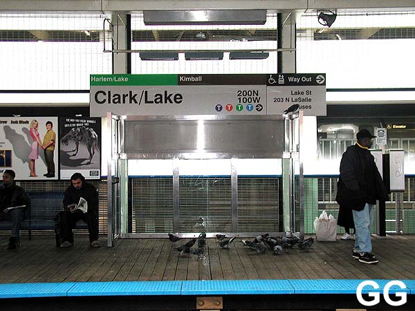
Clark/Lake Subway
Station
|
clark-lake.wells01.jpg
(136k)
As part of the renovation of the Well/Lake mezzanine, new
subway entrance kiosks were installed, designed to match the
modern style of the new finishes. The illuminated
"OPEN" sign is a remnant of the time
when the mezzanine was only open for entrance part-time,
during manned hours; the "CLOSED"
sign is rarely, if ever, used now. Above the south stairs to
the mezzanine, looking north on September 13, 2001, is
Junction 18
of the Loop
Elevated, the access point for Brown and Green Line
trains at the northwest corner of the quadrangle.
(Photo by Graham Garfield)
|
|
clark-lake.wells02.jpg
(153k)
As part of its 1995-96 renovation, the Wells/Lake subway
mezzanine traded its 1951 Art Moderne styling for modern
finishes of gray granite and stainless steel. Initially
after reopening, the mezzanine continued to be a part-time
entrance, with ingress only when the agent's booth was
manned. Otherwise, egress was allowed at all times through
rotogates. With the installation of farecard-access high
barrier gates (HBGs) in 1998, however, the mezzanine could
allow entrance at all times. Now, the booth is rarely
manned. The mezzanine is seen looking south on September 13,
2001. (Photo by Graham Garfield)
|
|
clark-lake02.jpg
(76k)
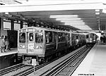
This rush hour view looking west on the subway platform in
the summer of 2001 shows what an important, busy station
Clark/Lake is. (Photo by Graham
Garfield)
|
|
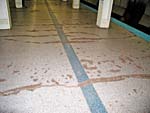
clark-lake04.jpg
(210k)
Not long after the new flooring was laid in the 1995-96
platform rehabilitation it began deteriorating. Part of the
problem was that it wasn't really a new floor at all, as the
original 1950s red concrete flooring was never removed.
Instead, a type of polymer was poured over the concrete,
which was intended to seal the old flooring and create a new
decorative surface on top. However, the material's integrity
failed, particularly along cracks in the old flooring
underneath. This view is on October 30, 2005.
(Photo by Graham Garfield)
|
Frankle-Monigle Test
Signage
|
clark-lake-Frankle01.jpg
(67k)
One of the Frankle-Monigle Station Identity Signs at
the west end of the Outer Loop platform, looking north on
October 30, 20001. (Photo by Graham
Garfield)
|


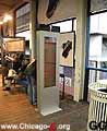
|
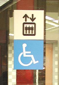
clark-lake-Frankle04.jpg
(27k)
clark-lake-Frankle05.jpg
(30k)
Examples of some of the Frankle-Monigle
"Breadcrumbs" installed at Clark/Lake. On the left is the
Frankle-Monigle "No Smoking" sign, while on the right is
their ADA-accessible elevator sign. (Photo
by Graham Garfield)
|
|
clark-lake-Frankle06.jpg
(66k)
Transfer/exit sign at 203 LaSalle exit on Outer
Loop platform, looking east on January 15,
2002.
(Photos by Graham
Garfield)
|
|
clark-lake-Frankle07.jpg
(64k)
Transfer sign on Outer Loop platform, looking
west on January 15, 2002.
(Photos by Graham
Garfield)
|
|
clark-lake-Frankle08.jpg
(66k)
Transfer sign on Inner Loop platform, looking
west on January 15, 2002.
(Photos by Graham
Garfield)
|
|
clark-lake-Frankle09.jpg
(69k)
An Information Kiosk on Outer Loop platform, looking west on
January 15, 2002.
(Photos by Graham
Garfield)
|
|
clark-lake-Frankle10.jpg
(59k)
Directional/Transfer signs posted at the top of
the escalator from the Blue Line subway on January 18,
2002.
(Photos by Graham
Garfield)
|

|
clark-lake-Frankle11.jpg
(61k)
Frankle-Monigle sign directing customers to the
Blue Line subway on January 18, 2002. Note the "Breadcrumbs"
on the column on the right.
(Photos by Graham
Garfield)
|
|
clark-lake-Frankle12.jpg
(51k)
Directional/Transfer signs in the passageway from
the subway to the street and elevated station, looking south
in the lower level of the Thompson Center on January 18,
2002.
(Photos by Graham
Garfield)
|


- clark-lake.wav
(14K): Conductor's station announcement for the Clark/Lake
elevated station.
.
- Clark-Lake_Orange.wav
(283k): Automated announcement for the Clark/Lake station: "This
is Clark and Lake. Transfer to Green, Blue, Purple, and Brown Line
trains, and the Thompson Center, at Clark and Lake. This is an
Orange Line train to Midway."
(Sound courtesy of Tony Coppoletta)
.
- Clark-Lake_next.wav
(49k): "Clark and Lake will be next. Clark and Lake."
(Sound courtesy of Tony Coppoletta)


