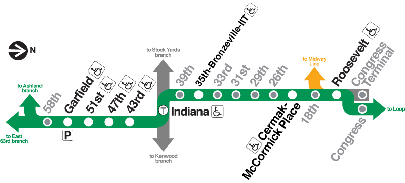
The Green Line was created in 1993 when the Lake Line was linked
with the Englewood-Jackson Park Line via the Loop elevated.
Previously, the Howard Line had been linked with the
Englewood-Jackson Park Line via the State Street Subway and the Dan
Ryan had been through-routed with the Lake Street Line via the
elevated and the Loop.
The South Side main line represents the oldest section of the "L"
in the city, with the portion between Congress
Street and Pershing
(39th Street) completed in
1892. To serve the Colombian Exposition of 1893, the Alley "L" (the
South Side's nickname at the time) began making plans to extend its
line directly into the fairgrounds. In 1893, an extension opened
between 39th Street and the
fair near 64th and Hayes via the alleys and East 63rd Street. In
1905, a new branch opened. Leaving the main line at about 59th
Street, the Englewood Branch wound its way to West 63rd Street, then
west to a terminal at Loomis
Street, extended a few blocks to Ashland
Avenue in 1969. These lines were built as typical elevated steel
trestles, mostly over alleys and private right-of-way, except for the
Jackson Park Branch, which runs over East 63rd Street.
In 1993, the Green Line was formed when the Lake Street and
Englewood-Jackson Park Lines were through-routed. With both halves of
the new line made up of the two oldest sections of the "L", the
structure was beginning to show the ravages of time. Early the next
year, the Green Line was closed for an extensive renovation project
lasting more than 2 years. A great deal of controversy raged during
the two year rehab, including debates over station closings,
retention of nighttime "owl" service and the date of reopening. On
May 12, 1996, the Green Line reopened. Owl service is retained (only
to be dropped a year later), but the line reopened with fewer
stations: Homan, Halsted,
58th, 61st, Racine
and University were
closed. Jackson Park trains began to terminate at Cottage
Grove Avenue (East
63rd) while the future of the elevated segment east of there to Dorchester
remained undecided. On September 27, 1997, the CTA reached a decision
on the fate of the Cottage Grove-Dorchster segment of the Green Line:
with less then 24 hours of public notice, city workers moved in and
dismantled the "L" line.
Also upon reopening, the branches were renamed from Englewood to
Ashland and from Jackson Park to East 63rd to be more specific and to
correlate with the new train signage, although many longtime riders
still use the original names.
The Green Line has a larger proportion of handicap accessible
stations than any other line (tied with the Orange
Line). This occurred during the 1994-96 rehab. Due to the large
amount of work done at many stations, federal law required the CTA to
make many of the stations ADA compliant during the project.

|
SSRTwoods@43rdSt.jpg
(79k)
A southbound train on the South Side main line is slowing
down while approaching 43rd
Street station in early 1907. The line narrows from
three tracks (the center express track having just been
installed at this time) and two here, just before entering
the station. (Photo from the LeRoy Blommaert
Collection)
|
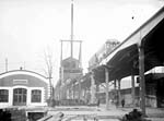
|
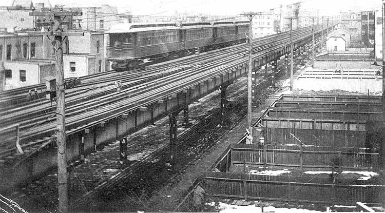
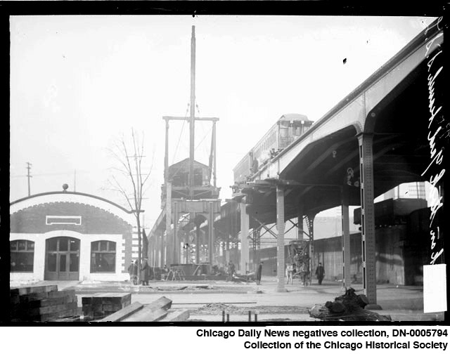
ROW_construction02.jpg
(93k)
A two-car South Side Elevated train heads east at Michigan
and 40th, with men kneeling on the structure near the train,
in 1908. On the right is the South Side main line, built in
1892, with it's special design for park boulevard crossings
as it goes over Michigan Avenue. On the left, the Stock
Yards branch is still under construction, the large hoist's
work nearly complete as the structure is only a block away
from the branch's Indiana
Avenue terminal. (Image #DN-0005794,
Chicago Daily News negatives collection, Chicago Historical
Society Collection)
|
|
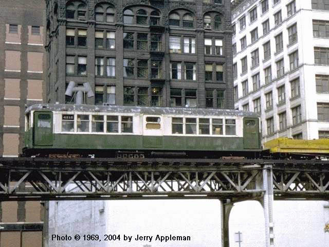
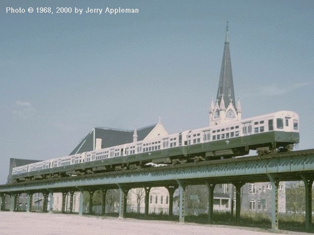
cta4215b.jpg
(50k)
With the arrival of the 2000s,
the Baldie 4000s
were retired quickly. Most were scrapped in 1964 and '65,
but a few stuck around for a while. Although car 4215 did
not formally become a work motor (i.e. it was not assigned
an "S" car number), it was used in nonrevenue service for a
few years. In this May 1969 view, it's south of the
Loop over Wabash Avenue hauling a
flat car as part of the preparation for return of this line
to revenue service when the Dan
Ryan line opened later in the year. Car 4215 was retired
the next year, in 1970. (Photo by Jerry
Appleman)
|
|
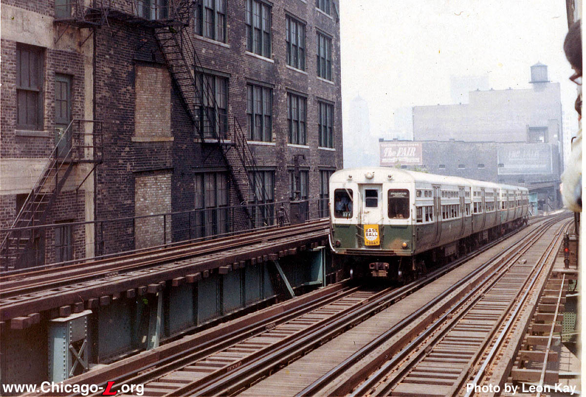
cta6000s@16th.jpg
(309k)
A North-South train of 6000s
on its way to Loomis/63
nears the top of the incline from the 13th Street portal in
June 1968. The Englewood-Howard All-Stop train is bearing a
"Baseball Today" sign, meaning a game is on at one of the
two ballparks served by the route. The shot is taken from a
fantrip train heading north on the South Side Elevated to
the Loop. At the time, the incline from the subway was in
regular use by North-South trains, while the track the
fantrip train was on was used only for special movements;
today the situation is reversed. (Photo by
Leon Kay)
|
|
cta6000s10.jpg
(51k)
A train of CTA 6000-6200 series cars run on a southbound six
car Englewood-Howard "A" train at 30th Street on the South
Side mainline in October 1968. (Photo by
Jerry Appleman)
|
|
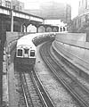
cta6000s@13th.jpg
(104k)
Between 1943 and 1993, northbound trains heading for the
State Street Subway on the North-South Route left the old
South Side elevated near 15th Street to enter the subway at
the 13th Street Portal. Two 6000-series
trains, including a Howard-bound "A" train (foreground), are
seen here at the portal circa the 1970s. The tracks in the
background, also part of the old South Side elevated, were
used by Lake-Dan Ryan trains at the time of the photo, from
1969 to 1993. (Photo by Brian J.
Cudhay)
|
|
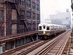
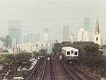
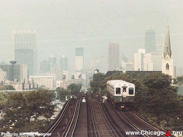
cta6684.jpg
(95k)
A Jackson Park train with 6684 on the rear end has left 35th
Street station and is heading northbound up the
roller-coaster south side main line. (Photo
by Michael Roegner)
|
|
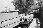
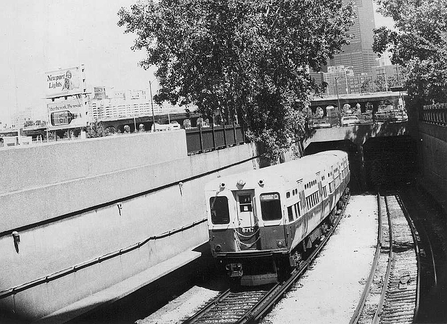
cta6717.jpg
(114k)
A black and white shot of 6717 emerging from the 13th Street
portal in 1985. (Photo by Leon
Kay)
|
|
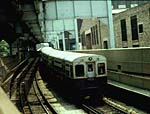
cta6500.jpg
(56k)
Car 6500 picks up the rear on this 6000-series
train climbing to the South Side "L" structure from the
State Street Subway on May 25, 1986. (Photo
by Leon Kay)
|
|
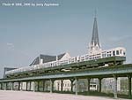
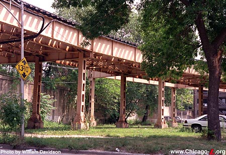
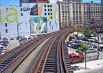
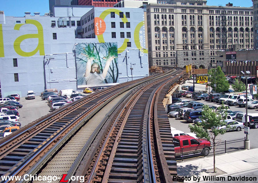
ROW@Prairie.jpg
(451k)
Just east of Prairie Avenue, the Kenwood branch split off
from the South Side Main Line. The main line (now the Green
Line) curves to the right here as we look east, while the
Kenwood continued straight for a short distance before
descending onto the embankment on the left.
(Photo by William Davidson)
|
|
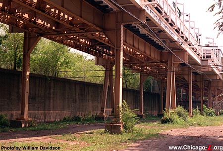
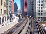
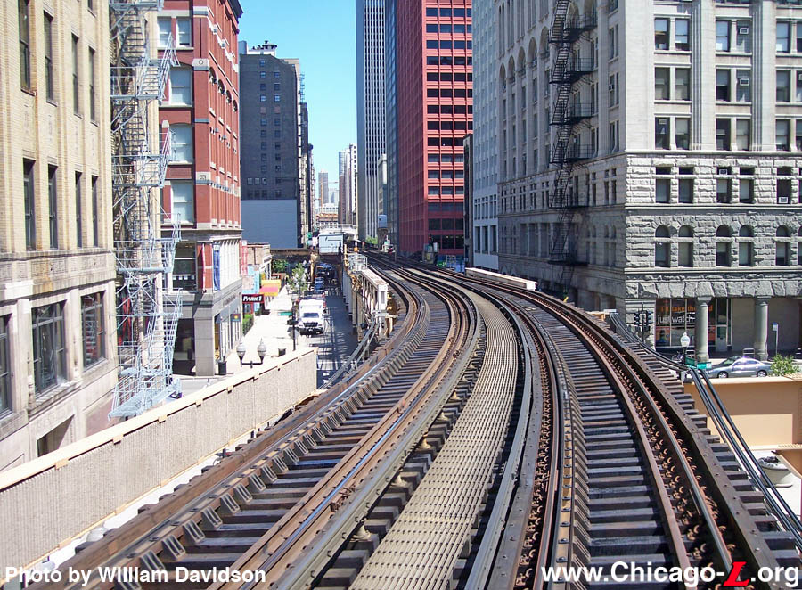
ROW@Indiana_station.jpg
(363k)
The elevated structure through Indiana
station was largely rebuilt between 1988 (when Indiana
station's platform were rebuilt) and 1996 (when the Green
Line rehab was completed), hence relatively little of the
1890s structure remains here. The embankment on the left
carried the Chicago Junction freight tracks.
(Photo by William Davidson)
|
|
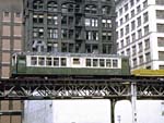
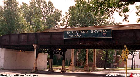
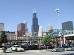
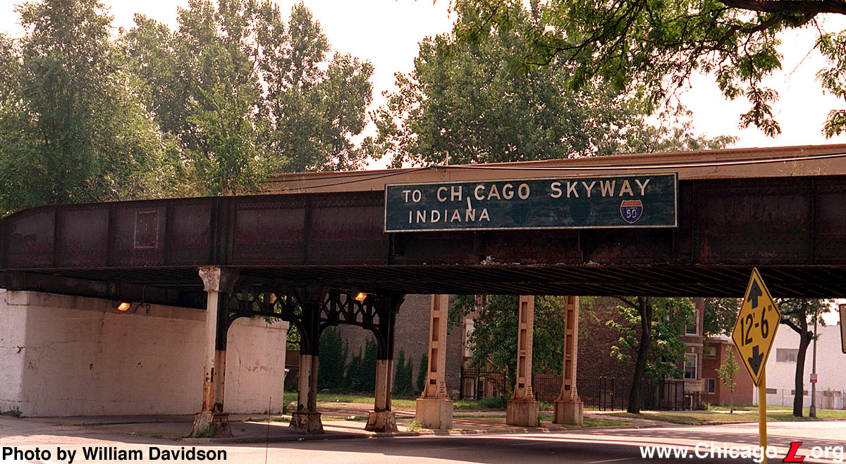
ROW@Michigan01.jpg
(355k)
Looking south along Michigan Avenue, one of the south side
boulevards. The street was a major north-south thorough fare
leading to, among other things, the Chicago Skyway, one of
the first expressways built in the city in the 1950s (hence
the very old sign on the bridge). (Photo by
William Davidson)
|
|
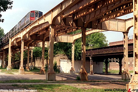
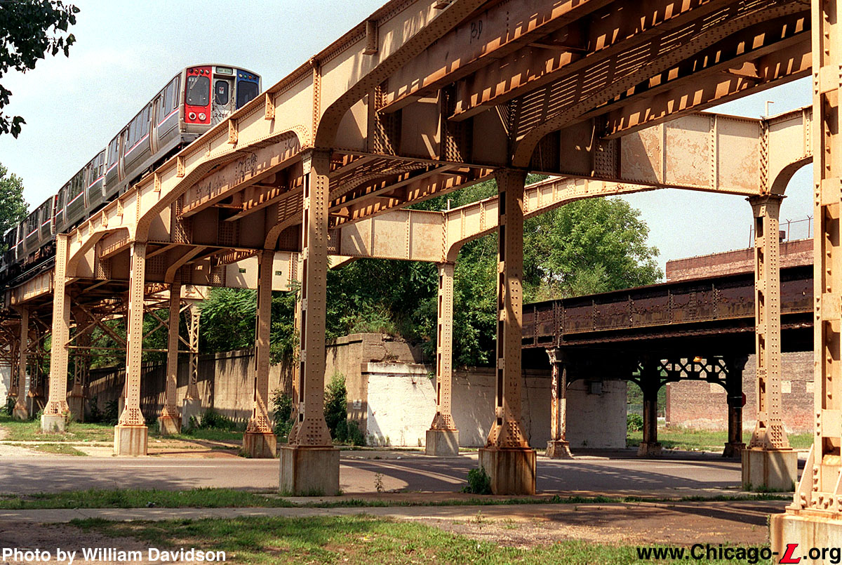
ROW@Michigan02.jpg
(406k)
Looking northwest at the structure of the South Side
Elevated as it crosses Michigan Avenue, as an East 63rd
Branch Green Line train passes overhead. The structure takes
on a somewhat more graceful appearance here because it is
crossing part of the city's park boulevard system, an
aesthetic requirement from the South Park
Commission.
(Photo by William
Davidson)
|
|
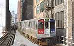
cta2515.jpg
(79k)
Car 2515, assigned to the Green Line, makes its way through
the canyon of former and current industrial buildings in the
South Loop as it makes it way to the Loop and Harlem/Lake
after leaving Roosevelt
station circa 1993. Despite the use of the
"Loop" destination sign,
this train is probably not being short-turned. For a short
time, operators were ordered to use "Loop"
destination signs on their way to the Loop, then change to
the terminal specific sign for use within the Loop and
beyond. This practice was quickly discontinued as it proved
to be confusing to riders and too much work for
motormen. (Photo by Eric
Oszustowicz)
|
|
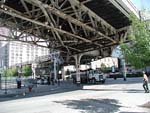
ROW@HarrisonCurve02.jpg
(243k)
Looking northeast at one of the tight turns of Harrison
Curve over the corner of Harrison and Wabash on September
30, 2002 as a southbound Green Line train enters the curve.
(Photo by Graham Garfield)
|
|
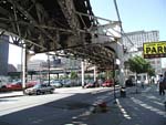
ROW@HarrisonCurve03.jpg
(207k)
Harrison Curve on September 30, 2002. (Photo
by Graham Garfield)
|
|
ROW@HarrisonCurve04.jpg
(178k)
Harrison Curve on September 30, 2002. (Photo
by Graham Garfield)
|
|
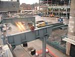
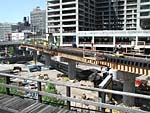
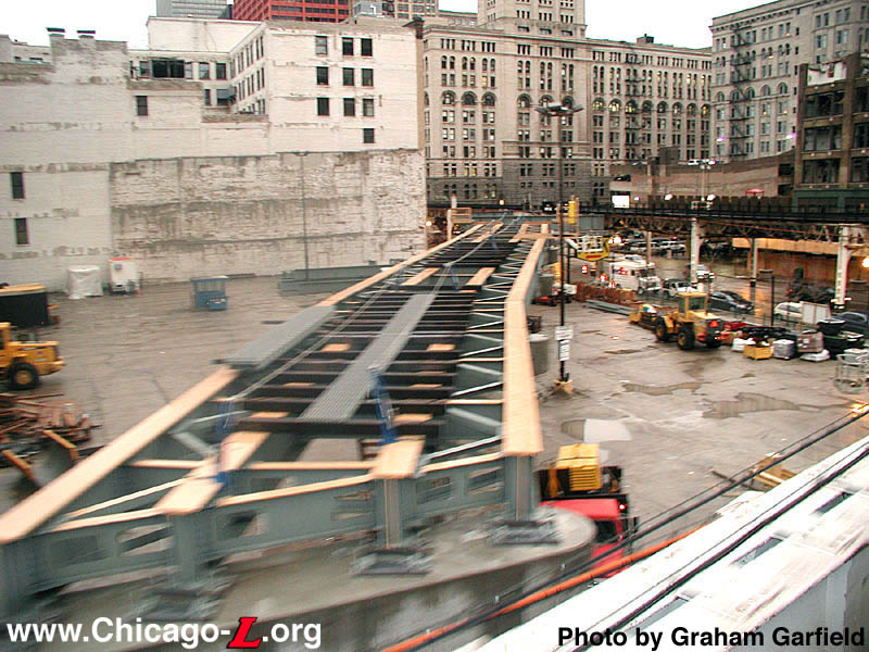
ROW@HarrisonCurve05.jpg
(225k)
On February 26, 2003, the new concrete columns -- similar in
design to most new "L" construction -- are in place along
the new alignment. (Photo by Graham
Garfield)
|
|
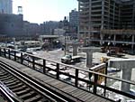
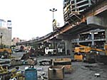
ROW@HarrisonCurve06.jpg
(140k)
This view looking southwest from the South Side Elevated,
north of Harrison Curve, on March 4, 2003 shows the new
steel bents that will connect the existing structure to the
new curve and the path the new alignment will take.
(Photo by Graham Garfield)
|
|
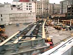
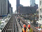
ROW@HarrisonCurve07.jpg
(161k)
By March 4, 2003, all the steel spans were in place on the
new curve and some ties and grated walkway sections had even
been put in place, as seen looking northeast from the
existing Harrison Curve. (Photo by Graham
Garfield)
|
|
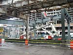
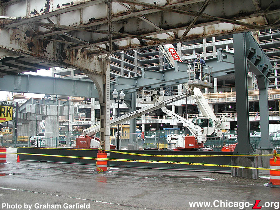
ROW@HarrisonCurve08.jpg
(225k)
The current 1897-vintage steel elevated structure is steel
alongside its eventual replacement, looking northwest on
Wabash on March 8, 2003, showing where the right-of-way will
curve off into the new alignment. (Photo by
Graham Garfield)
|
|
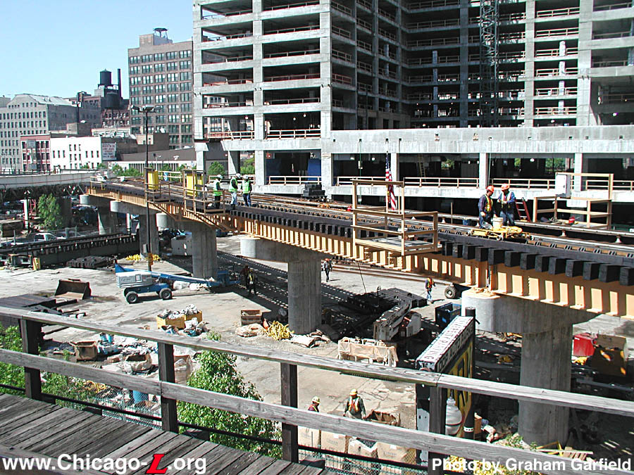
ROW@HarrisonCurve11.jpg
(225k)
The new Harrison Curve structure, seen looking west from the
current realignment, is almost totally complete on May 20,
2003, including its cantilevered platforms for signals and
equipment. The place where the new structure will connect to
the old at the south end is seen in the background. To see
how quickly the work was completed, compare with the
near-exact same view only four months before, on February
26th by clicking here.
(Photo by Graham Garfield)
|
|
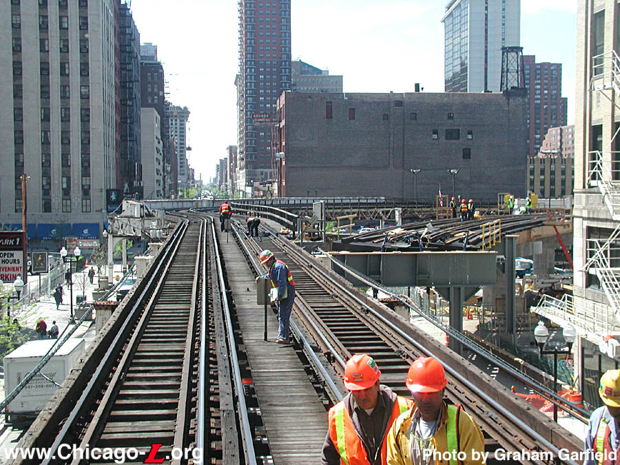
ROW@HarrisonCurve12.jpg
(225k)
Construction personnel are hard at work on May 20, 2003 to
make the final preparations and checks before the big
changeover on the weekend of May 23-27. The location where
the north end of the new structure will connect to the old
alignment over Wabash is evident. After this weekend, the
structure in the background will be taken out of service for
demolition. (Photo by Graham
Garfield)
|
|
ROW@HarrisonCurve14.jpg
(250k)
Holes and fractured sections of sidewalk where the footings
had been previously, like the one in the foreground, are all
that was left to betray the presence of the old Harrison
Curve only days before in this May 26, 2003 view looking
northwest at the new alignment in the background.
(Photo by Graham Garfield)
|
|
ROW@HarrisonCurve16.jpg
(152k)
On May 27, 2003, the new Harrison Curve was in service, as
seen in this view looking southwest as an outbound Green
Line train traverses the new alignment. Although most of the
fabrication work was done, the materials and equipment still
laying around reveal that not all the work, including
cleanup, had been completed. (Photo by
Graham Garfield)
|
|
ROW@HarrisonCurve17.jpg
(131k)
During the previous three days, this entire new section over
Wabash connecting the new curve with the old alignment --
footings, bents, spans, and all -- were erected from scratch
and is seen looking south on its first day in service on May
27, 2003. (Photo by Graham
Garfield)
|
|
ROW@HarrisonCurve18.jpg
(181k)
Looking south on Wabash from Congress Parkway on May 27,
2003, the clean steel and gentler sweep of the new alignment
stand in contrast to the older, preexisting elevated
structure. The street is still closed because much work
still needs to be completed before Wabash can reopen.
(Photo by Graham Garfield)
|
|
ROW@HarrisonCurve19.jpg
New Harrison Curve on June 19, 2006. (Photo
by William Davidson)
|
|
ROW@HarrisonCurve20.jpg
New Harrison Curve on J une 19, 2006. (Photo
by William Davidson)
|
|
.
Unusual Train Operations During Construction
|
|
cta2495.jpg
(202k)
During the three days that Harrison Curve was closed for
reconstruction, inbound Green Line trains on the Lake branch
were short-turned on the Outer Loop and displayed
"Loop"
destination signs and markers on their way east, as seen on
car 2495 stopped at Clinton
on May 26, 2003. (Photo by Graham
Garfield)
|
|
cta2523.jpg
(179k)
A Green Line train at Library station?! It happened over
Memorial Day weekend 2003, when Green Line trains from
Harlem were short-turned on the Outer Loop due to the
reconstruction of Harrison Curve. Here, car 2523 leads a
Green Line train pulling into Library
on May 26, 2003. (Photo by Graham
Garfield)
|
|
cta3378.jpg
(205k)
While Orange Line was truncated at Roosevelt over Memorial
Day weekend 2003 due to Harrison Curve reconstruction, there
would've been no service on the Inner Loop. To compensate
for this and aid in circulation of passengers around the
Loop, a shuttle was operated all weekend with Orange Line
equipment, as seen on Library
on May 26, 2003, with car 3378 leading the 4-car consist. To
see a close-up of the sign on the chains, click here.
(Photo by Graham Garfield)
|
|
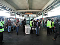
roosevelt-wabash05.jpg
(171k)
During the shutdown of Harrison Curve over Memorial Day
2003, Roosevelt/Wabash served as a stub terminal for
northbound Orange and Green line trains. The squad of vested
operating personnel, along with the paper signs on the
backlit sign, help passengers find their way in this view on
May 26, 2003. (Photo by Graham
Garfield)
|


)