|
|


|
|
|
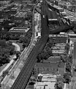
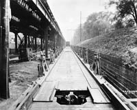
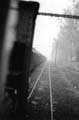
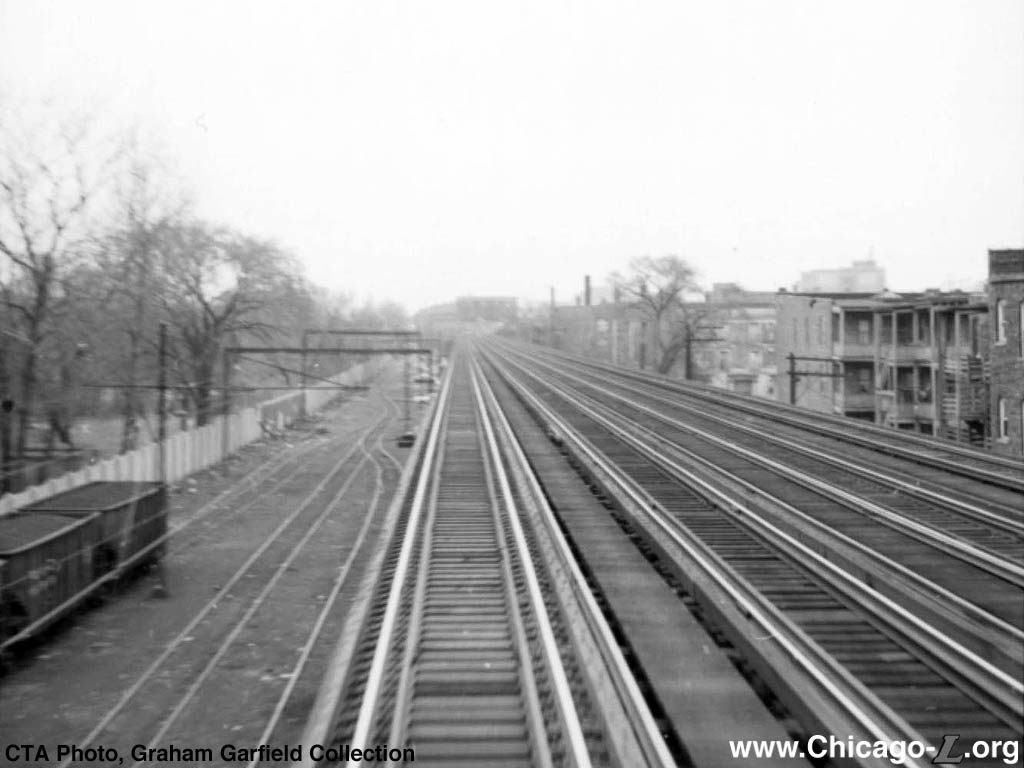
Buena Yard is seen below, on the left, from the back of a southbound train on Track 1 of the North Side Main Line, looking north on April 18, 1967. For a larger view, click here. (CTA Photo, Graham Garfield Collection) |
|
|
|
|
|
Buena Yard is seen below, on the left, from the back of a southbound train on Track 1 of the North Side Main Line, looking north on April 18, 1967. For a larger view, click here. (CTA Photo, Graham Garfield Collection) |
Buena
Yard
Buena Avenue and Kenmore
Avenue, Buena Park (Uptown)
Service Notes:
Located:
North Side Division
Serviced:
Freight interchange
Quick Facts:
Address: TBD
Established: 1920
Yard Area: unknown
Rebuilt: n/a
Status: Demolished
On May 1, 1885, the Chicago, Milwaukee & St. Paul Railway opened a steam rail line connecting the suburbs of Lakeview (annexed to the City of Chicago four years later) and Evanston to Chicago, running between Calvary Cemetery in the then-village of South Evanston and Union Station in Chicago. By mid-1889, trains ran as far north at Maple Avenue in suburban Llewellyn Park (Wilmette). Around the turn of the century, the Northwestern Elevated, which ended at Wilson and Broadway, adjacent to the CM&StP's Sheridan Park station, and the CM&StP began negotiations to extend the elevated company's trains north to the city limits and on to Evanston over the steam railway's tracks. An agreement between the Northwestern and the Milwaukee Road was reached in 1904, although franchise problems with the City of Chicago prevented finalization of the terms until 1907. "L" service was extended north of Wilson to Central in north Evanston on May 16, 1908 over the electrified St. Paul tracks. Coincident with the extension of "L" service over the St. Paul's tracks, the steam road cut their commuter operations back from Wilmette to their Sheridan Park station adjacent to the Wilson "L" stop. In June 1908, the St. Paul was running two trains a day between Union Station and Sheridan Park. They ran this limited service until June 1917, after which the former Evanston Division of the CM&StP just handled freight.
Following the extension of "L" passenger service over the CM&StP's tracks north of Wilson, Milwaukee Road freight service along the line into Evanston continued. One of the terms written into the lease agreement was that the freight service would be handled by the Northwestern Elevated for the St. Paul at cost. However, although the joint agreement assigned freight duty to the Northwestern, the St. Paul continued to operate the service This continued until 1920, when the "L" took over direct operation of the freight service.
In the 1910s, the Northwestern Elevated began the task of elevating the ground-level tracks between Howard Street and Leland Avenue. By early 1922, the new elevated, four-track main line between Lawrence and Howard was completed. Third rail was used on the three easternmost tracks, but overhead wire was retained on the western track for freight trains, which could not clear the third rail. (See the "L" Freight Service page for more details on this operation.)
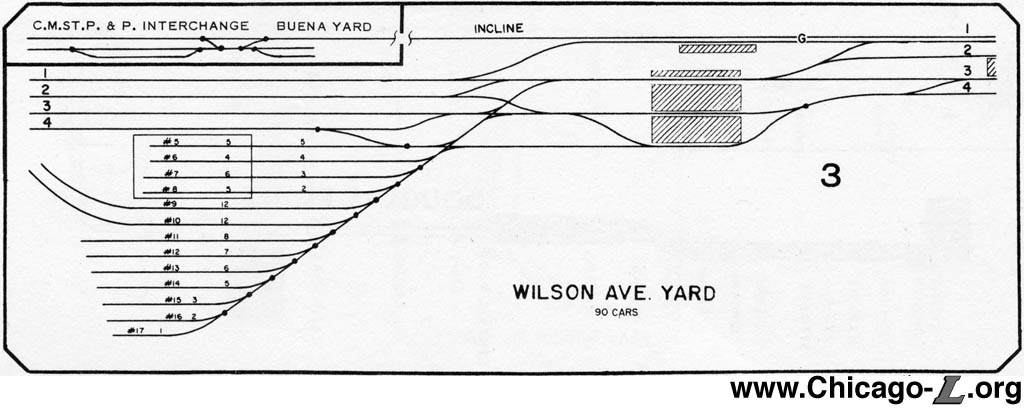
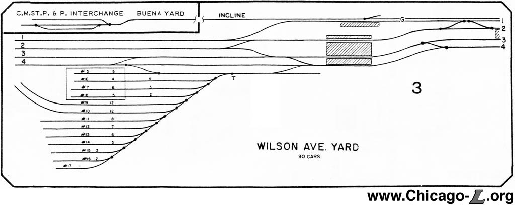
The St. Paul, later known as the Milwaukee Road, continued to haul freight north to where the "L" began operating on its former right-of-way, so an interchange yard was needed where the freight railroad could exchange cars with the "L" and vice versa. The site established for this operation was a narrow strip of land along the St. Paul's old main line between Graceland Cemetery and the elevated rapid transit structure between Montrose and Irving Park. The April 2, 1921 edition of Electric Railway Journal provided a detailed description of the yard:
The steam road leaves the cars in a receiving yard located between Irving Park Avenue and Montrose Avenue and having a capacity for thirty loaded and thirty empty cars. This yard comprises three tracks, one of which is the main line and one the storage track for loaded cars and the other the storage track for empty cars. About fifty cars a day are handled. Cars are taken from and delivered to this yard by the two electric locomotives purchased by the Northwestern for this purpose. Immediately north of the yard the track ascends a 2 per cent grade onto the elevated structure. This freight track then extends north to Howard Avenue...
The overhead construction employed is of the catenary type supported on 6-in. top 35-ft. and 50-ft. Bates expanded steel poles and steel mast arms. The poles set in the ground are all set in concrete 5 ft. deep and spaced for 150-ft. spans... In the storage yard at Irving Park Boulevard it was necessary, on account of lack of space of guy poles adjacent to the "L" structure, to support the overhead over the three tracks on a single line of poles, necessitating the use of 24-ft. mast arms on one side. The overhead equipment was of Westinghouse and Drew manufacture.
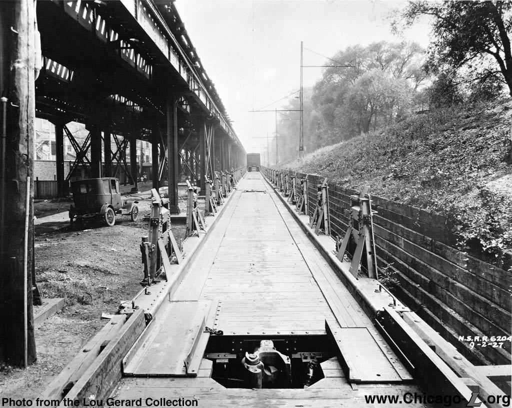
Just north of the yard, on account of the long cross-span necessary to provide for three tracks, the heavy weight of the overhead special work at that point, and short guy space, a bridge construction between Bates steel poles was employed. ... Over the incline leading up to the elevated track a double trolley was installed in order to provide more current-carrying capacity, for the two locomotives are sometimes coupled together to push heavy loads up this grade.
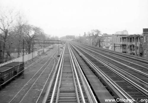
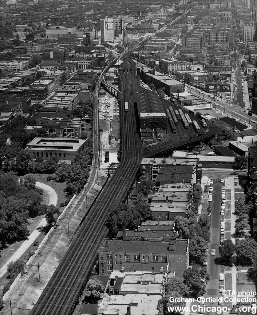
This view looking north at Wilson yard and shop on June 25, 1964 also shows the incline up from Buena Yard (lower left) and the elevated lead (center left) connecting to the North Side elevated. For a larger view, click here. (CTA Photo, Graham Garfield Collection) |
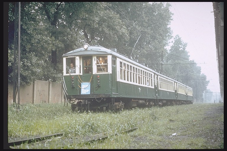
The Buena (pronounced "bewennah" by Chicagoans) Yard began at Irving Park Road, where the Milwaukee Road connected at-grade across Irving Park Road from its alignment in Seminary Avenue. There were two tracks beginning at Irving Park, with a third splitting off to the east from the easternmost the two tracks about 200 feet north of Irving Park. These three tracks ran parallel for about a 1,000 feet until just south of Buena Circle (an open area just east of the elevated structure where Buena Avenue terminated at Kenmore Avenue). The easternmost most of the three tracks was referred to as the "east track", the middle track was the "main track", and the west track was the "cemetery track". The east track merged back into the main track just south of Buena Circle, followed by a right-hand crossover between the cemetery track and main track less than 100 feet north of that. North of Buena Circle, there was a left-hand switch between the main track and the cemetery track, which merged the two into a single track to begin the incline up to meet the elevated. Between the two switches on either side of Buena Circle, the west track was known as "the pocket".1 In earlier years, a spur continued north at ground level along the main track alignment from the left-hand crossover leading to a set of tracks that ended mid-block between Buena and Montrose; these were used for loading cars for the North Shore Line interurban's ferry truck freight service. These tracks were removed by 1963, with the left-hand crossover replaced with a turnout the merged the main track into the pocket track.
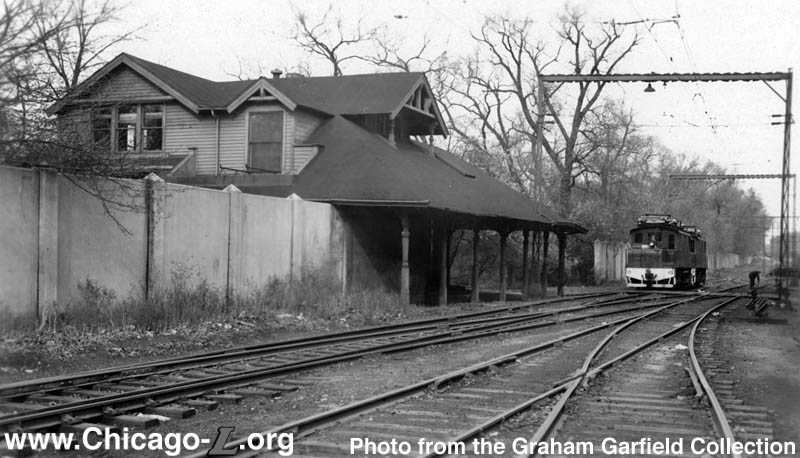
Centered in the yard was the CM&StP's Graceland station, which had ceased to function as a passenger station in 1917. There were actually two St. Paul Graceland station houses -- a dark brick structure on the east side of the tracks and a second clapboard station house on the west side, partially on cemetery land. The "L" structure was actually built over the east station house and the Buena "L" station platforms built above it. The "L" used part of the old St. Paul station for the "L" station, while the remainder was used as a freight office. The west station house may have been built after the Northwestern Elevated began using the older east station house. By 1924, the west station house was being used as an office by the Graceland Cemetery Association; it was demolished by 1967 and likely earlier. Meanwhile, the east building continued to function as an "L" station until the Buena rapid transit station closed in 1949. After this, it continued in use as a freight office into the 1960s. In 1961 or '62, a partial demolition of the building was performed. Half of the station house was removed and the open end of the remaining half was bricked up. It may have been used for storage after that. When the other half was removed is unclear. Today, the entire station is gone.
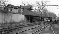
This view looking south in Buena Yard shows the "L"'s two electric freight locomotives parked midday between runs, with the former St. Paul Graceland station, which housed the Graceland Cemetery Association by the 1920s. For a larger view, click here. (Photo from the Graham Garfield Collection) |
Buena Yard was a tight space with little track space either to store cars or to switch cars around to easily make up trains in the desired order for the trip north to the customers' sidings. Making up a fair-sized train in the proper switching order within Buena Yard was almost impossible due to there being neither enough room nor enough switches to make all the moves that might be required. As a result, crews would often take train train north to Lill Coal, a company with sidings opposite the Berwyn station, and make up the train there.2
The neighborhood surrounding Buena Yard was rough in the later days of freight service. There were many nights when switchmen did not want to get off the freight locomotives alone. Vandalism was also frequent, from graffiti to hoodlums opening the doors on the bottom of hopper cars, burying their wheels in gravel or other contents. (This was no small thing to clean up, since the doors couldn't be closed with a load on them. As a result, the car would have to be emptied from the top to relieve the pressure, requiring the overhead wires to be spread so a bucket could get access to the top of the hopper.) Other times, crews would arrive back at the yard early in the morning to find unexpected things on the tracks, from debris to snowmen to amorous couples.3
By the late 1960s, railroads were fighting a losing battle nationally for their share of freight traffic, and in an effort to drum up additional business, in the early 1970s, the Milwaukee Road implemented a tariff which gave customers a special rate for batches of 45 cars. While producing economies of scale for the Milwaukee Road, handling that many cars at once was a problem for the "L". Lill Coal, a customer at Berwyn, took advantage of this discount and 45 cars would show up all at once at Buena Yard. The "L" freight crew couldn't handle that many cars at once, so the Milwaukee Road would spot the cars south of Irving Park Road along Seminary Street and would move them up into Buena as the CTA crew and Lill could handle them.4
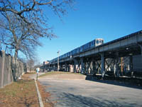
In the 1990s, the former Buena Yard was converted into a parking lot and park, with paths and an enclosed dog-friendly area. This view looks north at what was the middle of Buena Yard on January 2, 2011, as a 95th-bound Red Line train passes above. For a larger view, click here. (Photo by Graham Garfield) |
By the 1970s, several factors were spelling the end for CTA's freight service. The operation was becoming costly, with per-car switching costs on the order of $50.5 The CTA had safety concerns over various aspects of the operation, including the need to push the 18 empty cars back to Buena due to the Milwaukee Road's tariff and the switch layout at Lill. Customers were drying up. By 1973, there was just one freight customer left: the Lill Coal Company, located just opposite the Berwyn station. On April 30, 1973, the last freight cars returned to Buena Yard, marking the end of a unique operation.
The narrow sliver of land between the North Side Main Line elevated structure and Graceland Cemetery that once housed Buena Yard was essentially abandoned in the decades following the closure of the interchange yard. In 1990, Mayor Richard M. Daley announced plans for the creation of a park on the former yard site through a public-private effort involving the City of Chicago, the Chicago Park District, the Chicago Transit Authority, and the Chicago Cubs. The city and park district financed the project, supplemented by donations from Cubs Care, the Graceland Cemetery Trustees, and the Chauncey and Marion Deering McCormick Foundation. The 1991, project transformed the half-mile stretch of land into a linear park with native trees, grasses, wildflowers, jogging and walking paths, new sewers, lighting, and a new alley running underneath the elevated track structure. The project also included a dual-purpose basketball court and parking lot. During Cubs game days, the paved court provides a 200-car lot patrolled by Cubs security personnel. The Chicago Park District named the site Challenger Park in memory of the Challenger Space Shuttle disaster of January 28, 1986.6
The through girder bridge with ballasted deck that carried the freight lead over Montrose Avenue was removed on September 26, 1998. The Chicago Department of Transportation removed it as part of an improvement project on Montrose. The bridge itself was preserved, brought to the Illinois Railway Museum two days later as three 15-foot wide loads. IRM planned to use it to bridge a creek.
The single-track concrete elevated structure that connected the former yard and bridge over Montrose to the North Side Main Line remained in place north of Montrose Avenue for many years, into the late 2000s. In 2010, a large section between the divergence where Track 1 returns to the main line and a spot south of Sunnyside Avenue was removed to allow construction of a parking deck for the adjacent Truman College. The short section between this point and Montrose Avenue is still extant as of 2011.
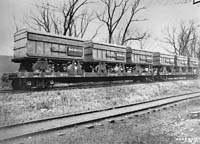 |
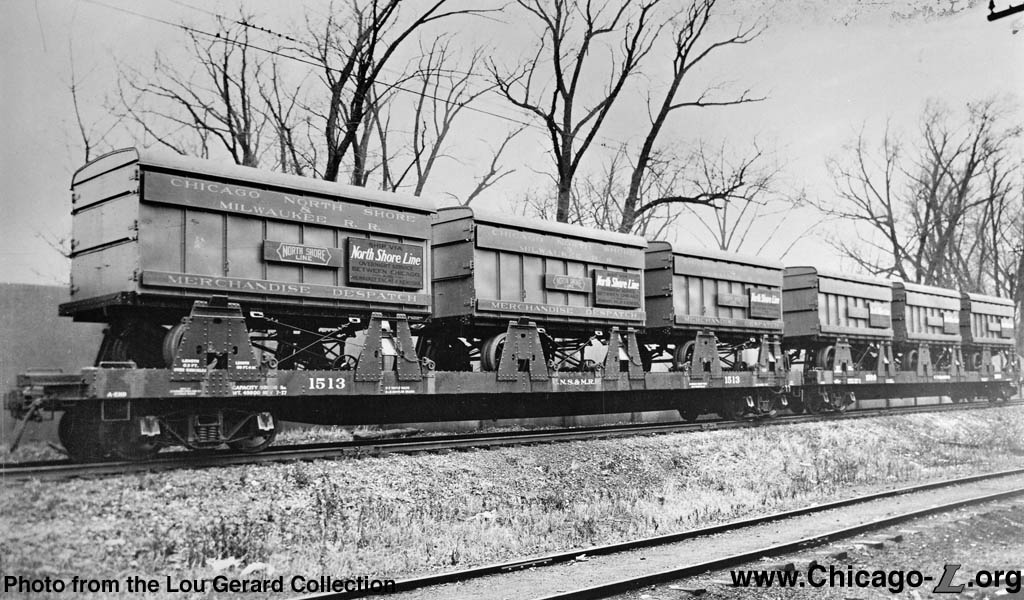
cnsm1513.jpg (219k) North Shore Line flatcar 1513 is shown loaded with piggyback containers on the incline from the Buena Yard to the elevated on November 28, 1927. Car 1513 was one of 10 flats purchased in 1927 to accommodate the interurban's growing ferry truck freight service, joining 10 shorter flat cars bought the previous year for the same purpose. The cars were specifically designed to hold the truck-trailer containers, which were transferred from the trucks to the trains at the Montrose ramp in Buena Yard. (Photo from the Lou Gerard Collection) |
 |
MontrosePiggybackRamp01.jpg (222k) This view looking south shows a long row of piggyback container-equipped flatcars backed up to the Montrose ramp on September 2, 1927. The coupler of the last flatcar is visible on the bottom. The metal uprights on the sides of the flatcars are the armatures that the containers were secured to. A container is seen in the distance, secured to a flatcar several cars down in the consist. The incline up to the elevated from the yard is seen on the right, while the North Side Main Line "L" structure is on the left. (Photo from the Lou Gerard Collection) |
 |
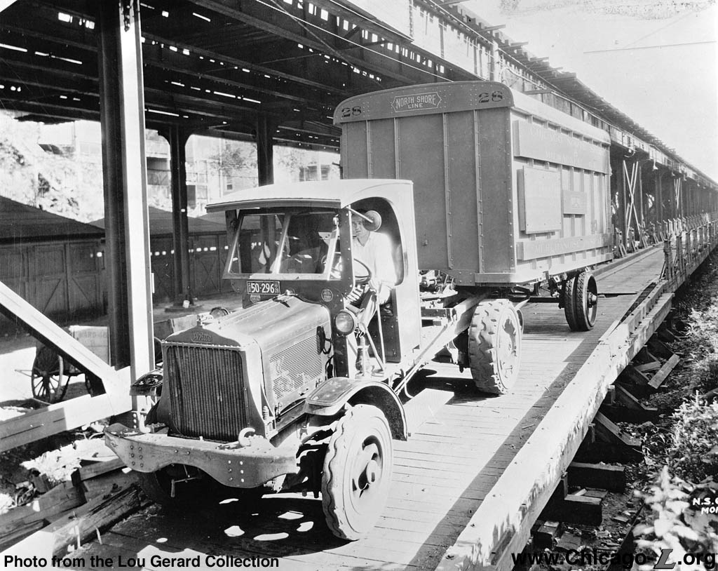
MontrosePiggybackRamp02.jpg (195k) A ferry truck backs up the Montrose Avenue ramp and onto a string of waiting flatcars specially designed to secure the containers on September 2, 1927. Loading of the containers onto the flatcars was accomplished by backing one trailer at a time up a ramp and onto the flatcars, a procedure still used today for "piggyback" freight operations. The North Shore Line reported it took an average loading time of nine minutes at Montrose in Chicago where only one ramp was available, whereas it took an average of only two minutes at Harrison Street Milwaukee where several ramps were available. (Photo from the Lou Gerard Collection) |
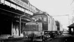 |
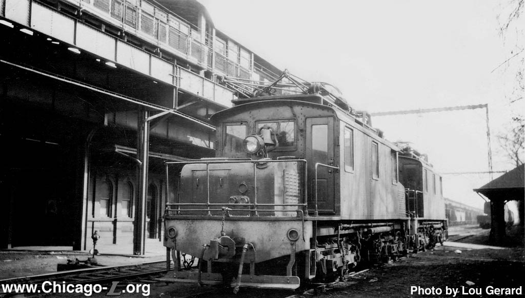
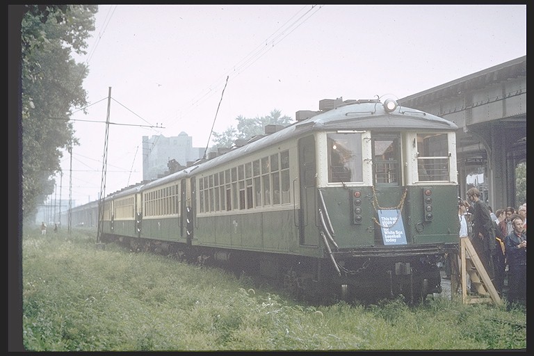
ctaS-104m.jpg (108k) In this 1940s view looking south in Buena Yard, S-104 and S-105 sit between freight trips, awaiting their next assignment. The CM&StP's old Graceland station (later converted for use as a cemetery office) is seen on the right, while the joint "L"/CM&StP Buena station is seen on the left, with the "L" platform above. The Buena station house was later used as a yard office for the "L" freight operation. (Photo by Lou Gerard) |
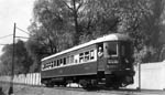 |
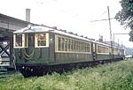
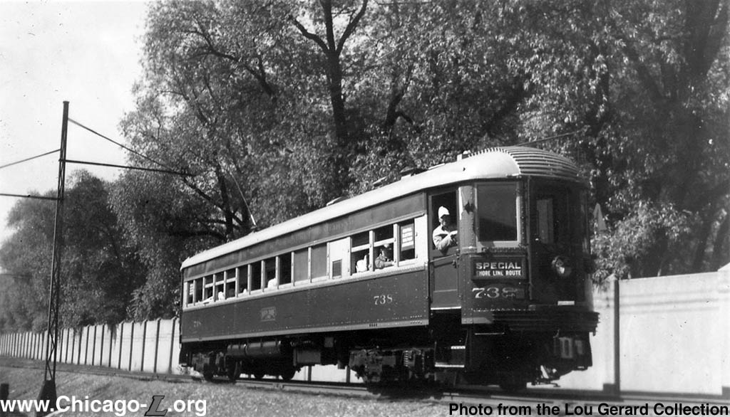
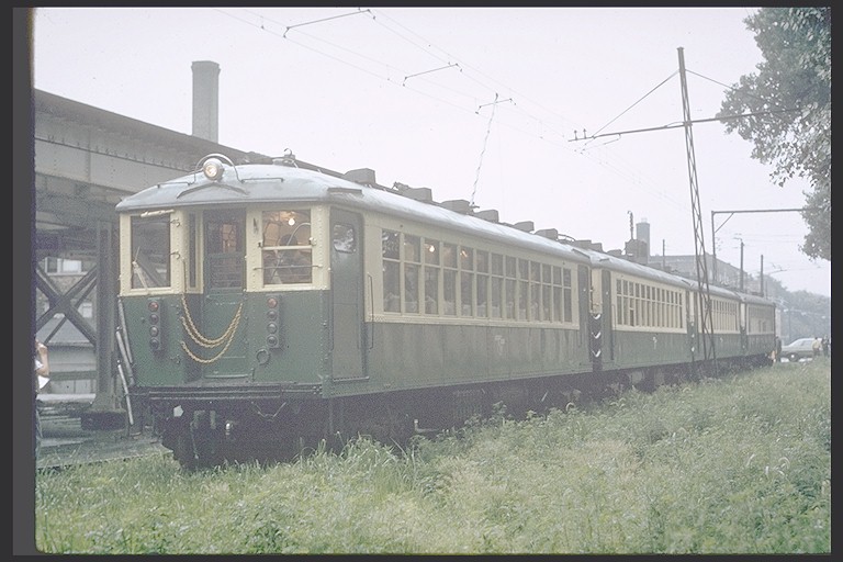
cnsm738.jpg (132k) Coach 738 is in an unusual location -- in Buena Yard, on the incline up to the elevated tracks. The occasion for bringing the passenger car down to the freight yard was CERA fantrip #21 -- fan inspection trips often went to unusual locations for purposes of interest, novelty, and interesting photo opportunities. Built by Pullman in 1928, this car has gone through the "Skokie Valley Modernization" program inaugurated in 1940 and has been repainted in the "Greenliner" livery. (Photo from the Lou Gerard Collection) |
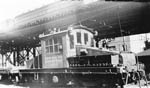 |
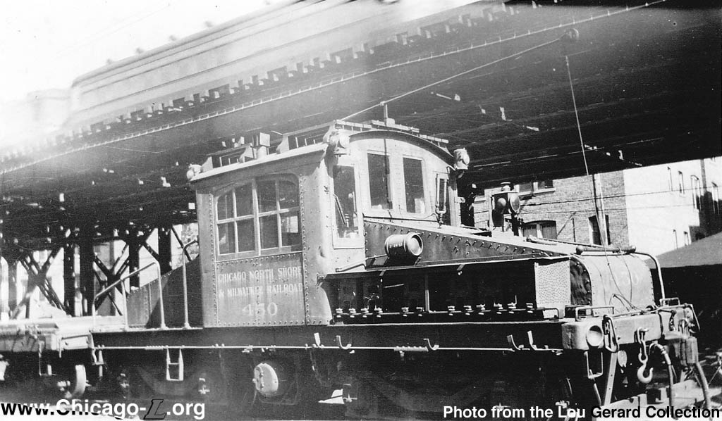
cnsm450.jpg (135k) Electric freight locomotive 450 is on the ferry truck loading ramp south of Montrose in Buena Yard, with the flatcars for the "piggyback" containers coupled to the locomotive on the left. The unit still has the carrier lettered on its side, rather than the North Shore Line herald it would later have. Locomotive 450 would be sold to the Commonwealth Edison Company in 1948, a year after merchandise despatch service ended. (Photo from the Lou Gerard Collection) |
 |
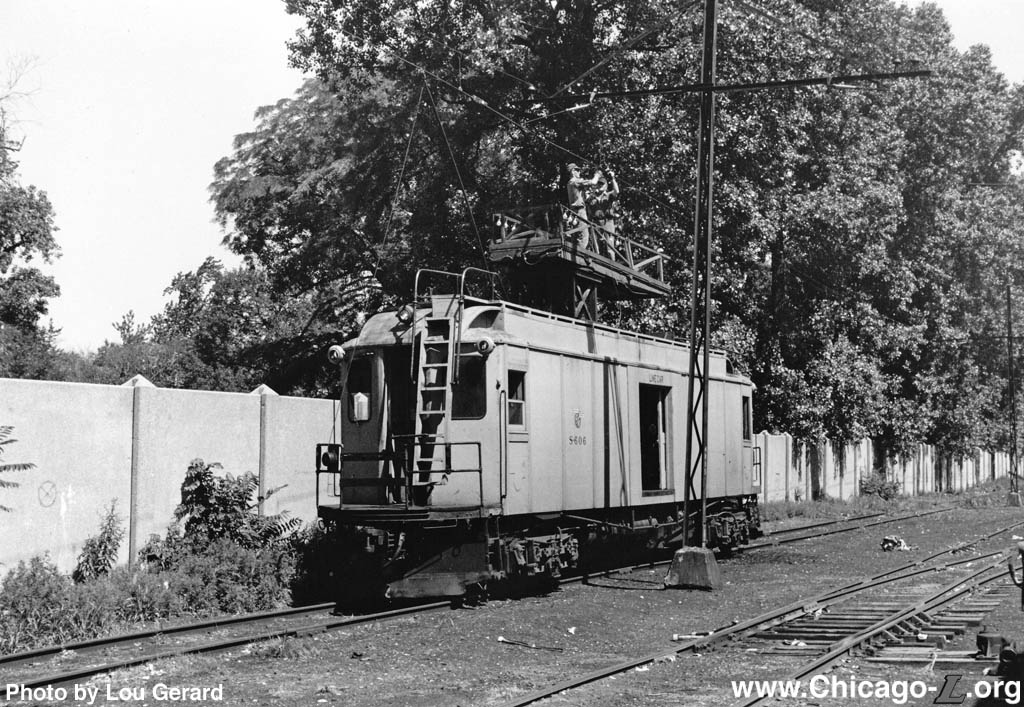
ctaS-606b.jpg (218k) Linemen are working to maintain the overhead wires in Buena Yard in July 1971, utilizing line car S-606 to access the wires. In less than half a decade, Buena Yard would be closed. Like other cars in the CTA service fleet, S-606 was painted yellow. The overhead wire poles and equipment were manufactured by Westinghouse and Drew. Due to a lack of space, the use of 24-foot mast arms on one side on a single line of poles were required in some parts of the yard to support the overhead over the three tracks . (Photo by Lou Gerard) |
 |
cta4272j.jpg
(105k) |
 |
cta4453.jpg
(143k) |
 |
cta4453b.jpg
(106k) |
 |
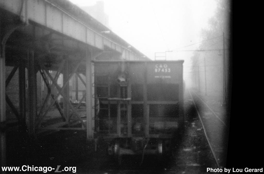
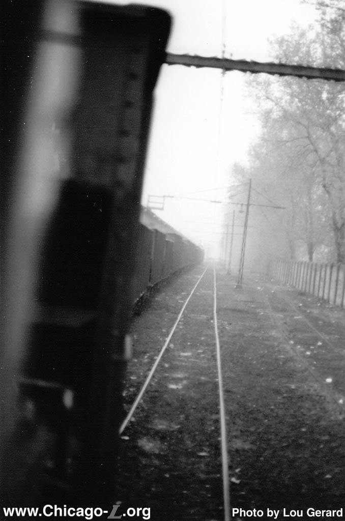
buena03.jpg (75k) Looking south from inside one of the freight locomotives, a Chesapeake and Ohio Railway hopper car is on the rear of a long string of freight cars in Buena Yard on the last day of "L" freight service, April 30, 1973. (Photo by Lou Gerard) |
 |
buena04.jpg (85k) A long consist of freight cars lines the East Track in Buena Yard on April 30, 1973, looking south. These would be the final freight cars handled by the "L", as freight service on the CTA was over the following day. The weather that day was damp and rainy. (Photo by Lou Gerard) |
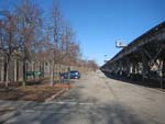 |
buena05.jpg (188k) The south end of Challenger Park -- the portion occupied by a parking lot -- is seen looking north from Irving Park Road on January 2, 2011. This was the farthest end of the former Buena Yard. Two tracks (later just one) continued out of the yard and across Irving Park Road to connect to the St. Paul (Milwaukee Road) tracks that headed south to downtown and connections to the rest of the CM&StP divisions and other rail lines. The Red Line elevated is on the right. (Photo by Graham Garfield) |
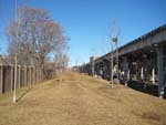 |
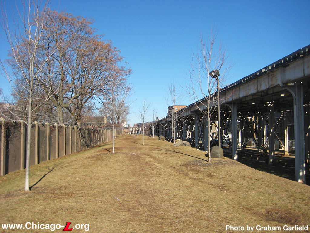
buena07.jpg (212k) The north half of the former Buena Yard is seen looking north on January 2, 2011, now converted to Challenger Park. The earthen incline leading up to the connection with the elevated tracks was on the left, while the North Shore Line's ferry truck loading ramp was on the right. Graceland Cemetery is on the left beyond the concrete wall. (Photo by Graham Garfield) |
 |
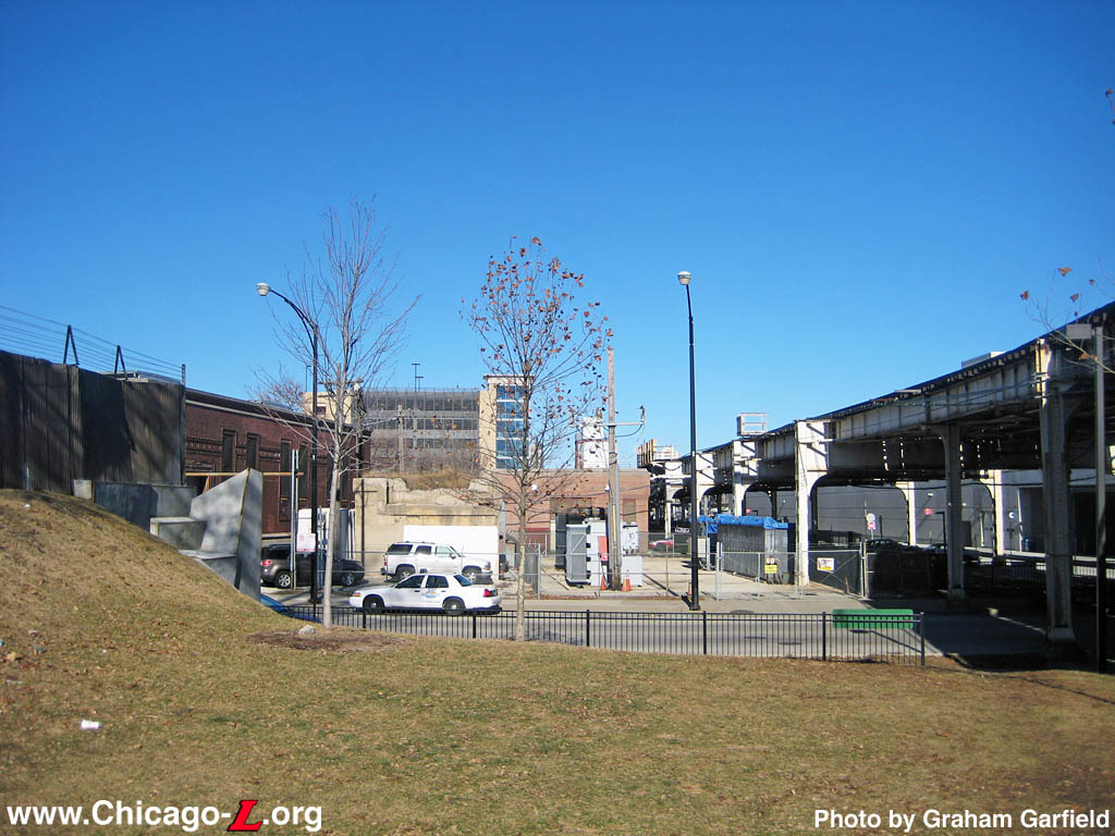
buena08.jpg (168k) The north end of the former Buena Yard, at Montrose Avenue, is seen here, looking north on January 2, 2011. The end of the incline up to the elevated track level was on the left, leading to a steel bridge over the street. The concrete abutment that supported the bridge's north end is visible across the street. The North Shore Line's Montrose merchandise despatch/freight house was across the street, between the concrete bridge abutment and the elevated structure on the far right. The old Clifton Substation is visible in the left background, whose electrical current conversion duties have been taken over by the new low brick substation building visible in the center background. (Photo by Graham Garfield) |
|
|
|