|
|
|


![]()
![]()
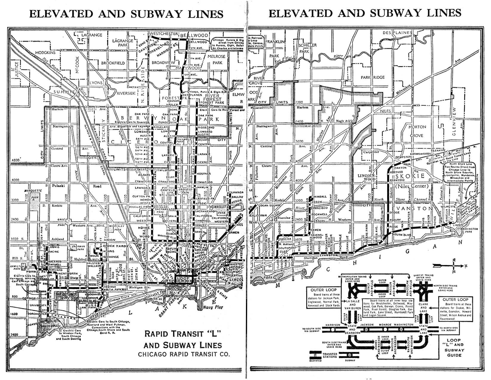
Route Maps
|
|
|
![]()
![]()
Route Maps
These files are scans of authentic antique and contemporary "L" maps from throughout the century. Just click on a name to see a large image of the map, cover, or inside booklet pages.
For those users with slower connections or who do not wish to wait for these to download, we offer lower resolution verions of some of our larger map files. Although these are less reabable, they still give a good idea of what the maps look like.
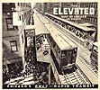
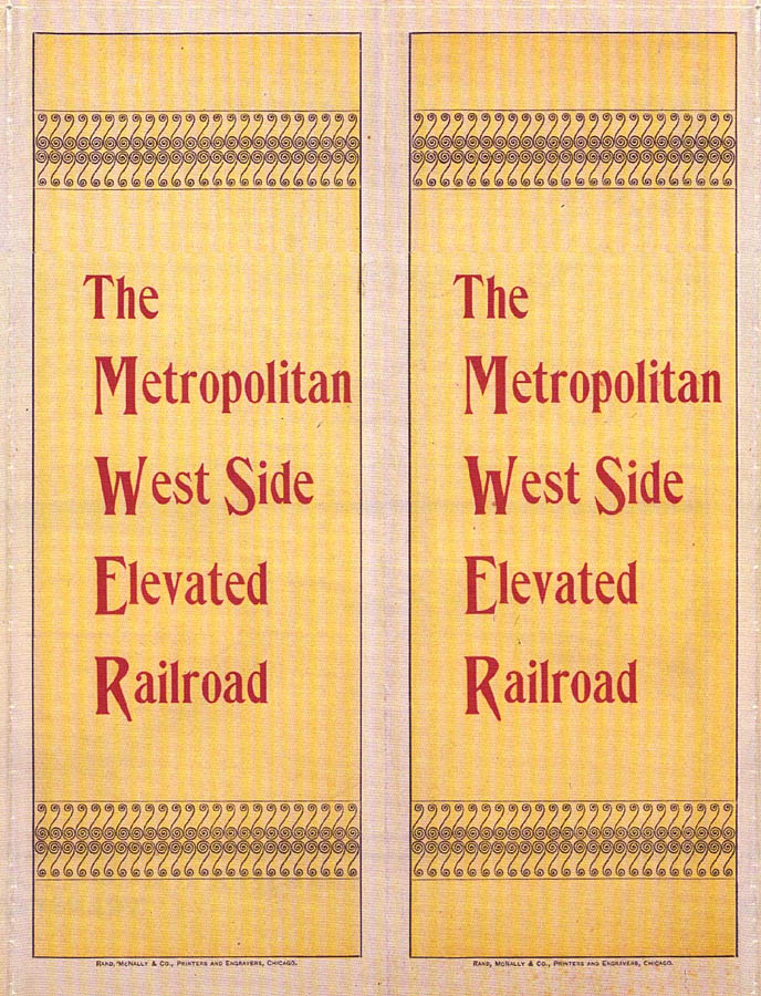
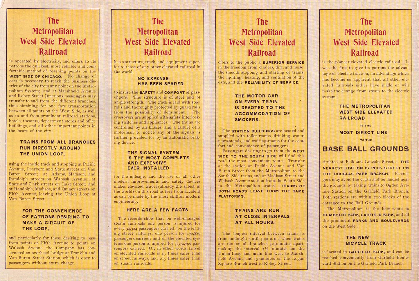
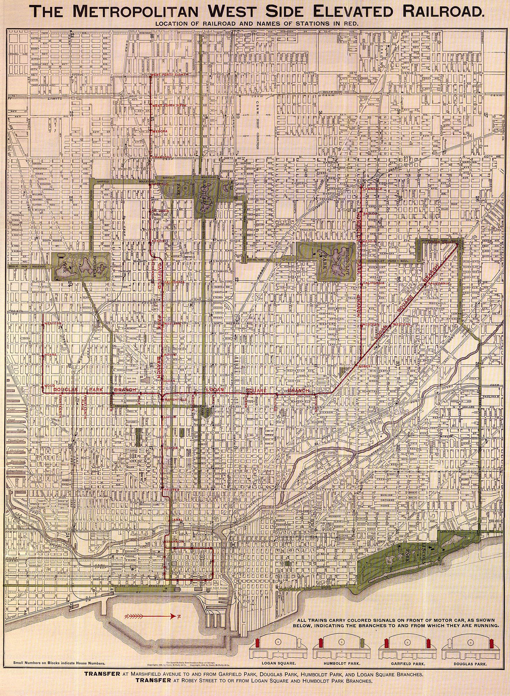
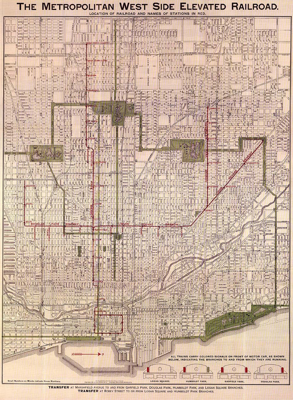
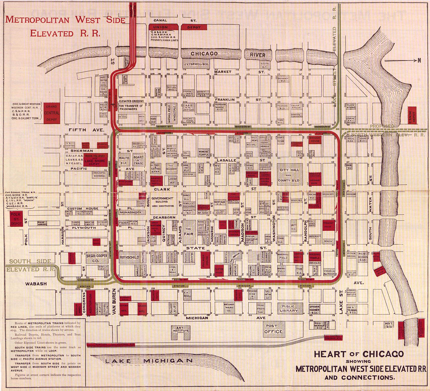
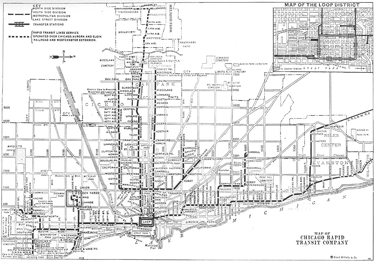
Metropolitan West Side Elevated
Railroad 1898 •
Cover
(196k) None

![]()
![]()
![]()
•
Pamphlet
Detail: Route and Rding Information
(336k)
•
Metropolitan
Elevated Map
(1.5MB)
[Low
resolution
(460k)]
•
Loop
Map (544k)
![]()
1913
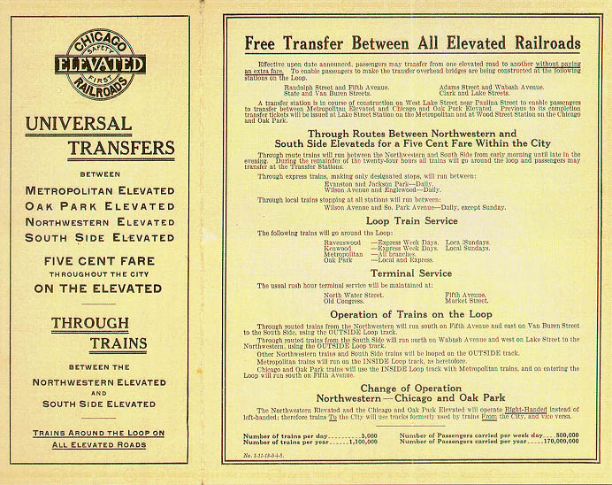
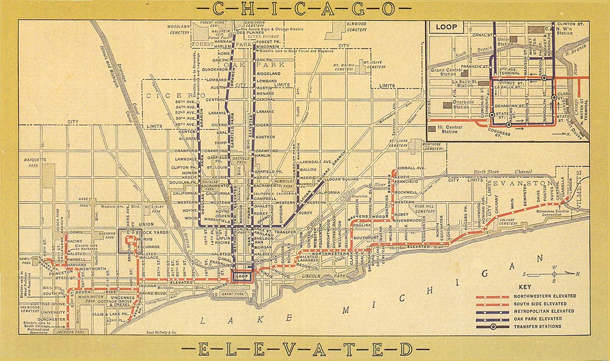
Chicago Elevated Railways 1913 •
Cover
(168k) Issued to announce universal
transfers, which took effect November 3, 1913
![]()
![]()
![]()
![]()
•
System
Map (276k)
![]()
1925
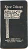
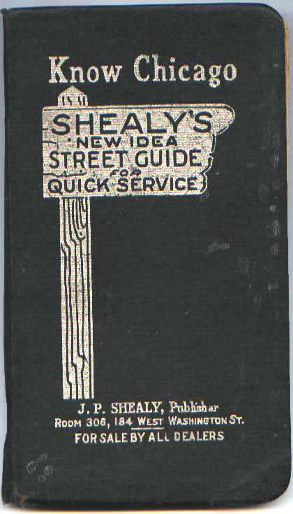
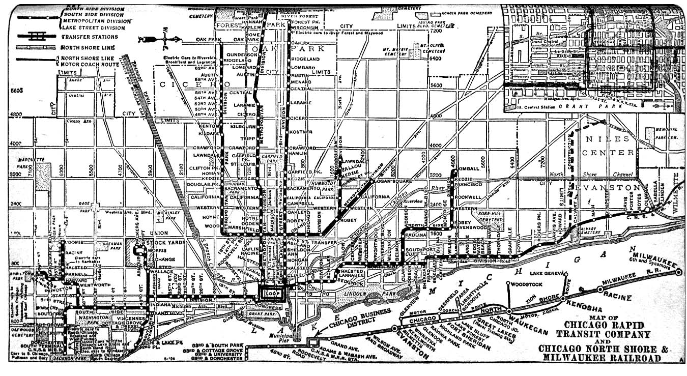
J.P. Shealy Street Guide 1925 •
Cover
(68k) Map of the Chicago Rapid Transit and
North Shore Line systems. Map shows the Niles Center (Skokie)
branch under construction.
![]()
![]()
![]()
•
System
Map (336k)
![]()
1926
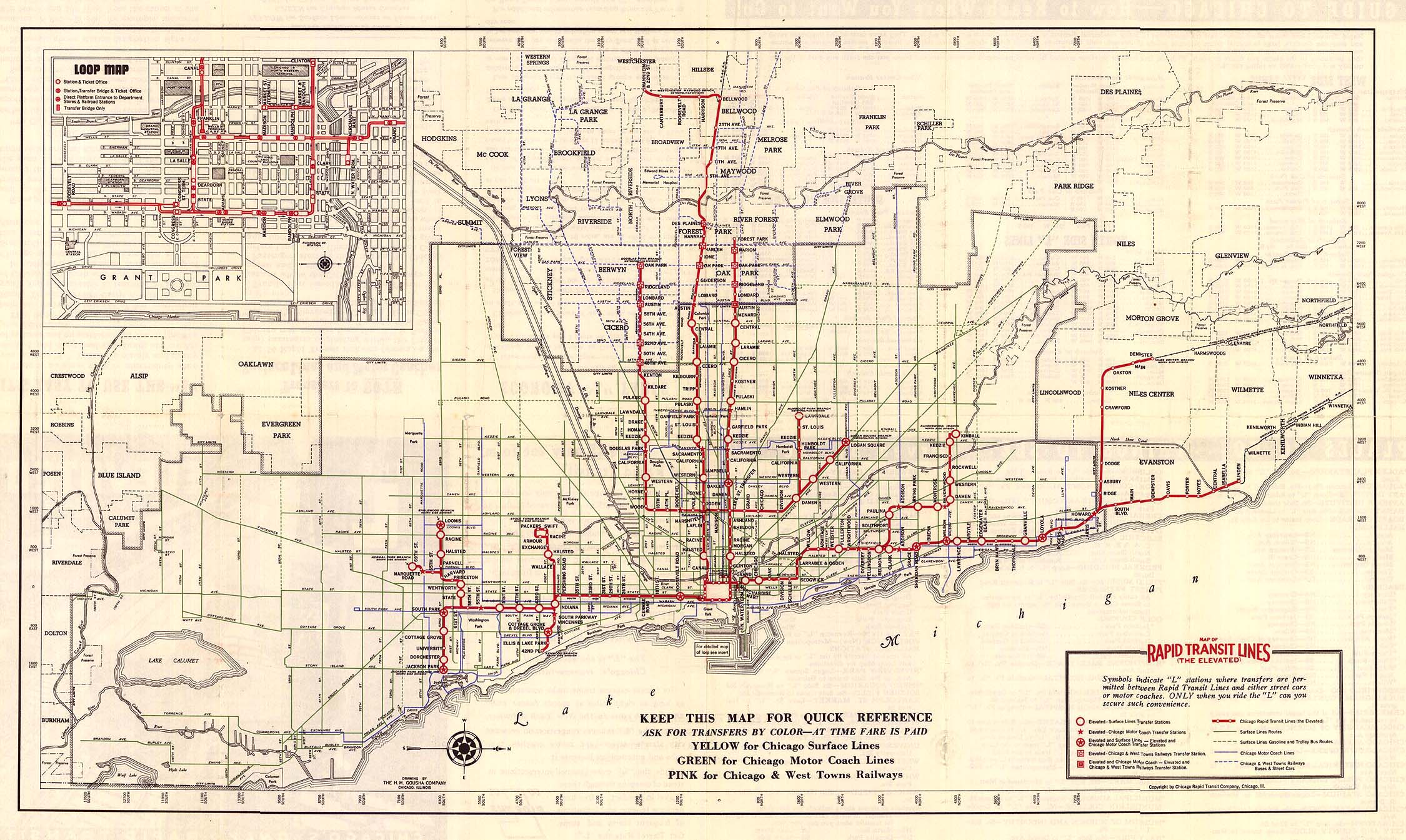
Rand McNally & Co. 1926 • System
Map (280k) None.
![]()
![]()
![]()
![]()
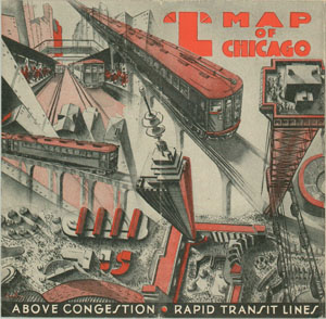
1933 NEW
|
|
Chicago Rapid Transit |
|
1933 |
|
|
• Cover (1.2MB) |
|
|
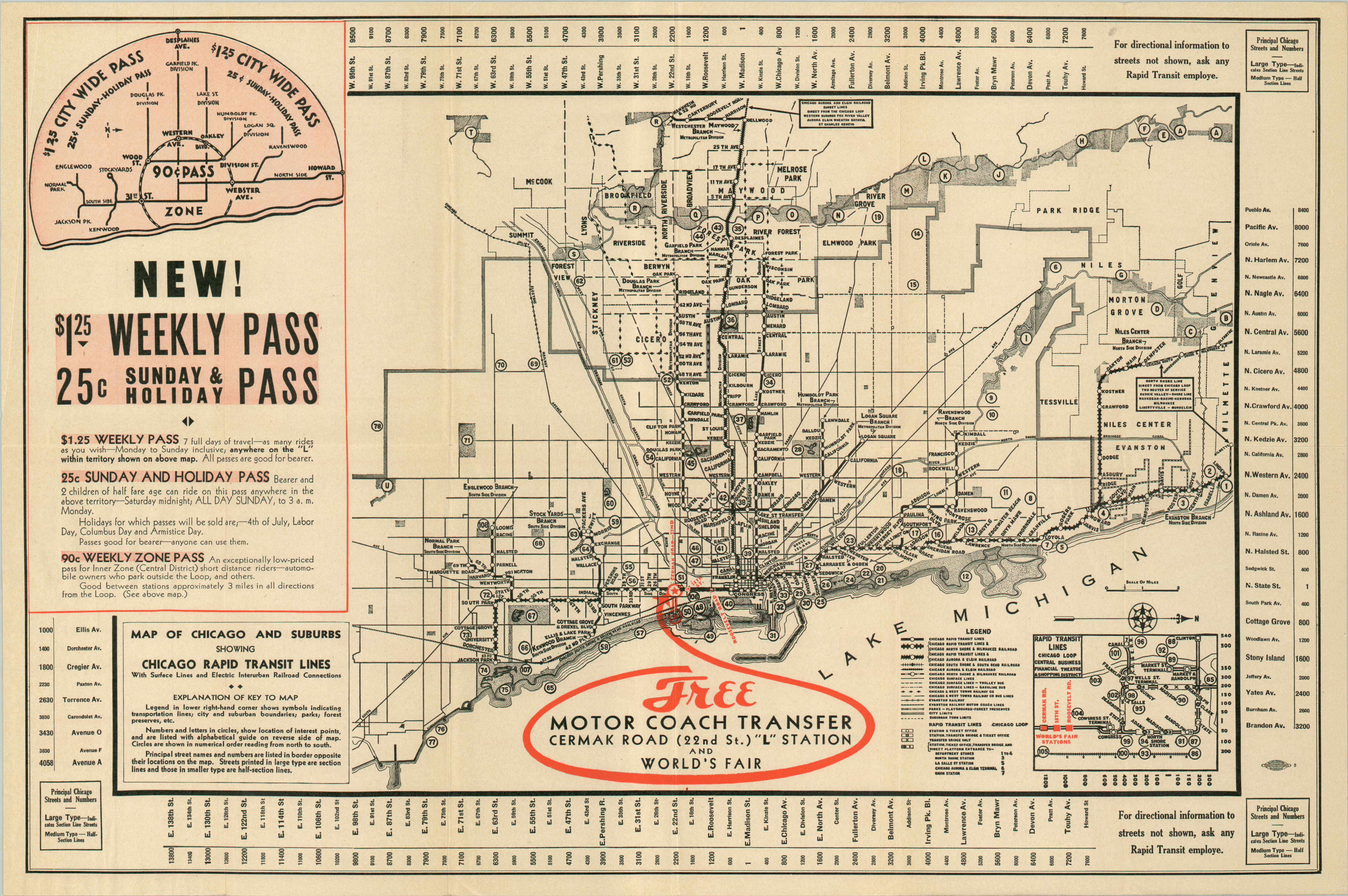
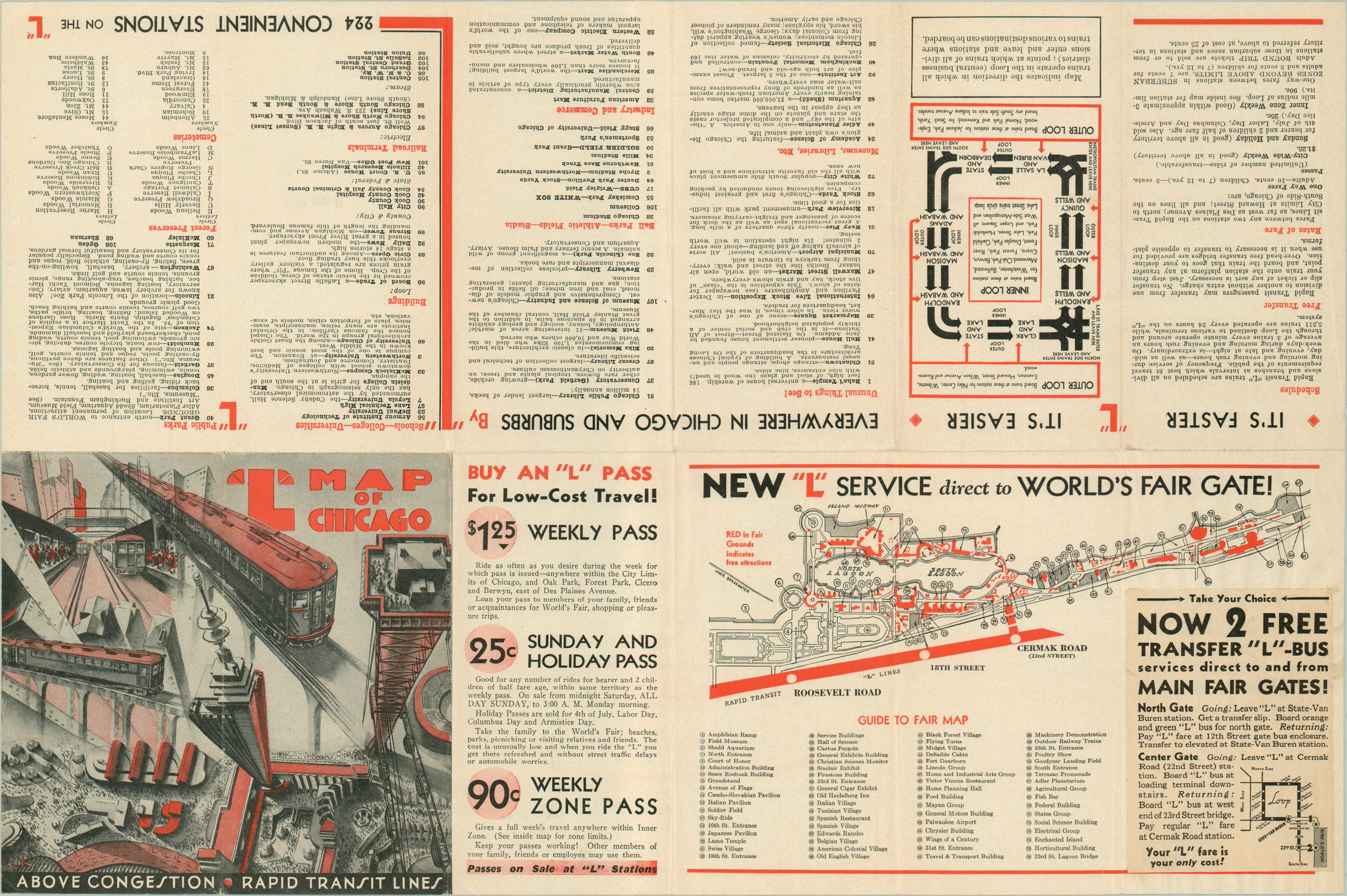
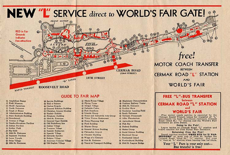
Depicts the system as it had appeared since 1930, when the Westchester branch reached 22nd/Mannheim. Published for the Century of Progress (1933-34 World's Fair). The complete back scan includes a pasted update on the New "L" Service Direct to World's Fair Gate pane, adding motor coach service to the fair from State/Van Buren in addition to from Cermak Road. The original panel scan shows what that panel looked like originally, without the patch, listing only bus shuttle service from Cermak. |
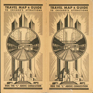
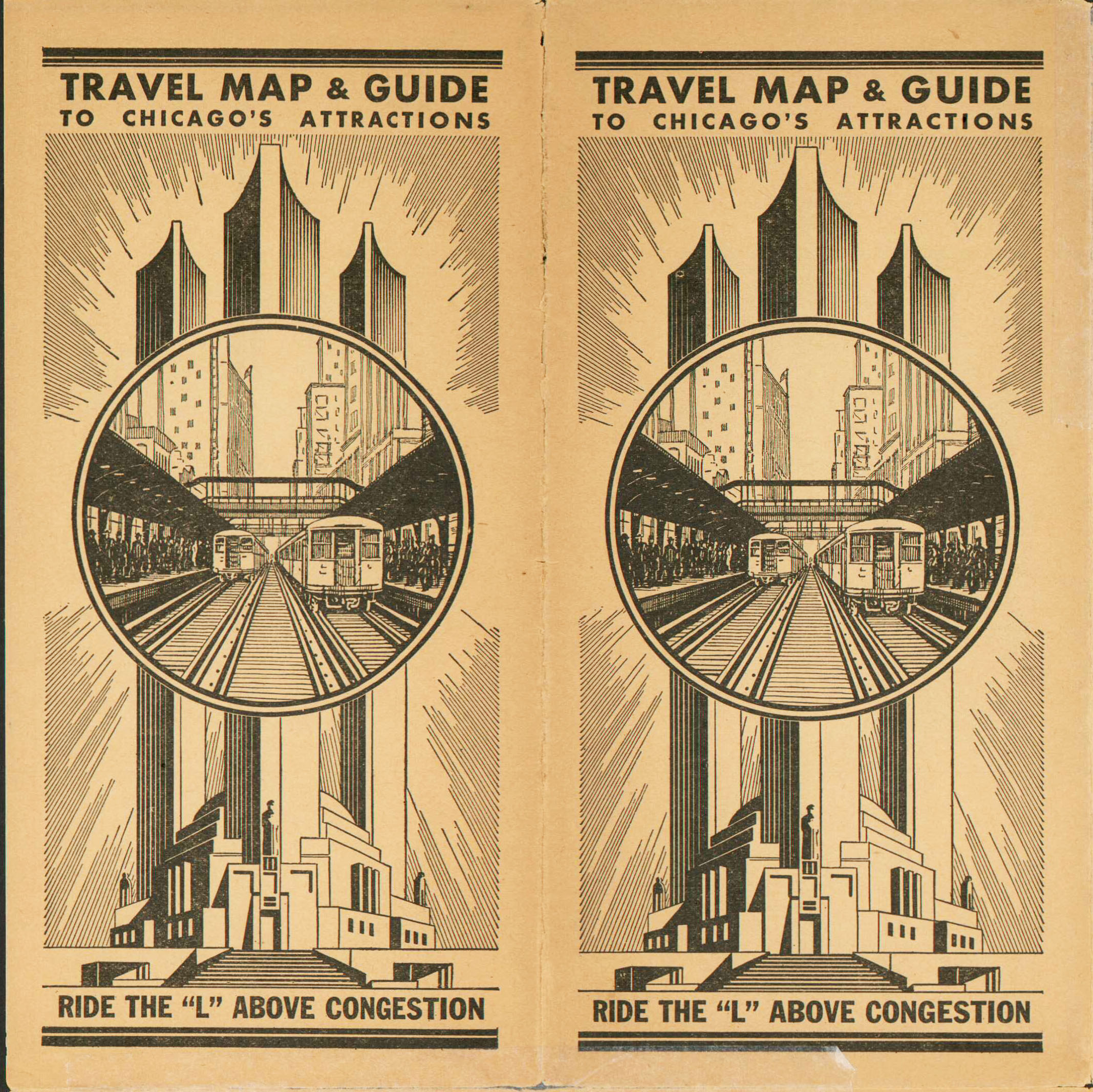
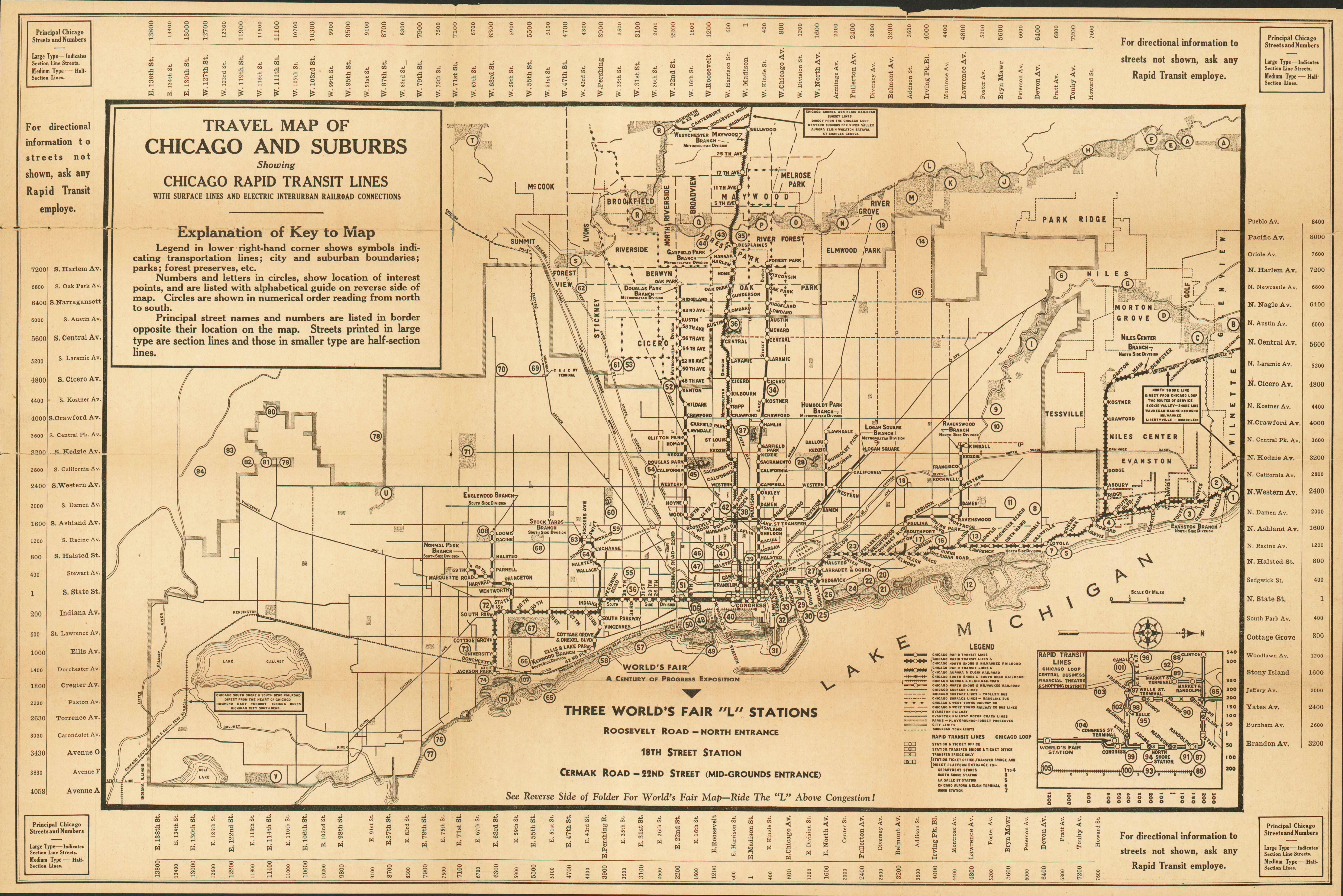
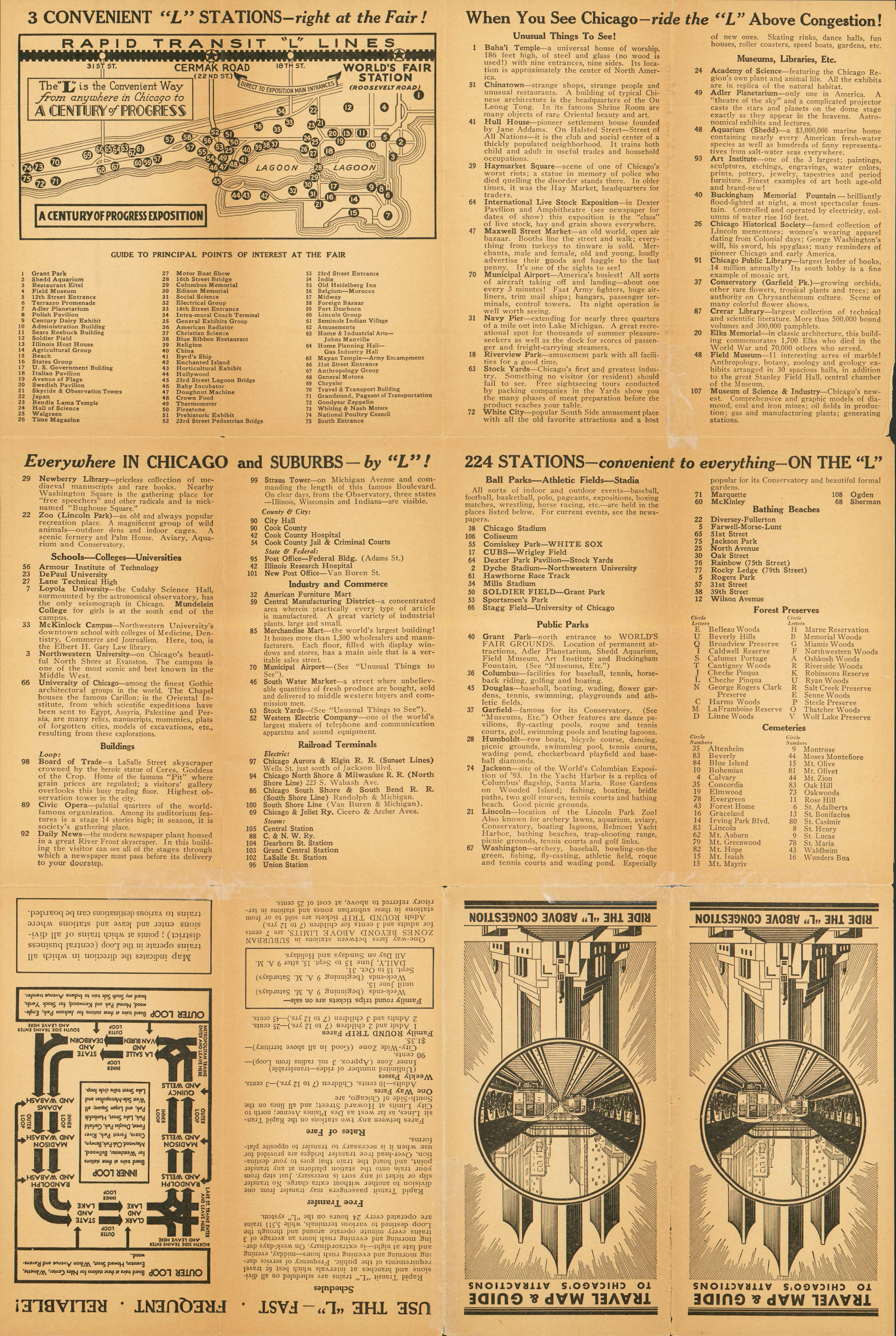
Chicago Rapid Transit 1933 • Cover (1.1MB) Titled "Travel Map and Guide to Chicago's Attractions", this map edition was also published to coincide with the Century of Progress fair, and included not only information about how to get to the fair but information about points of interest and sightseeing by the "L".
![]()
![]()
![]()
• Front/System
Map (4.6MB)
• Back/Service Information (5.4MB)
![]()
1934
Chicago Rapid Transit 1934 • Cover (112k) None.
![]()
![]()
![]()
• Front/System
Map (592k)
![]()
1935 NEW
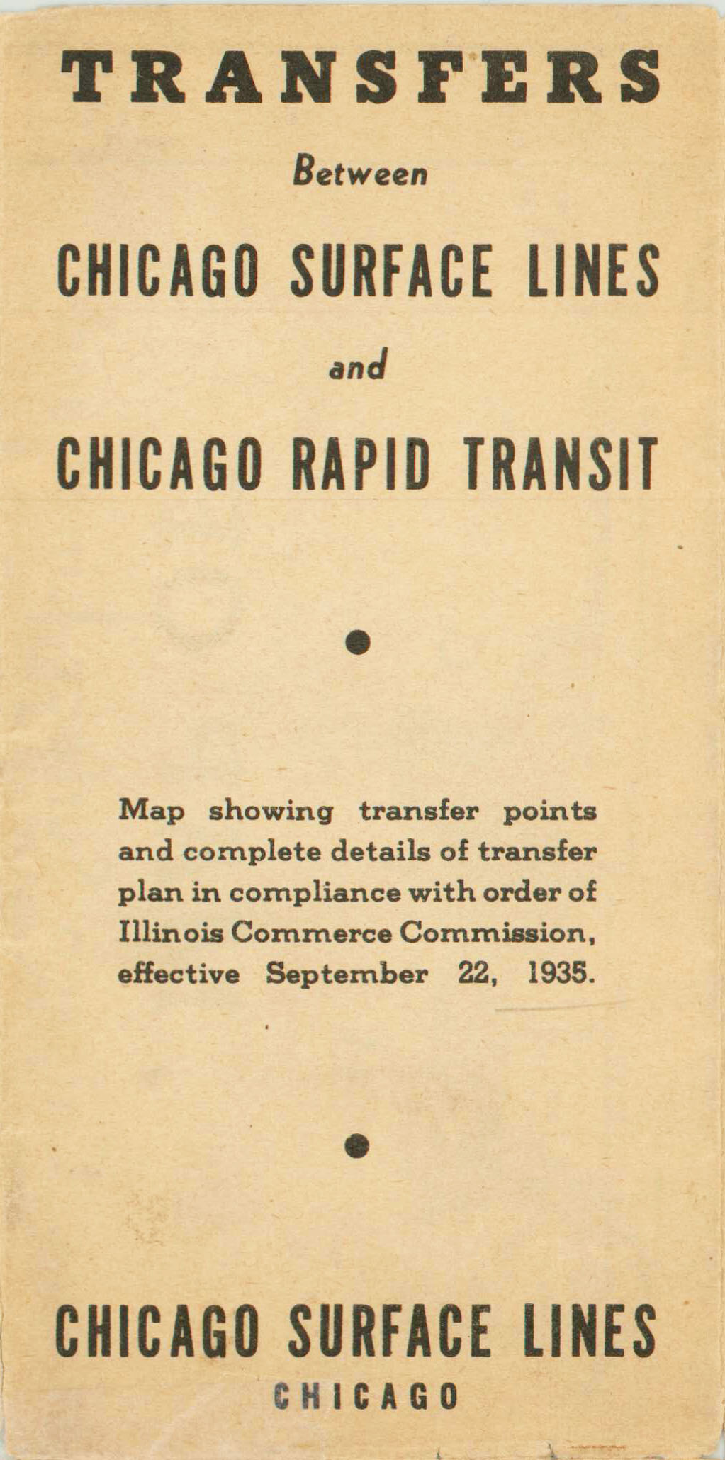
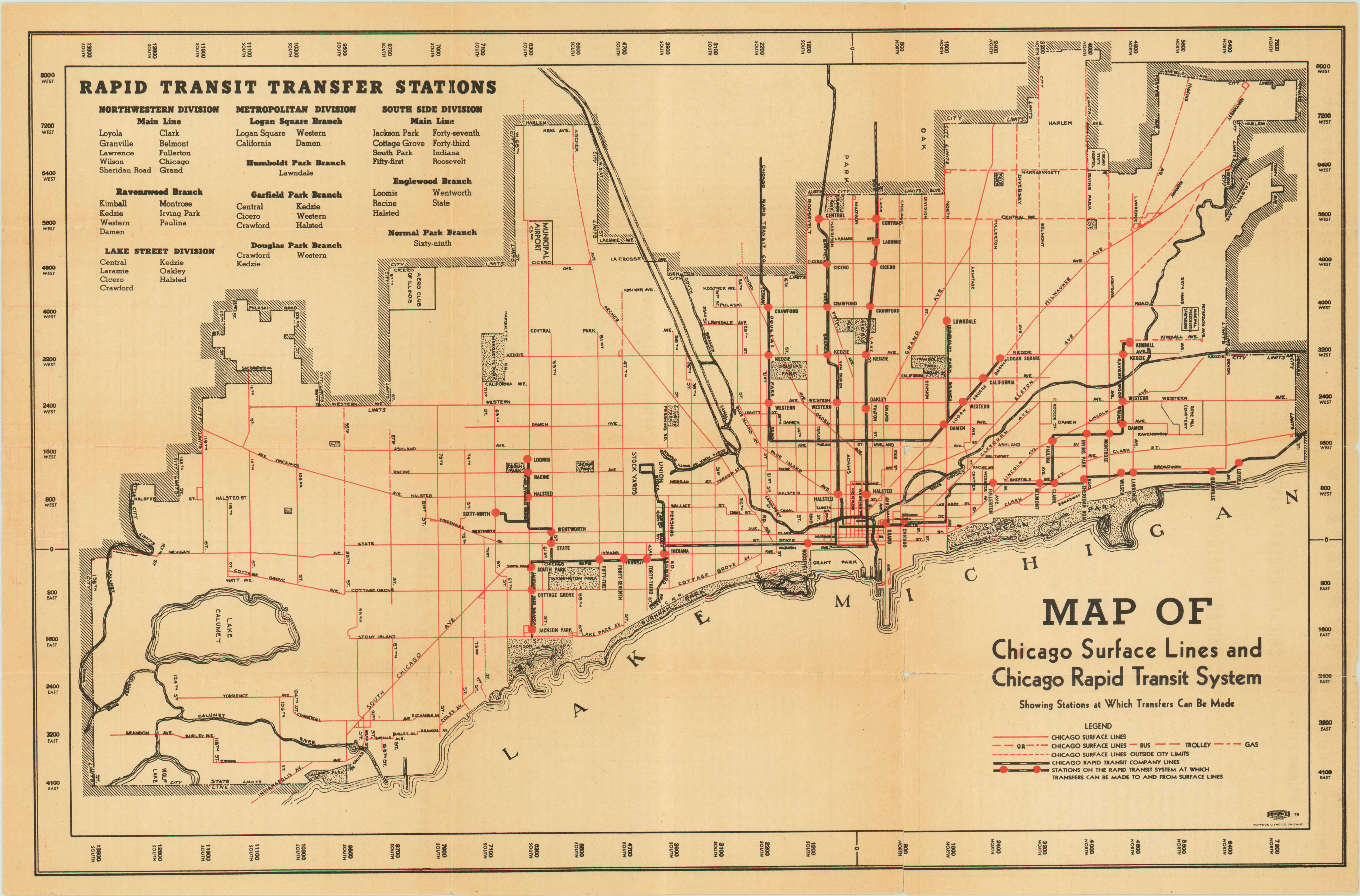
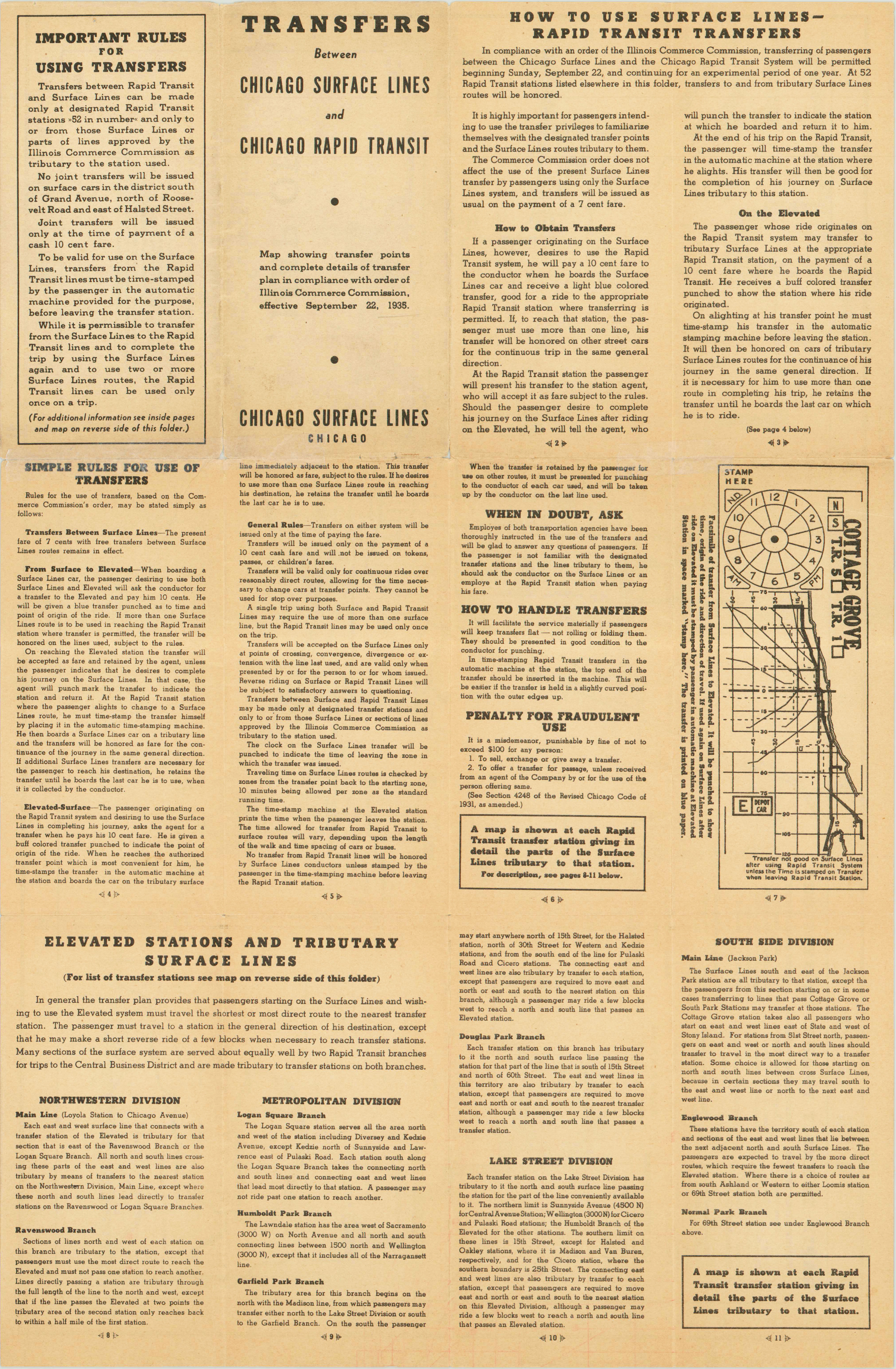
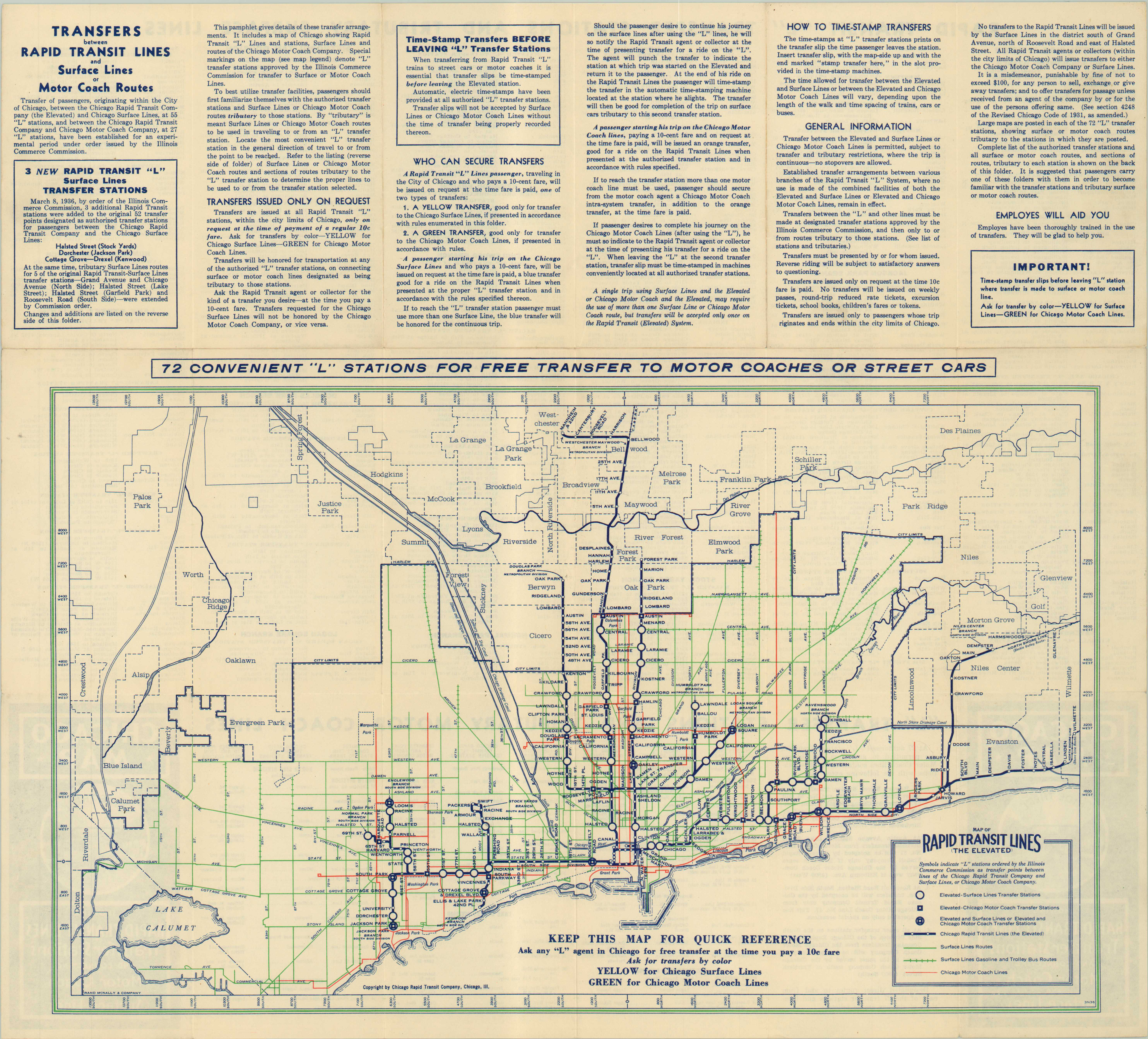
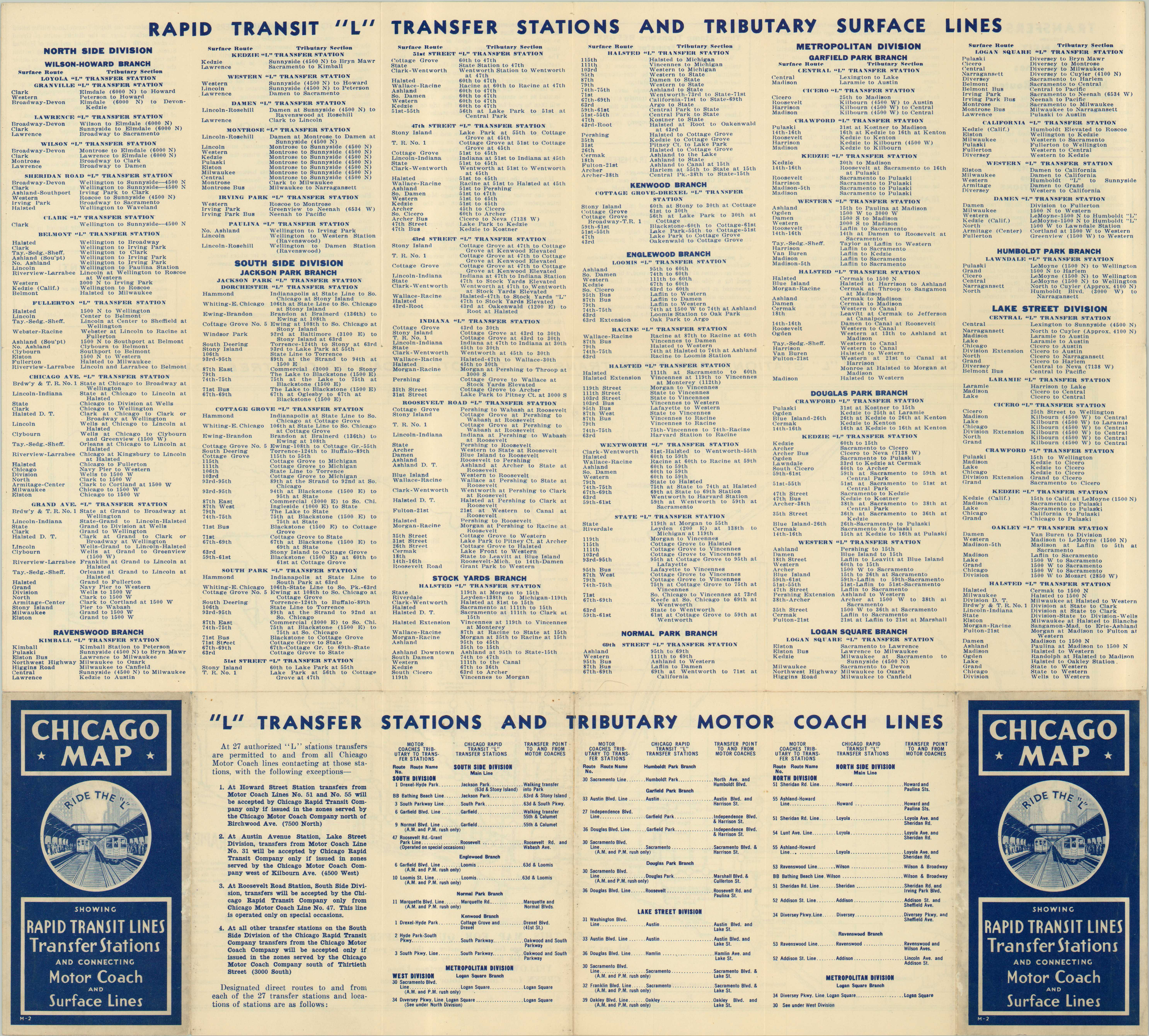
Chicago Surface Lines 1935 • Cover (270k) Map published by the Chicago Surface Lines company to explain the details of "L"-CSL transfers that were implemented by order of the Illinois Commerce Commission effective September 22, 1935. The map shows both the CSL and "L" systems, but only depicts the "L" stations where transfers can be made. The back includes extensive information about how transfers are issues and used. Chicago Rapid Transit 1936 • Cover (376k) Map published to coincide with the inauguration of transfers between the "L" and the Chicago Motor Coach Company for an experimental period of one year beginning January 19, 1936, in addition to the transfers with CSL initiated in 1935. The map shows the "L", CSL and CMC systems, and denotes transfer stations. The back lists each transfer station and what CSL and CMC services it connects with, along with other details of how the transfers worked.
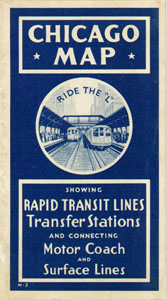
Chicago Rapid Transit 1938 •
Cover
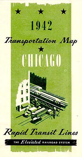
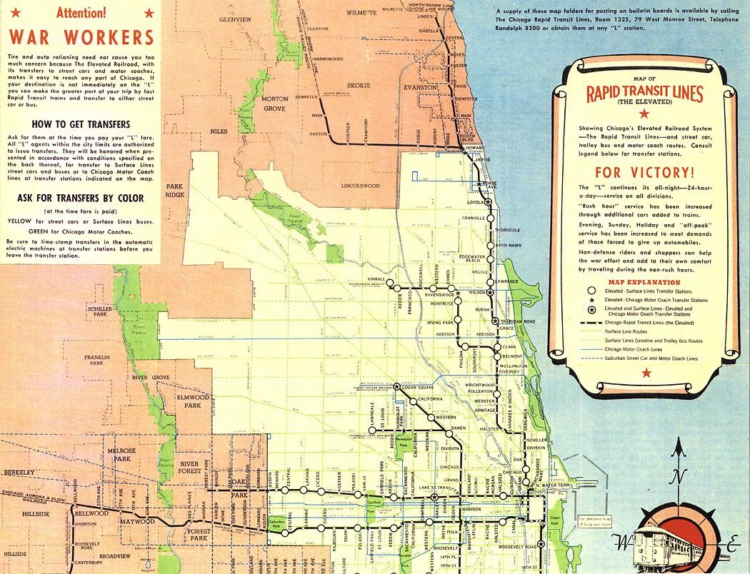
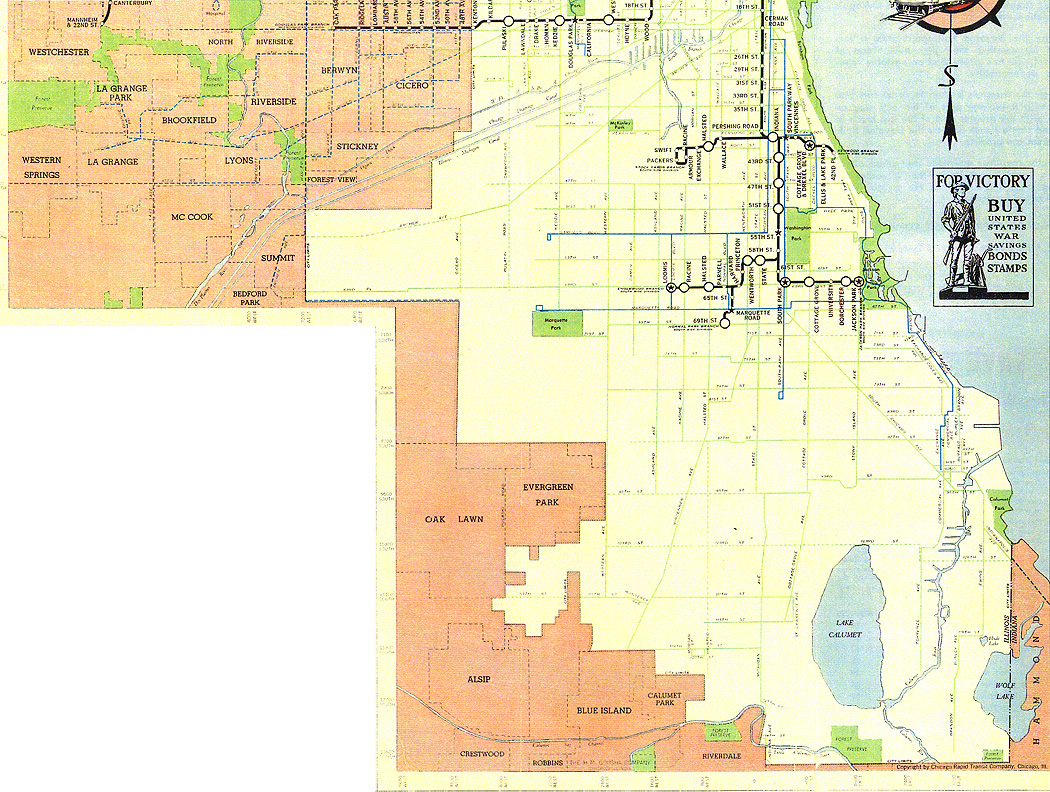
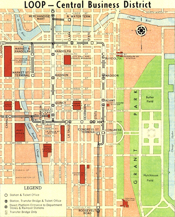
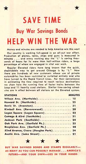
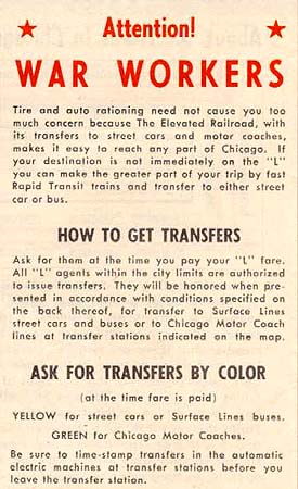
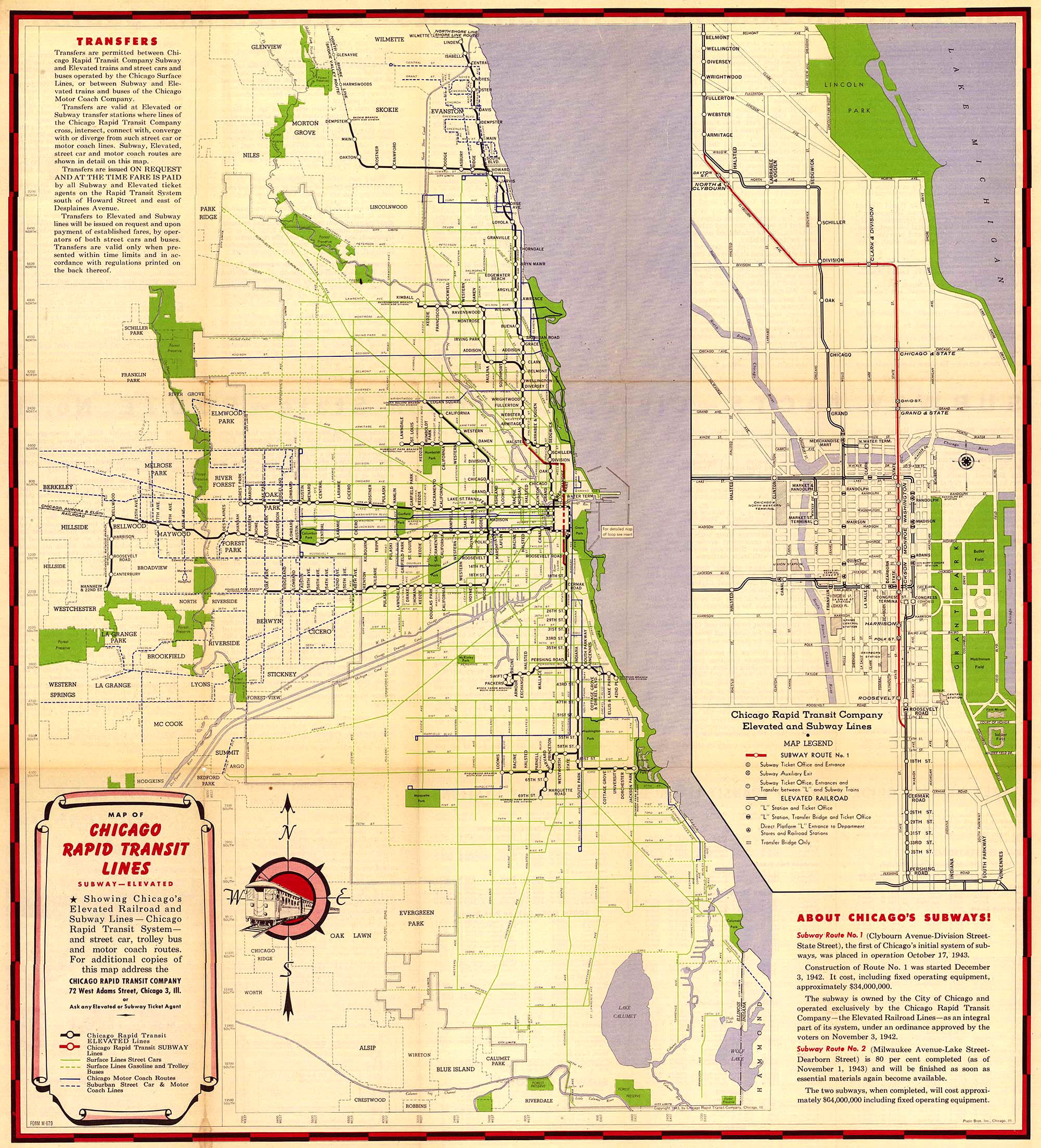
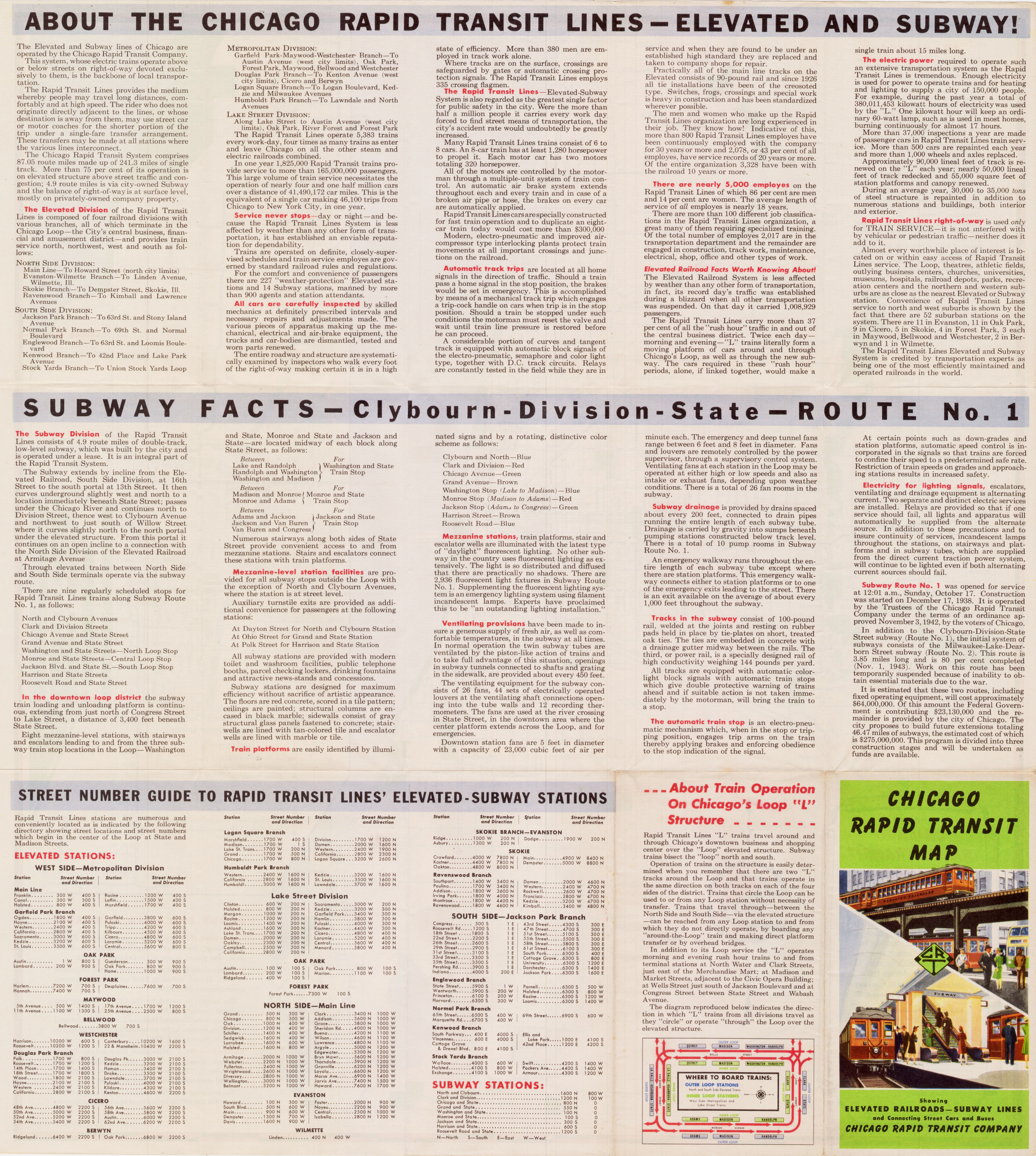
(196k) None Chicago Rapid Transit 1942 •
Cover
(56k) Map has several war bonds
advertisements. Chicago Rapid Transit 1943 •
Cover
(390k) Shows a
detailed map of the newly-opened State Street Subway in an expanded downtown inset
that includes the Near North and Near South
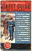
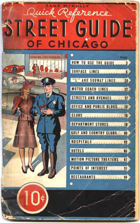
Sides. Back includes facts promoting newly opened subway. Rand McNally Street Guide 1944 •
Cover
(92k) Includes detailed information on how
to ride the elevated, including route descriptions, stopping
patterns, and hours of operation. Map shows the newly-opened
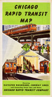
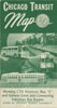
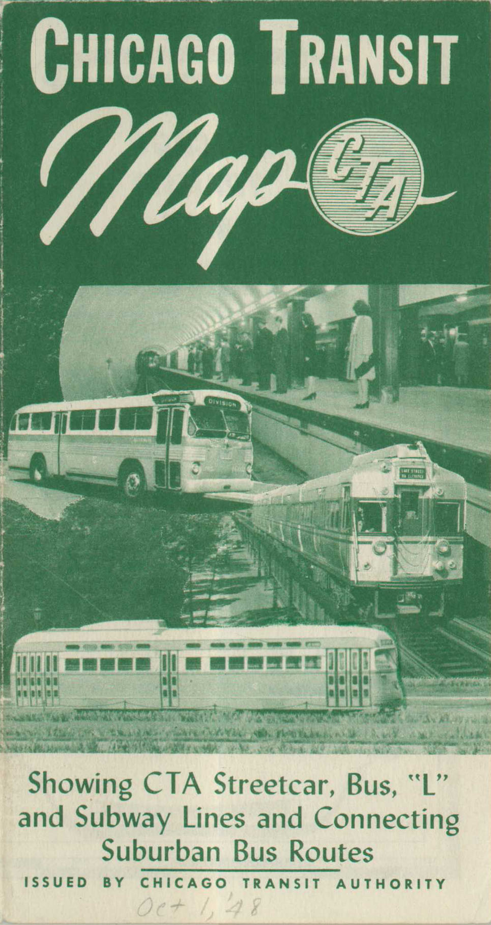
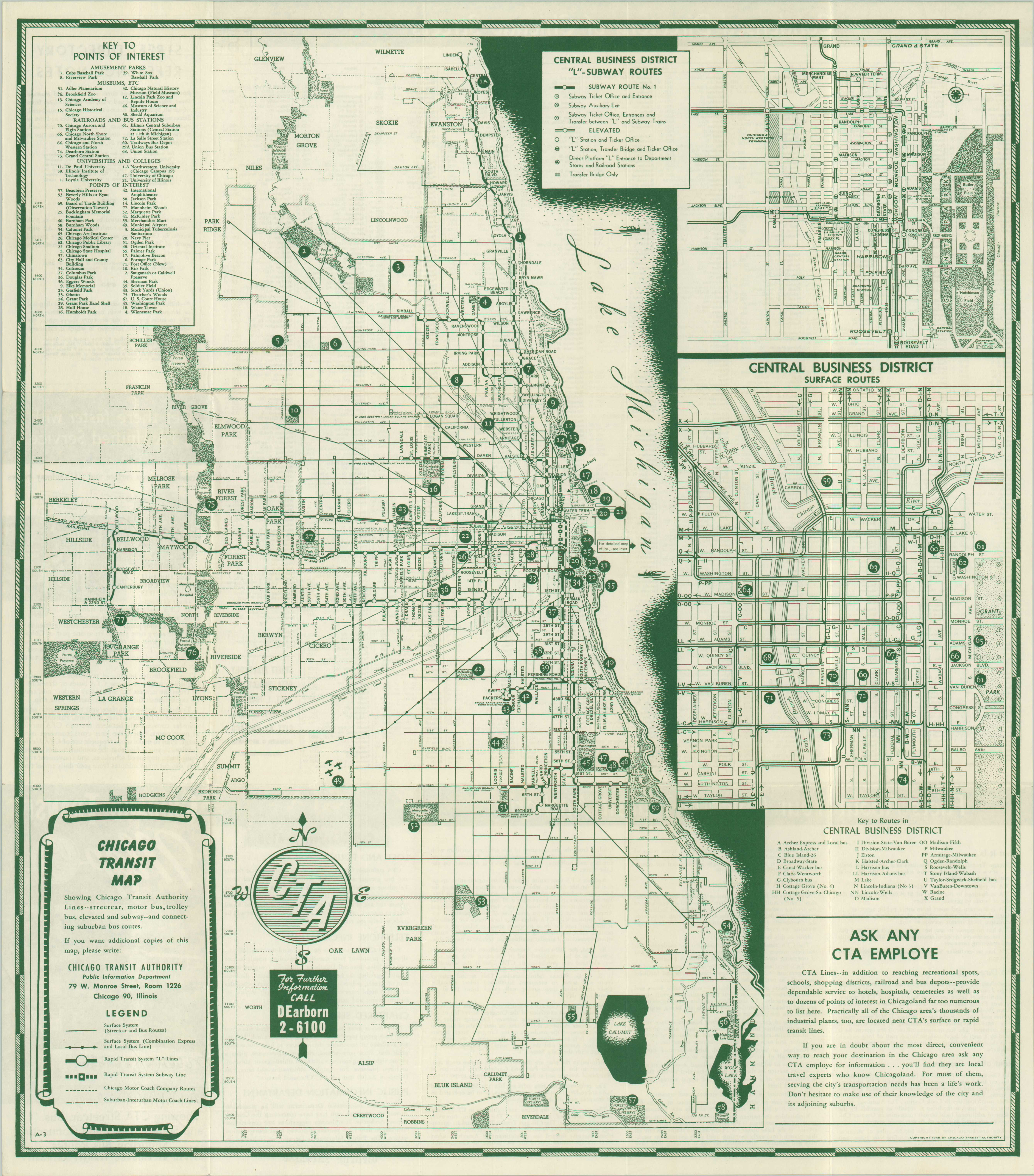
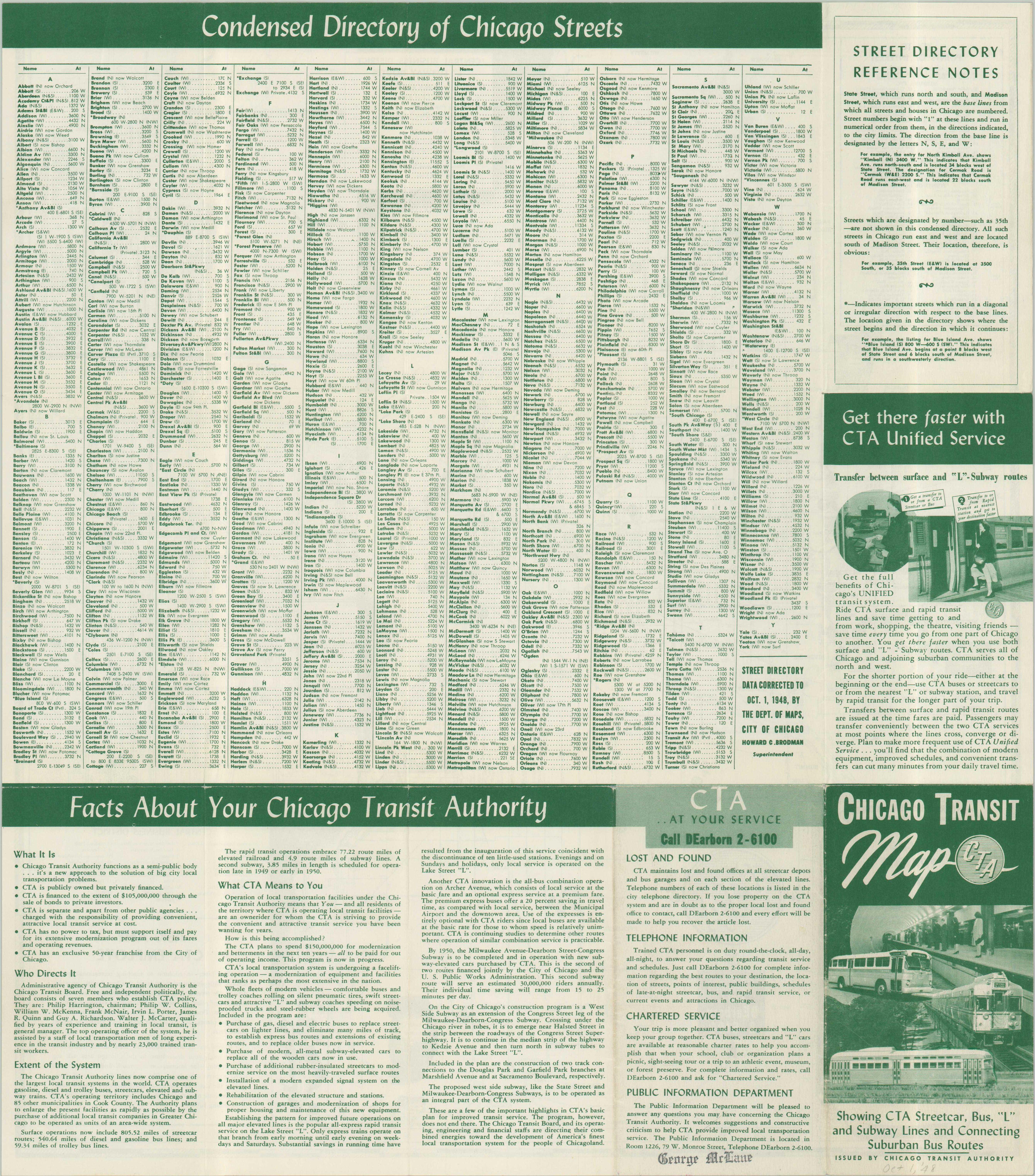
State Street Subway. Chicago Transit Authority 1948 •
Cover (290k) First map issued by the CTA; was largely a reprint of the last CRT map with minor changes.
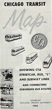
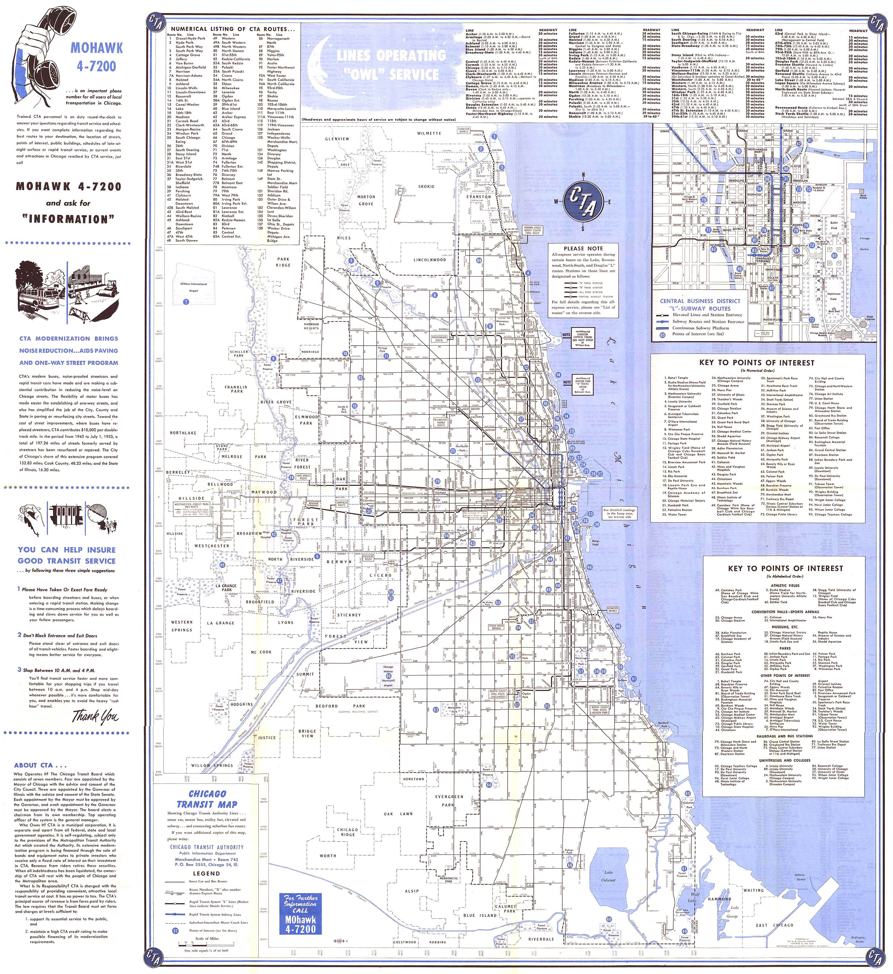
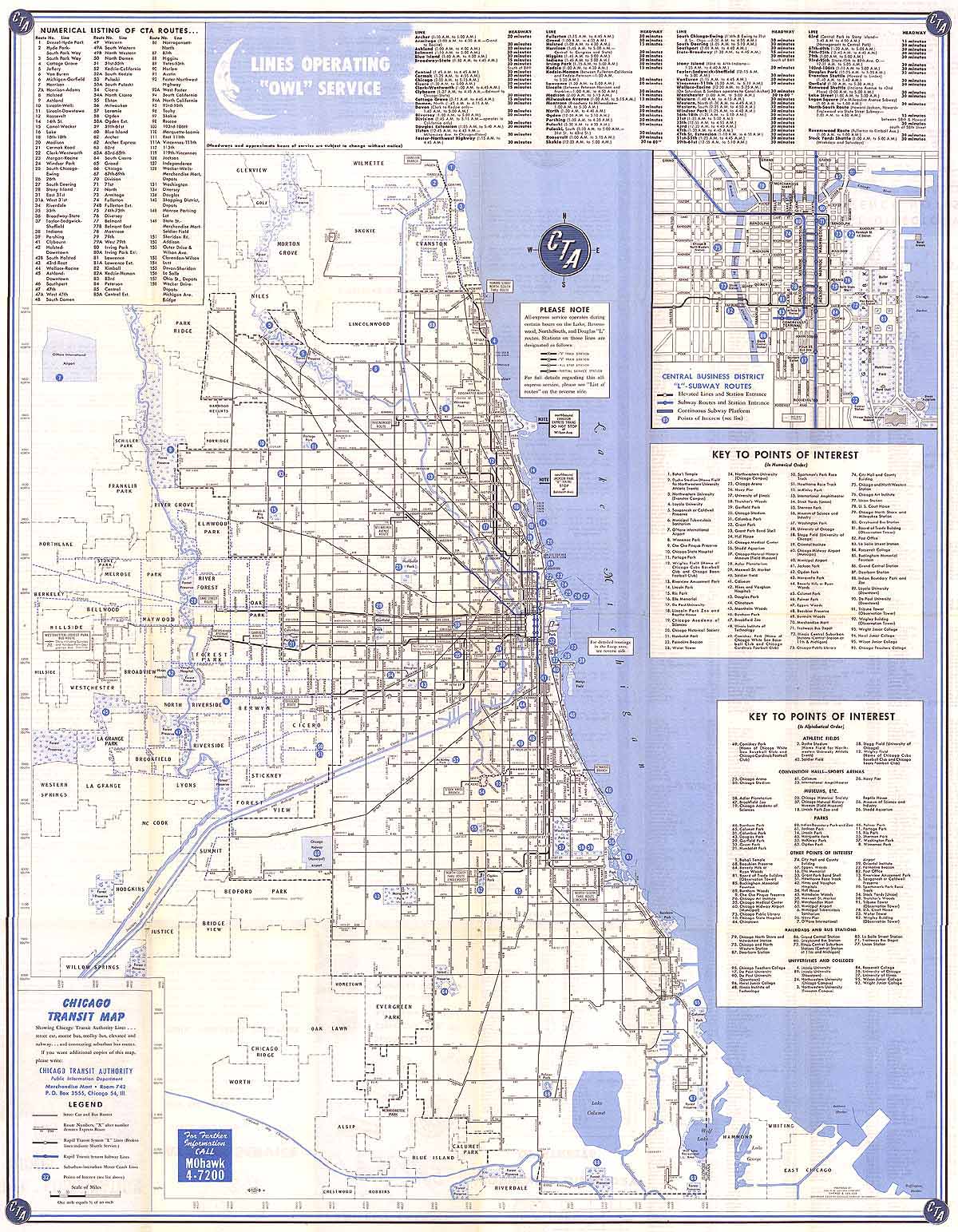
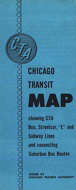
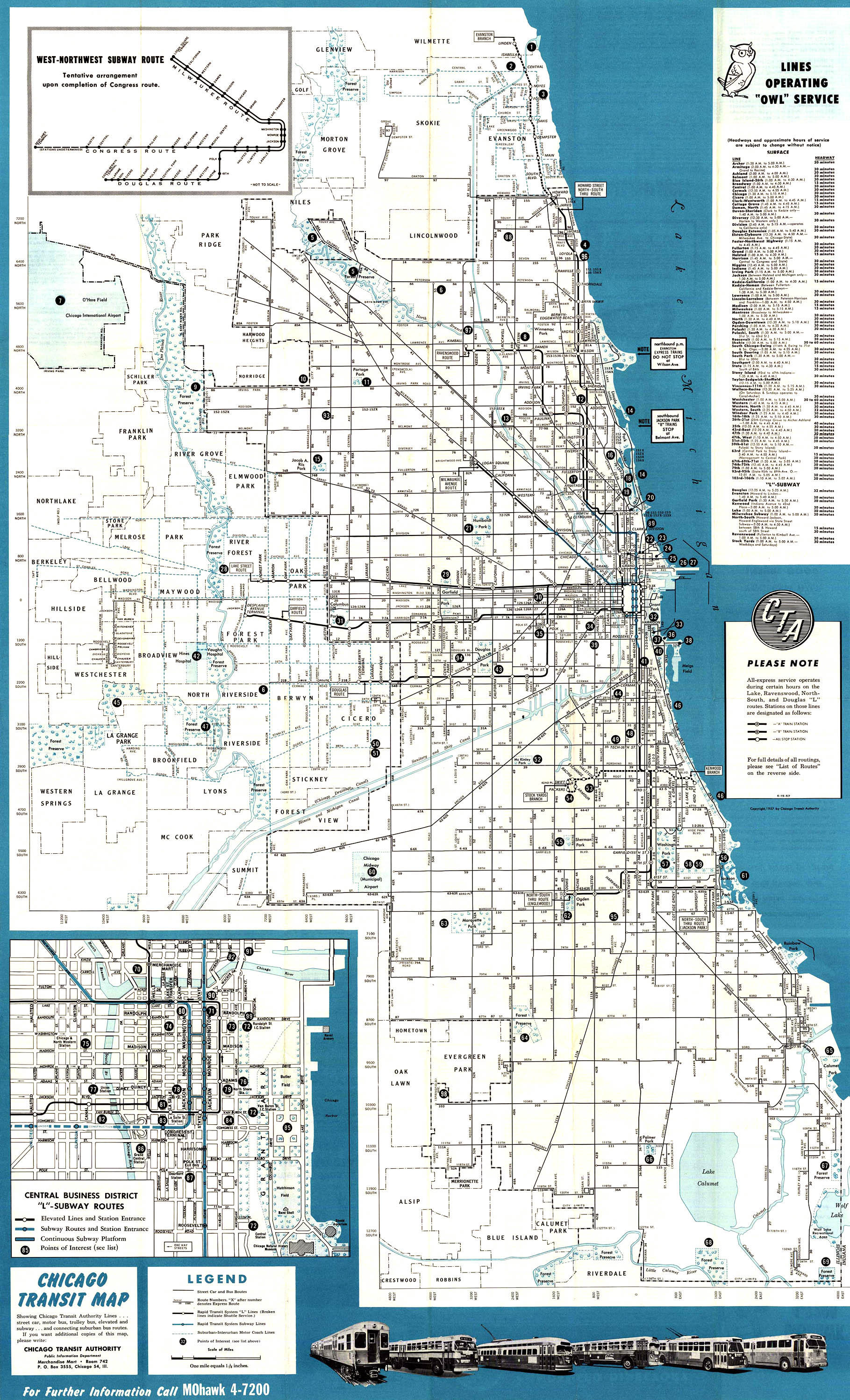
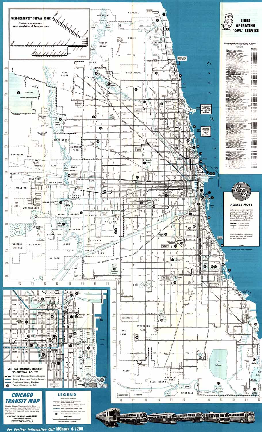
Chicago Transit Authority 1954 • Cover (40k) None Chicago Transit Authority 1957 •
Cover
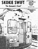
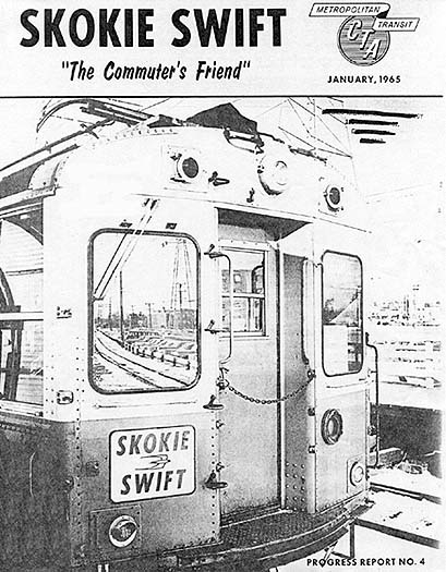
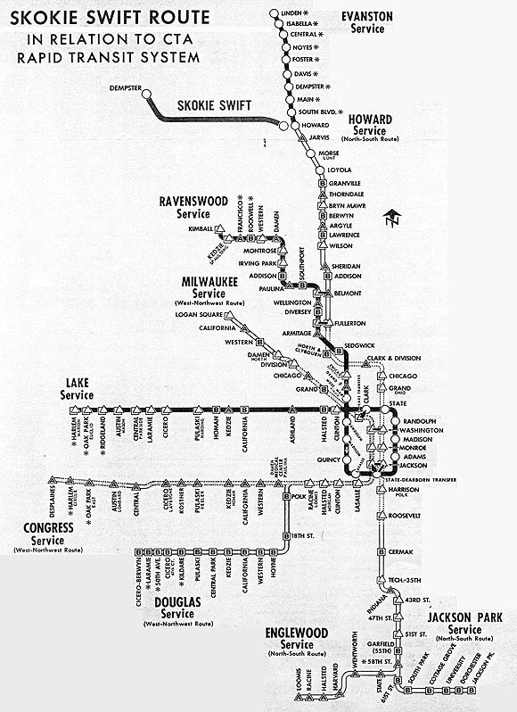
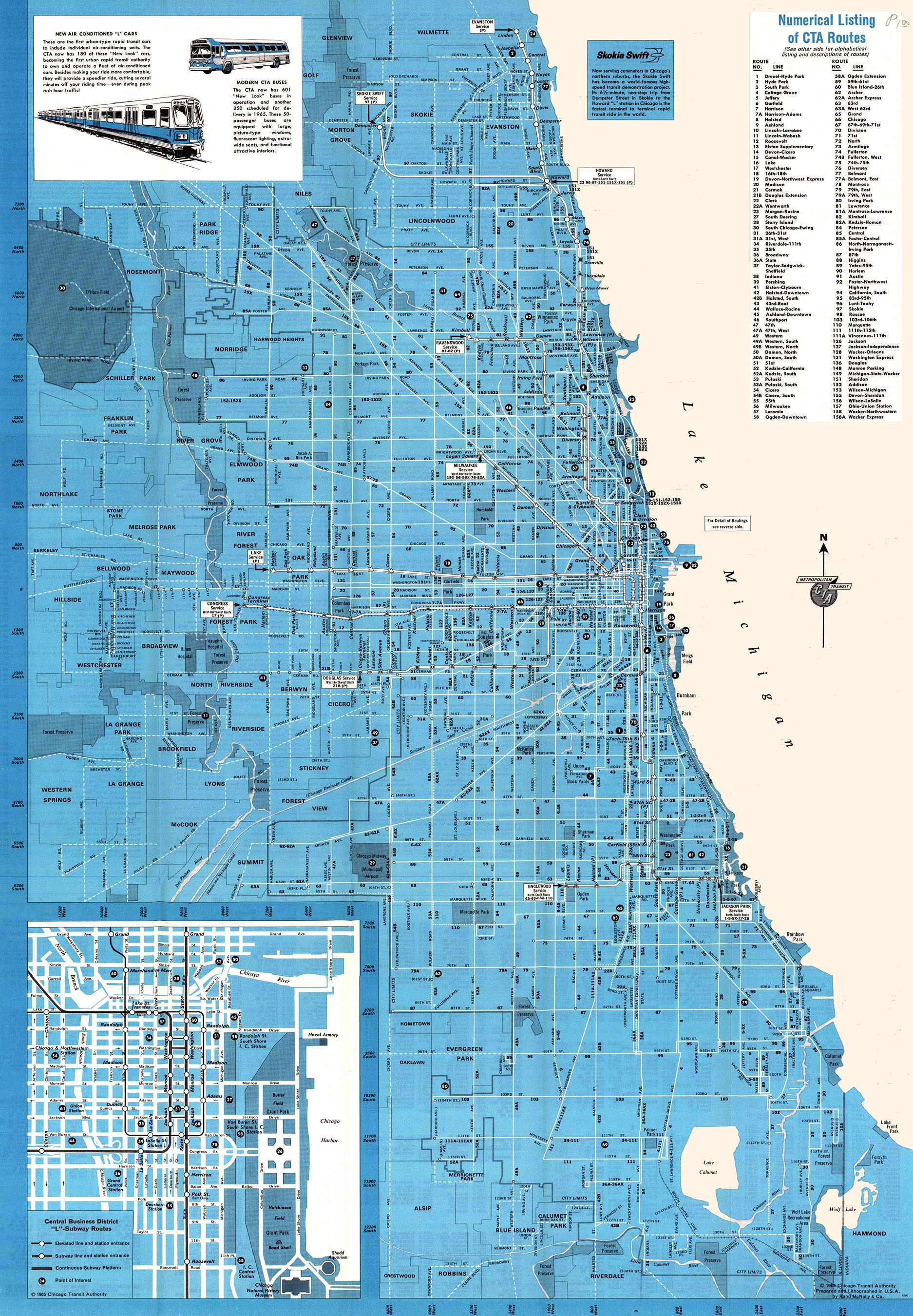
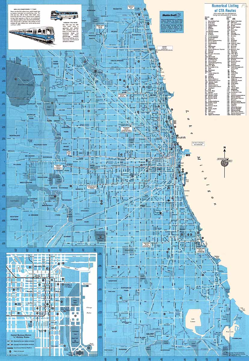
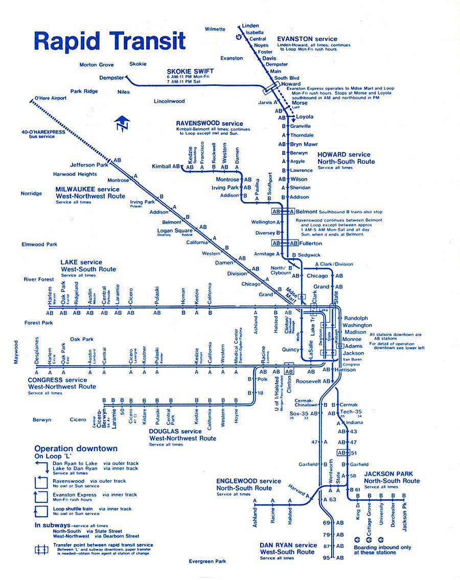
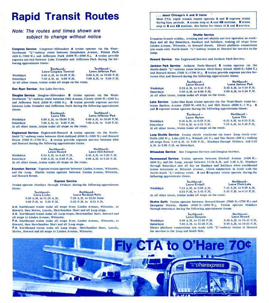
(56k) None Chicago Transit Authority January 1965 •
Cover
(84k) Skokie Swift: "The Commuter's
Friend" was the fourth in a series of progress reports
published on the Skokie Swift demonstration project. Map
shows the Skokie Swift's relation to the rest of the
"L"TM
system. Chicago Transit Authority 1965 •
Cover
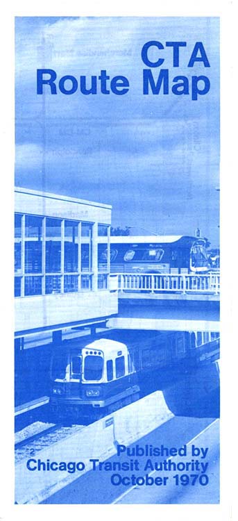
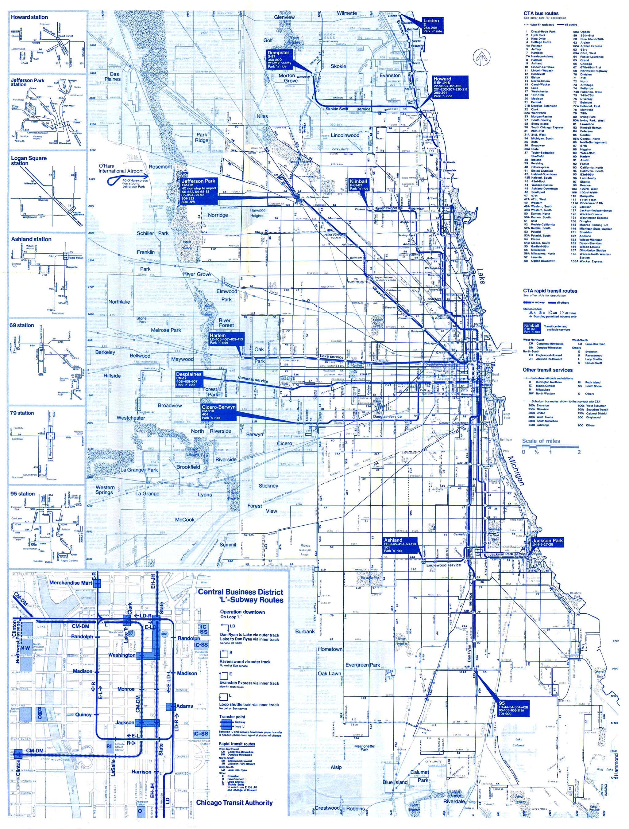
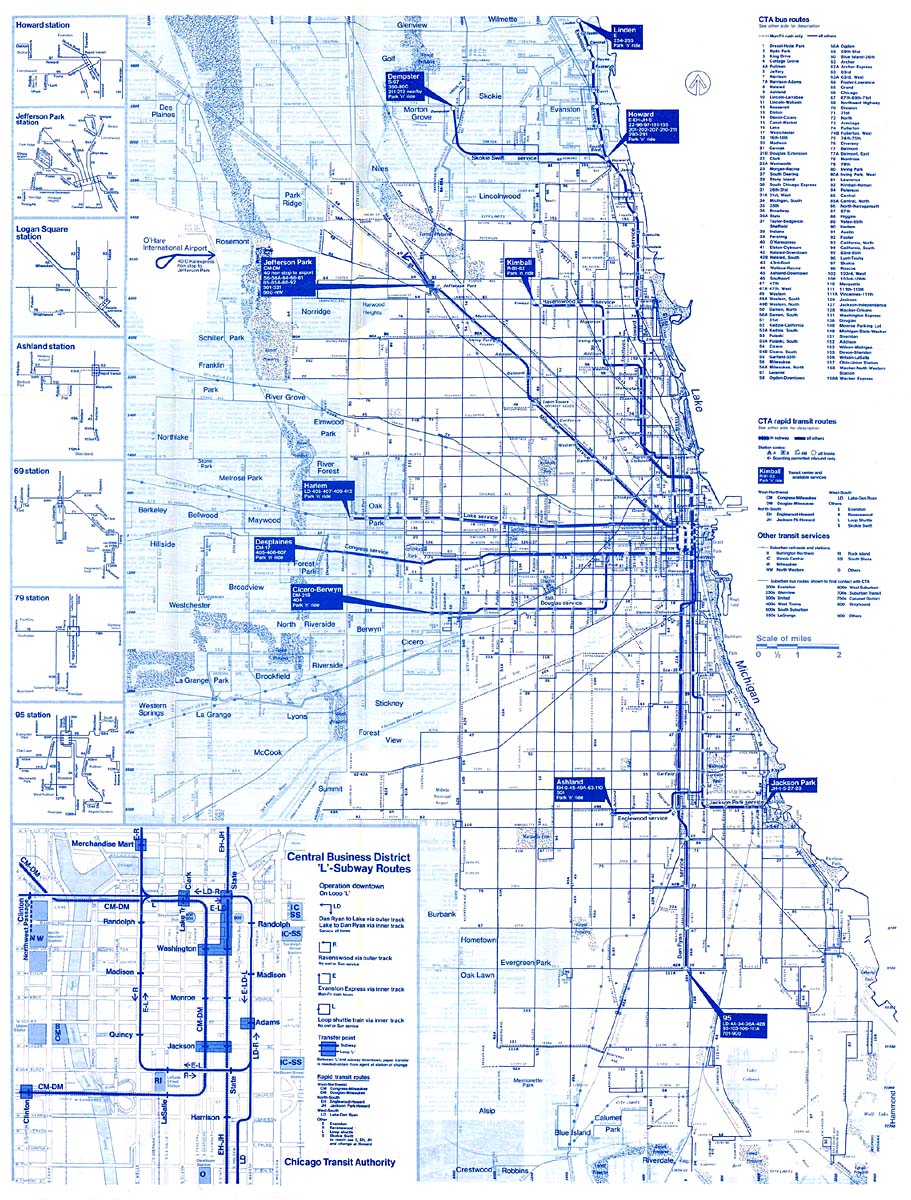
(52k) None Chicago Transit Authority October 1970 •
Cover
(60k) Includes newly-opened Dan Ryan and
Kennedy routes.
CTA®
system map adopted one- and two-letter abbreviations for
routes (i.e. "JH" for Jackson Park-Howard), though it would
prove to be short-lived. Note ad for the #40 O'Harexpress
bus extension route from Jefferson
Park to the
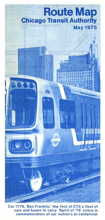
airport. Chicago Transit Authority May 1975 •
Cover
(72k) "L"TM
system map adopted one- and
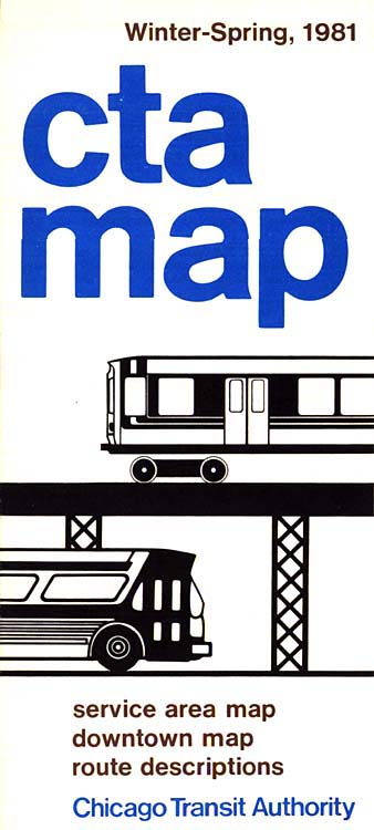
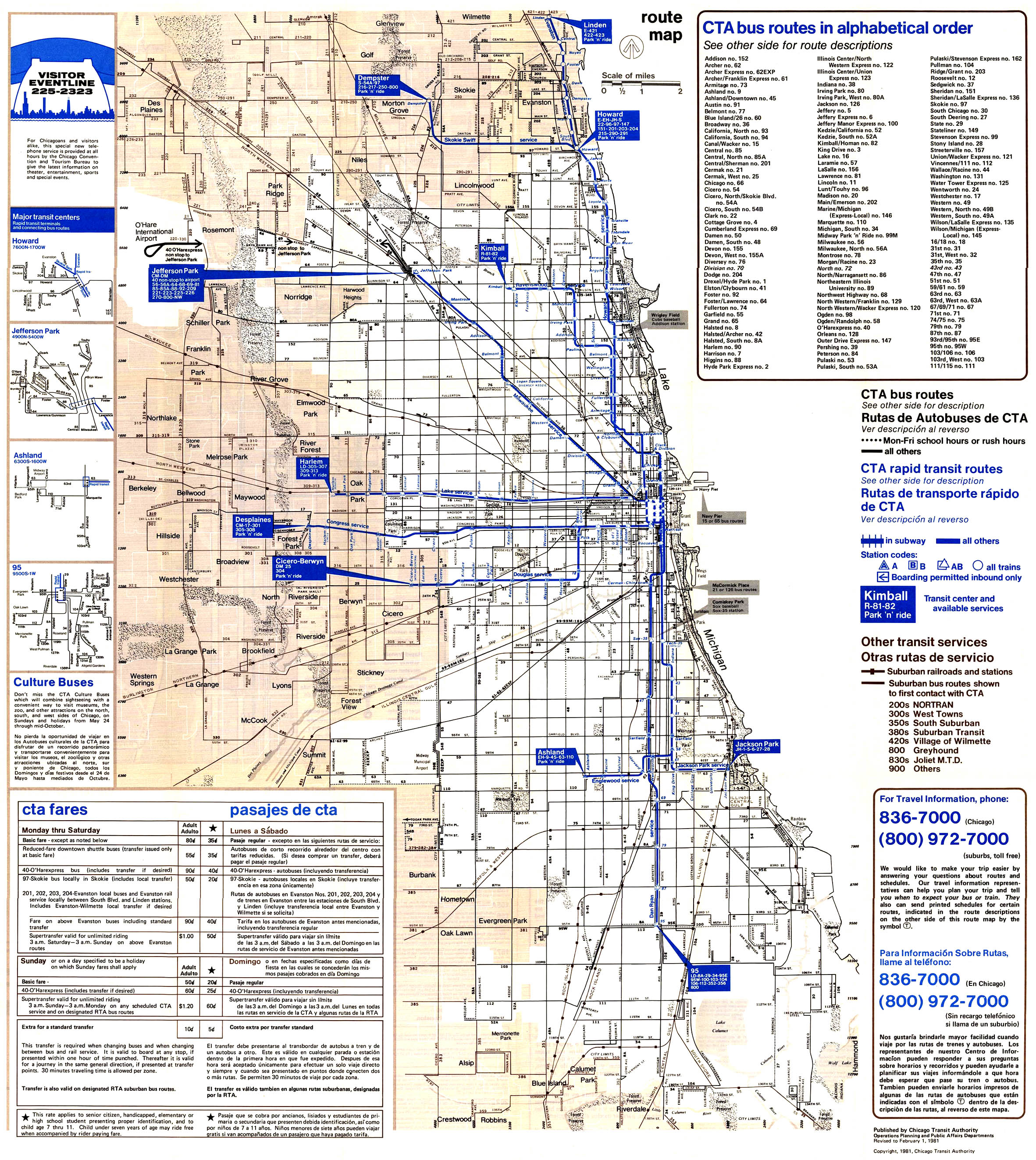
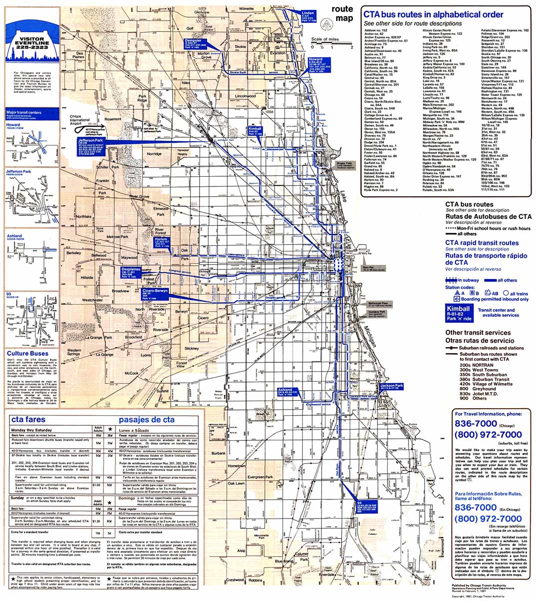
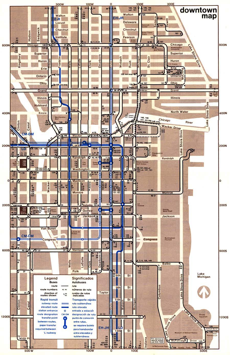
two-letter abbreviations for routes. Chicago Transit Authority Winter-Spring 1981 •
Cover
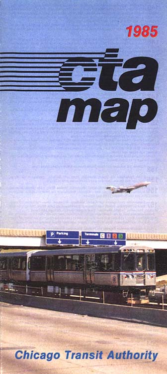
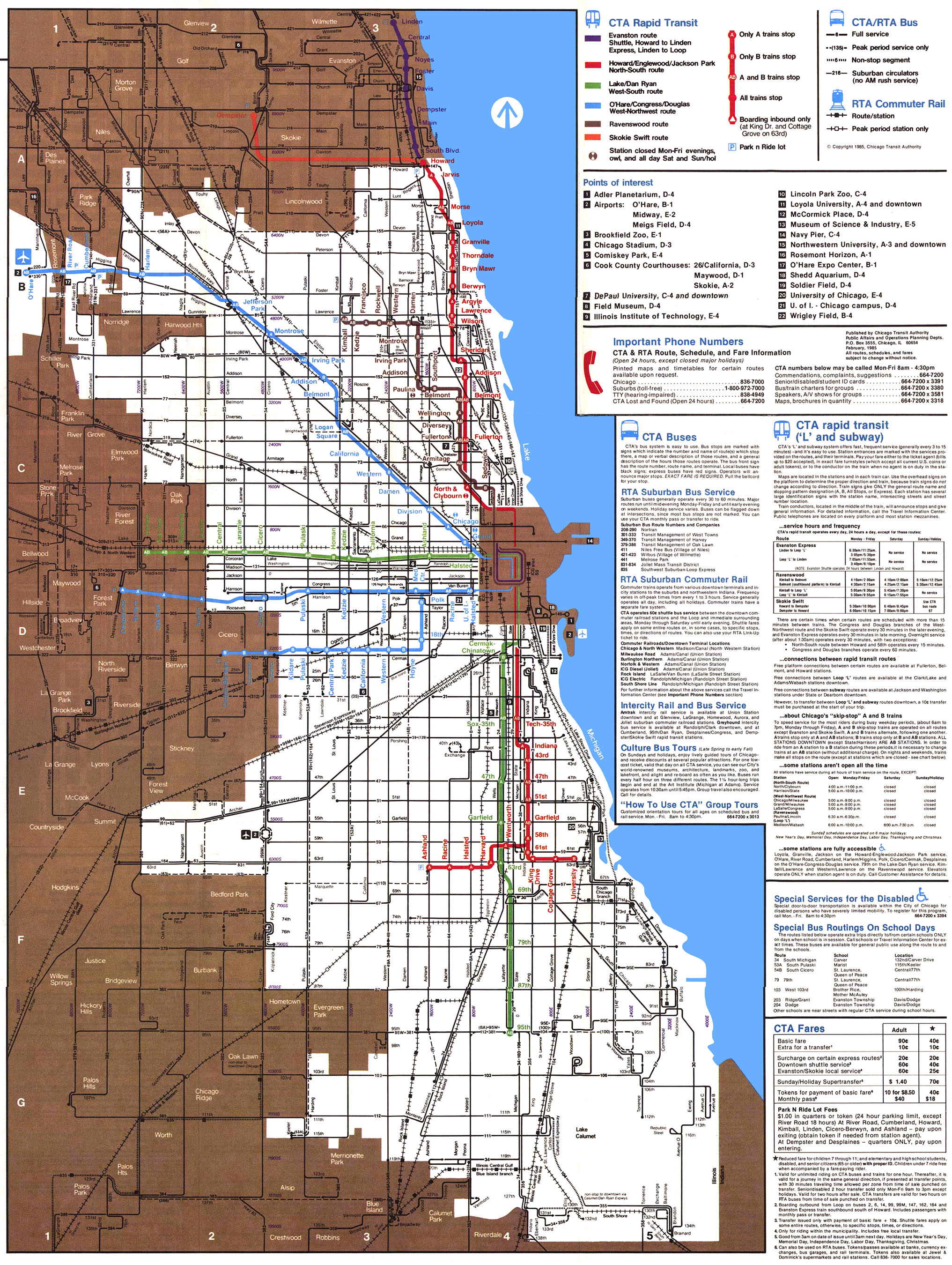
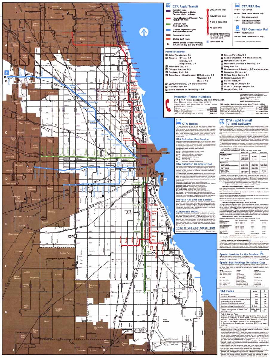
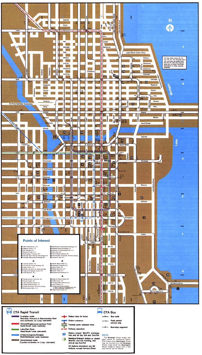
(56k) None Chicago Transit Authority 1985 •
Cover
(60k) Map includes the new O'Hare extension
and was the first to color-code the lines (although color
names for the lines would not be adopted until 1993). "A"
and "B" stations are no longer represented be triangles and
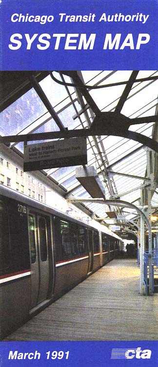
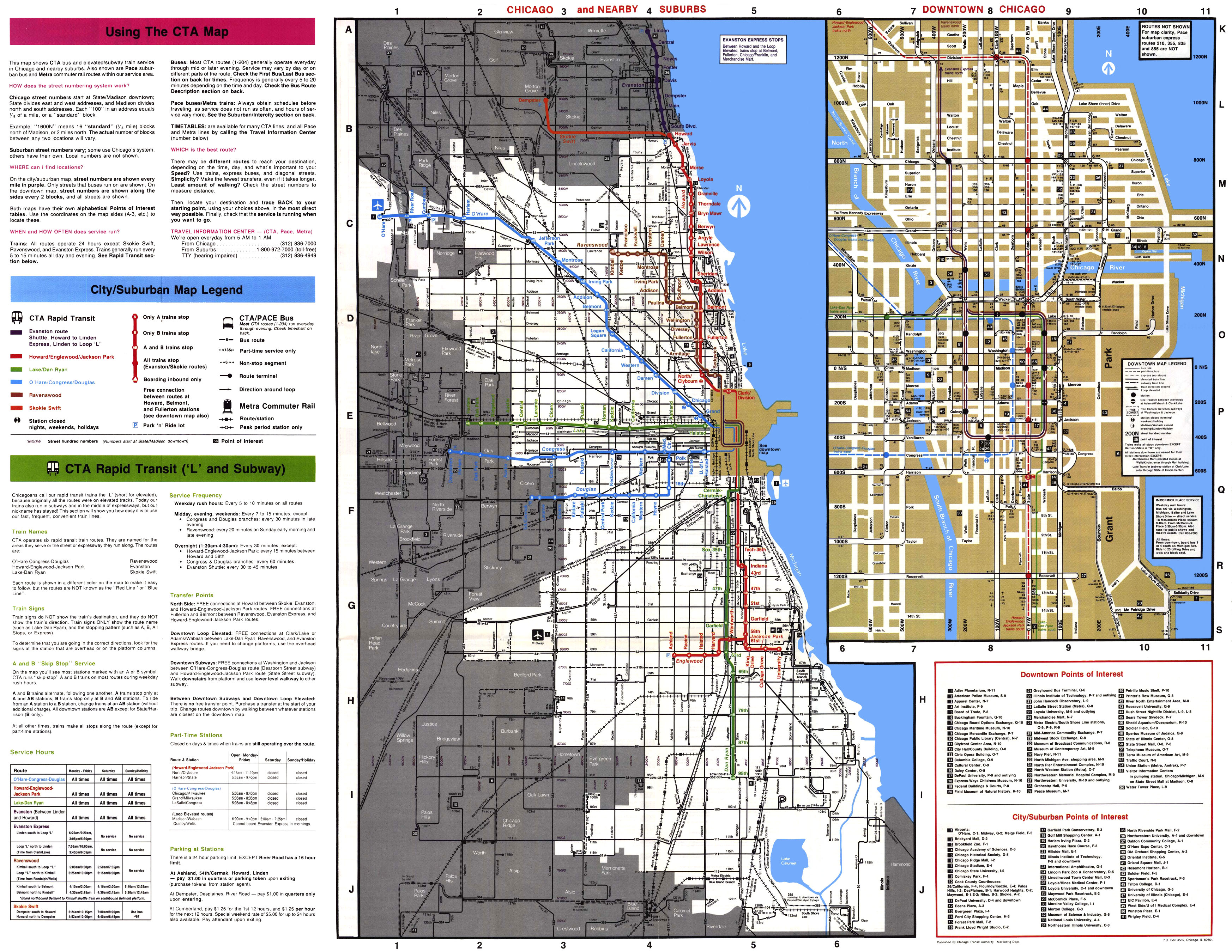
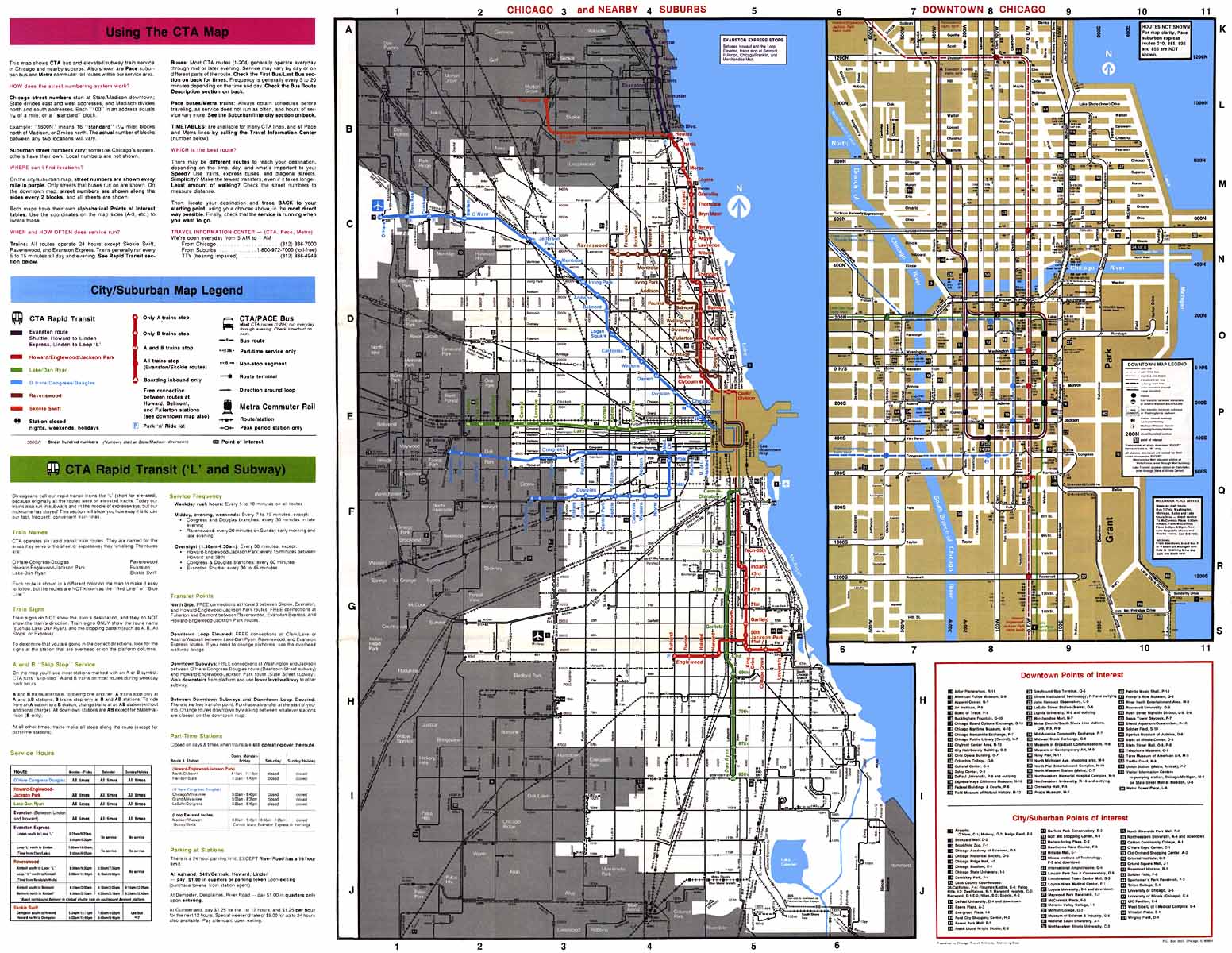
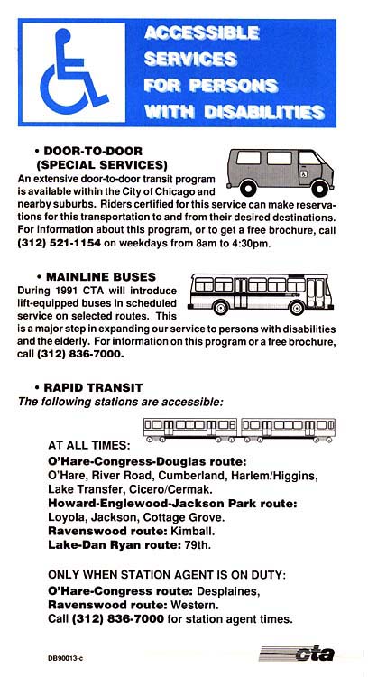
squares; all stops are represented by circles. Chicago Transit Authority March 1991 •
Cover
(76k) First map issued after the passage of
the Americans with Disabilities Act, outlining
CTA's®
accessible services on the rail and bus systems (see
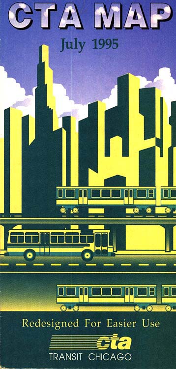
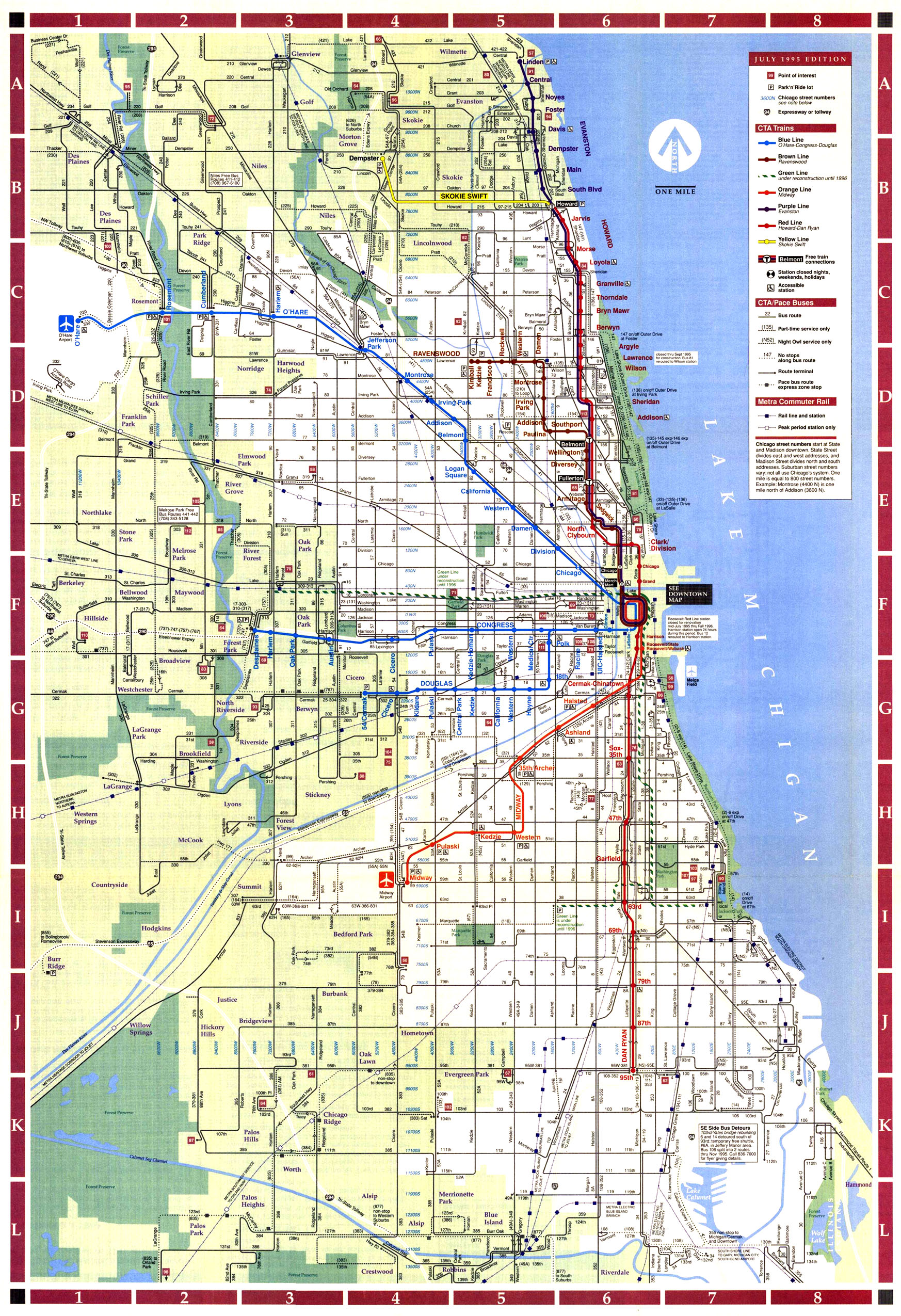
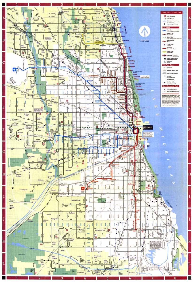
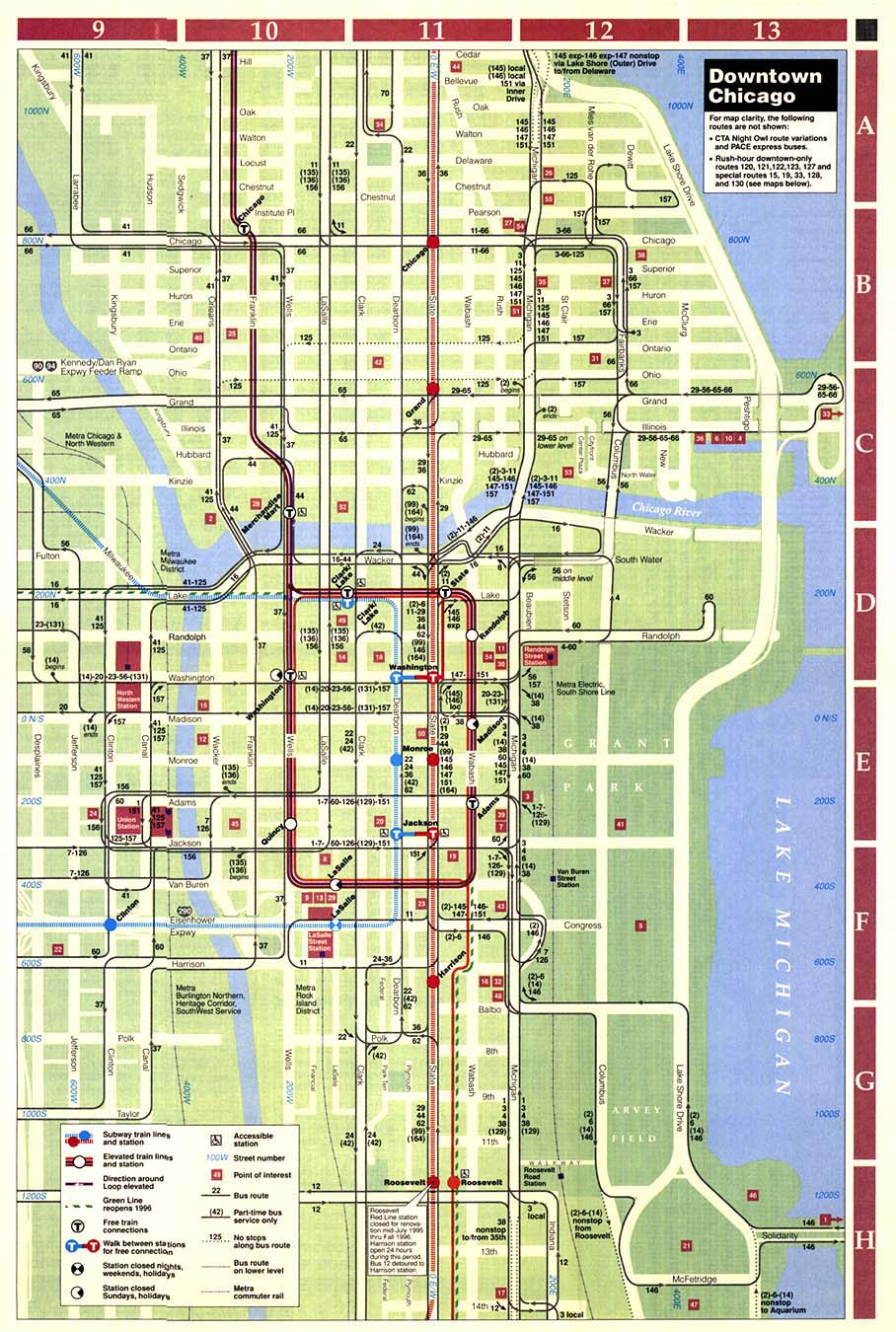
detail above). Chicago Transit Authority July 1995 •
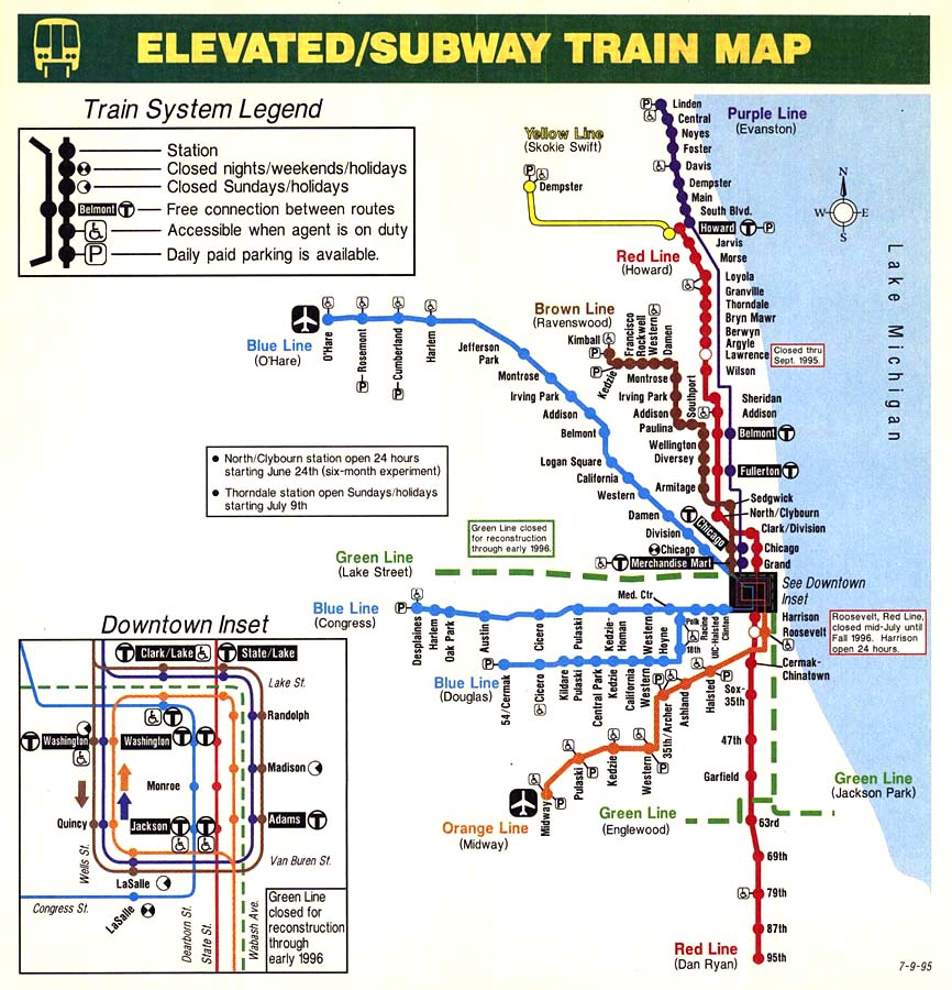
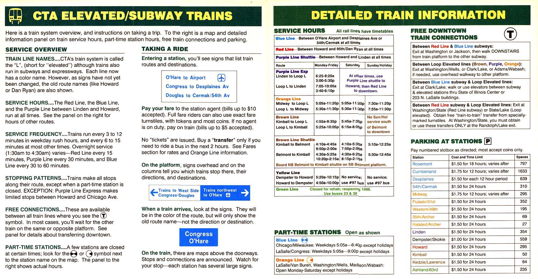
Cover
(80k) Green Line appears on the map only as
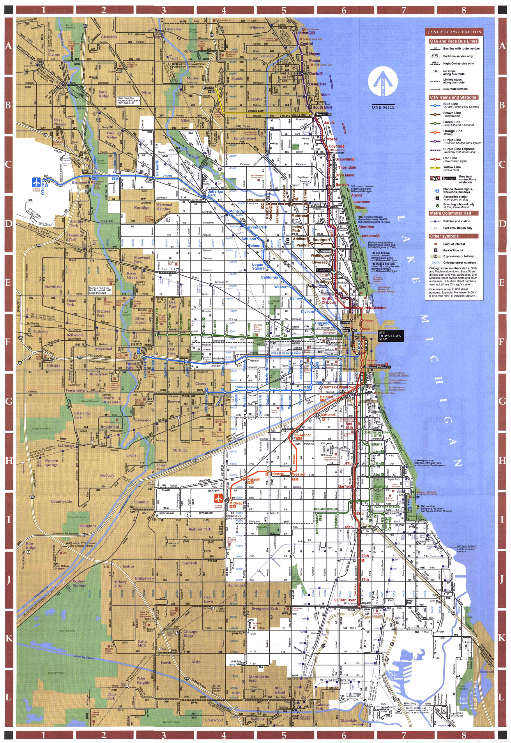
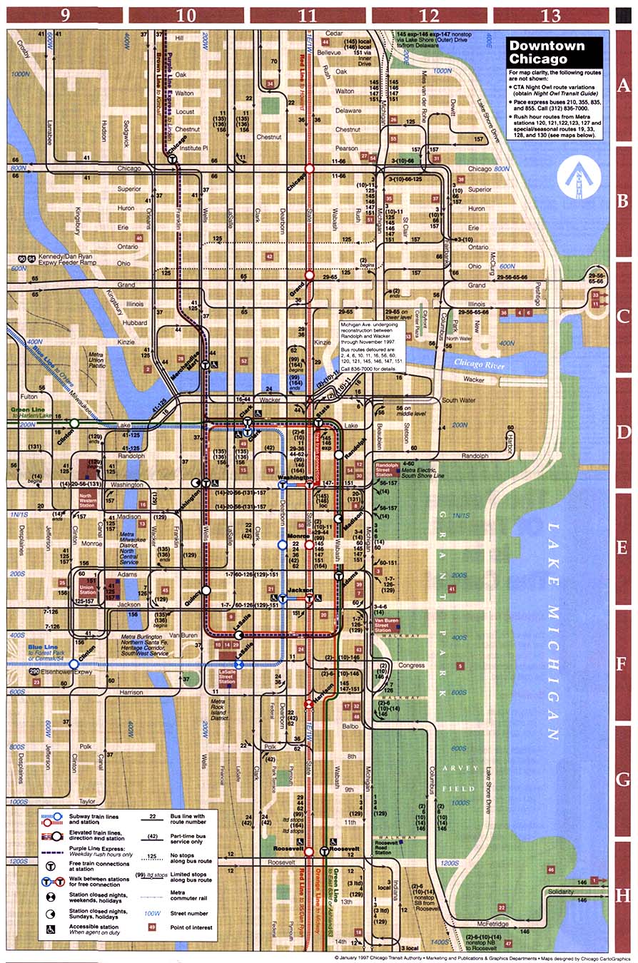
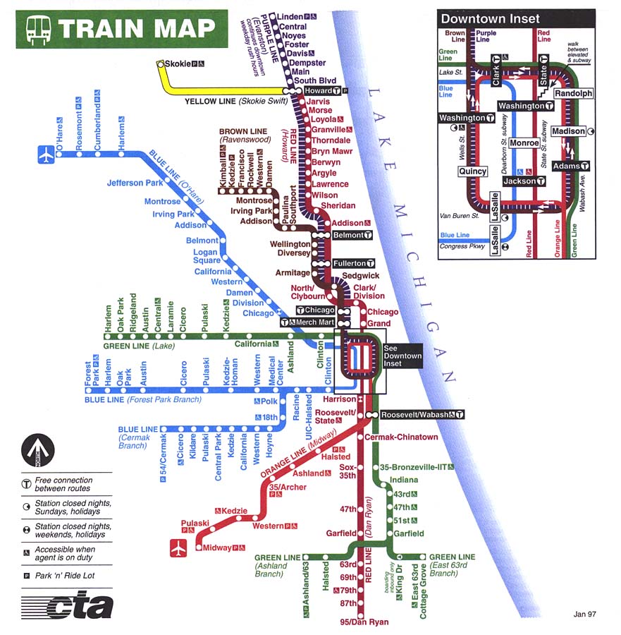
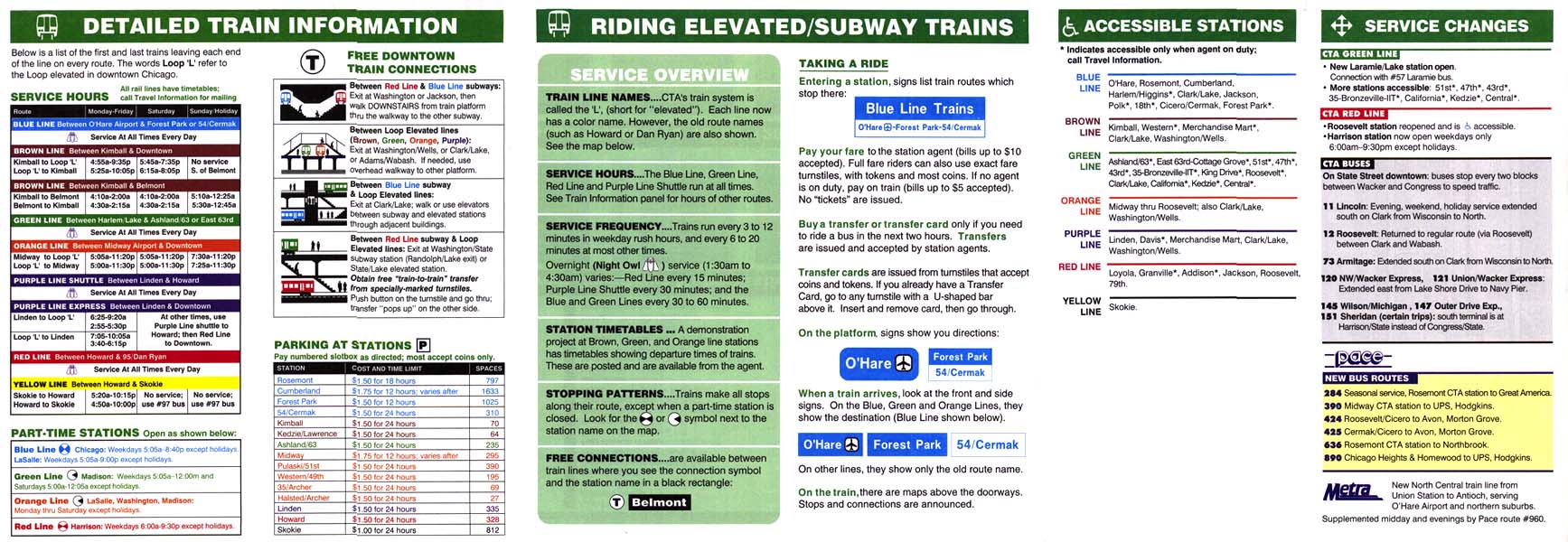
a dashed line, as it is closed for renovation. Chicago Transit Authority January 1997 •
Cover
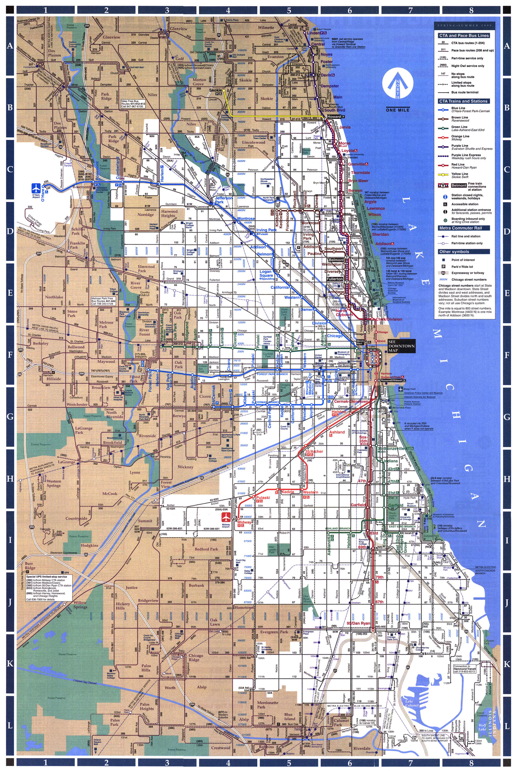
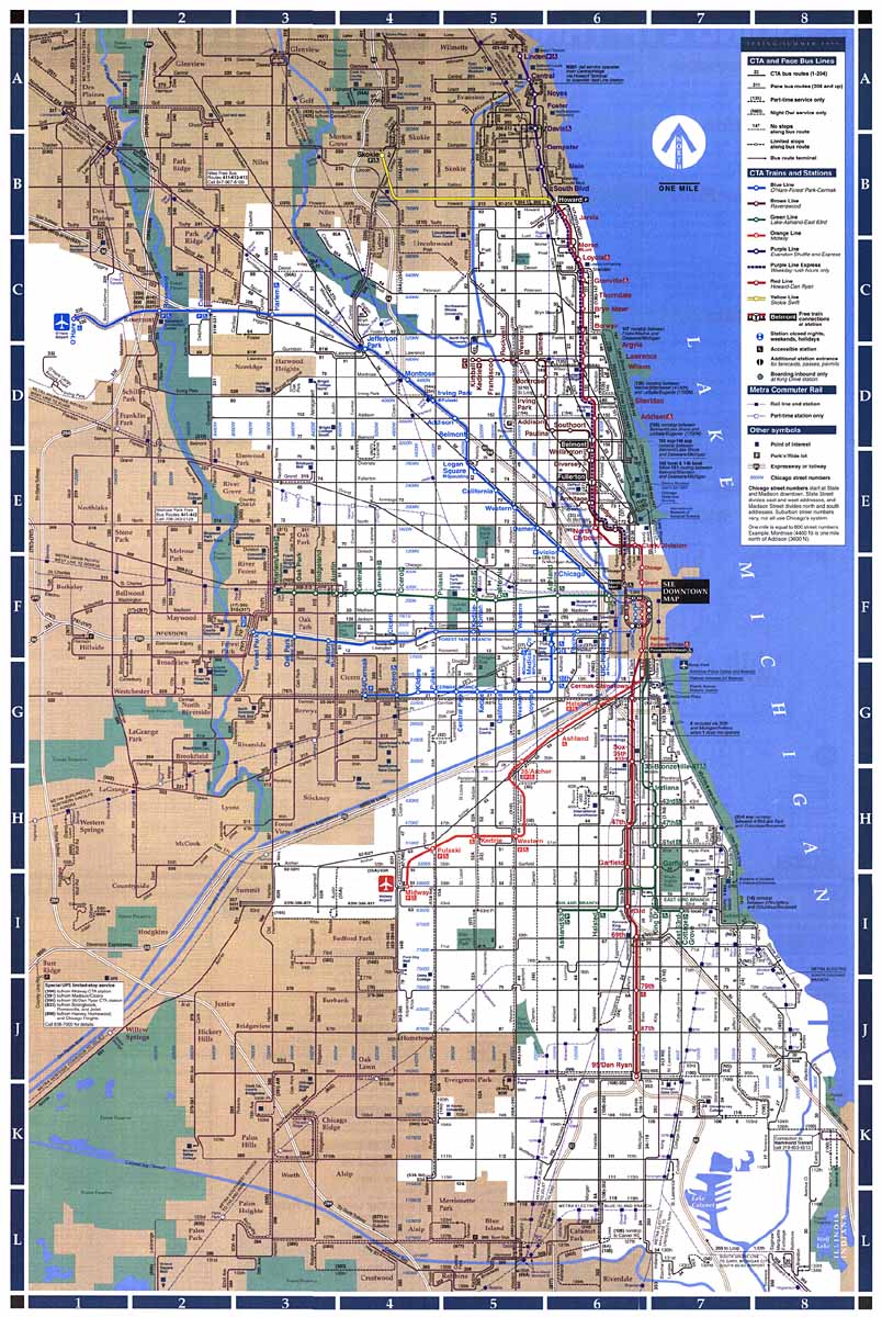
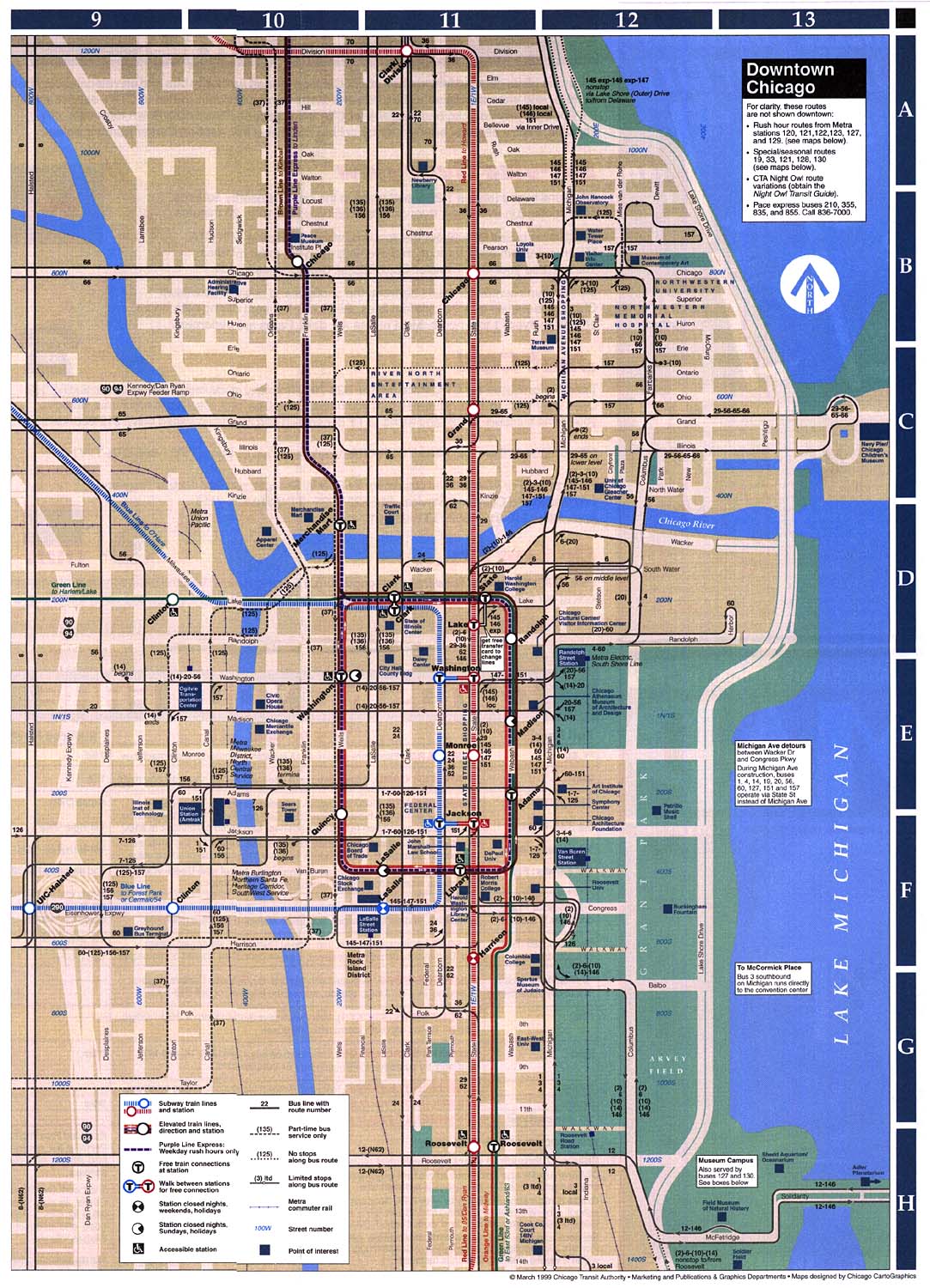
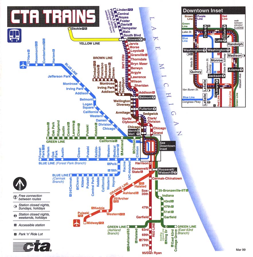
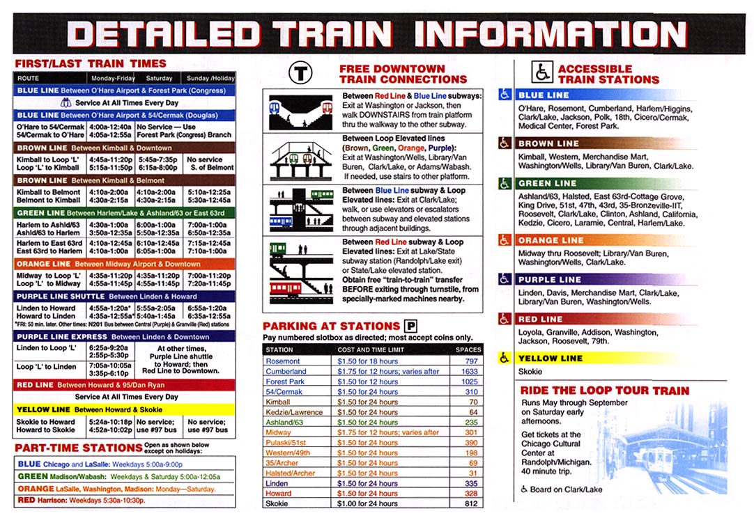
(72k) None Chicago Transit Authority Spring-Summer (March) 1999 •
Cover
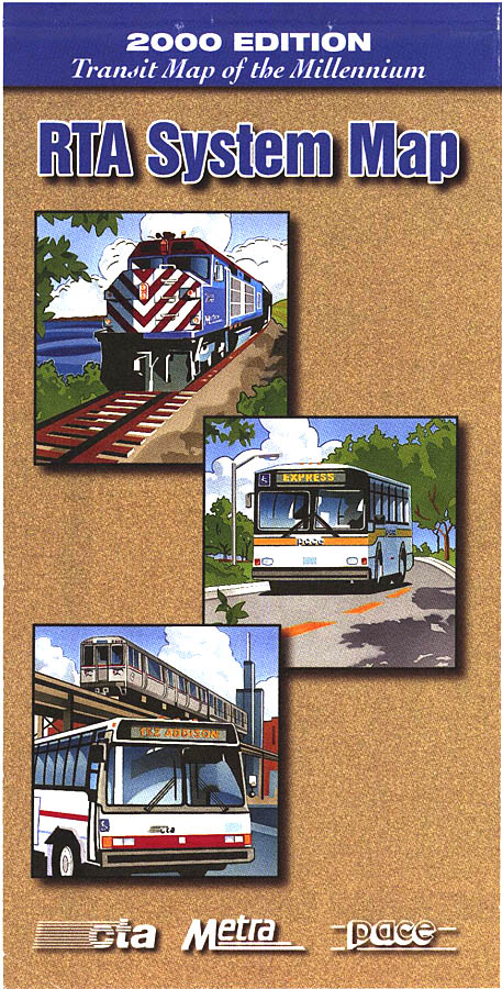
(84k) None Regional Transportation
Authority 2000 •
Cover
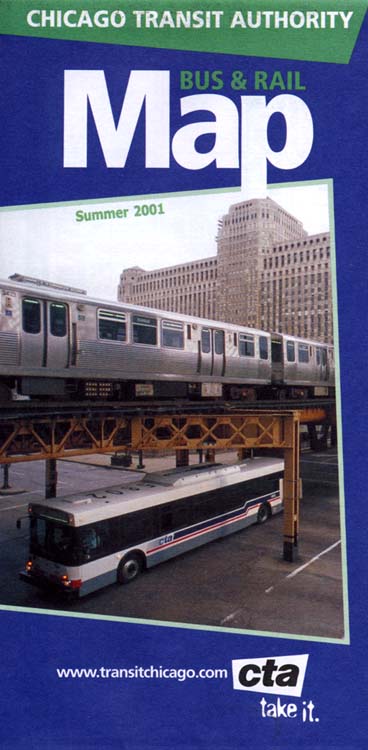
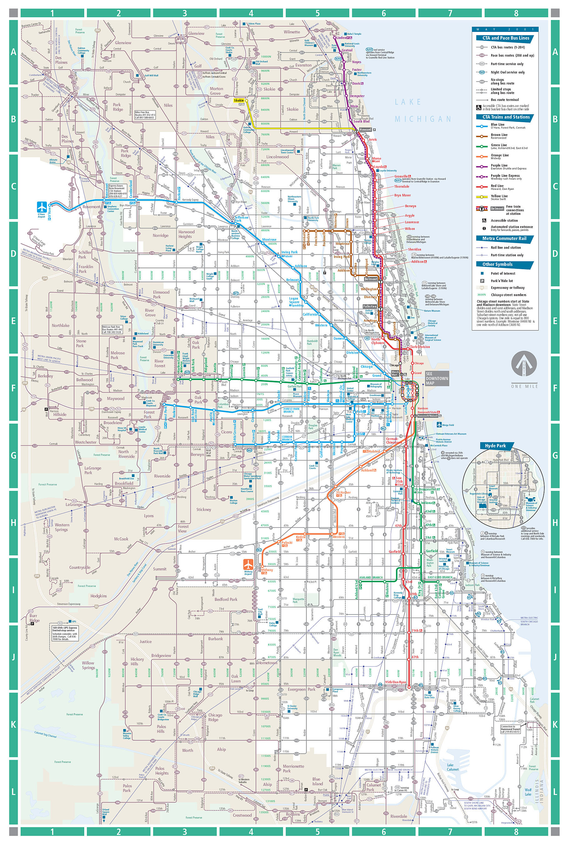
(171k) None Chicago Transit Authority Summer (May) 2001 •
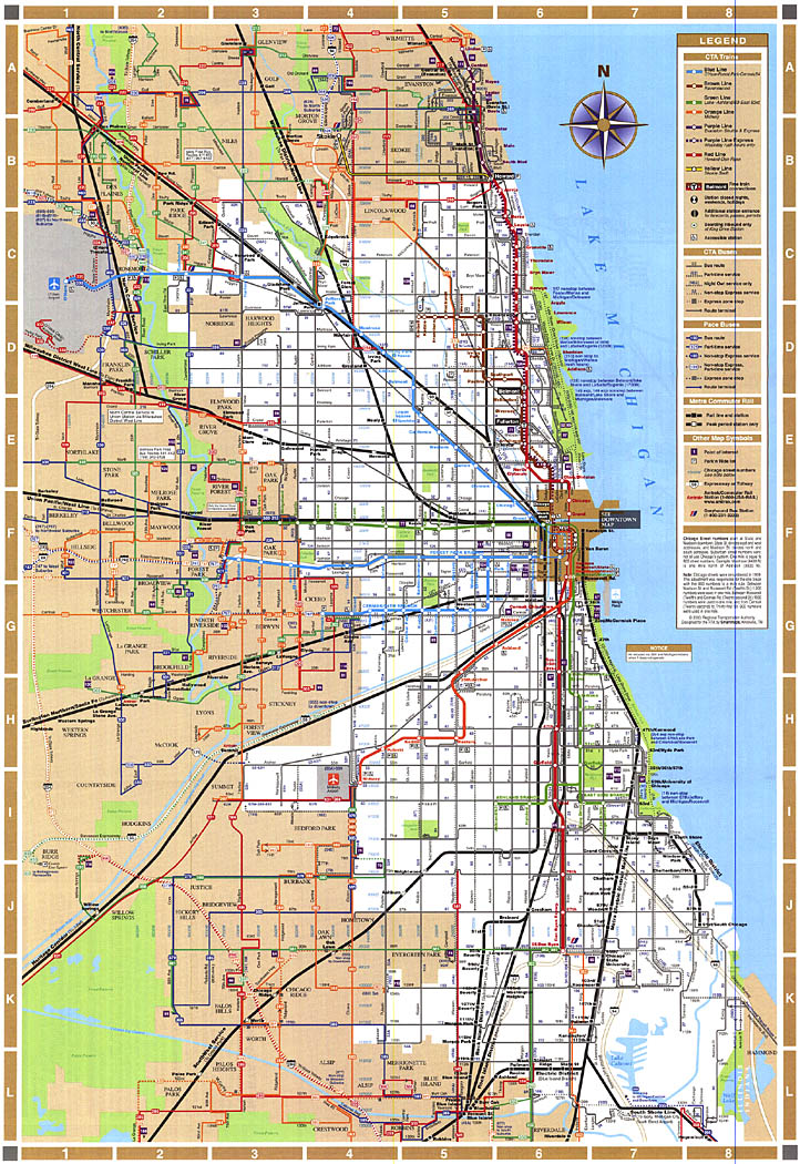
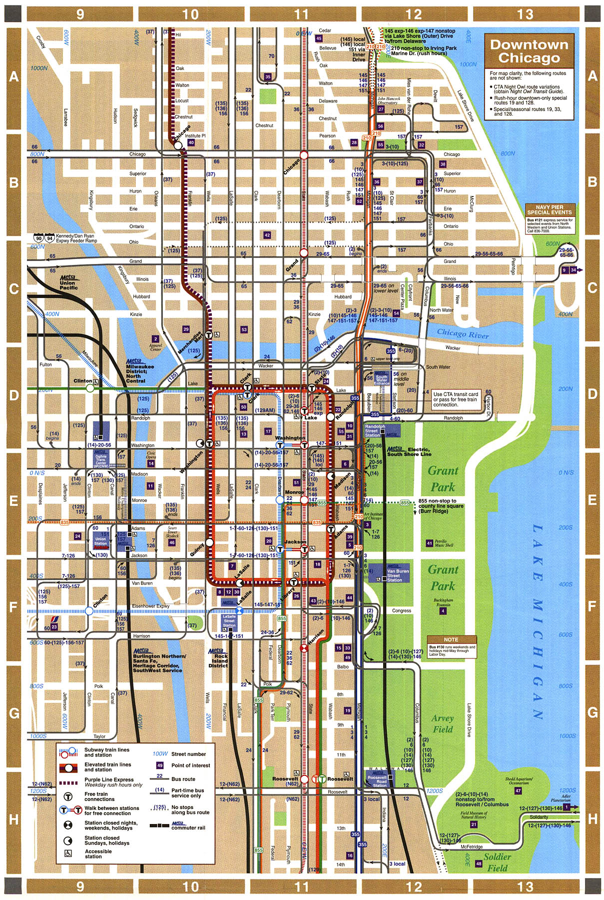
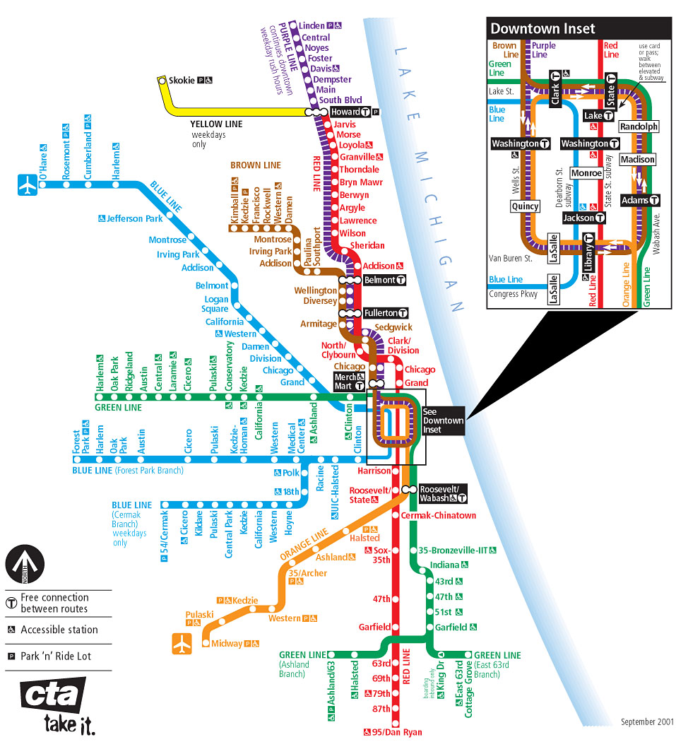
Cover
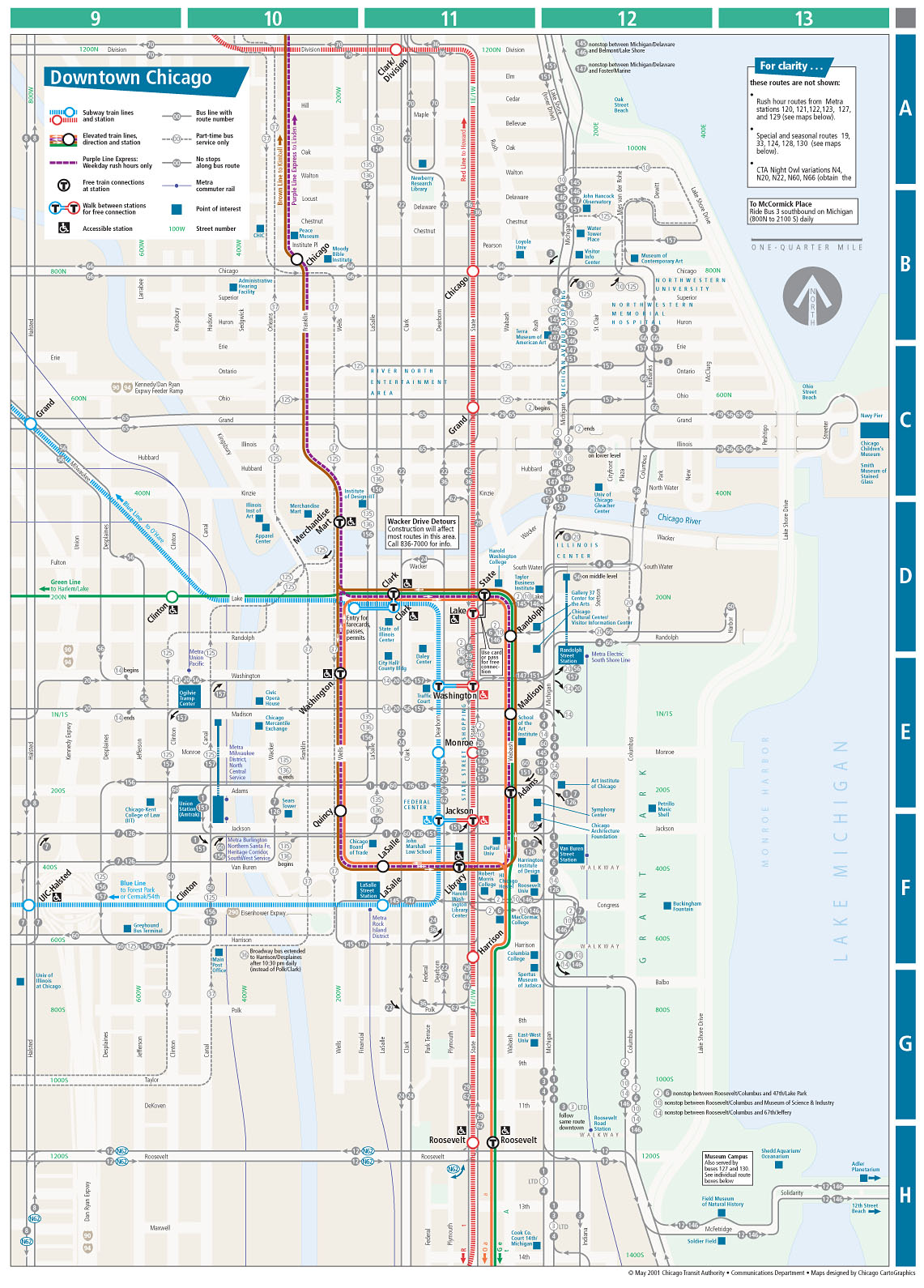
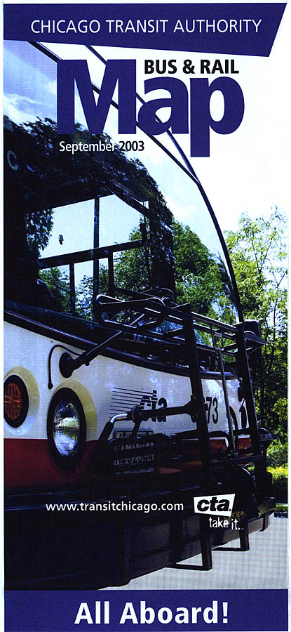
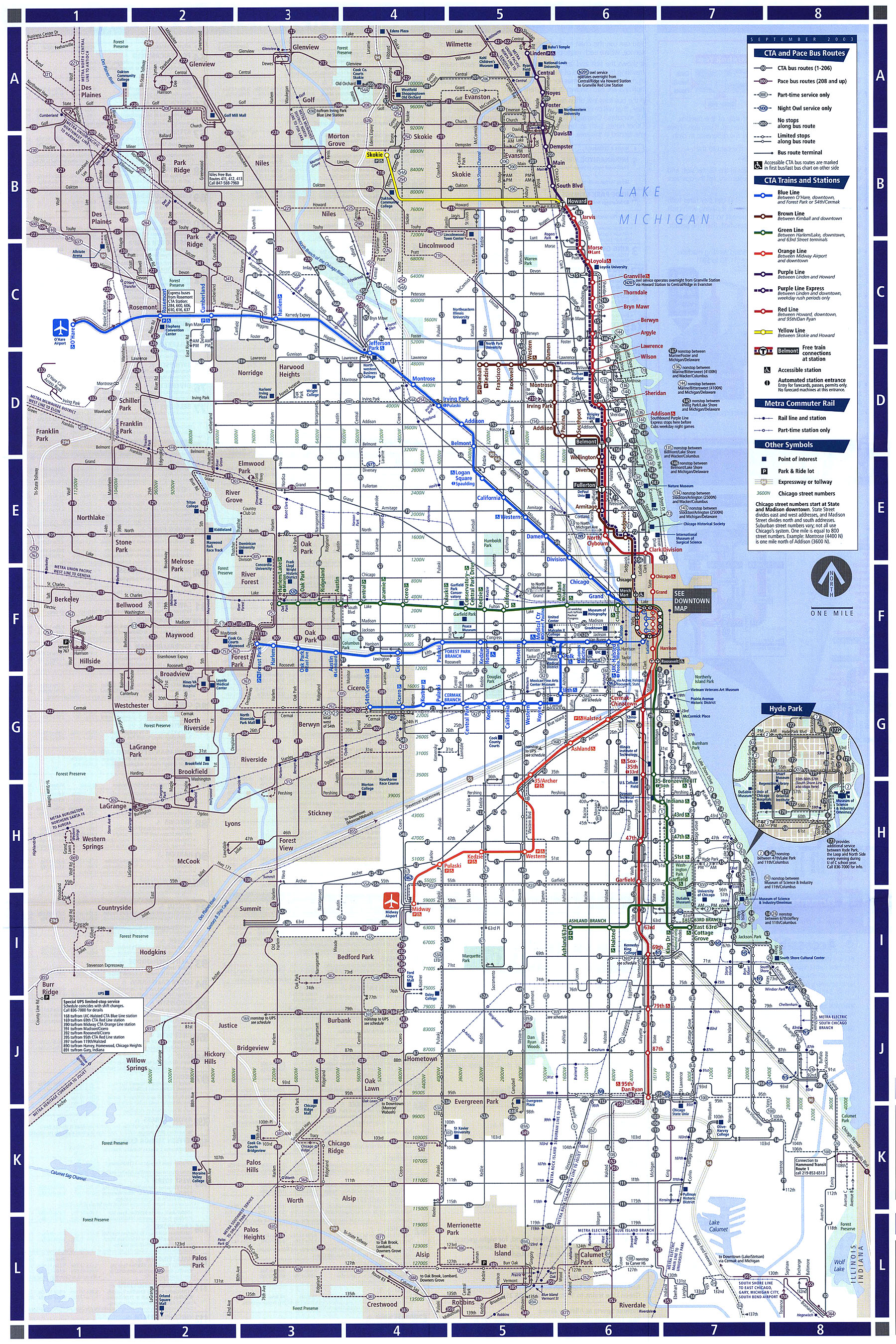
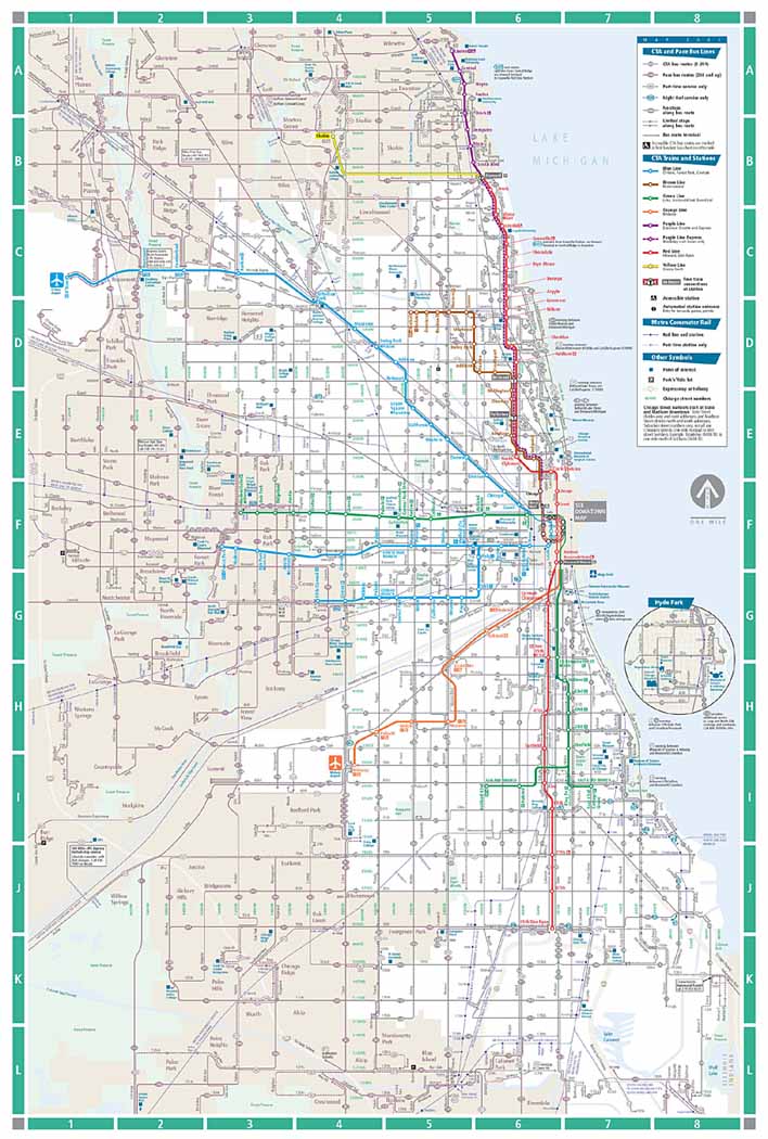
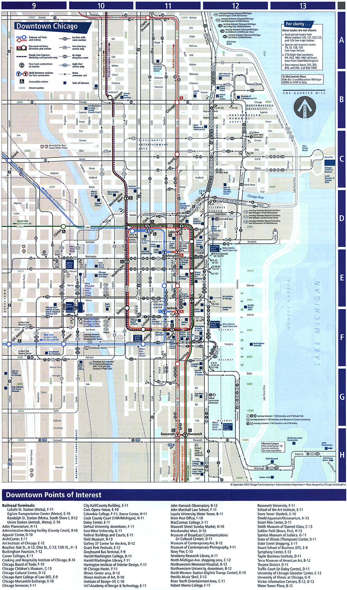
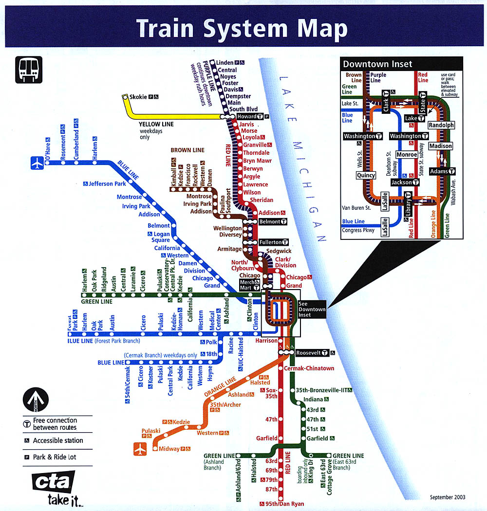
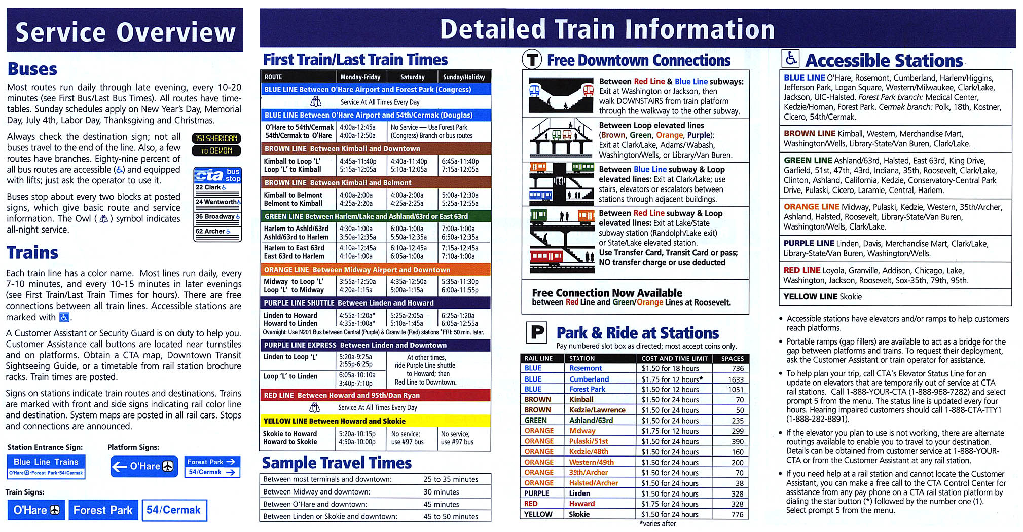
(64k) None Chicago Transit Authority Fall (September) 2003 •
Cover
(111k) Includes revised lakefront express bus
routes, revised Evanston bus routes, and the first new,
accessible Douglas stations (54/Cermak and
Kostner)
![]()
![]()
![]()
![]()
• Front/System
Map (3MB)
• Back/Transfer Information (4.1MB)
![]()
1936 NEW
![]()
![]()
![]()
• Front/System
Map (4.7MB)
• Back/Transfer Information (5.2MB)
![]()
1938
![]()
![]()
![]()
•
System
Map (640k)
![]()
1942
![]()
![]()
![]()
•
System
Map - North Side (708k)
•
System
Map - South Side (616k)
•
Loop
Map (412k)
•
Pamphlet
Detail - Travel Times
(72k)
•
Pamphlet
Detail - Transfer Info
(64k)
![]()
1943
![]()
![]()
![]()
• Front/System
Map (945k)
• Back/Service Information and Facts About Subway (5.5MB)
![]()
1944
![]()
![]()
![]()
•
System
Map (468k)
•
Information
page 1 (432k)
•
Information
page 2 (180k)
![]()
1948 NEW
![]()
![]()
![]()
•
CTA
System Map (4.4MB)
• Back side of map (5.1MB)
![]()
1954
![]()
![]()
![]()
![]()
• CTA
System Map (1.7MB) [Low
resolution (420k)]
![]()
1957
![]()
![]()
![]()
![]()
•
CTA
System Map
(1.2MB)
[Low
resolution
(280k)]
![]()
1965
![]()
![]()
![]()
•
"L"
System Map (112k)
![]()
![]()
![]()
![]()
![]()
•
CTA
System Map
(1.3MB)
[Low
resolution
(216k)]
![]()
1970
![]()
![]()
![]()
![]()
•
CTA
System Map
(1.5MB)
[Low
resolution
(328k)]
•
"L"
System Map (192k)
•
Train
Information: Routes, Fares, etc.
(268k)
![]()
1975
![]()
![]()
![]()
![]()
•
CTA
System Map
(1.3MB)
[Low
resolution
(336k)]
•
"L"
System Map (176k)
•
Train
Information: Routes, Fares, etc.
(268k)
![]()
1981
![]()
![]()
![]()
![]()
•
CTA
System Map
(1.5MB)
[Low
resolution
(336k)]
•
Downtown
Detail (264k)
![]()
1985
![]()
![]()
![]()
![]()
•
CTA
System Map
(1.5MB)
[Low
resolution
(256k)]
•
Downtown
Detail (228k)
![]()
1991
![]()
![]()
![]()
![]()
•
CTA
System Map (includes downtown
inset, route information, and more)
(2.3MB)
[Low
resolution
(376k)]
•
Pamphlet
Detail: Accessible Services
(100k)
![]()
1995
![]()
![]()
![]()
![]()
•
CTA
System Map
(1.2MB)
[Low
resolution
(224k)]
•
Downtown
Detail (268k)
•
"L"
System Map (188k)
•
Train
Information: Routes, Fares, etc.
(408k)
![]()
1997

![]()
![]()
![]()
•
CTA
System Map
(1.2MB)
[Low
resolution
(224k)]
•
Downtown
Detail (296k)
•
"L"
System Map (176k)
•
Train
Information: Routes, Fares, Service Changes,
etc. (272k)
![]()
1999

![]()
![]()
![]()
•
CTA
System Map
(1.3MB)
[Low
resolution
(252k)]
•
Downtown
Detail (364k)
•
"L"
System Map (180k)
•
Train
Information: Routes, Fares, etc.
(248k)
![]()
2000

![]()
![]()
![]()
•
Six-County
Regional System Map
(1.4MB)
[Low
resolution
(323k)]
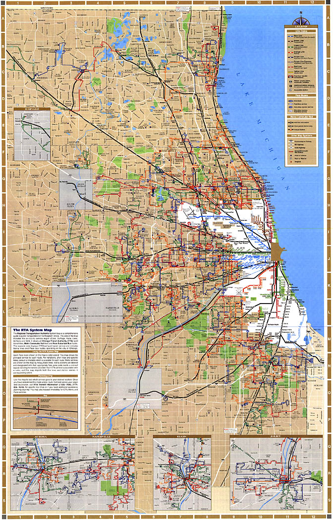
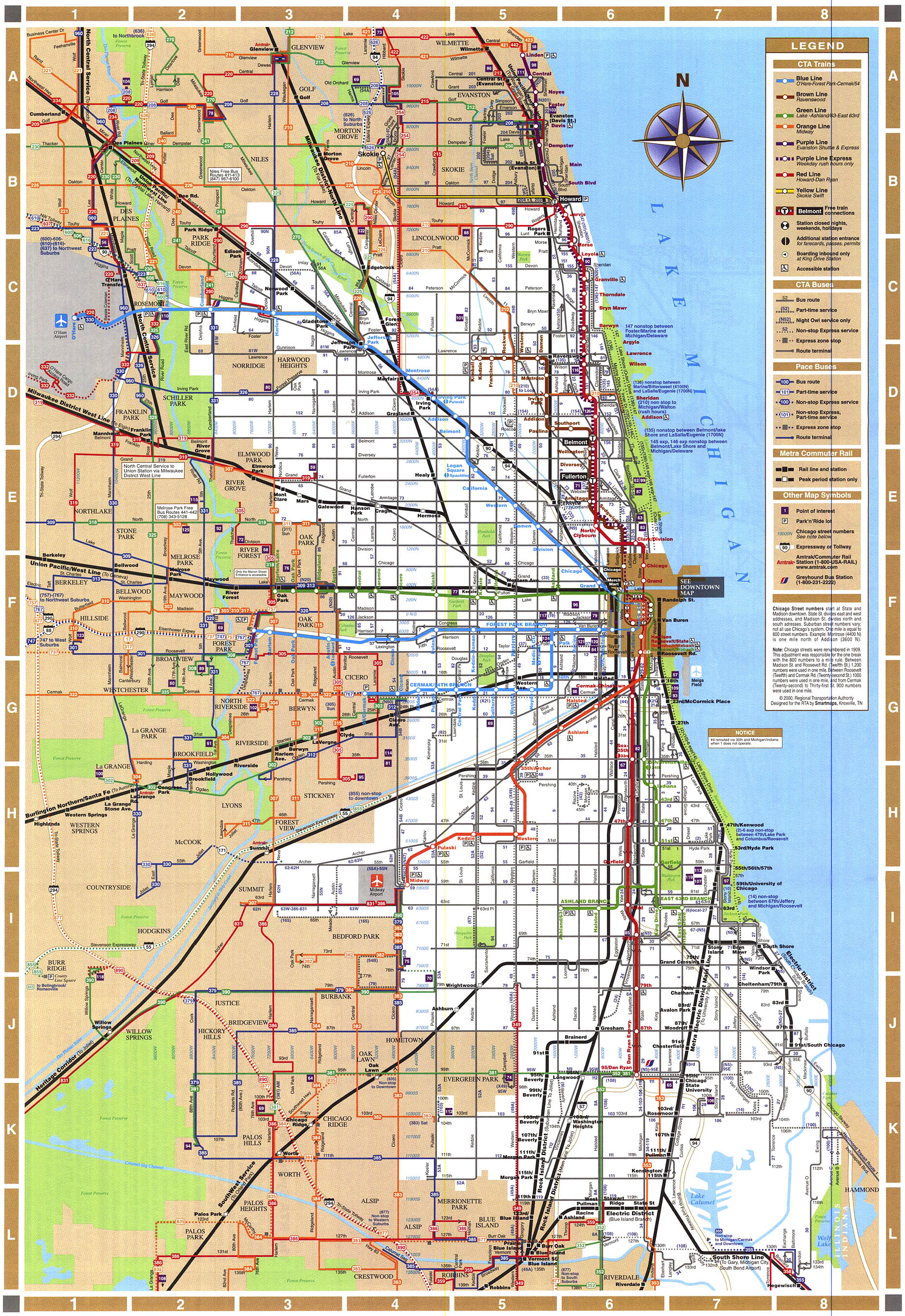
•
Chicago
System Map
(1.5MB)
[Low
resolution
(331k)]
•
Chicago
Downtown Detail
(636k)
![]()
2001
![]()
![]()
![]()
![]()
•
CTA
System Map
(1.1MB)
[Low
resolution
(156k)]
•
Downtown
Detail (448k)
•
"L"
System Map (300k)
![]()
2003

![]()
![]()
![]()
•
CTA
System Map
(2.1MB)
[Low
resolution
(137k)]
•
Downtown
Detail (691k)
•
"L"
System Map (250k)
•
Train
Information: Routes, Fares, etc.
(636k)
![]()
![]()
![]()